Stralsund, Germany
Navigation, Communications & Steering
Navigation
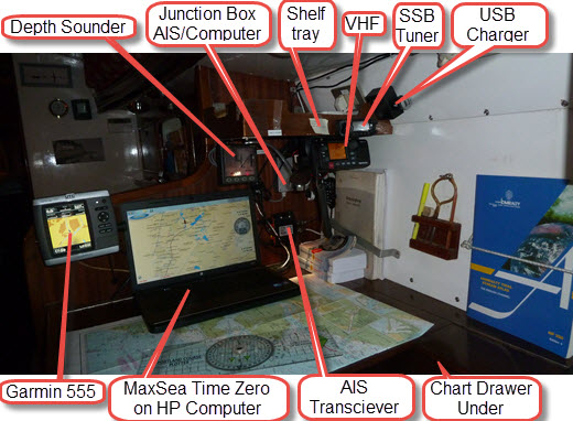
The navigation station has developed over the years with changing technology and to suit precisely our cruising needs. Therefore it does not look slick like a boat just off the production line but it is efficient.
There are two independent navigation systems, both are viewable by the helmsman and there are no problems with bright sunlight. The Garmin system drives the autohelm which will go to waypoints or follow routes; we generally like to set the course and do our own navigation. When sailing we usually set the Garmin screen to large digital readout of COG and Speed and watch for traffic and rocks on the big screen since it shows both our own position and that of surrounding traffic. It will warn of collision courses and there is a proximity alarm. The depth sounder screen is large and has a deeper water direction indicator. It is cloned at the helm.
The AIS transceiver is integrated with the MaxSea Time Zero system and provides the ‘own position’ and ‘transmitting other traffic positions’ on the chart screen. It also transmits the ship's position, course and speed to a central data base, (if this feature is turned on), so that anyone in the world can check out your position by logging on and entering the MMSI number. We installed this system after witnessing how difficult yachts are to detect in poor conditions from the bridge of a ferry. We now have much more confidence in fog knowing that our identification appears on other ships‘ radar. Virtually all ships that could do us serious damage now transmit AIS.
|
|
Communication
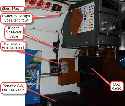
The VHF transceiver is at eye level with the hand microphone on the wall. It is cloned to a microphone in the cockpit and whichever is off-hook controls the VHF. The mast top antenna, connected using a heavy gauge low loss cable, gives us a range of about 30nm on full power. There is a setting for reduced power, as required for inland waterways.
The single side band radio receiver tuner is located on the front of the shelf/tray. The radio can be plugged into the computer for the receiving of synoptic weather charts as faxes. It will also receive Navtex reports and can record radio broadcasts.
The USB charger ports are primarily used for keeping mobile phones charged.
|
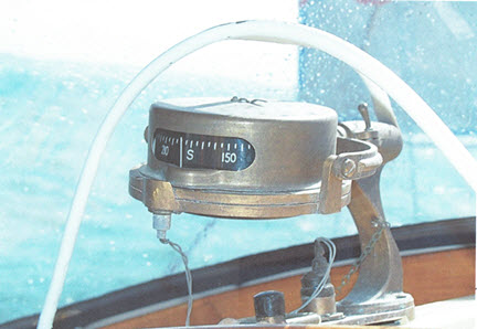
Our much loved prismatic compass that always works and gives the helmsman a feeling of real sailing not following some computer output. |
|
|
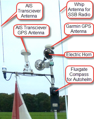
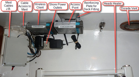
Although WiFi is becoming more available, the transmitters are still often marginally out of range in marinas. We set up an external omni-directional mast top antenna, using heavy gauge low loss cable, connected to a D-Link router configured as a wireless client. This is in turn connected to a D-Link access point so that we have a WiFi zone within the boat. This arrangement is located in the heads. A spare co-axial cable is installed in the mast for use with a wind speed and direction indicator if needed. Such and indicator's output would enable 'sailing to the wind' automatically. We have always resisted automated sailing so we never installed the indicator. |
|