|
When chatting with new friends in a snug cabin , as cruisers do when they meet in some lonely anchorage, talk turned to that Holy Grail of yachting; a little known and un-crowded cruising ground with fabulous scenery and a fascinating culture. "Oh, it exists," they said,"it is called the Basque Country and it is tucked away in the South-east corner of the Bay of Biscay." We were immediately hooked. We set off to leave the cold rain of Wales for this quasi mythical place.
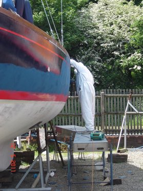
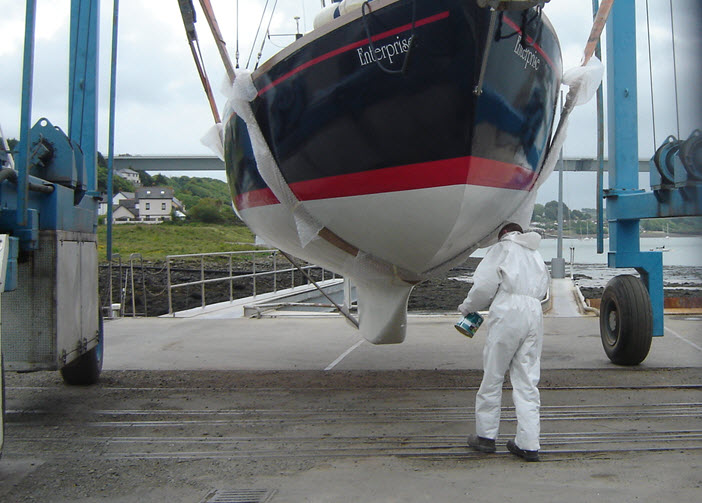
However, we were not going to make a dash to the destination and miss other interesting places along the way. First was the Cornish coast, that graveyard of sailing ships in the 17th and 18th centuries. Then the Jurassic Coast of Southern England where the science of palaeontology was born; and of course we had to visit our old haunts around the coast of Brittany and the French islands off the West coast that the French keep largely as their own holiday resorts. Finally, our destination would find us at the start of the Northern pilgrimage route to Santiago de Compostela. The full route can be seen by following this link to Google Earth, neyland_to_hondarribia_2011blog.kmz make sure that you have the ‘temporary places’ box ticked when it is open. Clicking on the yellow push pins will open log entries. 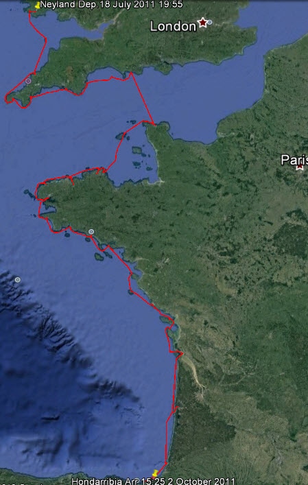 The 2011 Cruise The plan was to take the boat out of winter storage at Neyland, Wales, work on it for a couple of weeks and then set out. Now the only sure thing about sailing is that things will not go as planned. When we got back to start work we found that mould had flourished over the damp winter and everything had to be cleaned and laundered. The second thing was that the man who had made custom stainless steel fittings for collection in the Spring had dropped dead and his workshop contents disposed of. Just to top things off, health issues started to arise that reduced the work to a crawl. So our two week stay on a neighbouring sheep farm developed into a two month stay. However we learned a great deal about sheep along the way!
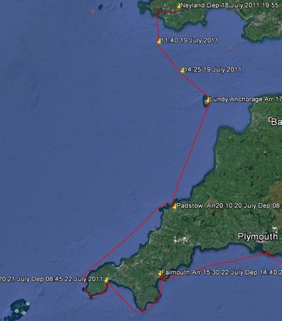
The Bristol Channel is like a large funnel with its open end pointing West to the predominant winds and storms so tidal ranges are great. The upper reaches become vast mud flats at low tide and when the tide comes in it can, quite literally, be like an advancing wall of water. This is the famous 'Bore' and Morecombe Bay is the site of the tragedy of the cockle pickers in 2004 who were cut off by the tide. Although there are many small harbours along the Somerset and Cornish coasts, they dry at low tide unless there is a lock gate, so our options were limited. We kept well to the Western end and crossed to Lundy Island then locked into Padstow before following the rocky and wild coast around Lands End to Newlyn.
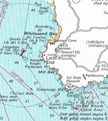
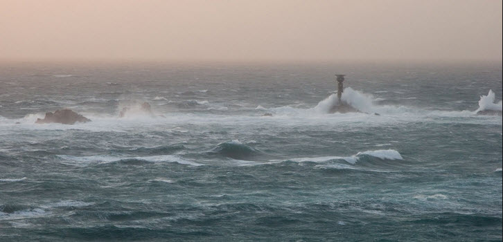 Longships Rocks
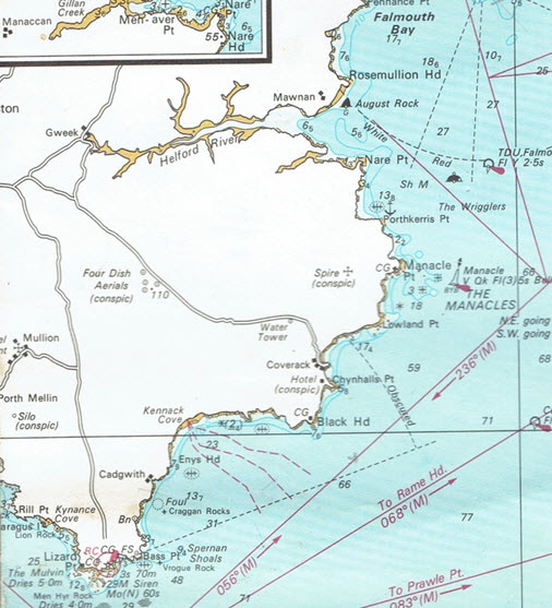
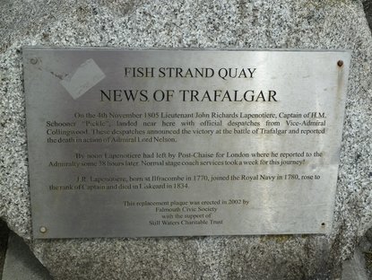
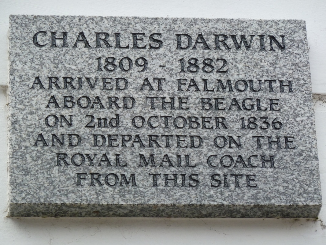
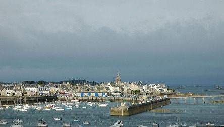
Safely past The Manacles we entered historic Falmouth Harbour. This is where long distance sailing ships would call to receive their orders before sailing up the Channel until the age of steam meant that they did not call any more. There were many famous events here; News of the victory at Trafalgar arrived here as did Charles Darwin returning on the Beagle from his famous voyage of discovery. In the Second World War the famous suicidal raid on St. Nazaire left from here.
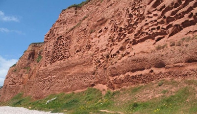
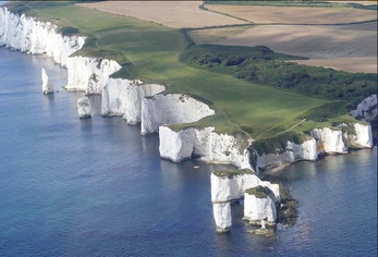
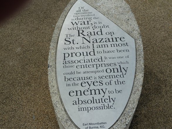 Part of Monument to the St. Nazaire Raid, Falmouth This Southern coast is an exercise in geology, progressing from the old igneous rocks of Cornwall in the West, through the red Permian and Triassic cliffs (where the first fossils and dinosaurs start to appear) to the Jurassic cliffs in the East. As you sail East along this coast the geology unfolds like a movie. This section of coast is the Jurassic Coast World Heritage Site where the science of palaeontology started and where the 'Father of British Geology', William Smith found his inspiration.
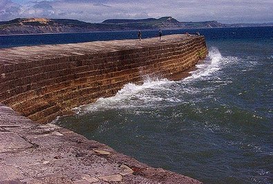
As the cliffs weather the fossils appear, making this a famous haunt for Victorian gentlemen searching for 'curiosities'. John Fowles set his novel 'the French Lieutenant's Woman' here in Lyme Regis in this era and when you sail into the harbour you may find her wrapped in a shawl standing on the end of the harbour wall (the Cobb) waiting for her lover to return. However, unfortunately it is not Meryl Streep but an employee of the Tourist Board!
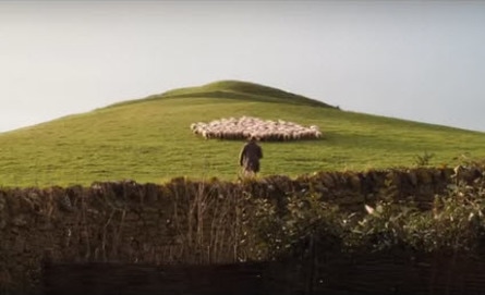
Further East we sail by Thomas Hardy country with green meadows sweeping down to the cliff tops and farms nestling in the rolling countryside. It is easy to Imagine that one of these is Bathsheba Everdene's farm in 'Far From the Madding Crowd' and the character walking among the sheep in the cliff-top meadow is Gabriel Oak.
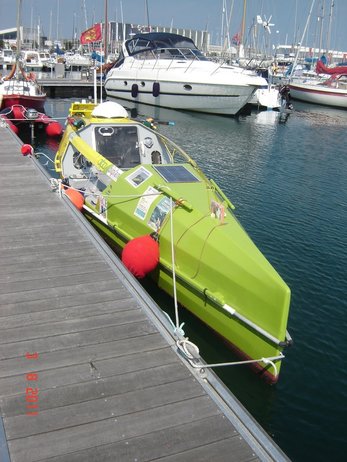
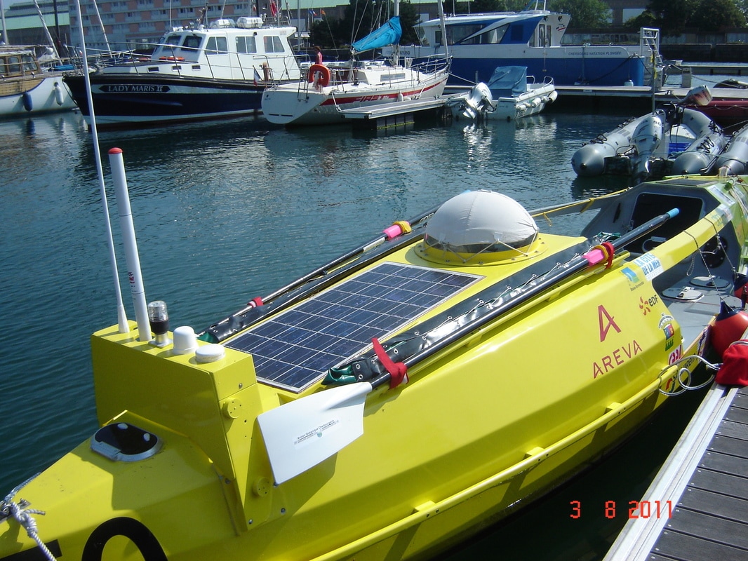
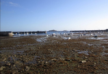
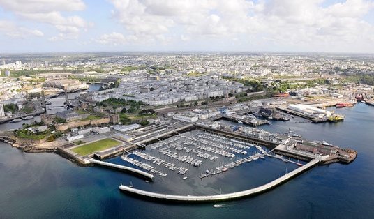
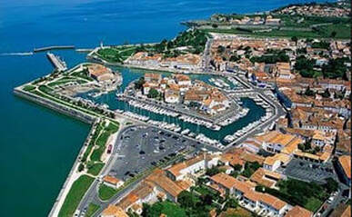
Do not let the beauty of this coast lull you into a false sense of security; this is a dangerous coast if you do not do your homework and get it right because there are dangerous tidal races off all the headlands. At slack water (which may only be 20 minutes) you can pass close to them but if you arrive early or late do not even attempt it. We unexpectedly lost time in crossing Lyme Bay and arrived at Portland Bill an hour late. This meant that we had to pass 3 nautical miles off the point and even then it was pretty choppy. We finally completed our run up the Jurassic Coast in a crowded anchorage in Lulworth Cove. After three attempts to find adequate swinging room we anchored over a kelp bed and spent a sleepless night listening to strange noises from the kelp and worrying that the anchor would drag. In short, this is not the coast to explore at the height of the holiday season. 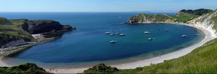 Lulworth Cove - Less Crowded Than When We Were There Crossing the English Channel, or La Manche, is always an interesting experience since it involves crossing two very busy traffic lanes and arriving on a coast that has very strong tidal streams, so arrival times are critical. We have done it in rough weather, in fog and at night but this time the tides were such that we could leave early in the morning and arrive 14 hours later, crossing the traffic lanes in the daylight. We arrived at the West entrance to Cherbourg Harbour, the second biggest artificial harbour in the world (1,500 hectares), after an uneventful crossing. It is always awe inspiring to enter the outer harbour which was designed for 80 warships to manoeuvre under sail. The outer walls alone are 6km long with forts along the way. It is a bit like a Russian doll with harbours within harbours, getting smaller and smaller. Unsurprisingly it was a key objective in the D-day landings of World War 2. Our destination was the third one in, where the Marina is located. 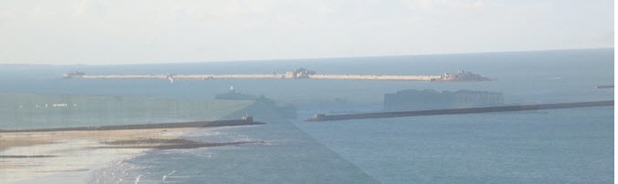 Cherbour Harbour from the East - Outer Walls and Forts 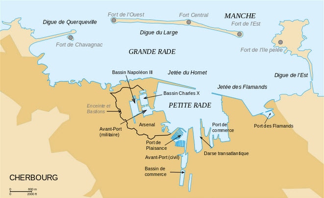 Chebourg Harbour Layout Near us was a man who had just launched his boat that was going to participate in the race from Senegal, Africa to Guyana, South America. The twist was that this was a single handed rowing race that lasts about 40 days and takes place every 3 years. We had never heard of it, but it is part of the new wave of extreme sports.
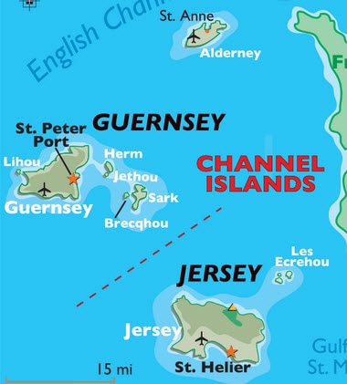
After a break in Cherbourg it was time to start on the second leg of our cruise, travelling by way of the Channel Islands along the North coast of Brittany to Brest. 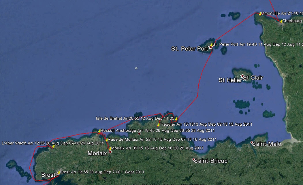 The Route from Cherbourg to Brest Travelling West it is necessary to round the Northwest point of the Cotentin Peninsular a rocky headland called Cap de la Hague. This high headland is famous for having perhaps the biggest nuclear fuel reprocessing plant in the world. Spent fuel comes from all around the world to be reprocessed here and this is where much of the warhead material from nuclear disarmament ended up. So this headland is a hot spot in more ways than one. 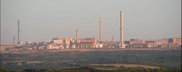 Cap de La Hague Nuclear Fuel Reprocessing Plant However, we only saw glimpses of the plant; what concerned us most was down at sea level. Rounding this headland and heading South between the Mainland and the island of Alderney is very interesting and challenging because the tidal streams in the Alderney Race can reach 6 to 7 knots and when this reverses in each tidal cycle it creates extremely confused seas all around Cap de la Hague to Alderney. Timing and reasonable weather are essential. 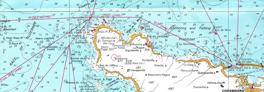 The Cotentin Peninsular, Cap de La Hague and the Alderney Race So the evening before the passage we sailed to the nearest anchorage to the headland, Omonville, and lay at a mooring to be in the best position to get the time right on the next day. The weather was marginal the next day but we thought it do-able and we set off. At the turning point off the headland the seas were big and confused, due to a strong wind against tide even though we had the timing right, but we thought that it would improve. 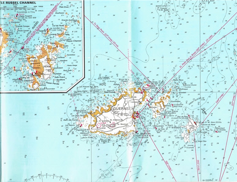 The Little Russell Approach to St. Peter Port, Guernsey It did not and continued rough all down to the Race to the Little Russell approach to St. Peter Port, Guernsey. We made slow progress such that the tide had turned and it was a battle, even on full throttle, to reach our destination. Even though the boat had been well battened down we had taken so much water over the boat that the bedding was damp. However, we were so tired that we hardly noticed it.
When the monarchy was restored (Charles II) the Bailiwick of Jersey was rewarded with lands in the New World; hence New Jersey. We have visited most of the islands on previous cruises and this time just wanted to press on with our cruise to Spain. We planned to make landfall in Brittany at the Lezardrieux River but the strong tidal currents were pushing us East and rather than fight it we decided to take the more adventurous route to the East of the Ile de Brehat. With the 10m tidal ranges in this area the landscape totally changes between high and low tide. When you look back at low tide you wonder how you ever did it! 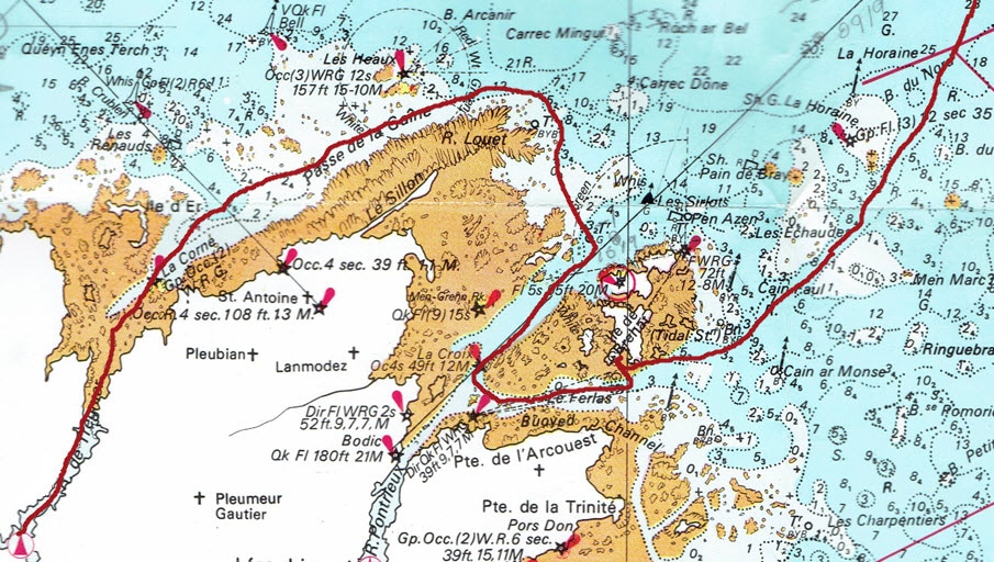 Isle de Brehat to Treguier Challenge
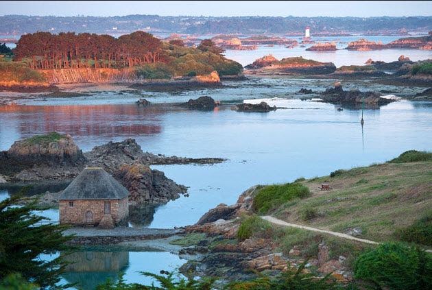
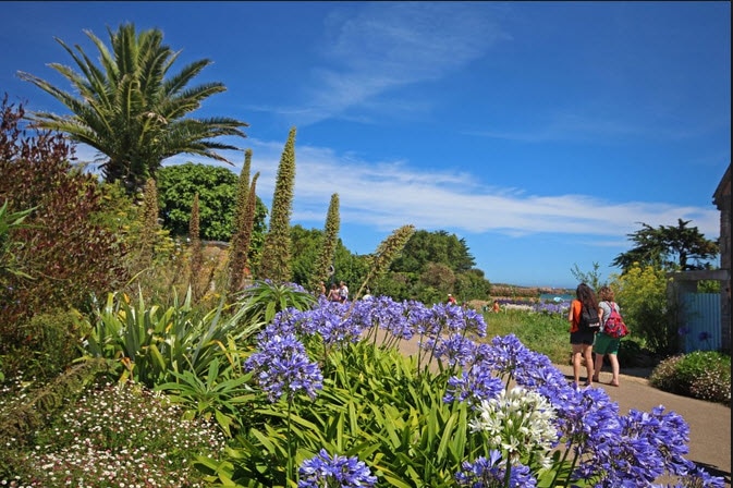
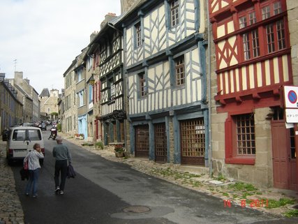
The islands here are known for their Mediterranean micro-climate and famous for the masses of agapanthes growing wild. This coast is a cruiser's dream as long as you are prepared to be bold and do your homework. There are myriads of hidden inlets. Exchanging our plans to go up the Lezardieux River we opted for the next one, the Treguier, because of the challenge of getting there! It involves sailing precisely to a leading line through rocks and then through the shallow Passe de la Gaine before entering the Treguier River to arrive at the charming Town of Treguier. This is rural France at its best and just to cap it all the circus had arrived in town and set up near the port. Many small itinerant circus are still around in France, like the markets that make a weekly circuit of small towns. To stroll the town, with its small shopkeepers and shoppers who still buy their bread daily and exchange gossip as they shop, is to enter a way of life that has largely disappeared from many countries. One can understand why the French so fiercely resist change; they know what they will lose.
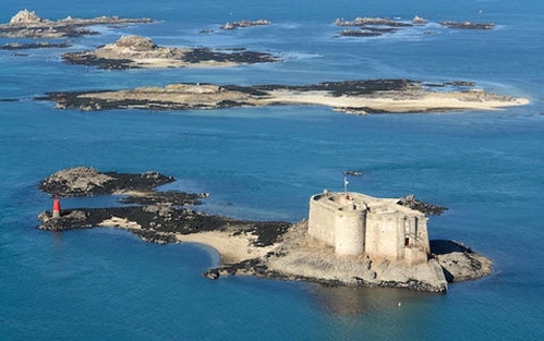
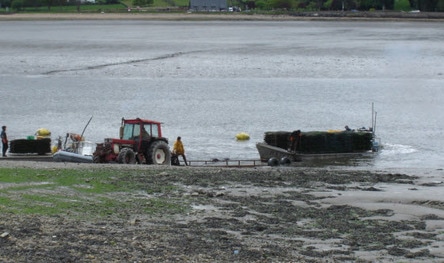
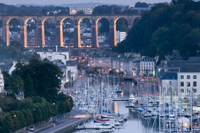
The Bay of Morlaix has many small islands and rocks as it narrows to the estuary of the Morlaix River. This was an ideal pirate sanctuary before the days of buoys, markers and accurate charts, for only those with expert local knowledge could get in here. 'Pirates' is perhaps too strong a word, for these were entrepreneurs sailing under a 'Letter of Marque' from the King, known as Corsairs in France. This was permission to attack the King's enemies as long as the King got his percentage of the spoils. This was cheaper than having a large standing Navy. When navies were first established the Corsairs continued and King's ships still operated in a similar way by sharing the spoils. After a disastrous raid on Morlaix by the English a fort was built (Château du Taureau) on one if the islets to block access to the Morlaix Estuary. Many of the great houses in this area were built on the spoils of this trade. 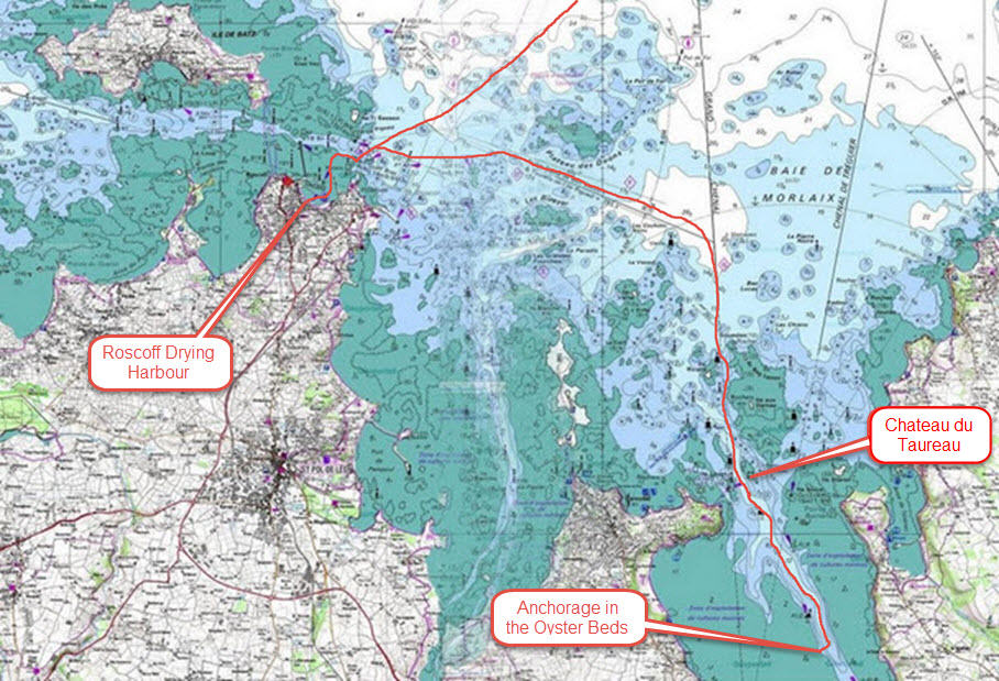 Route from Roscoff to the Oyster Beds Anchorage
The flaw was that we had to negotiate the perilous entry and find that spot in the dark as we were so late leaving Roscoff. The problem is that there are so many navigation lights and secondary channels that it is easy to get confused and find yourself going up the wrong channel.
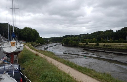
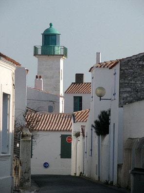
 Morlaix - Worth the Effort to get Here The Western end of Brittany is another of those places with exposed, rocky shores and strong tidal currents that mean that you have to get it right. It is not called the Chenal du Four, the Channel of the Oven, for nothing. There are a string of lighthouses on the coast around here with some great videos of them. , Phare La Jument, 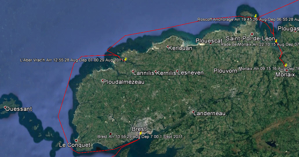 Chenal du Four There were multiple restraints to our next stage; lock out of Morlaix and get through the difficult passage to Roscoff in the daylight; pass through Roscoff Channel when there was sufficient water on an ebb tide so that the current would carry us to Aber W'rach, the last port before the Chenal du Four; leave Aber W'rach such that the tidal current would carry us down the channel, through the pinch point of St. Mathieu before it turned; then have a favourable current to get us through 'the Bottleneck', le Goulet, into Brest. All that with favourable winds and reasonable seas. 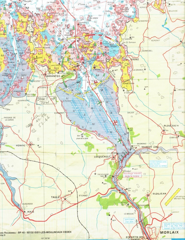 Morlaix River to Roscoff 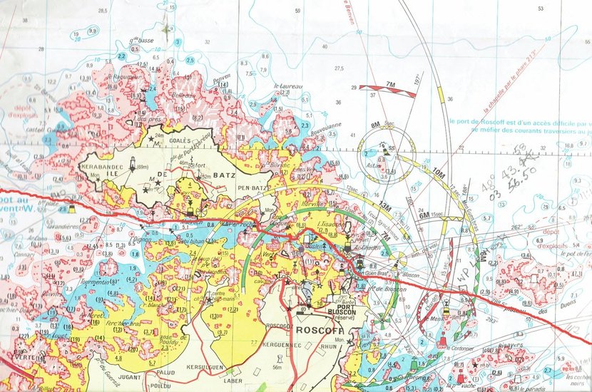 The Roscoff Passage 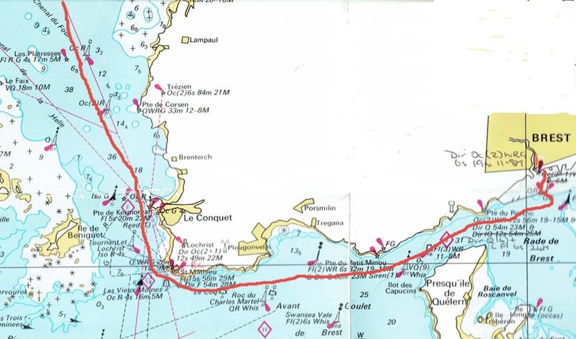 Pinch Point and Le Goulet It worked out that we would have to anchor in the the Roscoff Channel to get the tides right. The weather was not good enough the next day and we spent 2 days on the anchorage. Aber W'rach presented an interesting situation for there is a short cut through the rocks that cuts off some distance. So should we take it? We had done it once before from the other direction but the passage is tricky and shallow so the tide must be right. We did not take it as the tidal state would be marginal, the entrance is difficult to find at the best of times and the sun would be in our eyes when we arrived. That is experience and what makes this type of navigation so interesting and rewarding. 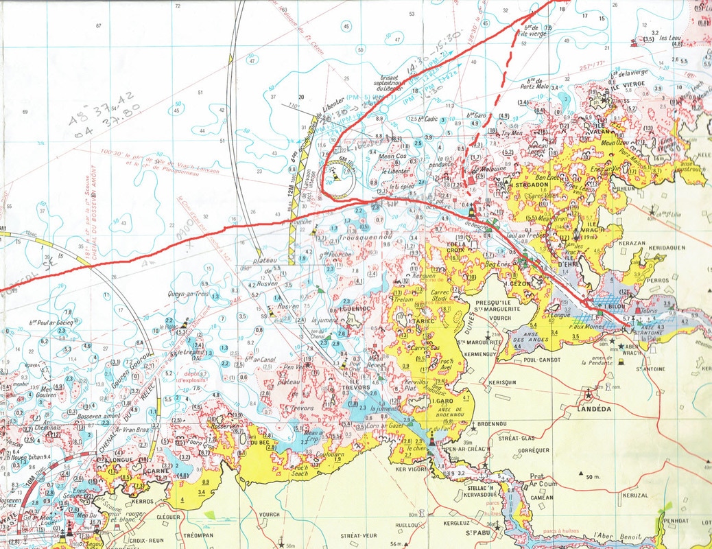 The Short Cut to Aber W'rach We were to pick up our son and granddaughter in Brest so we chose the old harbour rather than the new marina, which is some distance out of town. On arrival one crosses the military harbour with the U-boat pens in the background, and turns around massive harbour walls; it is all a bit intimidating but right in the centre of town. 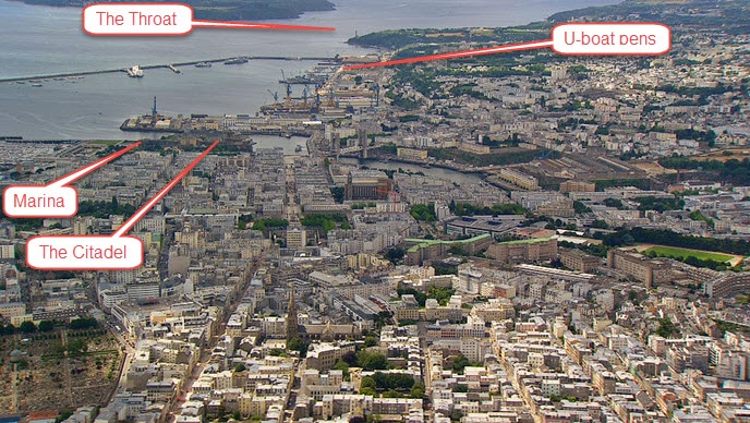 Overview of Brest Looking West
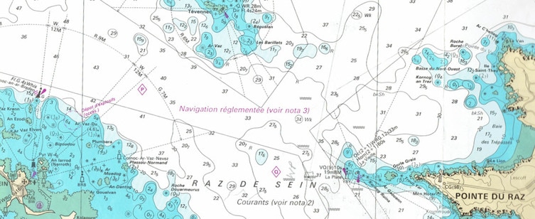 Raz du Sein and the Veille Lighthouse 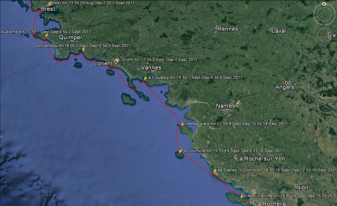 The Route from Brest to Ile de Re The climate changes quite dramatically to a milder , more Mediterranean one, on the South side of Brittany which probably explains its popularity with British yachtsmen. Once through the Raz de Sein there is a convenient port, Audierne, before a long stretch of inhospitable coast that extends past the Point of Penmarc'h. Once round that and a whole string of delightful ports are in reach. We have never passed this point without porpoises appearing around the boat; we always take this as a good omen. On this occasion we pushed on to the walled town of Concarneau.
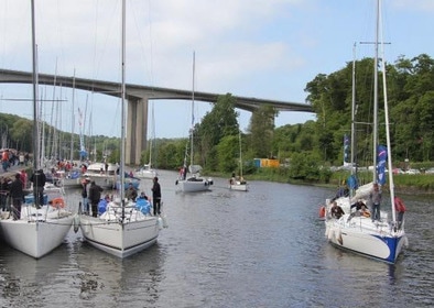
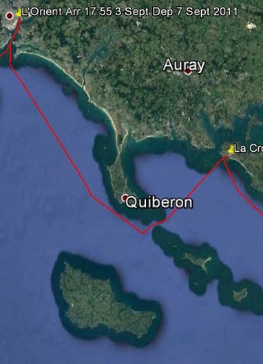
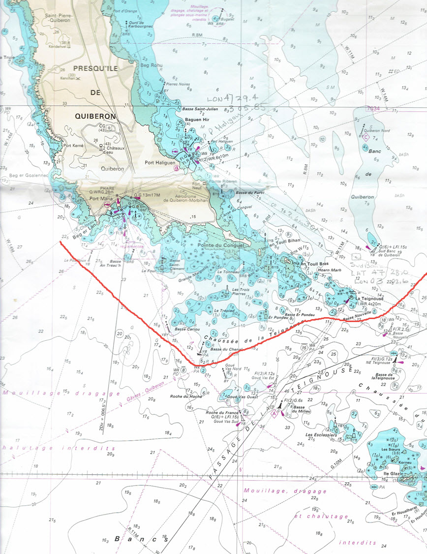
We passed by many interesting ports and islands along this South Brittany coast calling only at L'Orient and Le Crouesty before turning South. This involves passing through the Quiberon Peninsular, an interesting exercise. It would be easy to while away a couple of months around here, and we knew what we were missing because we had been here before, but we still had a way to go and September was upon us.
In la Crouesty one of those occasional unpleasant events occurred that always leaves a bad taste. Four French customs officers descended on the boat at the dock and declared that they wanted to search the boat. It seems an invasion of privacy but that is the price you pay for being a free spirit in a boat. They even wanted to see in the water tank but when they discovered how much work it was they gave up! We were not unhappy to leave and head South to the string off islands off the West coast of France; undiscovered gems that the French seem to keep for themselves.
The next day we had a great sail to Les Sables d'Olonne without needing the engine until the harbour entrance. Then once again the pump belt slipped and the engine overheated. This was starting to become worrying but once again we got the belt tightened and it seemed to hold. The next day the wind was favourable for the run South to St. Martin on the Ile-de-Re.
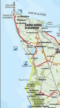
Determined to get to the bottom of the problem we sought out a marine engineer the next day. He solved the problem in 10 minutes and we have never had a problem since. The wrong vee belt was installed in Falmouth! The profile of the belt must exactly fit the profile of the pulley; if it does not excessive wear occurs and no matter how much it is tightened it will slip. When I think how the mechanic in Falmouth talked with such authority and kept us waiting while he ordered the correct belt, it just shows that talk is cheap. So we set off for the final stage with much more confidence and anticipation. 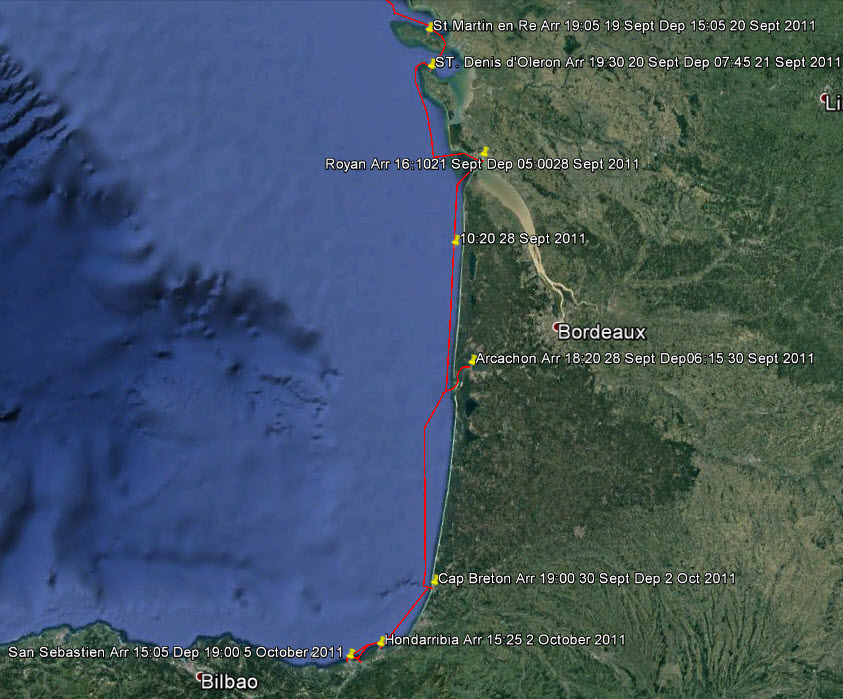 The Final Stage to Spain The island of Oleron is the last in the chain of islands going South. We decided to go through the very shallow waters at the Eastern side of the Ile de Re, under the bridge, past the commercial port of La Pallice and so to the main port of St. Denis d'Oleron.
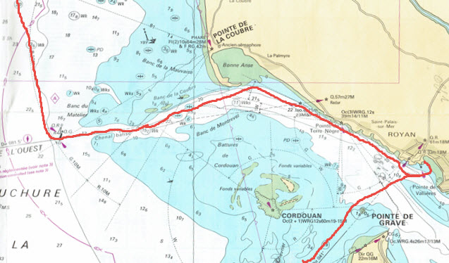
Rounding the Northern Point de Chassiron we met a particularly large swell which made the rocks off the point a maelstrom of breaking waves and flying spray. Although we were well off we changed course a little more, particularly when we saw a wrecked fishing boat perched on the rocks. After travelling South down this coast we came to the turning point to take the channel into the Gironde Estuary and our next port of call, Royan. I do not like this entrance for it is quite narrow and has
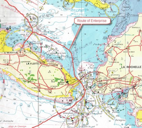
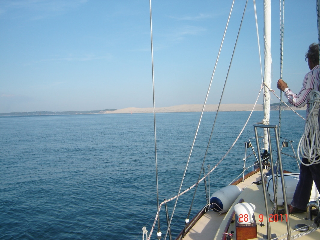
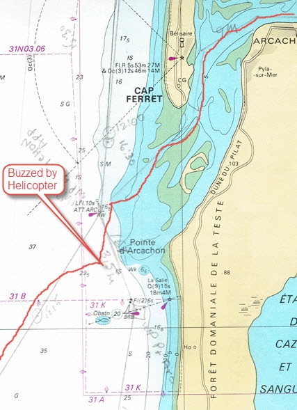
The last steps were perhaps the most challenging for there is a long stretch of coast to the first port, Arcachon, 78 nautical miles away which means a 14 or 15 hour leg in Enterprise. But that was not the main concern; the swells on this coast are large and the entrance to Arcachon is shallow, convoluted and cannot be attempted in heavy swells or rough seas. If you cannot enter, the next port is another 70 miles and also cannot be entered in those conditions. So the challenge is to get the sea conditions right and arrive at the right time, in the daylight. We were at the end of September and the days were now getting shorter. The extra crew member would be helpful if we could not enter either port and had to go straight through to Spain. Furthermore, parts of this coast are active firing ranges and one must read the notices and keep out of those zones.
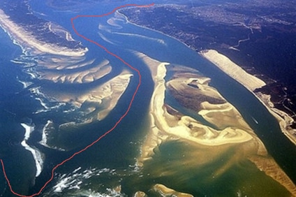
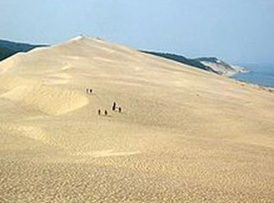
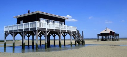
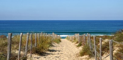
From the aerial photograph, the mass of sandbanks at the entrance show why the tide has to be just right to enter and leave but it does not show the strong tidal currents and the breaking waves from a big swell that can make the entrance impossible. Immediately on entry, the biggest sand dune in Europe, La Dune du Pilat, appears. It has been used for many movie sets to simulate desert scenes. The entry, on a flood tide, takes over an hour even doing 9.5 knots past the lighthouse at Cap Frehal. Once inside, it opens up to a a large shallow inland sea which largely dries at low tide. A marvellous playground, with endless beaches.
This area of France from the Gironde River to the Pyrenees on the Spanish border, is called Les Landes, meaning moors and heath. It is low and was largely swampy until modern agriculture drained large areas and planted maritime pines over 10,000 square kilometres. The French Army trains here and there are naval firing ranges off shore. The naval ranges are seldom used but the firing ranges from the shore out to sea are frequently used and restricted times are posted in the Marinas. 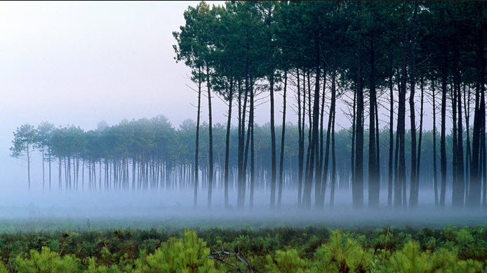 The Endless Forest of Les Landes
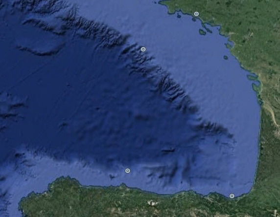
The great underwater cliff that is the edge of the continental shelf is cut with canyons that reach out like fingers into the shelf. As the edge gets closer to the shore these canyons can reach right up to it and feed water surges to the shore that show up as swells. So it is at Cap Breton where the canyon comes right up to the harbour entrance. 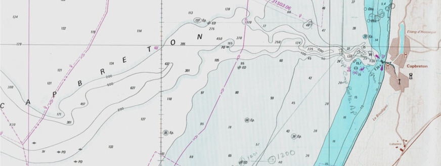 The Deep Underwater Canyon Running Into Cap Breton The Deep Underwater Canyon Running Into Cap Breton All went well, we approached swiftly on a small swell, dodged around the end of the harbour wall, and sailed sedately up beside the main street to a welcoming Marina at the end.
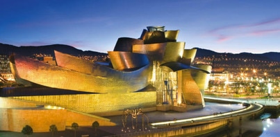
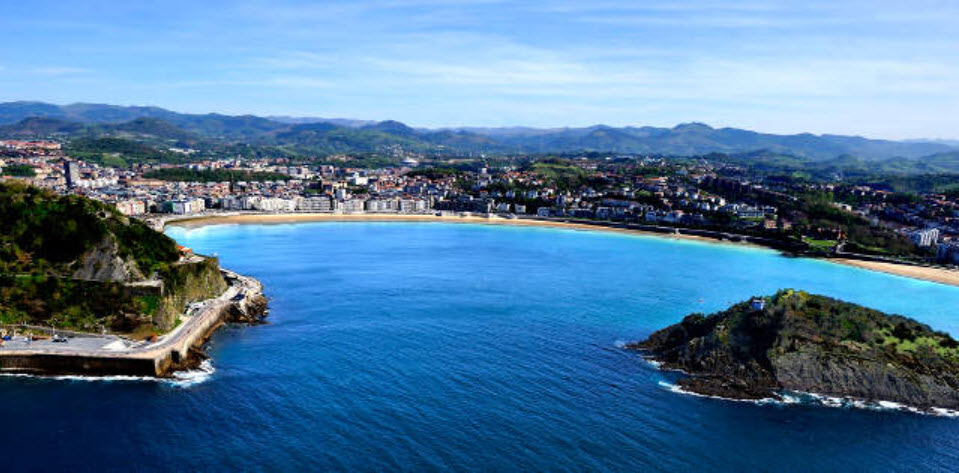
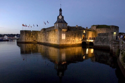
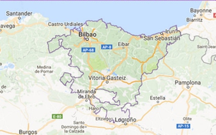
Then it was off to Hondarribia and the Basque country the next day; sailing South on this last leg we had time to reflect on just what The Basque Country is. Rather than a physical area it is the place where the Basque language is spoken and the Basque cultural traditions are followed, so the boundaries are rather fluid. The Northern boundary is somewhere around Bayonne in France, the Western one west of Bilbao, the Eastern is a couple of pyrenean passes from the coast around Saint-Jean-Pied-de-Port, where the French pilgrimage route to Saint- Jacques-de-Compostelle starts. Finally, the Southern border is roughly on a line South of Victoria-Gasteiz but the following map is more restrictive.
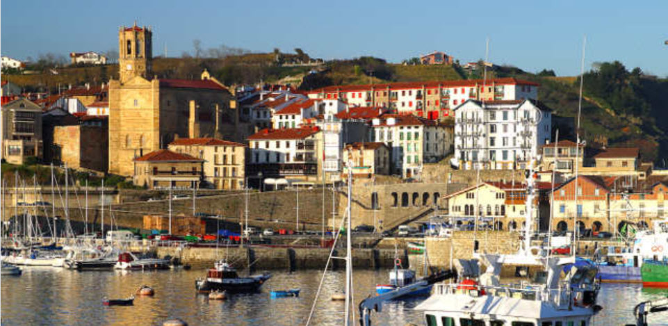
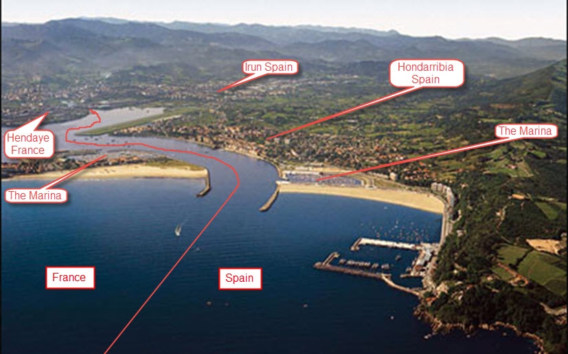 The French and Spanish Border at the Coast 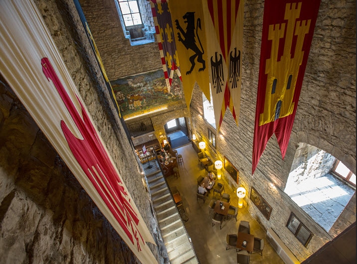 Old Hondarribia Dripping in Atmosphere For other Cruising blogs see the Archive links in the sidebar at the top of this page.
Other blogs of interest are The Retirement Dream and How to Live Your Dream
2 Comments
David Phillips
4/4/2023 17:25:45
Thank you, I am glad that you enjoyed it. I am currently working on the missing cruising season 2005. When you see the blog you will understand why that year got skipped. These are not the normal format for sailing blogs because for us it was not about the technicalities of getting from one place to another but rather the history of place, the social mosaic that we were passing through and intimate connection to the natural world. Leave a Reply. |
Author June and I (David Phillips) have sailed the European and UK coasts for 30 years, the last 14 in Enterprise. It has been a continual exploration , inspiration and growth of experience. We would not have missed a minute of it.
It is a symbiotic relationship, you look after her and she looks after you and takes you into a fascinating world that is otherwise inaccessible. Ill health finally forced us to sell her. On 2 September 2017 she was sold. We hope that she will bring the same life changing experiences to the new owners as she brought to us. Archives
August 2019
Categories
|