|
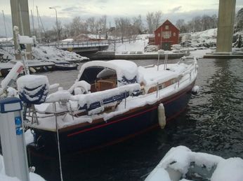
Enterprise over-wintered in the water at Stavanger awaiting her second new mast after our 2009 season. (see Northern Denmark & Norway) We were looking forward to a cruising season with a bit less excitement. However, the first event came from an unexpected source; the eruption of Eyjafjallajokull in Iceland. All flights to Norway were cancelled due to the ash clouds so we started our season by touring Hadrian’s Wall and the Scottish Highlands while we waited for a flight from Aberdeen. Finally arriving in Stavanger we found that we still did not have a mast and trepidation really set in.
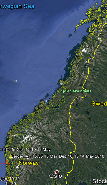
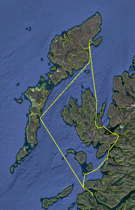
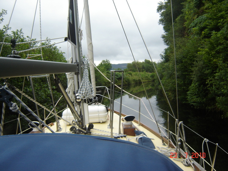
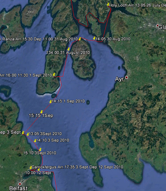
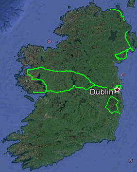
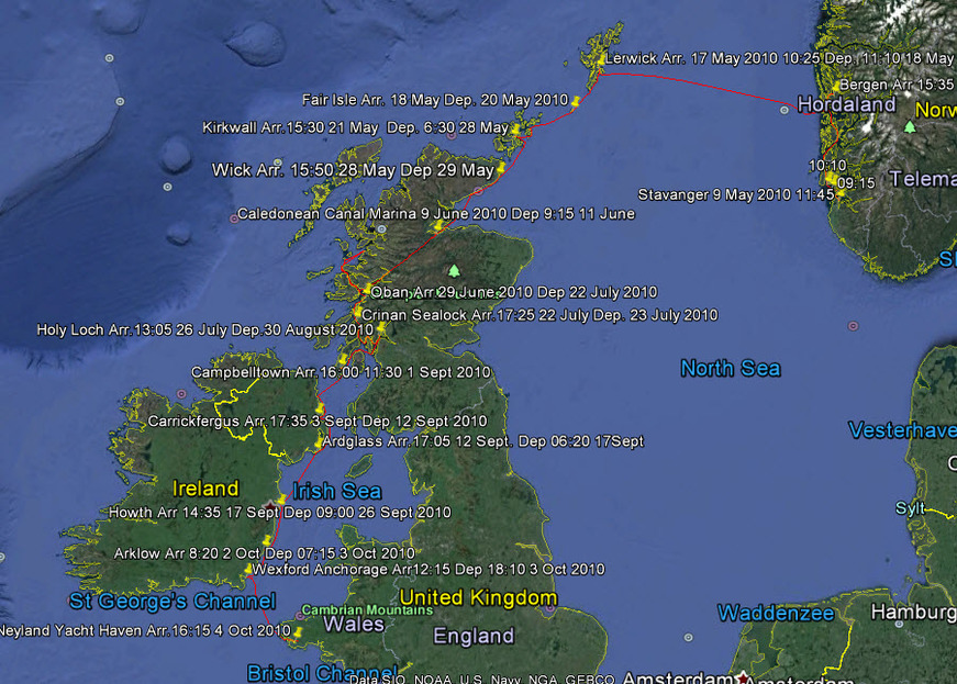 The 2010 Cruise - Go To Google Earth for the Full Version However, by May 9th we cast off to begin our cruise. The full route can be seen by following this link to Google Earth, The Norwegian Sea to the Irish Sea, make sure that you have the ‘temporary places’ box ticked when it is open. Clicking on the yellow push pins will open log entries.
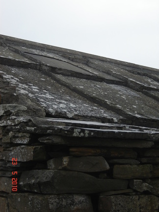
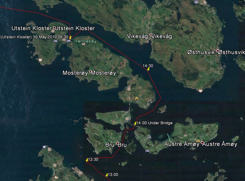 The Alternate Route Where We Hit the Bridge Only afterwards did I notice the antennae and tri-light hanging down! Later we determined by marks on the tri-light that we had cleared the mast by 2cm. The strong wind had created a tidal surge that I had not allowed for and could not calculate. We tied up that night at Utstein Kloster that we had visited the previous autumn but this time it was cold and windswept. Here we discovered that we had a dead cell in our deep cycle battery; these things always happen at inconvenient moments. Then after setting off next morning it started to snow quite hard, the first and, I hope, the last time that we sailed in a snow storm. We consoled ourselves by saying that it could only get better after that, and it did. Bergen has the reputation as the European city with the most days of rain but the Gods must have repented for it was a lovely day to sail into the harbour, with the sun highlighting the old, picturesque houses climbing up the mountainside from the wharf. 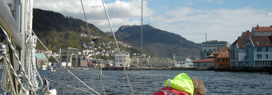 Entering Bergen Without Rain! This is the home of Eduard Grieg and there are daily lunchtime concerts throughout the summer at the composer’s home, with its modern museum and concert hall. This city is another one that was in the Hanseatic League, like the ones that we had visited in the Baltic, and which grew rich on the trade monopoly.
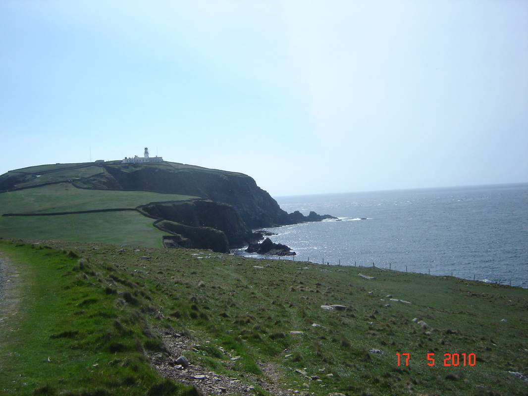
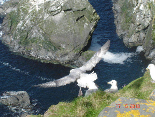
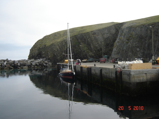
Arriving on Monday morning we were immediately struck by the lack of trees; this must be a very bleak place in the winter, however, there is a wild beauty to these islands that spoke to us. 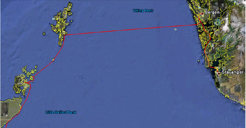 The Route From Stavanger to Scotland 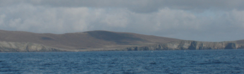 Our First View of Shetland We have often noticed that people who live in harsh conditions are usually warm and welcoming; Shetlanders were no exception. The Viking roots there are very strong with the language full of Old Norse terms; it is a very distinctive culture. There may not be many trees but there are huge numbers of sea birds. Taking the local bus to the Southern tip of the main island to visit Sumburgh Head , we marveled at how close we could get to nesting Fulmars, Guillemots, Kittiwakes, Puffins and Shags. We had previously only seen these birds in small numbers but here it was overwhelming.
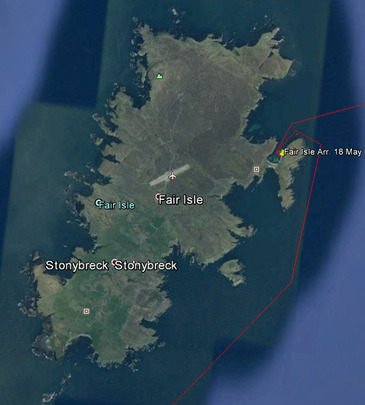
As a bonus there was the Jarlshof Prehistoric & Norse Settlement to see before we set sail for Fair Isle 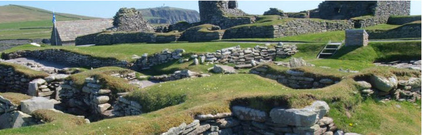 Jarlshof Prehistoric & Norse Settlement at Sumburgh Head
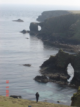
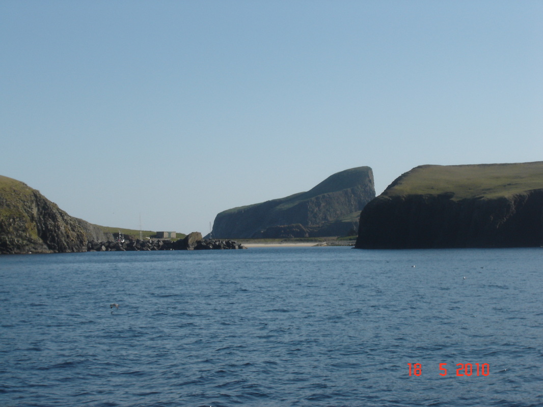
Dominating the island is Sheep Rock, sheer cliffs on all sides with a sloping, flat top, which from a distance looked like a lush green meadow. Discussion turned to Sheep Rock when a resident came to the dock to talk to the visitors. He said that he was the last person to graze sheep on it. In late Spring someone would scale the cliff and rig up a pulley and cable system to haul the sheep to the top, then when the sheep were all hoisted up they would be left all summer after which they were all hoisted down again; a very labour intensive process that is no longer reckoned to be worthwhile.
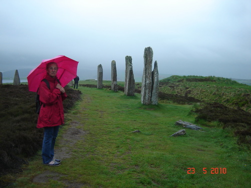
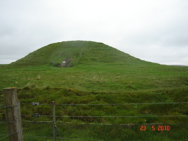
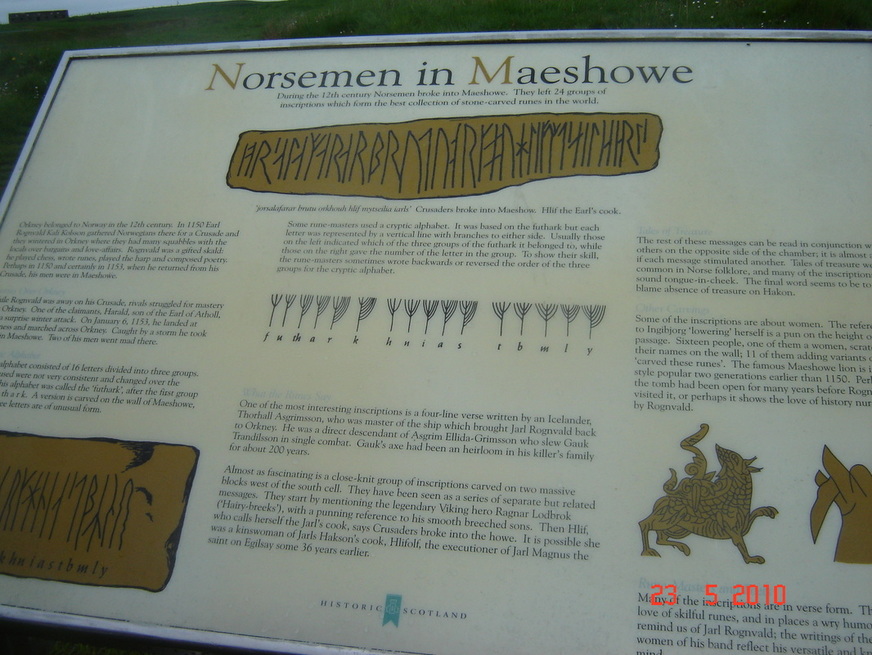
One hundred and twenty kilometres South are the Orkney Islands; quite different, low, fertile and sandy, with strong tidal streams coursing between the islands so it is important to get the timing right. They are much more closely related to the Scottish mainland, but still apart, and formerly speaking their own Orcadian language. Five thousand years ago people of the Neolithic culture landed here and settled. Everywhere there is evidence of ancient civilisations (including a complete Neolithic village ) overlain by Viking settlements giving a vague feeling of being in a time warp. Some of the cottages with their heavy stone slab roofs had a distinctly Neolithic air about them. We took a local bus to the Ring of Brodgar, a stone circle like Stonehenge but less well known. It is immense with 13 burial mounds near the circle. The walk towards it made us aware of many sites of Neolithic settlement and mysterious alignments.Previously we had visited Stonehenge but found this site in a sparsely settled landscape far more haunting.
Virtually nothing is known about this people, the meaning of their structures, how they could move stone slabs weighing several tons, or anything about their social system and psyche. They are still an unresolved mystery greater than the pyramids. We walked over this countryside and experienced feelings of awe and insignificance standing in the Ring of Brodgar and seeing in the distance other standing stones, each representing huge effort for no apparent reason that archaeologists have been able to fathom.
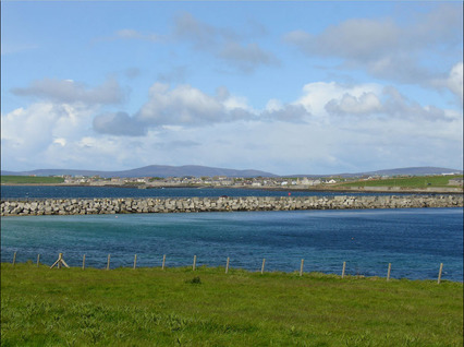
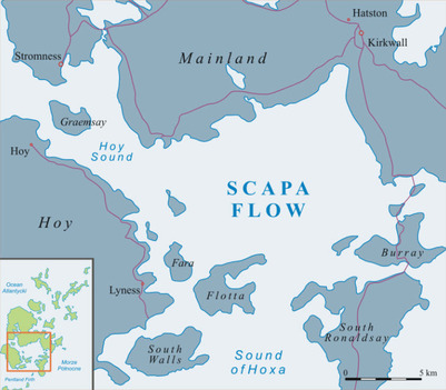
 The Story of the Norsemen The Story of the Norsemen From Orkney we had to decide whether to to go down the West coast of Scotland by way of Cape Wrath or down the East side by way of John O’ Groats. We finally opted for the later as we wanted to transit the Caledonean Canal. Leaving Orkney after days of torrential rain we passed the former Eastern entrance to Scapa Flow, the huge sheltered harbour that was a major naval base in the First and Second World Wars. ‘Former’ because, after a German uboat, U-47, slipped in in 1940 and sank the battleship Royal Oak and then escaped, Winston Churchill ordered the Eastern entrances dammed up. So we could only look into Holmen Sound and the ‘Churchill Barriers’, for it was too big a diversion to find the Southern entrance. A pity, because it is an interesting place. It was here that in 1919 the interned German Naval Fleet of 52 ships was scuttled by their crews simultaneously.
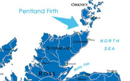
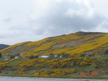
The treacherous Pentland Firth was crossed without incident because we got are timing right and the weather was fair. All down the East coast of the Highlands the gorse was ablaze with yellow and we had frequent visits by porpoises. Altogether a delightful sail.
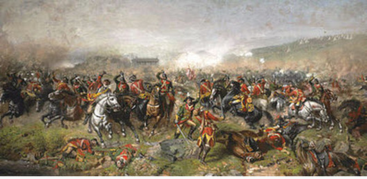
One of the surprises was how shallow the approach to Inverness was, the Moray Firth, which meant that the tide really rushed in and out; this was something that we had not allowed for in our timing so we struggled past Fort George and up to the Marina at Inverness. Our plan was to cross Scotland by the Caledonian Canal and then explore the Western Isles, fired I must confess by romantic dreams of Flora MacDonald ferrying Bonnie Prince Charlie ‘over the sea to Skye’. So before leaving Inverness we thought that we should visit that icon of Scottish history, the battlefield of Culloden (1746). The Great Glen crosses Scotland like a great rift valley from Inverness in the East, to Fort William in the West and was for a long time the battle line for the English against the Scots. Hence Fort George, Fort Augustus and Fort William. It is at the Eastern end, near Fort George that the battlefield is located. 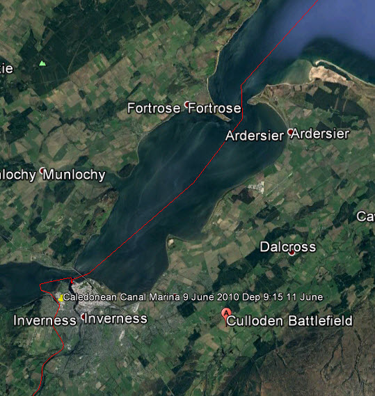 The Moray Forth, Inverness, Fort George and Culloden Thus one evening, when a light rain was falling and a mist was rising off this boggy moorland we visited Culloden. In retrospect a most suitable atmosphere for this mournful place. We were the only visitors at that time of day when the adjacent visitors' centre was closed (we returned another day to view the interactive visitor centre).
The Caledonian Canal connects a string of waterways by 29 locks, the River Ness, Loch Dochfour, Loch Ness, Loch Oich and Loch Lochy. In fact,only 33km of its 97km is in man-made canals. The first, Loch Ness was disappointing with its tacky tourist resorts exploiting The Loch Ness Monster or ‘Nessie’. However, after ascending the flight of locks at Fort Augustus it became beautifully remote and unspoiled such that we extended our passage by spending extra nights at moorings.
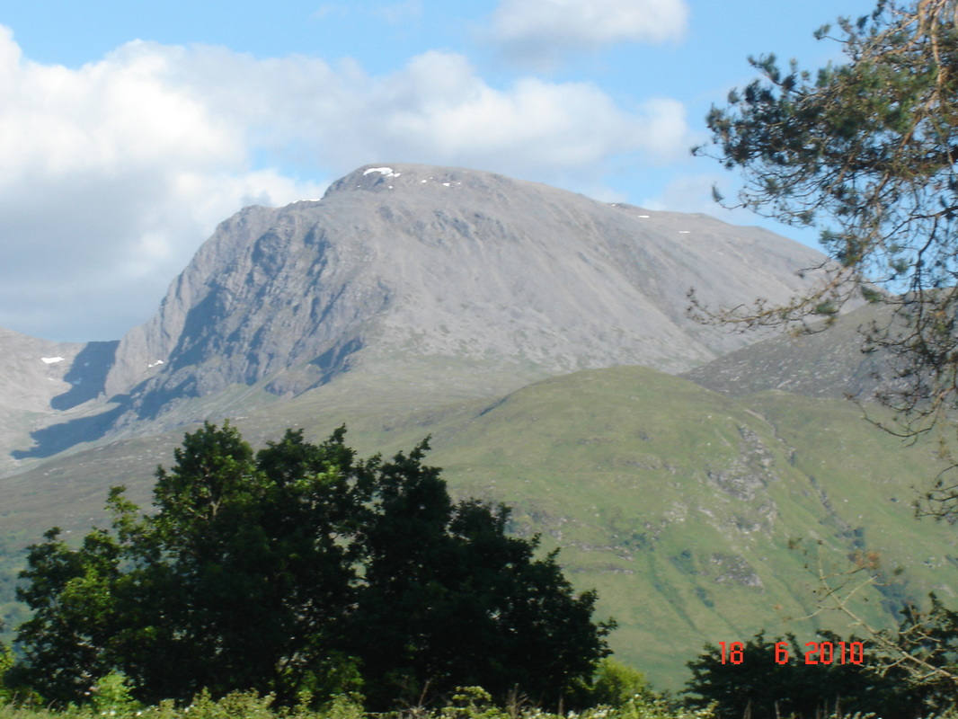
The passage finally skirts Ben Nevis, the highest mountain in Scotland, before descending by an impressive set of locks called ‘Neptune's Staircase’ to Loch Linnhe and the sea. 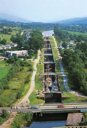 Neptune's Staircase
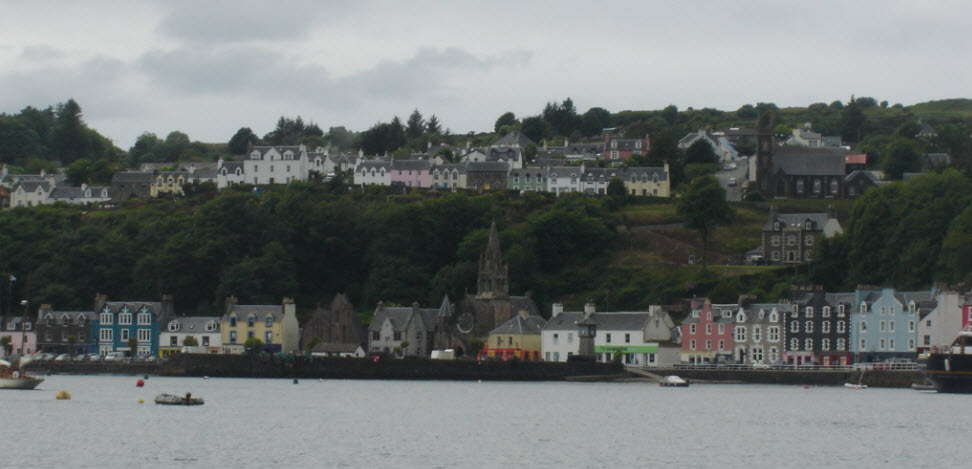 Tobermory Tobermory is a pleasant tourist town and the logical jumping off point for the Western Isles. Our plan was to round Ardnamurchan and pass North of Skye through the Kyle of Lochalsh before crossing to Portree on the Isle of Lewis. However, it was not to be, as we had so often learned when sailing.
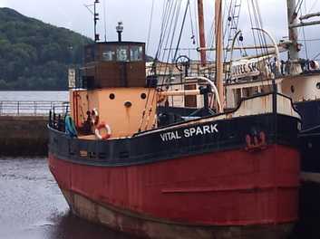
However, Scotland has a way of compensating. When we were passing Ardnamurchan again , in a temporary clearing of the weather, we were suddenly surrounded by porpoises, there must have been more than 100 for about a kilometre around the boat; some leaping in groups of 3 or 4, others singly but all in a feeding frenzy. It lasted about 10 minutes and then they were all gone. We were left breathless, realizing that we had witnessed something that very few people have seen and that we would never see again. 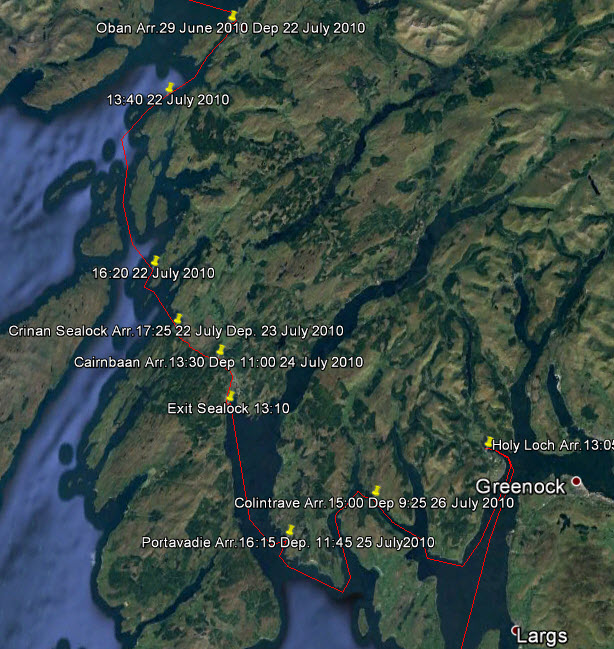 The Route from Oban to The Clyde From Oban we went South, threading through rocky islands with strong currents and eddies that made it exciting. We wanted to visit the Clyde estuary and Glasgow but in order to do this without a huge detour around the Mull of Kintyre it was necessary to transit the Crinan Canal. In the distant past we had lived in an old convoy assembly station at Kilcreggan on the Clyde and had never gone back to see it. 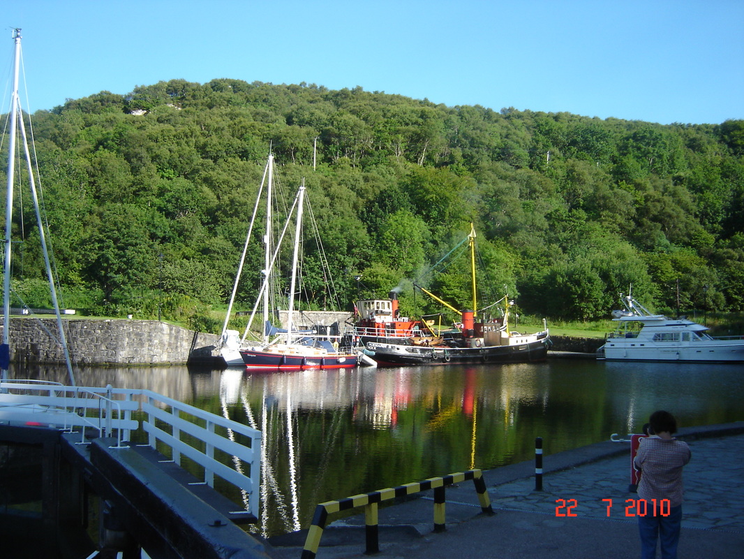 Enterprise Next to a Puffer Waiting in the basin to enter the canal we found ourselves next to one of the last remaining ‘puffers’ in Scotland. Now ‘puffers’ are a much loved icon in this country, they are small steam driven coasters that were the lifeline to the hundreds of coastal islands. They carried everything imaginable and could beach themselves on the sand to unload at low tide .
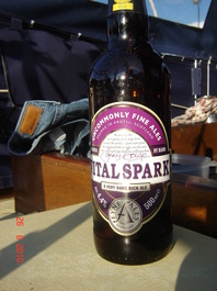
They became iconic when a series of stories about a puffer called ‘The Vital Spark’, and its irascible skipper ‘Para Handy’ ran for 20 years in the Glasgow Evening News from 1905. The last one in commercial service finished in 1993, killed by the roll-on roll-off vessels that did not need unloading. Later we went up Loch Fyne to Inverary where there is a puffer called The Vital Spark complete with an effigy of Para Handy. It is ironic that people pay big money for the privilege of shoveling coal, on a trip in a puffer. Old stokers must turn in their graves.
Now the Crinan Canal is a totally different kettle of fish to the Caledonian Canal since it is largely unchanged from when it was built 200 years ago, the 25 locks are all manually operated by the user so the passage is quite a feat of muscle power.
Leaving the Crinan Canal we were in an area of lochs and islands that are accessible to Glasgow and the Clyde with its history as a great manufacturing and shipbuilding centre of the industrial age. In those days this whole area was seething with activity, paddle steamers took the city people for excursions to the seaside and puffers plied their trade. Today there are relics of this age all over the area, decaying Victorian piers with their wrought iron curlicues and rusting hulks of once proud vessels. The shipyards are gone and Glasgow has many derelict factories but the area is re-inventing itself into a cultural centre with many new buildings in the downtown, and rehabilitation of the Clyde estuary. There is much nostalgia for the Golden Age of the Clyde and enthusiastic restoration efforts are under way to save features before they are lost.
Our course lay around the Isle of Arran and down the East coast of the peninsular called the Mull of Kintyre, which points like a finger to Northern Ireland, or Ulster. Over the last 50 to 60 years, great swaths of the Scottish countryside have been transformed from moors, bogs and infertile hillsides into coniferous forests. This was very evident as we sailed down the East side of the peninsular. Of course it makes good economic sense for nobody wants to live the life of a crofter scratching a living from infertile soil, but there is not much romance in looking at a coniferous plantation. Near the southern end is Campbeltown, the last harbour on this sparsely populated part of Scotland. Here the brutal Atlantic gales sweep right across the end of the peninsular. The countryside struck us as rather bleak with its steep, rocky, wind blasted crags.
The Harbour Master was right in the mould, telling us of all the stuff that we could do around Glenarm and the Antrim Coast.
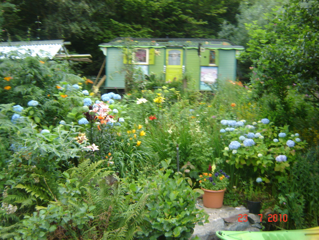
But there was an even bigger surprise, abutting the village were the grounds of a large country house, Glenarm Castle. The castle itself is very grand with turrets and porticoes but not open to the public except for one or two days per year. 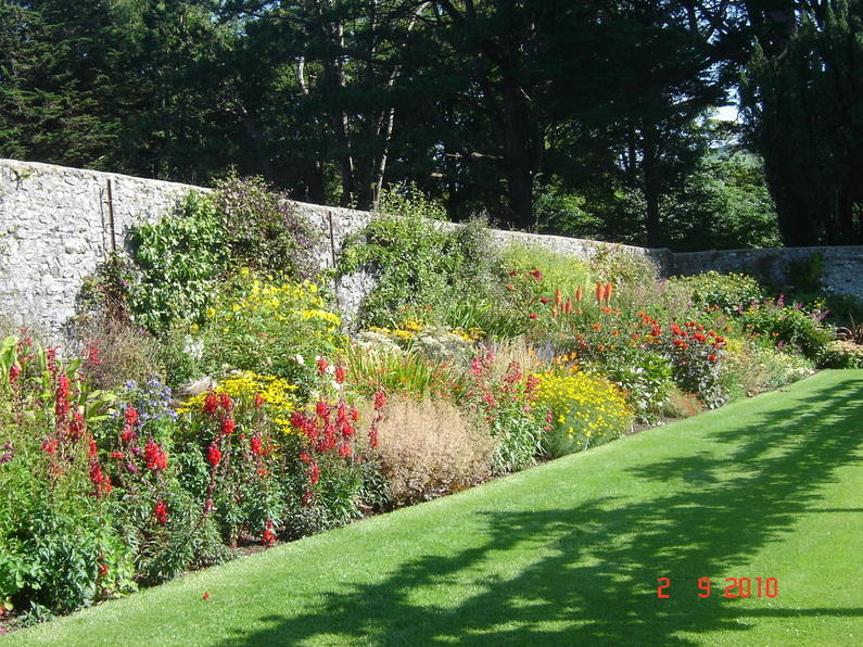 The Walled Garden ay Glenarm Castle The same goes for the meadows and grounds except for a large walled garden that has been extensively restored to its former glory, now rivaling the great European gardens. Although really too late in the season for most gardens this one still appeared in full bloom, an anomaly caused by the micro climate and sheltering walls. We were quite taken aback by this discovery, spending several hours there and returning for a second visit. Glenarm Castle is the home of Viscount and Viscountess Dunluce and their family. The castle has been in the McDonnell family (the Lords of Antrim) since it was first built in 1636. The McDonnell's have been in Glenarm for nearly 600 years and the Estate has been in the family for 400 years. Later when we had read the history of Ireland and learned of the Plantations we started to understand how these great houses, scattered throughout Ireland, fitted into the troubled history of the country.
From Carrickfergus we sailed South to the fishing port of Ardglass, near the border with Eire, passing the mountains of Mourne where they ‘sweep down to the sea’. It was a relief to refresh our souls with the beauty of the scenery but later we were to explore the countryside and found that echoes of the Troubles were nearby in towns like Newry, Armagh and Portadown. Then it was on to Howth in Dublin Bay as our cruise drew towards its end. 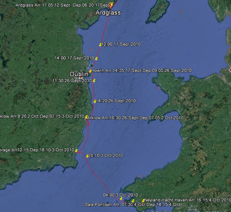 The Route from Ardglass to Neyland Suddenly the atmosphere felt quite different; gone was the underlying tension, people positively sought you out to chat, and they always seemed to have time to do it. Dublin was a hotbed of culture and we made the most of it with visits to three theatres, The Gate, The Abbey and Smock Alley, this latter one dating back to 1662; the Dublin Writers Museum and to the Book of Kells at Trinity College. The history of the ‘Easter Rising’ interested us and we saw key sites such as the General Post Office and others while covering other places like the Oscar Wilde Memorial. Everywhere there were side walk cafes, especially along the banks of the Liffey, and we were like kids in a candy shop. 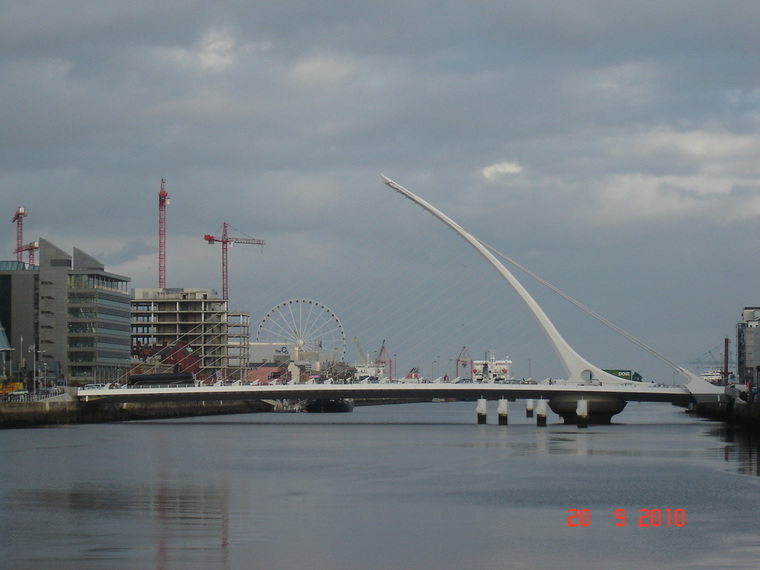 A Celtic Harp Over The River Liffey We could not resist the urge to dig deeper since we had read Edward Rutherford’s ‘Ireland Awakening’ and that history was all around us. Consequently we set off by car to cross Ireland and get a feeling for the country.
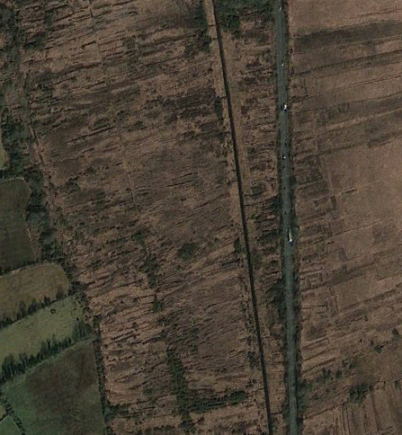
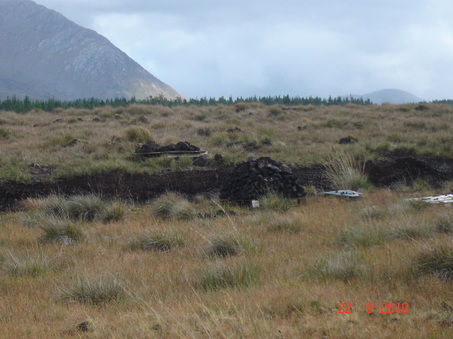
The West Coast is mountainous, bleak and treeless with poor soils. Traveling North we appreciated the wild beauty but it must have been a hard life; a few potatoes and digging peat . The extent of peat digging can be seen from aerial photographs; the whole countryside is scarred.
One item really got to us. This landowner was growing pineapples for his table in a heated glass-house while he evicted his starving tenants! During this great famine food was being exported to England. 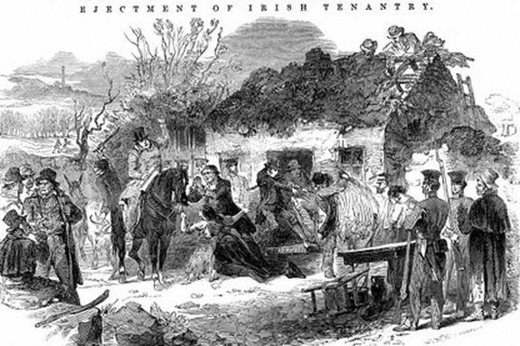 Contemporary Print of Evictions 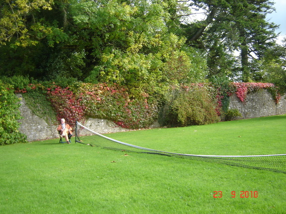 While the Land Owner Lived in Luxury The history of Ireland is a long tragic history of man’s inhumanity to man, it is a wonder that modern Irishmen can smile at all.
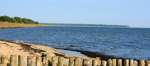
So as soon as the weather eased up we left for Wexford. Well not right into Wexford Harbour for it is a shallow, shifting channel and we did not want to get caught in there by bad weather.
That is how we ended up for the winter next to the ruins of the dock that was going to be the transatlantic terminal for Brunel’s great ship ’ The Great Eastern’, but that is another story. For other Cruising blogs see the Archive links in the sidebar at the top of this page.
Other blogs of interest are The Retirement Dream and How to Live Your Dream
0 Comments
Leave a Reply. |
Author June and I (David Phillips) have sailed the European and UK coasts for 30 years, the last 14 in Enterprise. It has been a continual exploration , inspiration and growth of experience. We would not have missed a minute of it.
It is a symbiotic relationship, you look after her and she looks after you and takes you into a fascinating world that is otherwise inaccessible. Ill health finally forced us to sell her. On 2 September 2017 she was sold. We hope that she will bring the same life changing experiences to the new owners as she brought to us. Archives
August 2019
Categories
|