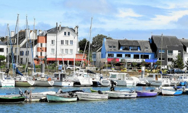
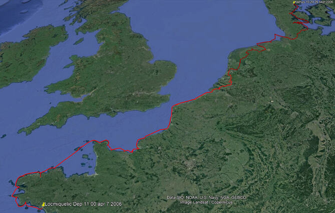
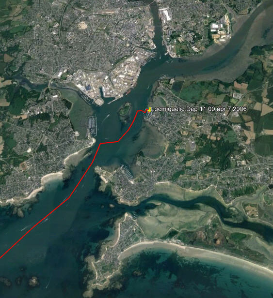
 Our Destination - Århus Denmark As soon as my winter work for the ‘oil patch’ was over we travelled back to England on March 18 to pick up our car from where it had been left for the winter. Then drove to Locmiquélic, on the estuary of the Blavat River leading to Lorient, where Enterprise awaited us at her mooring. All was well, except for a letter pinned to the mast asking us to call Customs in Vannes. The French Customs also act as a sort of taxation police, they dress like police and travel around looking for any tax infringements as well as customs duties. So, our hearts sank when we saw the letter but decided to worry about that later.
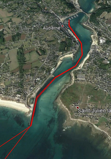
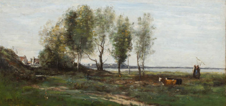
The next day we continued west around the headland of Penmarc’h to our next stop at Audierne. Penmarc’h is a formidable headland with scattered rocks way out to sea. We have passed it several times and it is always rough as currents clash here but we have usually been accompanied by porpoises playing around our bow and this time was no exception. 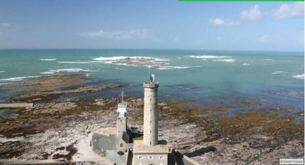 The Headland of Penmarc’h
 Locmiquélic to Morlaix
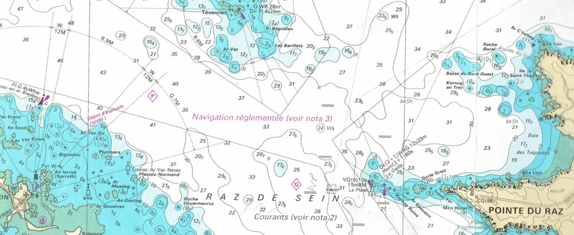
We had passed through on the last of the north going current so soon had to fight the current across the Baie de Douarnez, which was anticipated, but with the wind piping up to Force 3 against the tide it became a long, uncomfortable slog in a confused sea. The town of Douarnez has an interesting history as the birthplace of the sardine canning industry. When Napoléon was at his apogee, he needed a method of preserving food to feed his huge army, so a competition was launched to find such a method. It was won by Nicolas Appert in 1810 with a preserving method using sealed glass jars. For the sardine fishing fleet in Douarnez, fishing in these waters, this was a godsend for getting their product to new markets and sardine canning factories were established. Ten years later, with developments in tin plating and the invention of the can opener, the glass jars were dispensed with and canned sardines, as we know them today, were born. Today the industry is no more in Douarnez, having moved to more lucrative fishing grounds. At Camaret we were the only yacht in the marina, it felt very odd.
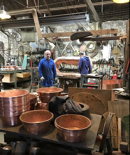
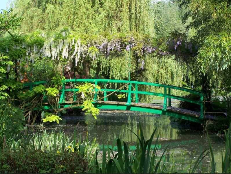
We had two urgent things to do once we had arrived in Morlaix; one was to meet our son and granddaughter in Paris but for that we needed our car which was back in Locmiquélic. So, the other thing was to get back to Locmiquelic. Now all through our cruising life on Enterprise we operated on the basis of having a car available to explore the countryside and cities away from the coast. First, we would usually use it to get to the last place we had left the boat and then sail away and leave it, sometimes for months, until we reached a place where it would be useful, then we travelled back to pick it up. However, it is often easier said than done because to get from one fishing village to another by public land transport is often very convoluted. This is particularly so in France for the main transportation links all radiate from Paris like a giant octopus and trying to cross from one leg to another is always difficult and sometimes impossible. On several occasions it was quicker to go into Paris and out again even though it was hundreds of kilometres longer. So, it took us a whole day with two train rides, two bus rides, a ferry ride and a fair amount of walking to get back to the car in this case. It was always worth it to have a car occasionally, for when driving through the countryside we would always find interesting places way off the beaten track. This car journey to Paris took us through Villedieu-les-Poêles, a town built on the manufacture of copper cooking pots, to the Bayeux Tapestry, then to Monet’s garden at Giverney. 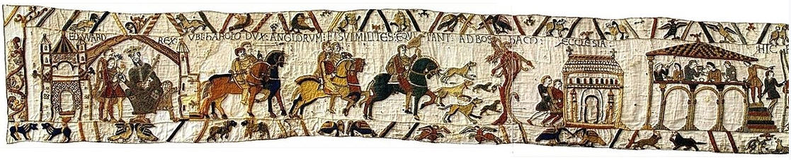 The Bayeaux Tapestry
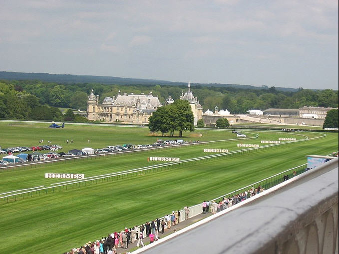
Finally to the elegant town of Chantilly where the upper crust of Parisians went to the races. Arriving at Charles de Gaulle Airport there was a precursor of things to come when part of it was suddenly shut down due to a terrorist scare.
We had spent 3 months in the winter of 1983 in Paris, so we knew our favourite places and made the most of the 3 days that we had.
The second priority was to take one of the hundreds of guided walking tours available. We took the one in the Palais de Justice where the French legal system was explained and several court rooms, with trials in progress, were visited. The court room where Marie Antoinette was tried has hardly changed since that time. We could imagine the offices of the famous Maigret right here on the Quai des Orfèvres side of the Palais. 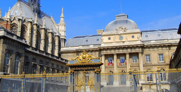 Palais de Justice
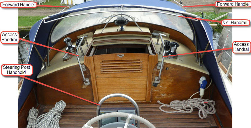
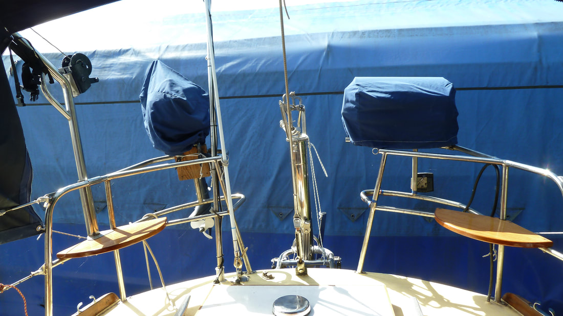
Back at the boat there was a long list of items to be attended to, including extra handholds around the hood (lessons from experience in heavy weather) and extra rails at the back of the cockpit for the BBQ and the outboard motor.
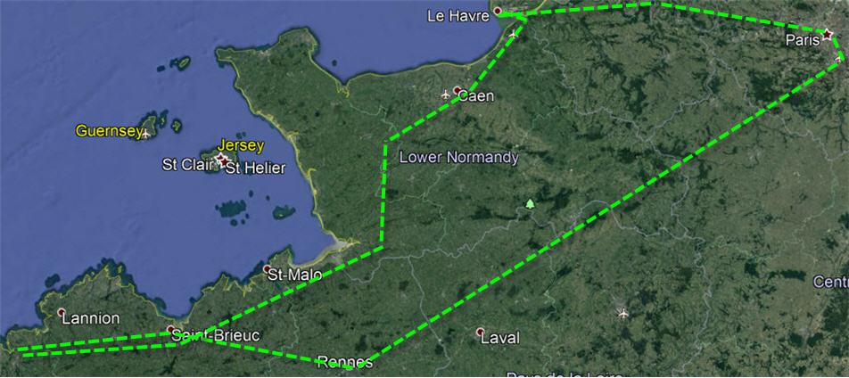
As soon as June returned from England with the car it was also time to tackle that annoying letter from the French Customs that had greeted us when we arrived back to Locmiquélic. Their office was in Vannes, a 3-hour drive away. After much interrogation they said that the boat had been in France for a year and therefore required a 'passport' for tax purposes regardless of whether we were on it or not. Actually, the taxes on the boat for 2005 were zero but they were still going to fine me 300 Euros for not having a 'passport'. They were determined to get money out of us one way or another. Then, because the boat was now outside their District, we would have to go to the office in Brest to get the 'passport'. Finally, I got back to the boat at 21:00 feeling very much down. A few days later we drove to Brest to visit the Customs Office who were appalled that we had been fined by the Vannes District; they said that a ‘Passport’ was not necessary and they were not going to issue one; we should forget the whole thing and enjoy our cruise. Our first big lesson in French bureaucracy. We benefited from that lesson when we changed our car registration to France from the UK. “There are so many regulations that one has to turn a blind eye to some or nothing would ever get done.” That was the lesson that we had learned. 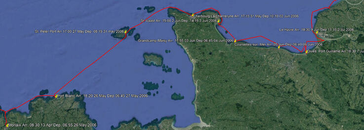 The Route from Morlaix to Le Havre We finally cast off from Morlaix on 26 May heading for Le Havre by way of Port Blanc, St. Peter Port, Cherbourg, St. Vaast, Grandcamp-Maisy, Courseulles and Dives-sur-Mer. This was our next rendezvous for we had agreed to crew for a friend on a cruise from Le Havre to the Scilly Isles and back to Falmouth. We were in the lock for 7:00 and sailed down the river on the rising tide to anchor in the Oyster beds until the tidal streams were right. At 13:00 we weighed anchor to carry on. By 1700 the wind really got up and we gave up the target of the Île-de-Bréhat and ran into Port Blanc (see our first experience in Port Blanc in 2004) but there was a very strong current to beat to get in. It was rough in there which gave us trouble picking up the mooring buoy and we had to launch the dinghy to do so. Finally we got it secured to the stern but before we could work it around to the bow, we swung into a neighbouring boat and smashed our port bow light. We eventually got the mooring line to the bow and things settled down. A very uncomfortable evening tossing about but June managed to cook supper. We both crashed with exhaustion to wait out the storm for a day at the mooring.
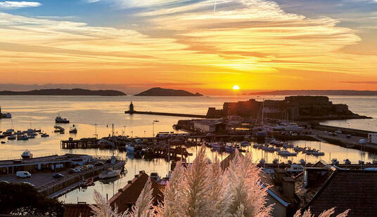
There is a brass plaque on the harbour wall commemorating the events. If you have watched the movie The Guernsey Literary and Potato Peel Pie Society you would recognize the harbour. We had visited the harbour several times on different boats but this time we decided to stay over for 3 days to explore the island and buy and install a new bow light. We were a bit disappointed with the island as it has been a bit overdeveloped and seemed to us like one big suburban sprawl.
The next leg to Cherbourg requires precise timing for the currents are extremely strong such that a sail boat cannot possibly fight them. So, at 08:15 we sailed out into the Little Russell channel, then into the Great Russell before threading the eye of the needle of the Alderney Race, around Cap de La Hague and on to Cherbourg. Our 2004 cruise blog describes this section in detail; this time it all went according to plan.
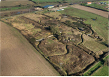
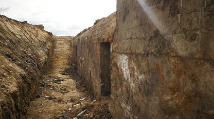
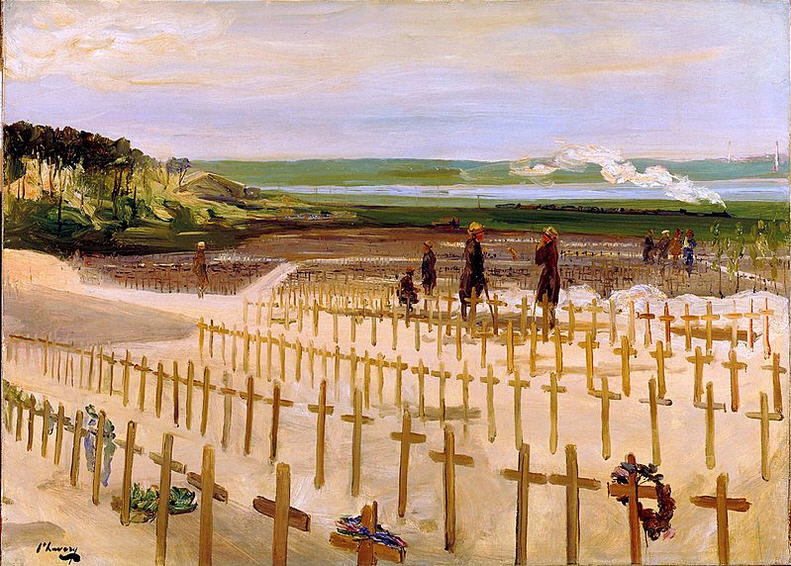
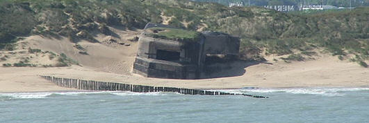
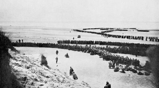
 Then it was time for the lock to open and we set off for Grandcamp-Maisy. A most perfect sail. Wind abeam and doing 6 knots. Straight through the lock on our arrival at 1800. Grandcamp-Maisy is located between Utah Beach and Omaha beaches of the D-Day landing on 6 June 1944 and held a real secret, for just outside of town was a huge buried Nazi command complex. Although the surface gun emplacements were known, the vast underground complex was unknown to the Allies and even to the locals. Built in particular secrecy, and under strict security, using forced labor brought in from the Soviet Union, Czechoslovakia and Poland. After the war the entrance was buried and the place forgotten for 70 years until it was rediscovered in the very year of 2006.
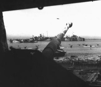
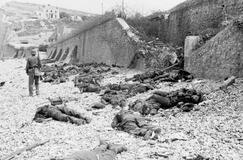
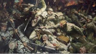
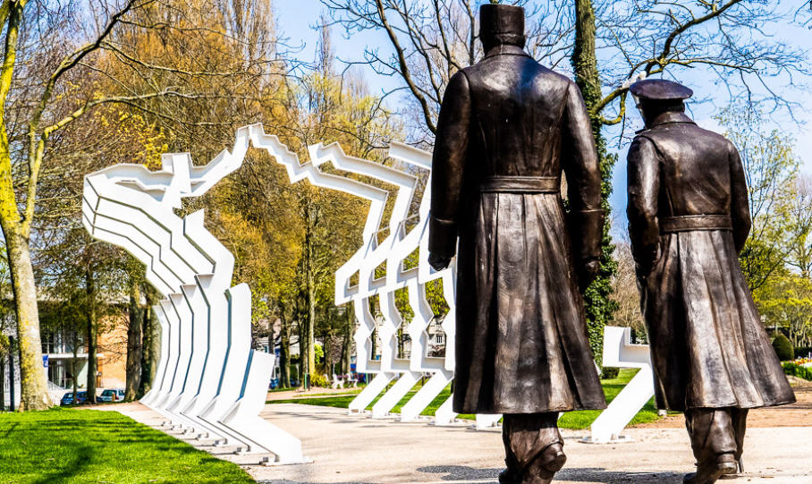
Omaha Beach was the bloodiest of all the landings because although planes dropped 13,000 bombs before the landing: they completely missed their targets; intense naval bombardment still failed to destroy German emplacements at the Maisy Battery and Pointe du Hoc. I had explored these beaches a few years before and when you see these fortifications with their 2 m thick concrete, like the U-boat pens, it is not surprising. The result was that Omaha Beach became a horrific killing zone, with the wounded left to drown in the rising tide.  Juno Centre at Courseulles-sur-Mer Juno Centre at Courseulles-sur-Mer A great sail to Courseulles with the genoa poled out. We got the spinnaker out and rigged but by the time that we were ready to fly it the wind had changed. An excellent day. We had not planned to arrive on the 62 Anniversary of the Canadians landing on these beaches, code named Juno. There were lots of veterans in uniforms around and at the Canadian Museum there were ceremonies and speeches. Then we walked along a beautiful sandy beach; it was hard to put oneself in that moment in 1944.
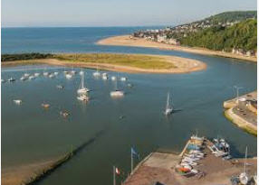
Another lovely summer day and we set out for Dives – Port Normande. A wonderful sail. An interesting approach. It looks as if you are going to sail right up onto the beach and then you suddenly turn to starboard and follow a dredged channel through a gap that opens up and there is a lock to enter into a huge new harbour.
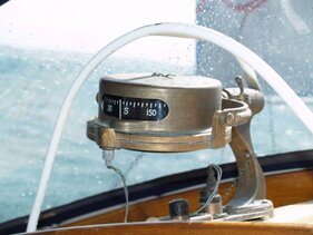
We tied up next to a Dutch couple of our vintage and spent time talking to them. They had exactly the same antique compass that we had! The harbour was surrounded with new apartment blocks. Many units were still empty. There is so much to see that we decided to stay a second night. It is just like a movie set of a 20/30's movie. The buildings survived the war and are, in their way, fascinating. It was from the harbour of Dives-sur-Mer that William the Conqueror set out on the Norman Conquest of England in 1066. A monumental plaque in the church lists the companions of the Conqueror.
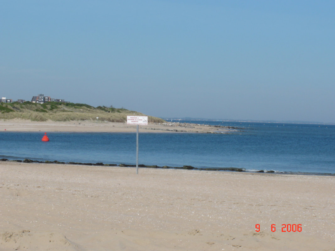
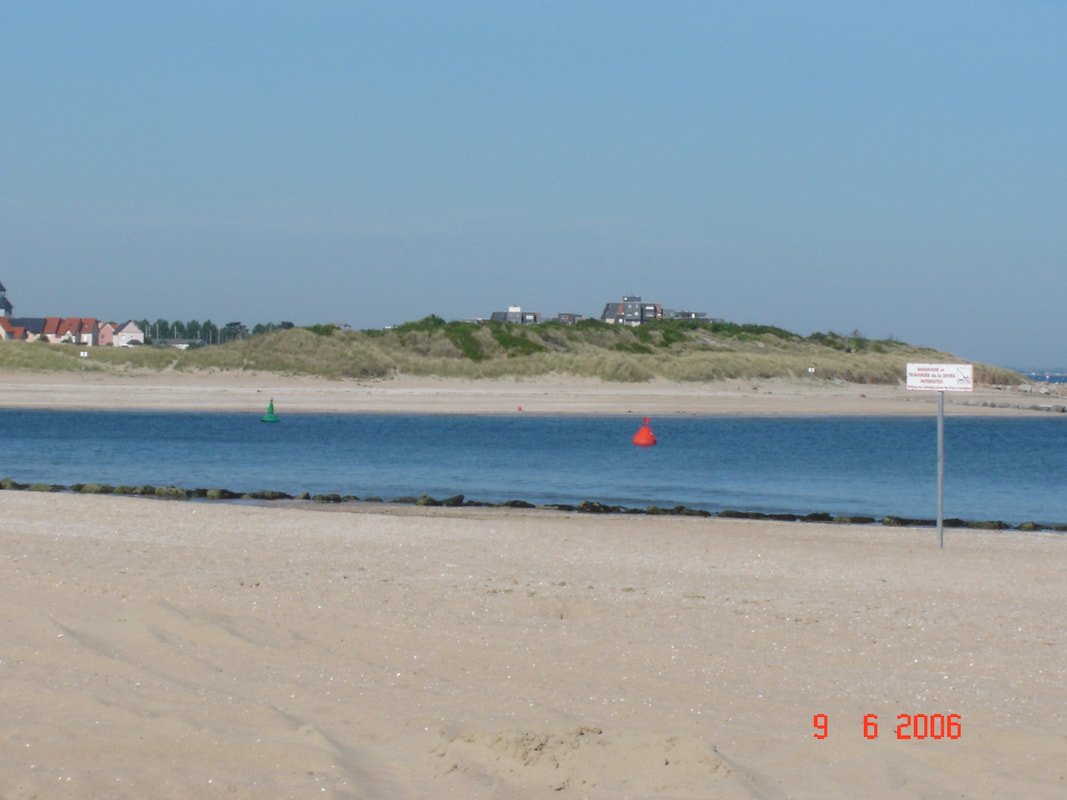
Locked out of Dives at 1100 and turned for Honfleur. The wind really came up and there was a strong current behind us. Scooted along at 8+ knots. Veered off up the Seine for Honfleur. However, we had not done our homework on the Seine currents and they turned against us before we reached Honfleur such that we were just crawling along and in danger of missing the lock to get in. So, we turned around and sailed back down and crossed over to the other side for Le Havre. We stupidly missed a Cardinal and sailed over a sandbank area. We did touch bottom but did not go aground; that would have been serious on a falling tide. A ridiculous, unnecessary error. There was a cruise ship coming out of Le Havre as we were going in, which is always interesting, like sailing very close to a moving skyscraper. 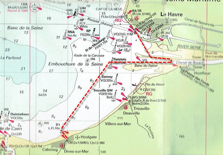 Our Seine Estuary Error The next day was fine so we decided to go to Morlaix and bring up the car. We found that it was impossible to go directly and we had to catch a train to Paris, St. Lazarre. Cross the city to Gare Montparnasse and catch a train to Rennes, then a train from Rennes to Morlaix!
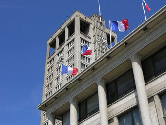
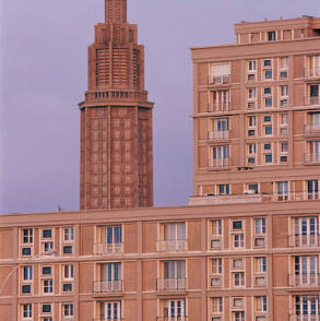
We researched where we could leave the car for the next 6 weeks, a skill that we were starting to hone, for standard parkades are far too expensive; marinas are usually OK since they are used to people being away for a 2- or 3-week cruise but sometimes they have events scheduled for their parking lots. We found that places that store holiday trailers in the winter are usually empty and cheap in the summer. However, they are usually out of town and require a long taxi journey to reach them. So, when that is factored in, we opted for an in-city parkade this time. A few days later our friend’s boat arrived and we set off in it to sail to the Scilly Isles; but that is another story. If you are interested in our cruise to the Scilly Isles click on this Google Earth link. (Depending on your browser, you may find that these two links just download a file that you then have to open). Make sure that you have the ‘temporary places’ box ticked when it is open. Clicking on the yellow push pins will open log entries. 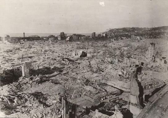 Le Havre After the Bombing of September 1944 Le Havre After the Bombing of September 1944 We have all heard of the bombing of Dresden but few have heard of the bombing of Le Havre in September 1944 when 5,000 men , women and children were killed by Allied bombs for a very dubious military advantage. Many feel that it was a war crime. In 1949 I went to Le Havre on a student exchange as part of a programme to rebuild ties between the UK and Europe after the war years of hate propaganda and devastation wrought by the Allies. The old city near the docks was just a wasteland of rubble with a couple of new buildings under construction.
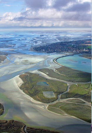
Arriving back early in the morning of 2 July by the night ferry from our cruise to the Scilly Isles and Cornwall we cast off and were on our way to Denmark by 11:15. This would be a different sort of challenge to our trip South down the western side of the English Channel in 2004. It is similarly strewn with sandbanks, somewhat more extensive, but there are less conveniently placed ports in the first part of the trip. ‘Convenient’ to a sailor means that the window for tidal access (if there are locks, sills or bars) is such that you can enter and exit to catch the tidal streams in the right direction. If there is not sufficient time between earliest exit and latest arrival then you are stuck with fighting the tidal current until the next port.
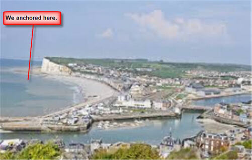
For us, with or draft of 1.43m, we could enter at all states of the tide (provided that the dredging was up to date). These high white cliffs are a geological extension of the white cliffs of the Jurassic coast and the Isle of Wight on the Southern English coast and that remained after the Atlantic Ocean had broken through. Approaching from the sea the first thing that comes into view is the ancient Benedictine Monastery perched on the cliff top and famous the world over for its liqueur. Le Tréport was the next port, about 38nm away. We could have gone for Dieppe but that was not quite far enough. Like Fécamp, Tréport is a former fishing port located in a river valley that cuts through the cliffs. However, this port was more problematic as there was a bit of a bar at the entrance and the depth contours on the chart did not match those in the Almanac; it all sounded as if the dredging was not up to date. Okay at high tide but a possible problem at anything less than half tide.
Then the infamous Somme River with its slaughter of epic proportions in the First World War and its 1 million casualties and then the equally infamous Étaples army base where one of the hushed-up mutinies of the same war occurred.
Boulogne is a tidal port and to reach the marina you must lock in. However, there are tidal pontoons that avoid having to lock in and that is where we went as we wanted to get away early to catch the tidal current going North. We found this location to be a rather depressing place next to an abandoned ferry dock that is rotting away. When the Channel Tunnel was completed there were far too many ferries for the remaining traffic and a brutal shakedown of the industry ensued. Boulogne missed out while Calais remains busy; similar situations exist everywhere we go, where an industry declines and the towns are left stranded. Local tragedies that most of us never see.  The Tidal Pontoons in Boulogne The Tidal Pontoons in Boulogne The pontoons for visitors were at the base of an intimidating dock structure, I always dislike these situations when you are up against the dark underside of a dock with the noise and slosh of the water at low tide. We did not explore the town, which was perhaps a pity because it has a long and interesting history, but it was raining hard and we were to cast off at 04:45 the next morning, July 4, to catch the tidal current. These early starts are always a little intimidating and this was particularly so; we felt like we were the only persons awake as we cast off from that ominous dark underside of the dock and motored passed the rows of silent boats. Sailing North from Boulogne the Channel narrows considerably and it is necessary to take an in-shore route to avoid the busy traffic lanes although this means that there are plenty of well marked sandbanks. Just after Cap Gris Nez we sailed past the village of Wissant. This was the Nazi headquarters for lobbing shells across the Channel; a practice that they kept up for nearly 4 years! Dodging lots of fishing boats again today, not surprising as Boulogne has an active fishing fleet. Motor sailing again. With the current at first but then it turned and the last bit was a battle. Arriving in Calais there are harbour traffic lights that prevent entry if a ferry is leaving, once through those there is a lifting bridge to wait for before reaching the marina. A busy port with ferries coming and going all the time. This is where Julius Cesar assembled his legions for the invasion of Britania; Calais has been the centre of battles over the centuries. It was conquered by the English in 1346 and remained English until it was retaken by the French in 1558. History repeated itself in 1805 when Napolean assembled his army here for the invasion of England which he later aborted. Then in 1940 the retreating British Forces held out here against the Nazi army and in the the process Calais was totally destroyed. Then after liberation it was bombed by the Allies by mistake! Currently it is in the news as the centre for refugees trying to get to England. The city was rebuilt in the utilitarian, concrete style of the 1950's but without the flair of Le Havre.
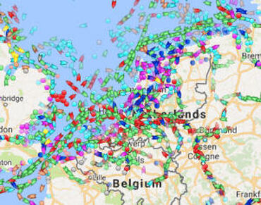
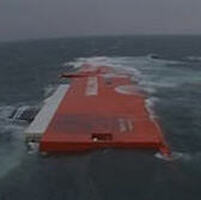
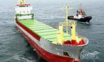
As we approached the Belgium border the French customs boat came out and hovered on our tail, probably checking up on us through our MMSI number but they did not board us. Then they went off to another yacht that they did board. We had been told that having an MMSI number and transmitting that number via AIS would reduce the hassle from customs police and it seemed to work here and latter in the River Elbe. This was to be a day of sandbars in the Scheldt Estuary. 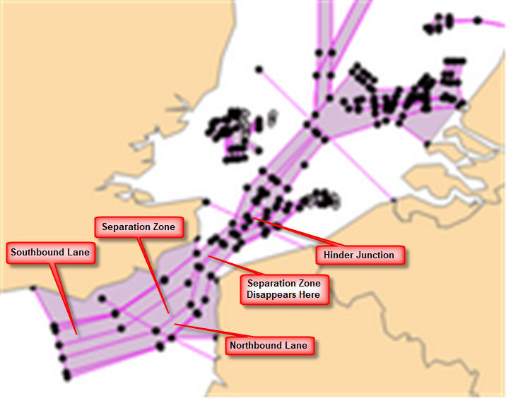 Traffic Control Lanes in this Area This is an area that seems to get very little exposure and yet has been the scene of great events. The Estuary is the main route to Antwerp and Rotterdam and branches off here from the traffic lanes continuing North to Hamburg and the Baltic. Just at this junction, less than 4 years earlier at Hinder Junction, a container ship ( the Tricolor) had rammed into the back of a car carrier which sank in 90 minutes taking 2,800 high-end cars down with it.
The incident triggered a lot of publicity about the lax standards in commercial shipping and the large number of near misses. There is a tendency to think that because a vessel is large it must be meticulously navigated but after reading the reports on this accident, we always assumed that there was no lookout on these large ships. In fact, the situation gets worse with auto navigation because it breeds an over confidence and yachts are often virtually invisible from the bridges of these large vessels.
We walked to a nearby village and found a poor, cheap grocery store. When we got to the cash desk, they would not take our French credit card (Carte Bleu) so we had to put most of the stuff back. Left with 6 euros in our pocket and a bad taste in our mouth. So, the day's impression of Belgium was rather negative but this is our only stop in the country so it did not matter.
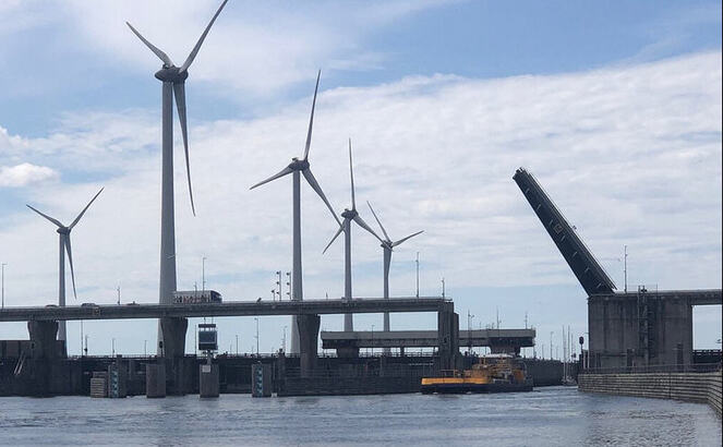
Sat in the café next door and had coffee. Spoke to a fellow who was born in Southampton like us. After our jobs were done, we walked into the old town of Vlissingen. It was Sunday afternoon and the centre all go with jazz blaring out from a temporary hall on the town green. It was a fete day but many places were closed. We wandered around and found it fascinating. Found an internet place but it was closed on Sundays! Stopped at the Marina bar and had drinks with bitterballen. We rather like them but they only seem to be available in the Netherlands. In the evening I went back to the bar to see the Final of the World Cup. France versus Italy, a very exciting game ending in a penalty shoot out after extra time. Italy won 1 – 0 but there was not the excitement of Calais because we were no longer in France. 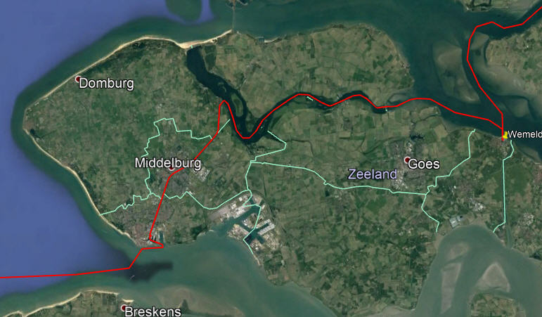 Our Route Through Zeeland Vlissengen to Wemeldinge We left Vlissingen at noon after buying groceries and charts to cover the next region. We did not have any info about the Dutch canal system until we reach Willemstad. We did very well under a baking sun all day. It exhausted me for on the inland waterways, you can't rely on the autohelm and must stand at the wheel all the time. Our route took us through 5 bridges between Vlissingen and the village of Middleburg and that was only 3 nm! No stopping but carried straight on to the Veere Meer and over into another canal and through a couple of sluis until we came out into the tidal Oosterschelde. Perfect timing. Then on to Wemeldinge. Current against us in this tidal water. Lovely surprise for the marina was great, although quite large. We radioed in for a berth and were allocated F7, a pontoon with smooth easy access with electricity right next to the boat. Very efficient and convenient.
Nowhere else, wherever we go, has this degree of exactness, precision, cleanliness and so on. In the afternoon we went to our bar and used their internet. We spent a good 3 hours sending email and organising our trip to England for my brother-in-law's 75th birthday party. They only charged us 5 euros for all that time; which was cheap compared to other places. Then we walked all around the headland on the dyke. It was very refreshing to have a breeze with the intense sun. Then back through town to buy phone cards and back to the boat and supper. HOT: HOT Glaring sun all day from 8:00 the next day. After breakfast it was 9:00 and we left the lonely spot called Welmeldinge. I would return as it was a very hospitable place. Then it was on to Krammersluisen where there was only a short wait before we were out again and on to Volkeraksluizen.
We left to make the 10:13 bridge opening. It was a bit tricky to get out with all the rafting up. Then up the Hollands Diep before turning to port and into the river system. This took us into the Province of South Holland, a densely populated and more industrial province. The whole system around here is busy with big barges. The River Patrol stopped us and asked us to use the starboard side of the river (where we should have been anyway). Further on, we took a wrong channel, down the Oud Maas and did not realise it for a while before we had to backtrack to the main channel. Then there was a long wait (20 min) for a spoorbrug; Veerkeersbrug. These are always slow as they only open to the train timetable and not traffic demand. This area is very confusing with waterways everywhere. 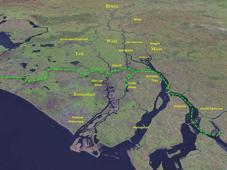 Finally, we took a humble entrance into Alblassadam with a little marina on the other side of a broken green bridge. Found a corner spot and neighbours helped us in. Another fellow explained how to get to an Albert Hein grocery store - they are everywhere. Travelled from Alblassadam to Gouda. Neighbours helped us out again as there was a nasty cross wind. Pottered around to get the 10:13 spoorbrug opening. Tied up for a short while to wait for it. Once through another 9 bridges to go until we arrive in Gouda. This canal trip has taken us through all the different views of the Netherlands, industrial areas, recreational zones with their hundreds of dinghies whipping around, quiet rural suburbs and cities. We could have by-passed the recreational zone for there are several alternate routes but I am glad that we have done it, but would not do it again.
Travelled from Gouda to Lisse via Leiden - a heavy day in the heat with 19 bridges to get through. It seems that all our day was about bridges. A number of them were time specific but most of them opened when it suited them. It is the railway ones (spoorbruggen) that seem to cause the trouble.
 Sixhaven Marina, Amsterdam, Just Across from Central Station The log of that cruise can be found on the Google Earth File on this link. However, this episode is different story. After they had left we took the train to Paris and the next morning a train to Le Havre where we picked up the car and took the ferry to England to attend my brother-in-law's 75th birthday party. Then a visit to see the Constable paintings at the Tate Gallery and a Proms Concert at the Albert Hall before travelling back to Haarlem via Harwich and the Hook of Holland. Finally, after having a Wabasto hot water heating system fitted, getting the engine checked out, the VHF programmed for our MMSI number, the ship registration updated and then, loaded with vegetables from nieghbours gardens, we left for the Baltic at 15:30 on the 1st September. We went down the canal tucked in behind the barge Watergeus and at the second bridge tied up to her as there was a 1½ hour wait. All bridges through Haarlem were closed between 16:00 and 17:40. At last, tied up at Haarlem Yacht Club at 18:50 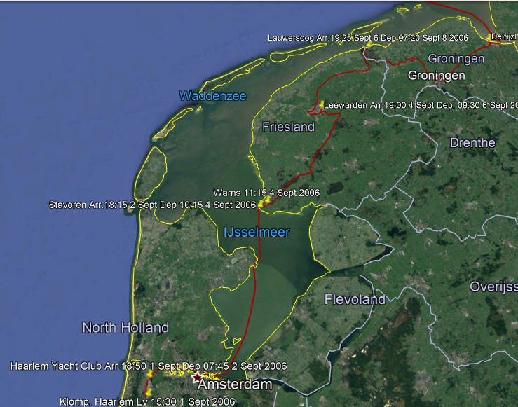 Our Route Through the N Part of the Canal System
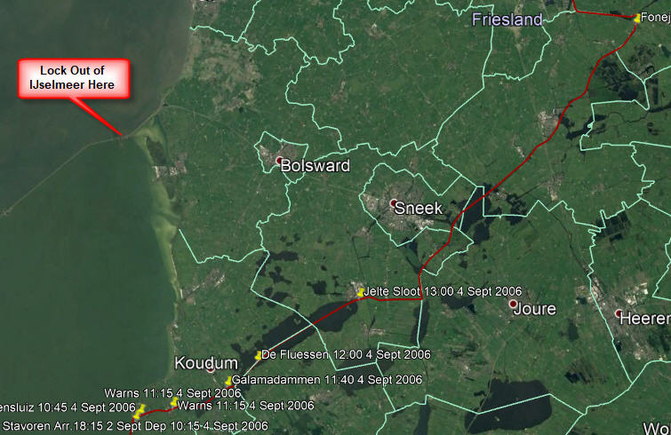
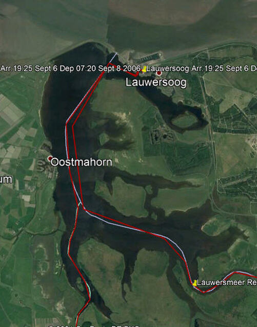
From Stavoren there are various possibilities; lock out of the IJsselmeer into the Wadenzee, but for that route you need to be able to sit on the bottom at low tide and you need good weather; go through the canals to Lawersoog, lock out into the Wadenzee and take a shallow winding passage through sandbanks to get outside the islands but the weather must be good for that; finally go all the way up to Delfijzl in the canals and lock out into the River Eems. We decided to go to Lawersoog and then make a decision about Delfzijl.
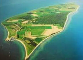
To Delfzijl on the Eems River. 07:30 -18:30 a mixed day. We had to call up on the VHF about getting the bridge open at Reitdiepbrug. They said "press the button"! It turned out to be on a pile close to the bridge; obviously designed for motor boats for it was very tricky for us to reach the button so close to the bridge. Several bridges like that today. Through Groningen - 14 bridges which were all synchronized and opened as we approached. It was a long day as there is little chance to use the autohelm which means that you are stood at the wheel all the time. As far as Groningen it was extremely picturesque but after that it became rather boring. Once again, perhaps we should have stopped at Groningen for it looked fascinating with its ultramodern buildings. Several bridges had artwork on the underside that could only be seen when the bridge was open. At Delfzijl we locked out of the controlled waterways and into the marina at the Eems river level. The German border runs down the centre of the river. 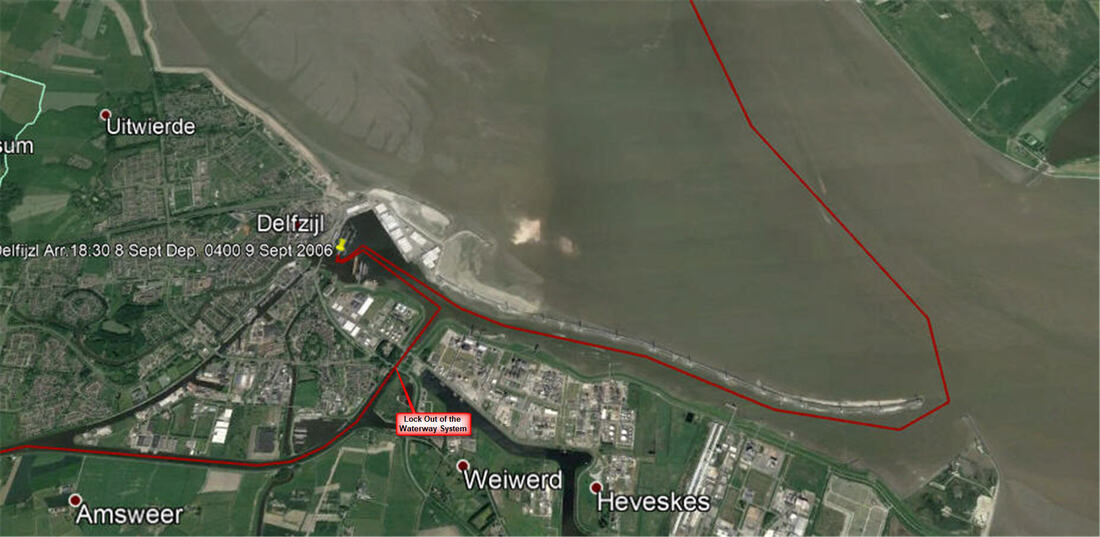 Our Route at Defzijl Where We Exited the Controlled Water System There were some tricky navigational calculations for today to catch the right tidal streams in the River Eems and then to get through the Gat at Langeroog. Left Delfzijl at 04:00 9th September and it was rather intimidating with a mass of navigation lights as one left the harbour entrance and inserted oneself into the traffic stream at the right place. The channel does a big sweep to the West to get outside the island of Borkum. There is a passage on the inside but you need a flat bottom to dry out at low tide and then float again on the rising tide. Tricky entrance to get in between the islands with strong currents with a small window. Arrived at Langeoog harbour 14:55.  Langeoog Harbour - Sandbanks Everywhere
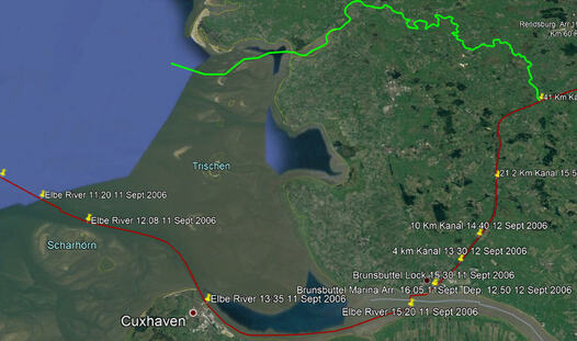
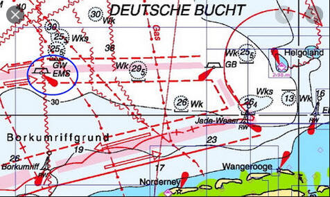 Traffic separation Schemes Approaching Helgoland Traffic separation Schemes Approaching Helgoland We got away as early as possible and so ploughed a furrow in the mud to get out. It was a bumpy ride into the wind. We both feel very tired because of the long hours that we had been sailing and the nature of the sail. Crossed the Jade River entrance and traffic lane then the Elbe lanes and North to Helgoland. It was quite a stressful time. We were finally rafted up and were rather penned in by others rafting up to us. We did not go into town although it has been developed as a casino and duty free destination since its days of being a practice target for bombers. Helgoland to Brunsbüttel and into the Kiel Canal today. Up at 05:00 to let our neighbour out and then left at 07:00 - arrived Brunsbüttel 16:05 An early start as it is vital to get the current in the Elbe right. It is so strong that you cannot fight it at the flood/ebb so you have to get to Brunsbüttel well before the full ebb current. We had the 'departure shuffle' when you are not rafted on the outside but have to leave first.
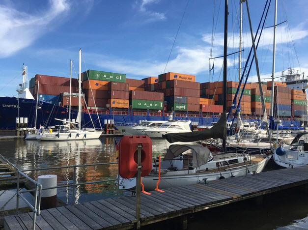
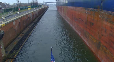
The trip was OK to get to the Kiel Kanal, arduous but altogether reasonable and we did not encounter any of the difficulties we had read about. The South bank of the estuary is the North end of the Waddenzee a huge area of sandbanks that are submerged at high tide. This is 'Riddle of The Sands' territory. Erskine Childers, the author, was a fascinating character who ended up being executed by a firing squad. Approaching Cuxhaven the coast 'hardens' wih dykes holding back the sea. One's eye is always on the clock and the tidal stream for if it looks like you cannot make Brunsbüttel before the full ebb current then Cuxhaven is the last place to stop. We were in good time, went straight on and were very lucky that the lock gates were open and we could go straight into the lock. There are four locks side by side, the two small original ones (out of service when we arrived) and two huge ones completed in 1914 and built to handle the Kaiser's battle ships. We entered one of these. 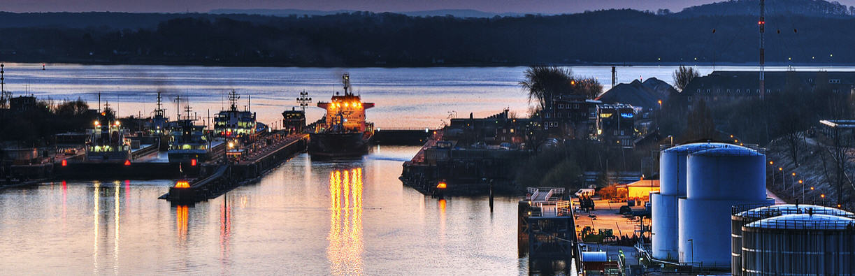 The Lock That We Used, With The Gate Open The procedure for small pleasure vessels is different from the usual i.e. tying up to chains on the walls or bollards at the top; here there are floating, slimy log pontoons that you must tie up to, probably they act as fenders for large ships. A crew member must manage the lines from the pontoon as it floats up. This is not so easy if you have a boat with a high freeboard. Another problem is that the boats fender float because the logs are at water level, so you can get some nasty black marks on a pristine boat. It is the same situation at the other end in the Haultenau locks but there you have to secure the boat and go to the Kanal office to pay the passage fees.
We had not found a succinct set of regulations for sailing the Kanal and were muddling through. Then we sailed past a traffic light set up; three rows of lights on top of each other. We did not understand the traffic light system. Did they only apply to large vessels? The traffic lights were Red Red White and we were debating whether to stop since 3 Reds means that yachts must stop and we had been seeing a single Green. We decided to proceed and at that moment the VHF switched itself to channel 16 with an emergency alarm followed by an emergency announcement in German. (We had 'dual watch' on the VHF set to Channel 2 for canal traffic and Channel 16). We did a U turn and went back to where we could see the traffic lights and reflected about the meaning. We proceeded. However, looking back we saw a rescue helicopter doing something. So there was an emergency but it was elsewhere. Although we had set off late to do the 66km to Rendsburg and worried about making it in time, we did it by sunset and were tied up in a box about then. Quite a day. We did not leave for the last leg to Haltenau until 15:20 and it took 20 minutes to get to the Kanal, this turned out to be too late. Unknown to us, at the 86km point the Kanal narrows (the 'Eastern Section') and larger vessels take turns in this stretch. At 84 km there is a widening with mooring piles down both sides and as we went by we passed a yacht hovering outside the piles but we did not realise the significance and continued. 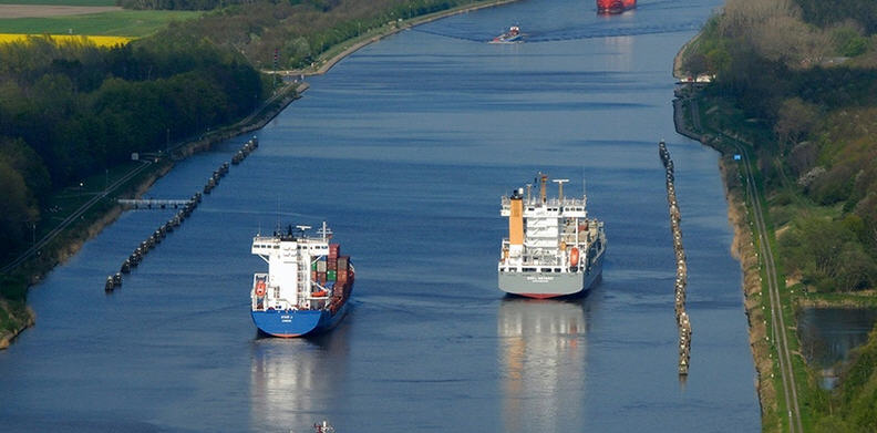 Mooring Piles at Kilometre 84 before the Eastern Section A couple of kilometres further on, at the narrowest part, we met a large frieghter coming the other way and squeezed close to the bank. What we did not realise is that the ship pushes a bow wave which lifted us up and slid us down and outwards towards the ship. We were so close to the bank that we touched bottom in the trough. The same thing happened as the stern went by but that was not so alarming as the ship had then passed. When we arrived at the Holtenau Locks it was getting dark, just in time to comply with the regulation of not travelling after dusk. The mass of lights were confusing and we hovered by the old locks that are usually used for small craft. The large locks were full with ocean going vessels. Eventually they left and two more entered. Then the light went white for us. The small locks were not being used and we were being tucked in with these huge vessels! Then we had to wait for two more large vessels to enter. We were the only pleasure craft in the lock.
I was a bit shaken by the experience as I don't have the head for heights that I used to have and it all felt claustrophobic. Next time we will make sure that it is daylight!! We exited to a mass of lights in the pitch darkness and crept over to the tiny marina at Holtenau. Now we are in the Baltic. The harbourmaster banged on the hull at 07:00 and gave us a sudden start to the day! Lovely sunny morning. We walked around Holtenau, picturesque on the waterfront; cottages and roses etc., then we walked up to the top and back.
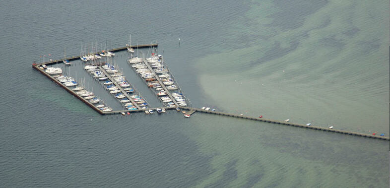 Wackerballig Marina, Very Tight Alleys in a High Wind We made a mess of trying to get into the box. The trouble is that you can get the stern lines on the piles but then have to drive forward strongly at the risk of hitting the dock hard but even then you can't get over the bow to secure it before the bow blows off and you end up diagonally in the box, or worse if the adjacent box is empty. After a couple of tries we gave up and backed out with great difficulty and left the marina. The alleyways were tight so we could not turn round in such a strong wind. We continued and put in at Gelting. Hard to get in between the piles (as usual) but made it. 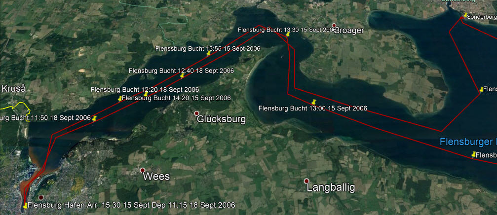 After great showers at Gelting we set sail for Flensburg on 15 September. Again a fine, sunny sail, brisk and enjoyable, there were lots of sail boats out, some racing. The border between Denmark and Germany runs down the centre of Flensburg Bucht so we were crossing from one country to the other all day. Put in at Flensburg at 15:30.
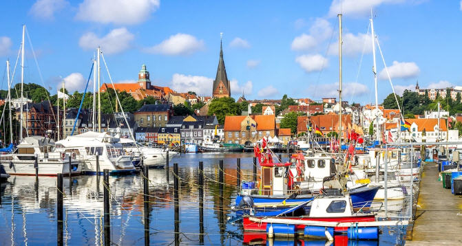
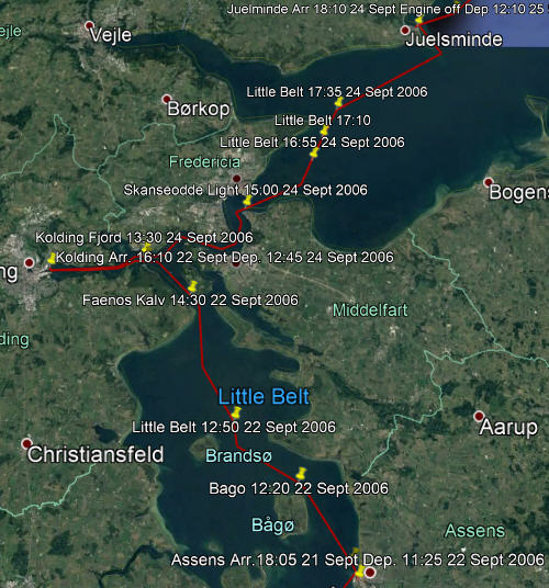
Flensburg struck us as a very pleasant town and has the dubious honour of having been the capitol of Germany for three weeks from 1 May (the death of Hitler) to 23 May 1945 when the Regime was dissolved. Until 1864 Flensburg was part of the Kingdom of Denmark until lost in a war with the Prussians, there is still a strong Danish presence here. Tomorrow our friend Ron is joining us for the sail up to Århus and driving our car up from Haarlem to get here. 18 September. Showers and then a walk up to the butcher. Back to the boat and off to Sønderborg . Pleasant enough sail until fog set in and it got a bit tossy. Tied up at the quay wall close to the red brick castle. This was our first experience of Denmark. We walked into town. It all struck us as clean and beautifully maintained. Now we have to change from Euros to Kroner. Denmark like the UK kept their own currency. 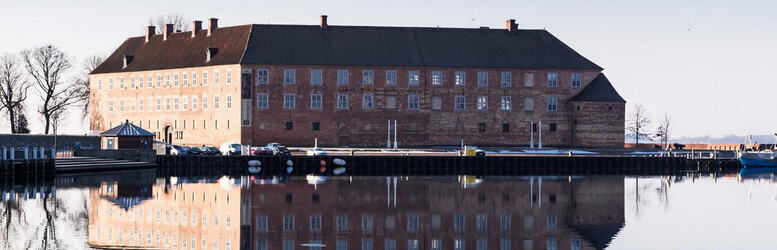 Sønderborg Castle Housing the Museum 19 September - In the morning we went to see the castle museum close to the boat. Fascinating and so well displayed. At noon we left for Marstel, about 30nm. Arrived at 18:15 through a very narrow channel entrance. A good sail today but very rolly in a choppy sea. Went to the pub in town in the evening and chatted to three retired merchant seamen. It seems that Marstal is very popular with the martime community that finally want to drop the anchor. A very pleasant evening. Engine on and cast off at 13:30 in a SW wind Force 5 from a very wide box with a strong cross wind. Used the new spinnaker line to hold the bow as we backed out. It worked well but the danger is that the long line can easily get caught around the prop when it is released. 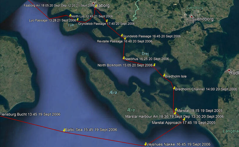 Sonderborg to Marstel to Faborg An interesting day picking the narrow channels and then a flog against the wind until we cut through the Reutille Passage. A challenge but that is why we came this way. Then a short cut to Fåborg through the Grydelob Passage. The wind moderated to Force 3 and came around to the West. It was a truly beautiful day, Enterprise sailed nearly the entire 30 nm, sea was just right, the sun shone and the land looked warm and comforting. Very sucessful sail. Our first box at Fåborg did not fit and we got wedged in. Changed to a wider box; you would think that we could judge the width by now but it is easier to go for a snug fit than one that is too wide. 21 Sept - Wind SW Force 3 A bit of discussion about the channel markers, where we will cut across Lyo Kug to Assens. Engine on and cast off using the long bow line technique again. Out through the exit channel using the Leading Line, then West past the N Cardinal to Knoldon Point and on to Assens. A superb sail. We rigged up to use the spinnaker but the wind got too strong for it. Again, lots of discussion about the passage. Not many sail boats out but lots of ferries hopping from island to island and a few tall-masted ships. In the first box that we tried we misjudged the width of the piles again and got stuck at the widest part like a cork in a bottle! Backed out and found another one.
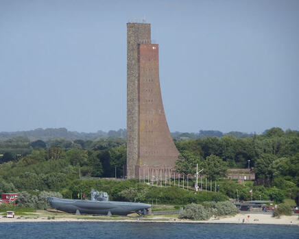
 The Little Belt Looking NE Juelsminde is a small, pretty and welcoming town with a good marina. In the summer a destination for rural, family holidays, the sort of place that invites you to stay longer but we were so close to our destination and the season was getting late that we felt an urgency to move on.
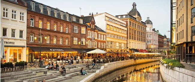
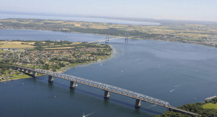
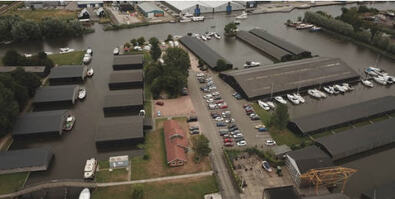
26 September, our last day of sailing this season and it was with mixed feelings that we sailed from Tunø to Århus. Sandbanks are all around Tunø so it important to not take the direct route but thread the sandbanks. We took the route to the East. Trying the spinnaker again today across Århus Bugt in light winds and mist. We put it up and down twice. As we approached Århus in the late afternoon high speed ferries crossed our path and commercial traffic increased. We tied up at the Aarhus Yacht Club in the Fiskerihavn. At that time there was a busy container port next door which would give us hours of interest in the days to come. It was great to have the car close by in the parking lot which enabled us to go downtown and sample the excellent cuisine to celebrate our arrival. The following day we drove to the airport to say goodbye to our crew member who had sailed with us from Flensburg. We were to spend the next 3 years in the Baltic and get to know the city quite well. It was the start of a love affair with Århus. For other Cruising blogs see the Archive links in the sidebar at the top of this page.
Other blogs of interest are The Retirement Dream and How to Live Your Dream
3 Comments
Randy L Parcels
2/6/2021 08:24:08
Awesome photos and an incredible adventure.
David Phillips
4/4/2023 17:13:21
I know that I am 2 years late in responding to you but now I am getting around to it! It is always nice to get feed back when you create something and just sent it out into the ether, I am glad that you enjoyed it. I would be interested to hear how retirement is going on the Island. Keeping up beat I hope. David
Eduardo Rhodes
20/6/2021 13:20:49
Awesome year David. Im working my way through the journals. We are going on a camping jouney this week so I should have time to read more about the Baltic. Ciao Leave a Reply. |
Author June and I (David Phillips) have sailed the European and UK coasts for 30 years, the last 14 in Enterprise. It has been a continual exploration , inspiration and growth of experience. We would not have missed a minute of it.
It is a symbiotic relationship, you look after her and she looks after you and takes you into a fascinating world that is otherwise inaccessible. Ill health finally forced us to sell her. On 2 September 2017 she was sold. We hope that she will bring the same life changing experiences to the new owners as she brought to us. Archives
August 2019
Categories
|


