|
June and I (David Phillips) have sailed the European and UK coasts for 30 years, the last 14 in Enterprise. It has been a continual exploration , inspiration and growth of experience. We would not have missed a minute of it. It is a symbiotic relationship, you look after the ship and she looks after you, taking you into a fascinating world that is otherwise inaccessible. Ill health finally forced us to sell her. On 2 September 2017 she was sold. We hope that she will bring the same life changing experiences to the new owners as she brought to us. 2015 The Waddensee
2012 The Green and Little Known Side of Spain 2011 Cold Welsh Rain to Warm Basque Rain 2010 The Norwegian Sea to the Irish Sea 2009 Northern Denmark and Norway 2008 Cruise in the South-Western Baltic. 2007 Cruise Norway, Sweden, Finland and Denmark 2006 Biscay to the Baltic 2005 Exploring Biscay - The Year That Nearly Broke Us 2004 Learning in More Dangerous Waters July 2004 Learning in Tricky Waters Other blogs of interest are The Retirement Dream and How to Live Your Dream Technical Blogs are Nail Biting Experiences #1 Crossing the Bar , The Changing Nature of Sailing and Cruising and Yacht Docking Skills for Northern Europe
0 Comments
The Waddensee is a magical place of shallow tidal waters where land and sky are indistinguishable on a misty morning. 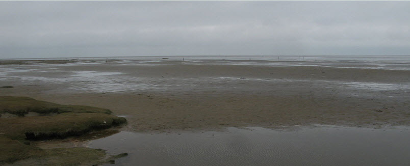 It is vast, stretching from the middle of the Netherlands to the north of Denmark; yet few know of it and less have seen it , in spite of it being a World Heritage site. This is because it is so difficult to access, and in the wrong conditions can be dangerous. 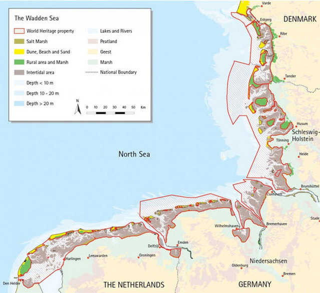 We decided to see something of this special place this year; although our boat is not suited to travel the shallow, drying channels that interlace its sandbanks because we cannot sit on the bottom without tipping over (we did that once a few years ago and it is not an experience to be repeated). Now we have done it we can say that it was marvellous to see this world of basking seals on sandbanks watching us sail by; families of birds of every type rearing their young, each in their chosen environment; oysters thick on anywhere they can find to attach themselves; and every pool teeming with aquatic life. However, the navigational challenge in a boat like ours was extreme. 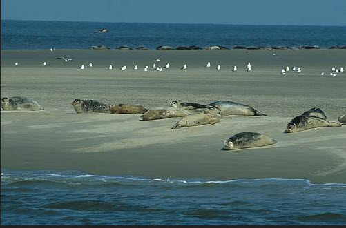 The west coast of Europe from Belgium to the north tip of Denmark is really a collection of sandy deltas formed by the great rivers of the Rhine, Scheldt, Maas, Ems, Jade, Weser and Elbe but after 1,500 years of building dykes, pumping and drainage the edge of the coast has ‘solidified’. Never-the-less, outside that edge, it is still as it always was; a water world of shifting sandbanks. This world is protected from the worst of North Sea storms by a string of 15 islands upon which the storms can expend their energy. The shelving outer coast builds up waves like a surfing beach and which continually cuts channels & fills them up like a cosmic bulldozer fuelled by the moon as it pushes and pulls twice a day. All that water behind the islands has to run in and out through the narrow gaps between the islands so not only are the currents strong but the channels are changing. This world outside of the islands can be calm and benign on a still summer’s day but change in an hour or so to a very inhospitable place. 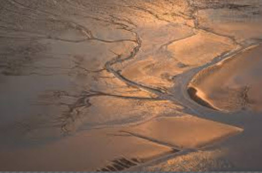 So we set out, by necessity to take the outer route to these islands with exotic names , like Terschelling, Schiermonnikoug, Langeoog, Spiekeroog and Wangerooge; then pass between some of them where there were suitable channels to see that inner Waddensee. The overall route can be seen in the Google Earth file; Haarlem to Aarhus 2015.kmz The first leg was to leave Den Helder on the Dutch mainland and pass out between Norderhoek and Texel, sailing past Vlieland before going back inside between it and Terschelling. These opening between the islands (called ‘Gats’) have long sinuous channels starting way off shore but are generally well marked with buoys. With the latest charts, cooperative weather (i.e. not strong Westerlies), and arriving at the right time at the right place they do not present a problem. Since we had a beautiful summer’s day, a flat sea and were due to arrive on time, we did not anticipate a problem. As we were approaching our rendezvous with the Gat, the sky darkened, the wind rose and the waves built; a sudden summer thunderstorm arrived at the worst possible moment. We had no choice but to tough it out and navigate the 12 km. of channel with waves crashing on sandbanks on either side of us, the rain coming down like a fire hose. We made it to the harbour at the back of the island and rafted up to the first boat that we came to. Out came the crew who said, “We have been watching you come in on the AIS, it was quite exciting!” Well, that was not quite how we felt but an hour later the sun was shining as if nothing had happened. 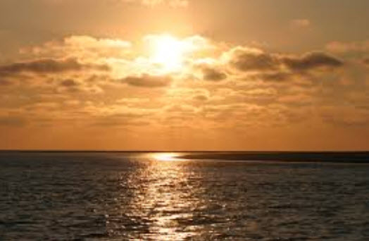 To our surprise, since we had not seen any other ships in the Gat, the harbour was full. The reason quickly became evident for the island is a beautiful resort with endless sandy beaches, a picturesque village and bicycle trails. 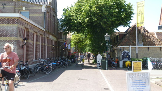 So Dutch people in the know, load up their ‘bottom friendly’ boats with a whole menagerie of children, dogs and other pets, and navigate the inner channels. After a night sitting high and dry on a sandbank, the next tide takes them to one of the inner harbours where they sit for a week or so. Each island has a different character, some being thinly inhabited and not developed for visitors while 3 or 4 have been made very family friendly. 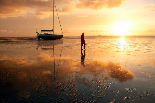 In earlier times people eked out a living with subsistence farming, fishing and beach combing. Beach combing was quite a lucrative business in those times for there were many shipwrecks on these outer coasts. On some islands refuges were built for the few sailors that made it to shore so that they would not die of exposure before being found. Vlieland has a statue to commemorate beach combing. 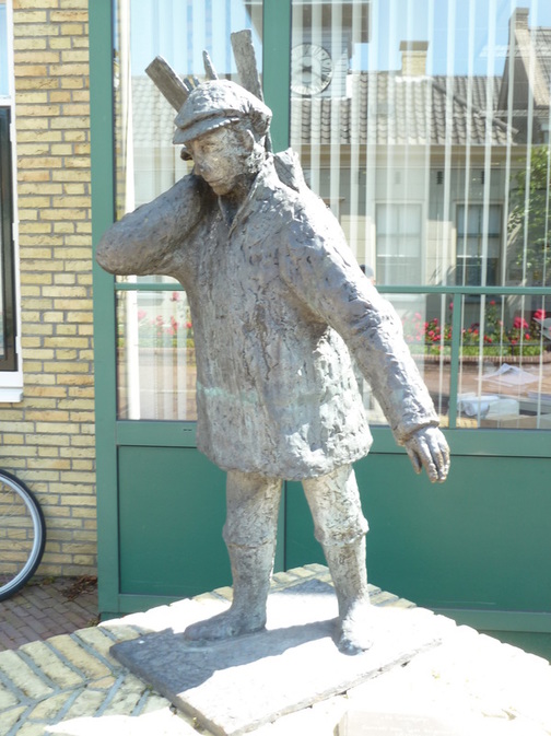 To get agricultural products to market there were large, Frisian sailing barges designed to ply the Waddensee. They were of very shallow draft and used big external paddles that could be lowered to serve as a keel when water depth permitted, and when it did not they sat on the bottom. 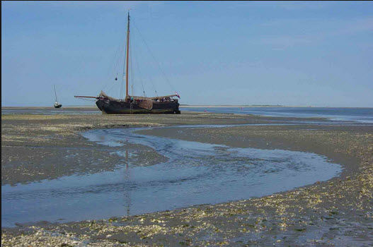 In the slack season the skippers indulged in races; a tradition carried on today with the few remaining barges. The unique thing about these races is the terms of qualification. A skipper can only enter if his family made its living in the trade in the previous century and he has done so in the past 30 years; quite an exclusive club. Luckily for us, the barges were assembling for this year’s races and there were 6 or 7 in the harbour that night. 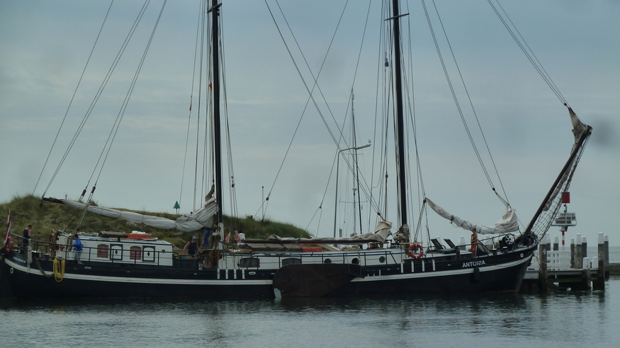 Further along our route at Lauwersoog, there is a very long approach channel of some 22kms because we had to go right into the mainland as the harbour behind Schiermonnikoog is far too shallow for us (pleasure craft are not allowed to use the ferry dock). However, it proved to be a delightful journey observed by so many basking seals. 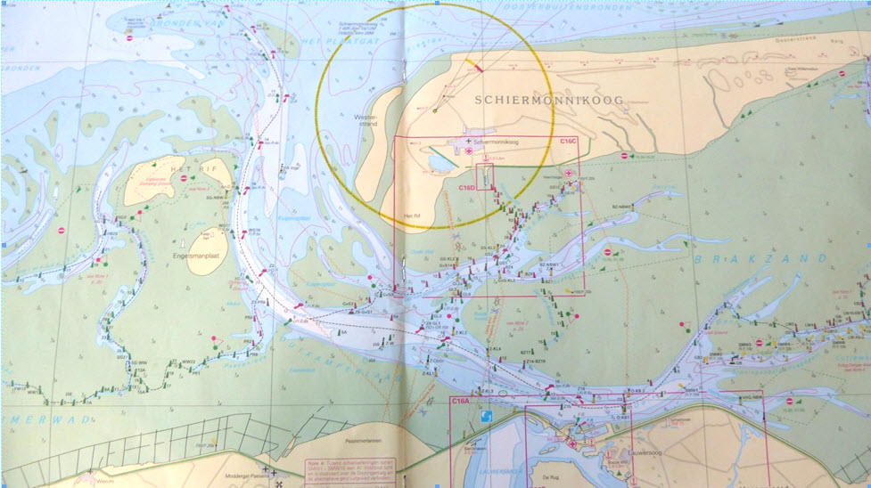 There is a shrimping fleet based there, that fishes the outside banks, as the inner sea is protected as a National Park. These shrimp boats returning to port with their nets hung up were a special sight.
With more or less difficulty we made our way along the Dutch islands and then along the German ones, all with their particular attributes and challenges. At Norderney we chose the SW approach channel shown on our 2015 charts but could not pick up the buoys; it was only when we faced an horizon of unbroken crashing waves did we realize that the channel no longer existed and the markers had been removed. A quick u-turn avoided disaster. It is those experiences that really add spice to cruising! The last one, Wangerooge, was the sting in the tail, for there is a very shallow approach and harbour. There appeared to be enough water for us by an hour either side of low water and that was critical because we needed to get away as soon as possible after low tide to catch the current up the Elbe at the other end of the next day’s journey. However, after arriving and checking in with the harbour master we learned that that would be impossible. Due to the configuration of the sandbanks in the approach channel there was a dangerous ‘bar’ formed until 2 hours before high tide. A ‘bar’ is a situation where although there is theoretically enough water, waves form across the shallow area from the incoming tide so that in the troughs there is not enough water. The effect is to pick up a boat and smash it on the bottom with each wave and no boat can stand that for long. As the water gets deeper with the incoming tide the effect disappears. In this case it meant that we had to fight a very strong current from the incoming tide to position ourselves to get out. We then knew why most sailors avoid Wangerooge! So we were stuck with leaving 3 hours late and gunning the engine for the next 7 hours to reach Cuxhaven in the Elbe estuary before the falling tide made the current impossible to combat. We made it by the skin of our teeth, sometimes the Gods are with us, but we will not be visiting Wangerooge again. The Elbe, Jade and Weser estuaries combine at their western ends to form part of the Waddensee with its typical sandbanks and shifting channels but have busy commercial traffic lanes passing through and up the rivers to cities such as Hamburg, some 100 km inland. Our destination was Cuxhaven, a city on that ‘solidified’ edge, protected by large sea dykes. Although an industrial port, it has exploited its location on the edge of the Waddensee to create a popular holiday resort where excursions onto the dunes in horse drawn carts are popular. You know immediately when you are in Germany because every beach has the characteristic wicker beach chairs that can be rented for the day and are very cosy.
This was where we left the Waddensee to head for the Kiel Canal and the end of our Waddensee adventure. For all the challenges we are glad that we experienced such a special place. For other Cruising blogs see the Archive links in the sidebar at the top of this page.
Other blogs of interest are The Retirement Dream and How to Live Your Dream The Northern coast of Spain is where the high central plain changes into dramatic mountain ranges with green alpine valleys reminiscent of the Swiss Alps, before falling to the sea with impressive cliffs.
This coast consists of four autonomous regions Galicia, Asturius, Cantabria and Euskadi (The Basque Country) three of which still have their own languages in everyday use. Many people along this coast only have Spanish as a second language. Although briefly occupied these regions were never subdued by the Romans or the Moors and were the last areas to be subdued by Franco. Only in 2017 was the final agreement for ETA (the Basque terrorist group) to lay down their arms concluded. 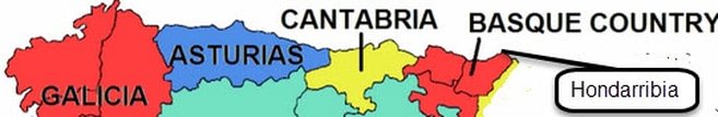 So this was to be our cruising ground for 2012, starting from Hondarribia. While preparing the boat to go back in the water we had to stay somewhere and, as usual, we thought that we would plunge into the atmosphere by finding a really rural Basque lodging, which we booked in advance. At first approach our hearts sank. 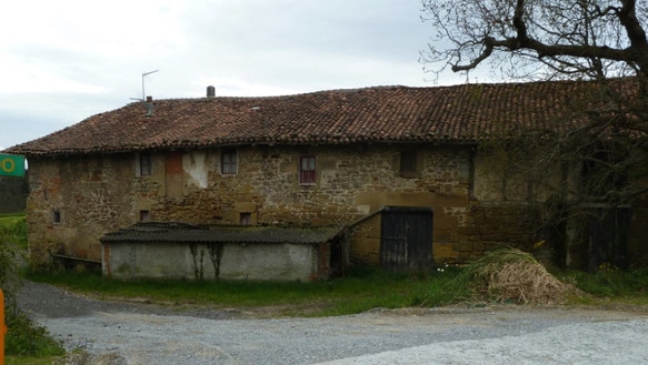 But when we went around to the front things improved! 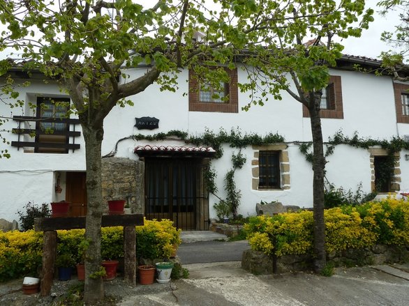
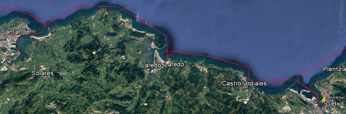
With the boat finally back in the water and having gorged ourselves on the superb local pinchos we set off. The complete log of our outward leg can be seen by following this link to Google Earth, Hondarribia to La Corruna make sure that you have the ‘temporary places’ box ticked and the files within it ticked when it is open. Clicking on the yellow push pins will open log entries. However, if you do not wish to do that here is the picture. 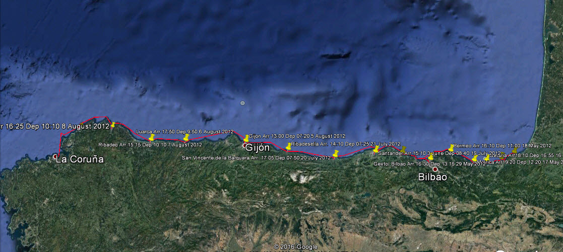 The Outward Leg with Stopping Points We explored the the coast and poked our nose into Pasajes harbour but our first stop was San Sebastian, the 'Cannes of Spain', situated on a beautiful bay with fabulous scenery. The 'beautiful people' come here for the annual film festival. The town itself is picturesque with old streets and fabulous pinchos in the bars. The marina was very small and crowed so we were forced to moor in the bay and take the dinghy ashore but it was well worth the effort.
From the above map it is clear that the continental shelf comes relatively close to the coast with underwater canyons reaching like fingers even closer. As deep water currents push up onto the shelf swells are caused which add to the effects of distant Atlantic storm generated swells. These are only of consequence when sailing broadside to them, which causes excessive rolling, on shelving bottoms, which often occurs on the approach channel to a harbour, and when crossing a bar. When choosing our destinations these last two effects were often dominant. 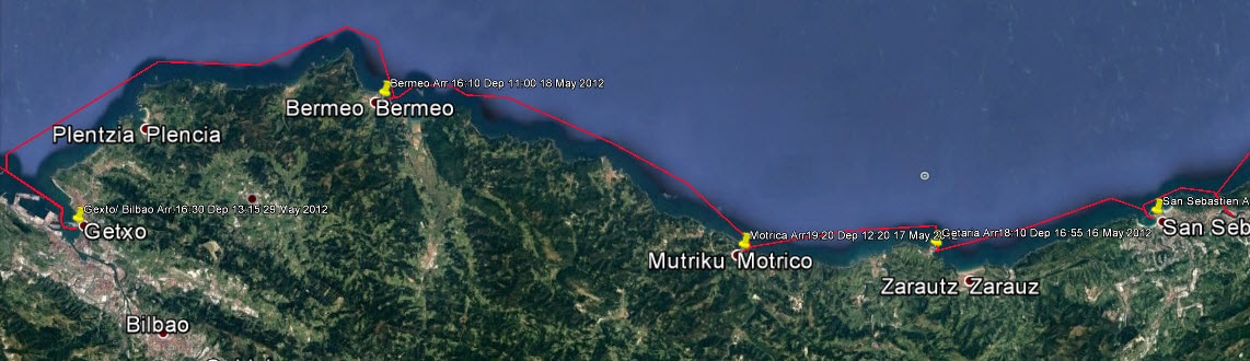 The next three ports were Getaria, Motrico and Bermeo. Former fishing ports built for donkey traffic and untouched by mass tourism, they are having to re-invent themselves. Since we were there a marina has been built in Motrico as part of this process. We were intrigued by these small Basque towns.
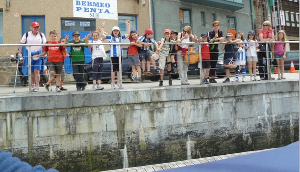 Our Reception Committee - Pressure on the skipper's docking skills. Then it was on to Bilbao; well actually Getxo, as Bilbao is inland, up an industrialised river that is in the process of renewal. There is a huge harbour with one of the outer walls submerged at high tide; a real trap for a skipper who does not do his homework. In its industrial heyday Bilbao was very wealthy as witnessed by its grand boulevards and magnificent mansions built out of town around the harbour. 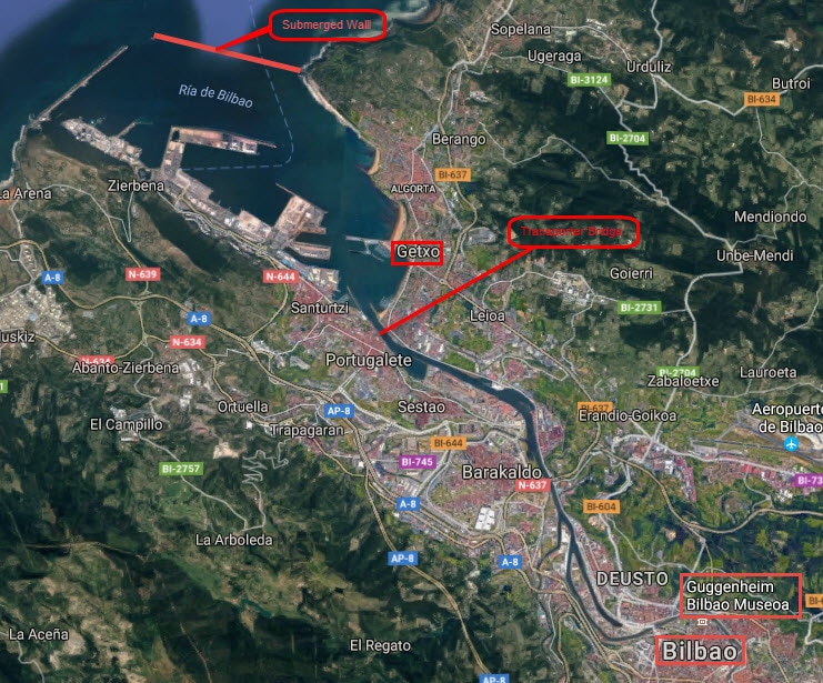
Bilbao's genius in it's re-invention was to host the Guggenheim Museum with its fantastical architecture which has triggered growth of the metro system, a cruise liner dock and other modern architecture. Now the city feels dynamic and vibrant; a must see.
We spent a week here and explored some of the back country. It was full of surprises. World class architecture in the most surprising places. 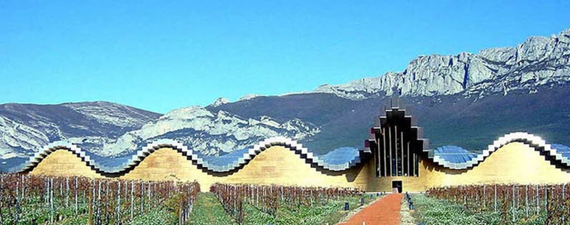 Santiago Caltrava's Spectacular Ysios Winery
This coastline and countryside was such a feast for the senses that we rather got stuck in Getxo and were reluctant to move on. But there is a darker side to this exuberant Europeanism, for every week there is a newspaper article revealing some new aspect of the Franco era. At this time they are still excavating mass graves to identify victims. Franco killed and enslaved people in a frenzy of retribution for years after the Civil War and it all received very little coverage by the outside world because of the Second World War and subsequent Cold War, (when Franco provided air bases for the Americans). Because there was a a peaceful transition to a monarchy after his death there was no cathartic cleansing of state institutions. The re-established monarchy had to appease the Francoists and extreme right who still held many positions of power and although an amnesty was declared it excluded many Basques; hence the birth of ETA. The angst drags on. 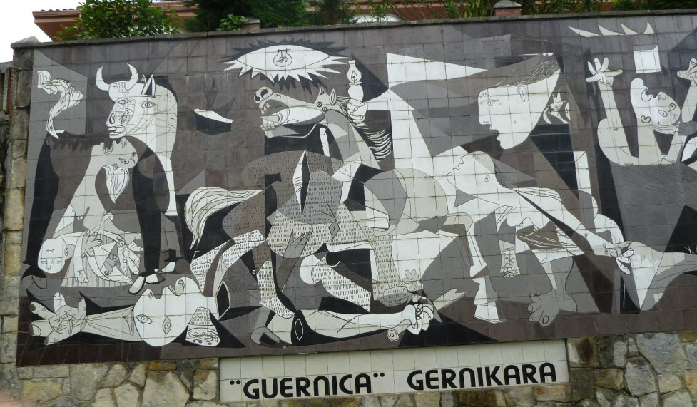 The 26 April was the 75th Anniversary of the bombing of Guernica by the German Condor Legion and the newspapers published special editions. The German bombers appeared in the skies over Guernica in the late afternoon of April 26, 1937 and immediately transformed the sleepy Spanish market town into an everlasting symbol of the atrocity of war. Unbeknownst to the residents of Guernica, they had been slated by their attackers to become guinea pigs in an experiment designed to determine just what it would take to bomb a city into oblivion. The town was nearby and we had to visit. Apart from the above mural there is little to see as the town has been rebuilt and Franco did not want anything to witness the event. However, there is an excellent and very moving museum which is well worth seeing.
 The down-town marina in Santander has little or no space for visitors so we sailed on by to a marina that is located right next to the airport runway and rather a long way out of town. Santander is the capital of Catalonia and a large elegant town with developed beaches and promenades. Elegant, but it was a big city and it did speak to us. Once again we headed off to the mountains, the Picos de Europa, precipitous and dramatic.
Continuing West from Santander the mountain ranges approach ever closer to the coast producing a rugged coastline with numerous headlands, also the continental shelf with numerous canyons approaches close to the shore. So there is seldom a day without significant swells even if the weather is fine. Our first stop was San Vicente de la Barquera, one of many ports that requires an act of faith when entering for the first time with a swell. 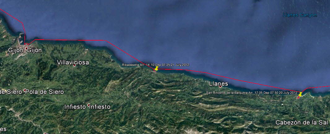
The next stop was the port of Ribadesella and another 'interesting' entrance on a moderate swell. This time the 'escape' is invisible from the seaward side and the turn to port seems awfully close to the beach when you are not used to it.
The largest city of Asturius is Gijon our next port of call. A town with many charming buildings but extremely vibrant, there seemed to be street events taking place everywhere. The music and revelling went on until the early hours of the morning and since the marina in located right down-town we can testify to that. How people managed to get up and go to work in the morning was a mystery to us. We were here for two weeks as we found a very competent company to fix our auto helm. At the end of the previous season we had had trouble with it holding a course and shortly after leaving Hondarribia it had packed up altogether. Having to be at the helm constantly was a real drag. The wind vane steering works well on open sea passages but is not well adapted to coastal cruising so we determined to get it resolved and had a whole new auto-helm and navigation system added. We took the opportunity to install transmitting AIS. Once on the bridge of a ferry crossing the North Sea we were appalled to realise how difficult it is to see a yacht, even on a reasonable day. So now we rest easy knowing that we show up as a signal on every radar screen and chart plotter.
All along this coast we found that cider was as popular as beer and probably more powerful. It was always aerated by pouring from as high as possible and the skill of the bartenders was often impressive. A glass of cider and some slices of the dry Iberica ham was a very pleasant way to pass an hour. On leaving Gijon we first had to round Cabo Penas with a nasty swell rolling us and knocking us back. Here we re-learned lessons that we had learned many times before; firstly that if you neglect a job or fail to do it correctly it will catch up with you and probably at the worst possible moment; and secondly a job that takes 5 minutes at the dockside can take an hour when you are trying to do it at sea. Just off the point we looked behind us and saw the dinghy floating away! We had only attached the painter (and obviously not well) instead of a second safety line. The struggle to retrieve and reattach the dinghy in that heavy swell with the boat rolling and pitching took half an hour and much discomfort reaching over the side with the boat hook.
Many of the old fishing villages deliberately build their prominent features like church spires, gable ended buildings and lighthouses so that they could serve as markers for leading lines. We liked Ribadeo, the main town was a stiff climb but they had thoughtfully provided an elevator for lazy people. Several towns in Spain have installed outdoor escalators for steep main streets. This is the only country that we have ever seen this.
The last part of our outward trip was to prove the most challenging as this North West corner of Spain consists of jagged headlands and strong currents. The country behind these headlands is sparsely populated and the roads are not the best so it is not a coastline seen by many from the land side; or from the sea side for that matter since unless the weather is very good it is best to keep well offshore. We had one of those rare weather windows when the weather was perfect and so had the privilege of getting up close.  Rugged North West Spain
West of Cabo Ortegal are some of the highest cliffs in Europe down this coast known as the Altas Rias. Because we were in so close we could see the tiny sanctuary of San Andres de Teixido, but not the wild horses that roam these cliffs. This Saint had himself reincarnated as a lizard; a place of pilgrimage but the pilgrims never step on a lizard! There is a strange festival on 8th September each year which is on the weird side of strange. We continued down this coast and came to anchorage in the beautiful Ria de Cedeira.
But there is always a sting in the tail with sailing when everything seems to be going well! When we came to leave we found that our anchor was caught in old fishing tackle on the sea bed and we had not rigged a trip line. We had been told of such situations in many of these old fishing ports. After going back and forth and winching excessively we managed to collapse the anchor platform so had to finally cut the chain. That was not to be the end of our challenges that day for immediately upon exiting the Ria we found ourselves in thick fog. Our new transmitting AIS and chart plotter stood us in good stead as we crept down the coast, the only danger is from small vessels that do not transmit. Luckily another yacht about half a kilometre away from us was following a parallel course so we could keep in touch by VHF. That yacht had a close encounter when it came across a fisherman sat in a rowing boat and not making any fog signals in the fog. Some people seem to have a death wish. The fog persisted until the entrance to A Coruna. With the fog we were unable to see the famous Roman lighthouse called the Tower of Hercules which dates from the first century AD, although greatly modernised since then.
There was so much to see and do that we hardly knew where to start. Not only were the ships on display but there was the city to explore and aerobatics over our heads every day.
But now there was a major decision point; did we carry on down the Portuguese coast to winter in the Mediterranean or return the way we had come? If we continued we would spend two years in the Mediterranean and then three years back to the Baltic. We had lived a year in the South of France so we were a little familiar with the sailing environment there and we were not enthusiastic about it. If we had been 5 years younger we would probably have gone on but we made the momentous decision to return the way we had come. The complete log of our return journey can be seen by following this link to Google Earth, A Coruna to Hondarribia make sure that you have the ‘temporary places’ box ticked and the files within it ticked when it is open. Clicking on the yellow push pins will open log entries. We determined to try some different ports on the way back but it was not just that that made it a very different journey.
We tried to continue next day but once out of the Ria conditions were bad and we were pitching and rolling badly. Besides only making 2 knots on full throttle we did not have the stomach for a 14 hour slog. So we returned and dropped anchor again. For 5 days we sat on the anchor while the wind howled and running the engine to charge the batteries from time to time. Just to compound matters the outboard would not start and the wind and distance were too great to try rowing; so the cook really used her ingenuity as supplies dwindled. The wind seemed to have dropped on 4 September so we thought that we would try again. The wind was less but the seas were not. We pushed on to Punta Candellaria but we had a strong wind on the nose and were really being tossed about and only making 2 knots. At that rate we would have taken another 5 hours just to reach Cabo Ortegal. So we turned back and flew in the opposite direction over that ground that we had fought so hard to gain. Once again we anchored with out tail between our legs, for what turned out to be another 3 days. Luckily another yacht took pity on us and ran us ashore in their dinghy (with an outboard) for supplies. Later when we took the outboard in to be fixed we discovered that the people who had overhauled it in Hondarribia had put two-stoke fuel in the tank instead of gasoline! 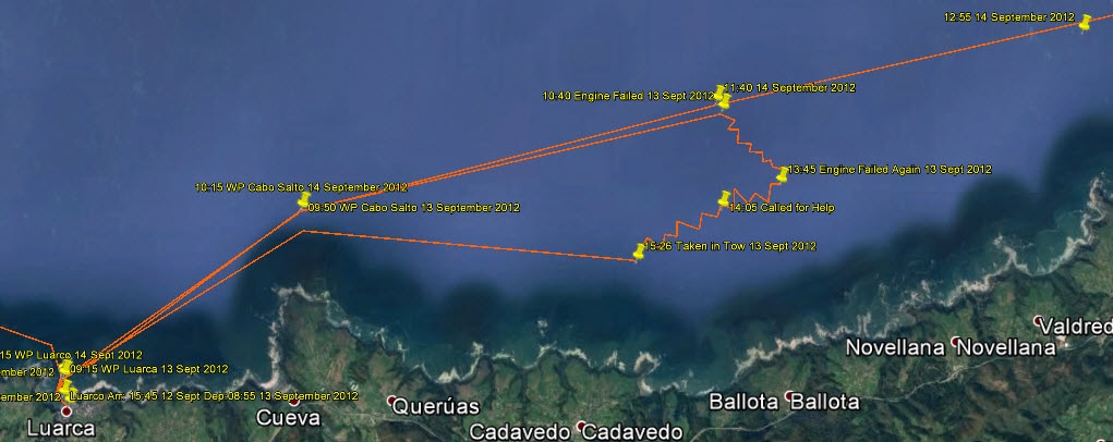 Our Rescue Near Luarco Our next excitement was just the opposite, a still, overcast day with a Northerly 2 to 3 metre swell. Two hours out of Luarca the engine started choking and then finally died. We unfurled the foresail but there was hardly any wind. The first step was to change the high pressure filter but the engine only ran for two or three minutes then stopped. It appeared that the water pump belt was slipping and, after our experiences of the previous season, I jumped to the conclusion that the engine was overheating without the alarm going off; so I set about changing the pump belt which is a big job because it is located behind the generator belt. After achieving that with my head down in a rolling boat I felt thoroughly sick and the engine still did not go. The last thing left was to change the low pressure fuel filter, I had a spare but it was another upside down job and the breakers at the bottom of the cliffs seemed to be getting awfully close! We could not afford to waste more time on the gamble that the filter change would work, for if it did not we would be on the rocks. So we called for help on VHF 16; to our horror there was no response! Suddenly things took on a very different aspect. I found that I had the phone number of the Marina in Gijon and got the receptionist to call the rescue services. Immediately they responded on channel 16 and thanks to our transmitting AIS could immediately see our position. The lifeboat was dispatched from Luarca while we spent an anxious hour and a half watching the breakers get closer.
Once the tow line was secured the life boat took off at 10 knots without giving me time to get off the foredeck. These life boats don't seem to realise the power that they have compared to a yacht. In A Coruna we saw a yacht that had been towed and the tow had ripped out the front end of the fibreglass yacht. Once again we were thankful that we had a steel boat, tough as nails! It was a scary ride back to Luarca. Once docked in the inner harbour mechanics came aboard and changed the low pressure filter, blew out the lines and everything was fine. A good job that I did not try to do it myself as my spare filter was the wrong model!
We called in a few new ports on the way back and were enchanted by them all. Llanes, Elantxobe, Orio and St. Jean de Luz. 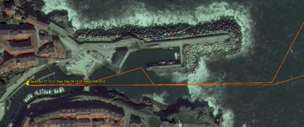 Llanes with its Entrance Sills
Finally St Jean de Luz, a French Basque town, before arriving at Hondarribia and the fantastic pinchos at El Gran Sol
For other Cruising blogs see the Archive links in the sidebar at the top of this page.
Other blogs of interest are The Retirement Dream and How to Live Your Dream When chatting with new friends in a snug cabin , as cruisers do when they meet in some lonely anchorage, talk turned to that Holy Grail of yachting; a little known and un-crowded cruising ground with fabulous scenery and a fascinating culture. "Oh, it exists," they said,"it is called the Basque Country and it is tucked away in the South-east corner of the Bay of Biscay." We were immediately hooked. We set off to leave the cold rain of Wales for this quasi mythical place.
However, we were not going to make a dash to the destination and miss other interesting places along the way. First was the Cornish coast, that graveyard of sailing ships in the 17th and 18th centuries. Then the Jurassic Coast of Southern England where the science of palaeontology was born; and of course we had to visit our old haunts around the coast of Brittany and the French islands off the West coast that the French keep largely as their own holiday resorts. Finally, our destination would find us at the start of the Northern pilgrimage route to Santiago de Compostela. The full route can be seen by following this link to Google Earth, neyland_to_hondarribia_2011blog.kmz make sure that you have the ‘temporary places’ box ticked when it is open. Clicking on the yellow push pins will open log entries. 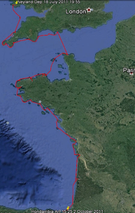 The 2011 Cruise The plan was to take the boat out of winter storage at Neyland, Wales, work on it for a couple of weeks and then set out. Now the only sure thing about sailing is that things will not go as planned. When we got back to start work we found that mould had flourished over the damp winter and everything had to be cleaned and laundered. The second thing was that the man who had made custom stainless steel fittings for collection in the Spring had dropped dead and his workshop contents disposed of. Just to top things off, health issues started to arise that reduced the work to a crawl. So our two week stay on a neighbouring sheep farm developed into a two month stay. However we learned a great deal about sheep along the way!
The Bristol Channel is like a large funnel with its open end pointing West to the predominant winds and storms so tidal ranges are great. The upper reaches become vast mud flats at low tide and when the tide comes in it can, quite literally, be like an advancing wall of water. This is the famous 'Bore' and Morecombe Bay is the site of the tragedy of the cockle pickers in 2004 who were cut off by the tide. Although there are many small harbours along the Somerset and Cornish coasts, they dry at low tide unless there is a lock gate, so our options were limited. We kept well to the Western end and crossed to Lundy Island then locked into Padstow before following the rocky and wild coast around Lands End to Newlyn.
 Longships Rocks
Safely past The Manacles we entered historic Falmouth Harbour. This is where long distance sailing ships would call to receive their orders before sailing up the Channel until the age of steam meant that they did not call any more. There were many famous events here; News of the victory at Trafalgar arrived here as did Charles Darwin returning on the Beagle from his famous voyage of discovery. In the Second World War the famous suicidal raid on St. Nazaire left from here.
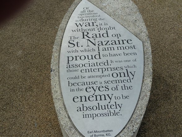 Part of Monument to the St. Nazaire Raid, Falmouth This Southern coast is an exercise in geology, progressing from the old igneous rocks of Cornwall in the West, through the red Permian and Triassic cliffs (where the first fossils and dinosaurs start to appear) to the Jurassic cliffs in the East. As you sail East along this coast the geology unfolds like a movie. This section of coast is the Jurassic Coast World Heritage Site where the science of palaeontology started and where the 'Father of British Geology', William Smith found his inspiration.
As the cliffs weather the fossils appear, making this a famous haunt for Victorian gentlemen searching for 'curiosities'. John Fowles set his novel 'the French Lieutenant's Woman' here in Lyme Regis in this era and when you sail into the harbour you may find her wrapped in a shawl standing on the end of the harbour wall (the Cobb) waiting for her lover to return. However, unfortunately it is not Meryl Streep but an employee of the Tourist Board!
Further East we sail by Thomas Hardy country with green meadows sweeping down to the cliff tops and farms nestling in the rolling countryside. It is easy to Imagine that one of these is Bathsheba Everdene's farm in 'Far From the Madding Crowd' and the character walking among the sheep in the cliff-top meadow is Gabriel Oak.
Do not let the beauty of this coast lull you into a false sense of security; this is a dangerous coast if you do not do your homework and get it right because there are dangerous tidal races off all the headlands. At slack water (which may only be 20 minutes) you can pass close to them but if you arrive early or late do not even attempt it. We unexpectedly lost time in crossing Lyme Bay and arrived at Portland Bill an hour late. This meant that we had to pass 3 nautical miles off the point and even then it was pretty choppy. We finally completed our run up the Jurassic Coast in a crowded anchorage in Lulworth Cove. After three attempts to find adequate swinging room we anchored over a kelp bed and spent a sleepless night listening to strange noises from the kelp and worrying that the anchor would drag. In short, this is not the coast to explore at the height of the holiday season. 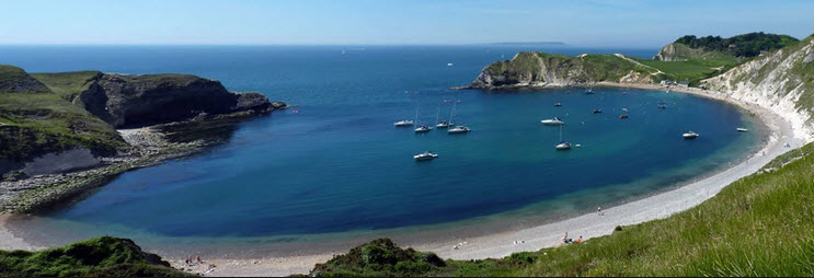 Lulworth Cove - Less Crowded Than When We Were There Crossing the English Channel, or La Manche, is always an interesting experience since it involves crossing two very busy traffic lanes and arriving on a coast that has very strong tidal streams, so arrival times are critical. We have done it in rough weather, in fog and at night but this time the tides were such that we could leave early in the morning and arrive 14 hours later, crossing the traffic lanes in the daylight. We arrived at the West entrance to Cherbourg Harbour, the second biggest artificial harbour in the world (1,500 hectares), after an uneventful crossing. It is always awe inspiring to enter the outer harbour which was designed for 80 warships to manoeuvre under sail. The outer walls alone are 6km long with forts along the way. It is a bit like a Russian doll with harbours within harbours, getting smaller and smaller. Unsurprisingly it was a key objective in the D-day landings of World War 2. Our destination was the third one in, where the Marina is located. 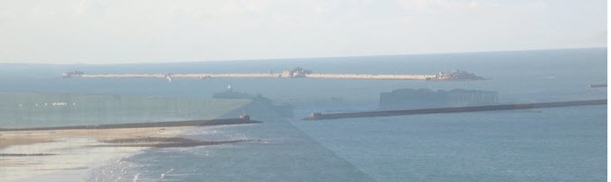 Cherbour Harbour from the East - Outer Walls and Forts 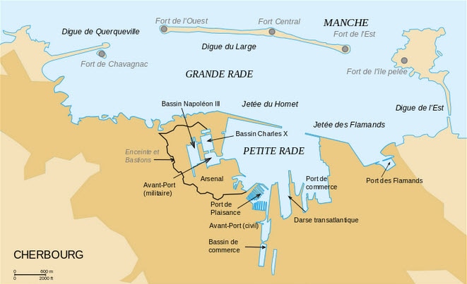 Chebourg Harbour Layout Near us was a man who had just launched his boat that was going to participate in the race from Senegal, Africa to Guyana, South America. The twist was that this was a single handed rowing race that lasts about 40 days and takes place every 3 years. We had never heard of it, but it is part of the new wave of extreme sports.
After a break in Cherbourg it was time to start on the second leg of our cruise, travelling by way of the Channel Islands along the North coast of Brittany to Brest. 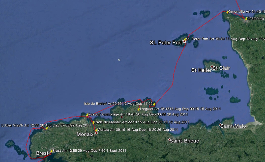 The Route from Cherbourg to Brest Travelling West it is necessary to round the Northwest point of the Cotentin Peninsular a rocky headland called Cap de la Hague. This high headland is famous for having perhaps the biggest nuclear fuel reprocessing plant in the world. Spent fuel comes from all around the world to be reprocessed here and this is where much of the warhead material from nuclear disarmament ended up. So this headland is a hot spot in more ways than one. 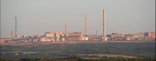 Cap de La Hague Nuclear Fuel Reprocessing Plant However, we only saw glimpses of the plant; what concerned us most was down at sea level. Rounding this headland and heading South between the Mainland and the island of Alderney is very interesting and challenging because the tidal streams in the Alderney Race can reach 6 to 7 knots and when this reverses in each tidal cycle it creates extremely confused seas all around Cap de la Hague to Alderney. Timing and reasonable weather are essential. 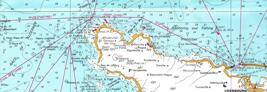 The Cotentin Peninsular, Cap de La Hague and the Alderney Race So the evening before the passage we sailed to the nearest anchorage to the headland, Omonville, and lay at a mooring to be in the best position to get the time right on the next day. The weather was marginal the next day but we thought it do-able and we set off. At the turning point off the headland the seas were big and confused, due to a strong wind against tide even though we had the timing right, but we thought that it would improve. 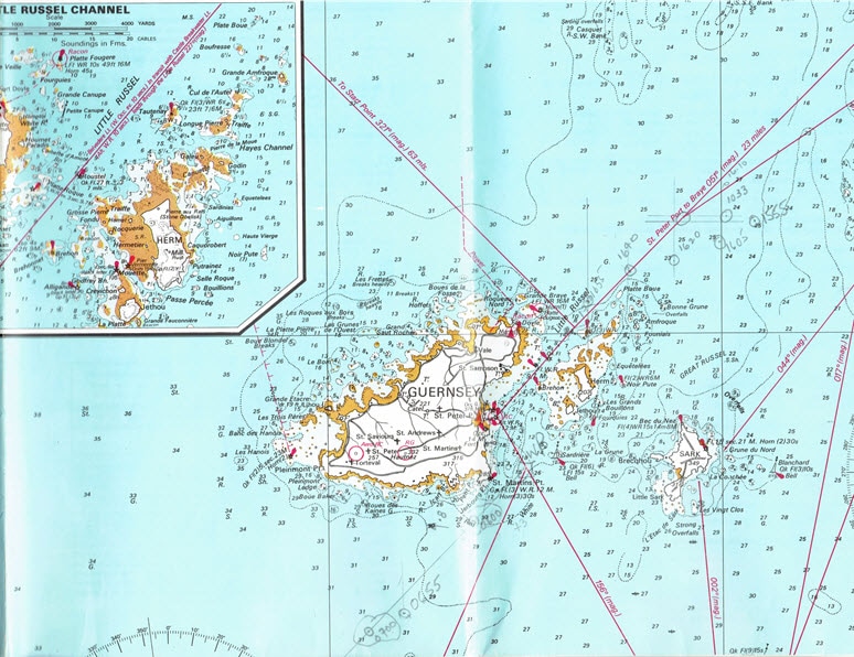 The Little Russell Approach to St. Peter Port, Guernsey It did not and continued rough all down to the Race to the Little Russell approach to St. Peter Port, Guernsey. We made slow progress such that the tide had turned and it was a battle, even on full throttle, to reach our destination. Even though the boat had been well battened down we had taken so much water over the boat that the bedding was damp. However, we were so tired that we hardly noticed it.
When the monarchy was restored (Charles II) the Bailiwick of Jersey was rewarded with lands in the New World; hence New Jersey. We have visited most of the islands on previous cruises and this time just wanted to press on with our cruise to Spain. We planned to make landfall in Brittany at the Lezardrieux River but the strong tidal currents were pushing us East and rather than fight it we decided to take the more adventurous route to the East of the Ile de Brehat. With the 10m tidal ranges in this area the landscape totally changes between high and low tide. When you look back at low tide you wonder how you ever did it! 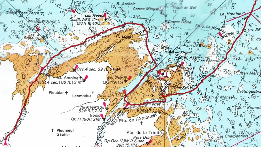 Isle de Brehat to Treguier Challenge
The islands here are known for their Mediterranean micro-climate and famous for the masses of agapanthes growing wild. This coast is a cruiser's dream as long as you are prepared to be bold and do your homework. There are myriads of hidden inlets. Exchanging our plans to go up the Lezardieux River we opted for the next one, the Treguier, because of the challenge of getting there! It involves sailing precisely to a leading line through rocks and then through the shallow Passe de la Gaine before entering the Treguier River to arrive at the charming Town of Treguier. This is rural France at its best and just to cap it all the circus had arrived in town and set up near the port. Many small itinerant circus are still around in France, like the markets that make a weekly circuit of small towns. To stroll the town, with its small shopkeepers and shoppers who still buy their bread daily and exchange gossip as they shop, is to enter a way of life that has largely disappeared from many countries. One can understand why the French so fiercely resist change; they know what they will lose.
The Bay of Morlaix has many small islands and rocks as it narrows to the estuary of the Morlaix River. This was an ideal pirate sanctuary before the days of buoys, markers and accurate charts, for only those with expert local knowledge could get in here. 'Pirates' is perhaps too strong a word, for these were entrepreneurs sailing under a 'Letter of Marque' from the King, known as Corsairs in France. This was permission to attack the King's enemies as long as the King got his percentage of the spoils. This was cheaper than having a large standing Navy. When navies were first established the Corsairs continued and King's ships still operated in a similar way by sharing the spoils. After a disastrous raid on Morlaix by the English a fort was built (Château du Taureau) on one if the islets to block access to the Morlaix Estuary. Many of the great houses in this area were built on the spoils of this trade. 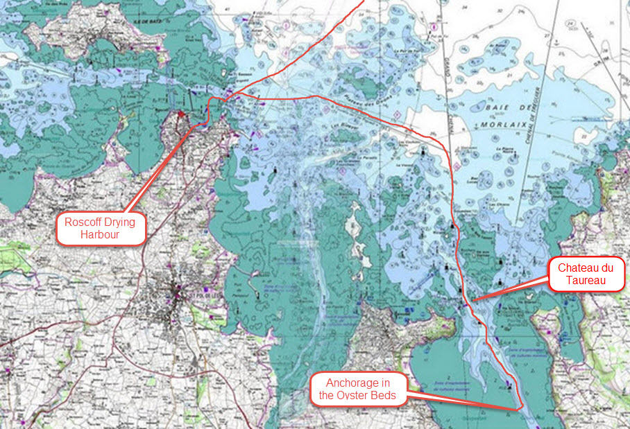 Route from Roscoff to the Oyster Beds Anchorage
The flaw was that we had to negotiate the perilous entry and find that spot in the dark as we were so late leaving Roscoff. The problem is that there are so many navigation lights and secondary channels that it is easy to get confused and find yourself going up the wrong channel.
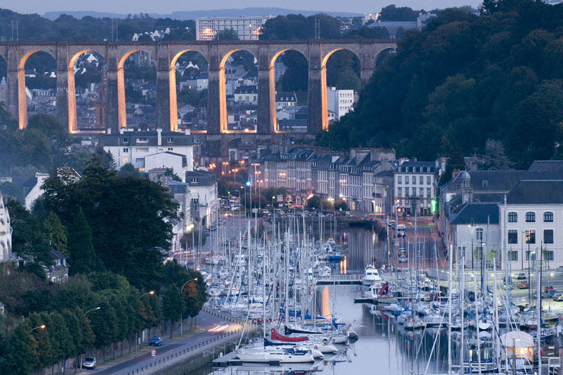 Morlaix - Worth the Effort to get Here The Western end of Brittany is another of those places with exposed, rocky shores and strong tidal currents that mean that you have to get it right. It is not called the Chenal du Four, the Channel of the Oven, for nothing. There are a string of lighthouses on the coast around here with some great videos of them. , Phare La Jument, 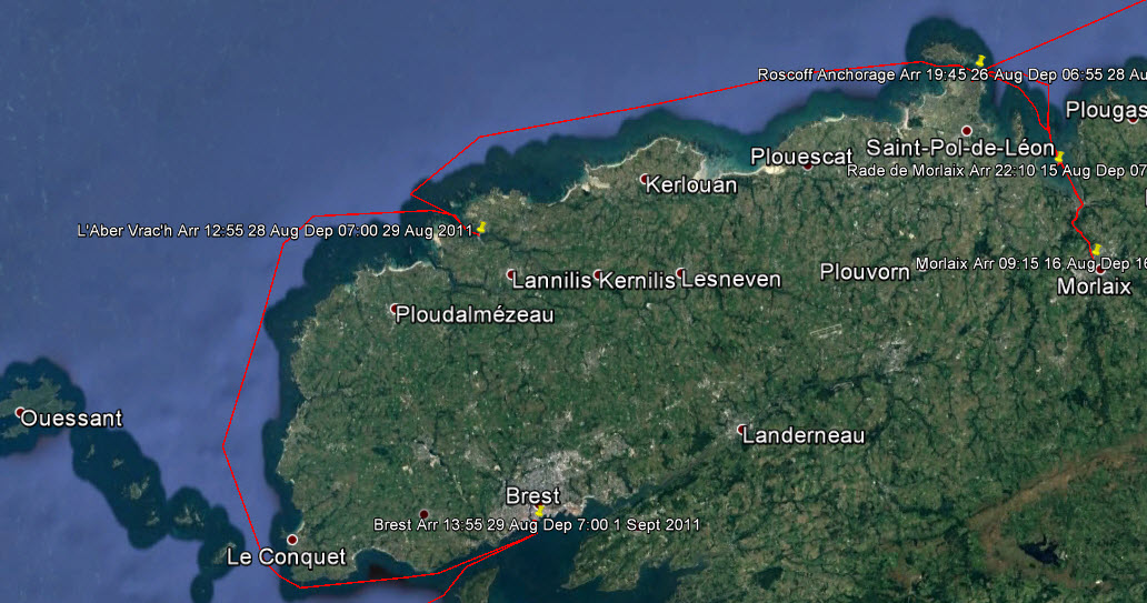 Chenal du Four There were multiple restraints to our next stage; lock out of Morlaix and get through the difficult passage to Roscoff in the daylight; pass through Roscoff Channel when there was sufficient water on an ebb tide so that the current would carry us to Aber W'rach, the last port before the Chenal du Four; leave Aber W'rach such that the tidal current would carry us down the channel, through the pinch point of St. Mathieu before it turned; then have a favourable current to get us through 'the Bottleneck', le Goulet, into Brest. All that with favourable winds and reasonable seas. 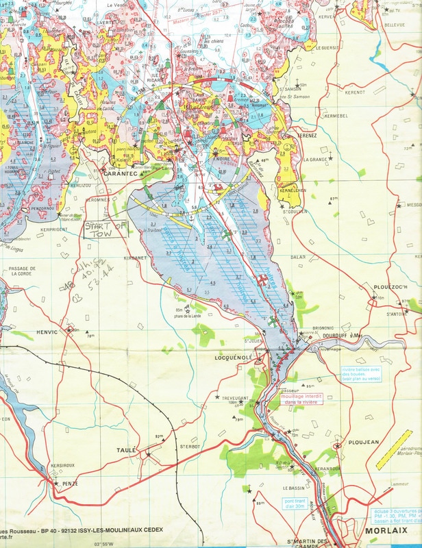 Morlaix River to Roscoff 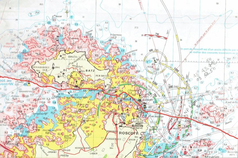 The Roscoff Passage 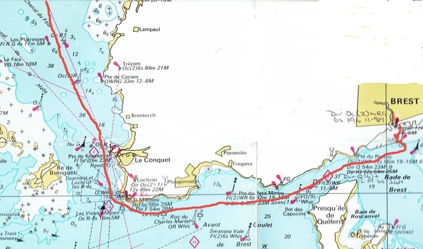 Pinch Point and Le Goulet It worked out that we would have to anchor in the the Roscoff Channel to get the tides right. The weather was not good enough the next day and we spent 2 days on the anchorage. Aber W'rach presented an interesting situation for there is a short cut through the rocks that cuts off some distance. So should we take it? We had done it once before from the other direction but the passage is tricky and shallow so the tide must be right. We did not take it as the tidal state would be marginal, the entrance is difficult to find at the best of times and the sun would be in our eyes when we arrived. That is experience and what makes this type of navigation so interesting and rewarding. 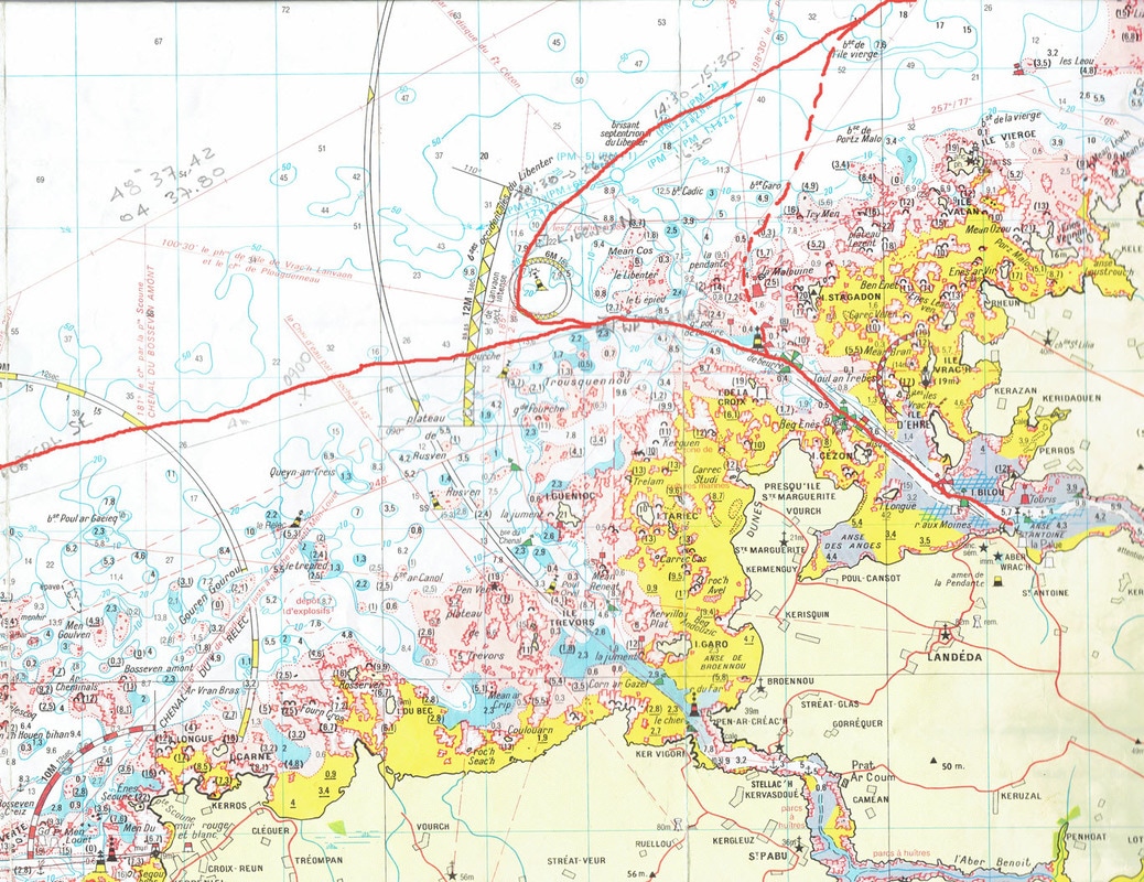 The Short Cut to Aber W'rach We were to pick up our son and granddaughter in Brest so we chose the old harbour rather than the new marina, which is some distance out of town. On arrival one crosses the military harbour with the U-boat pens in the background, and turns around massive harbour walls; it is all a bit intimidating but right in the centre of town. 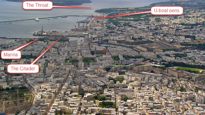 Overview of Brest Looking West
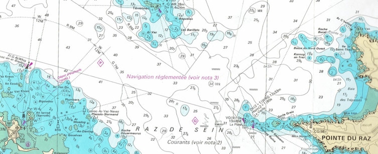 Raz du Sein and the Veille Lighthouse 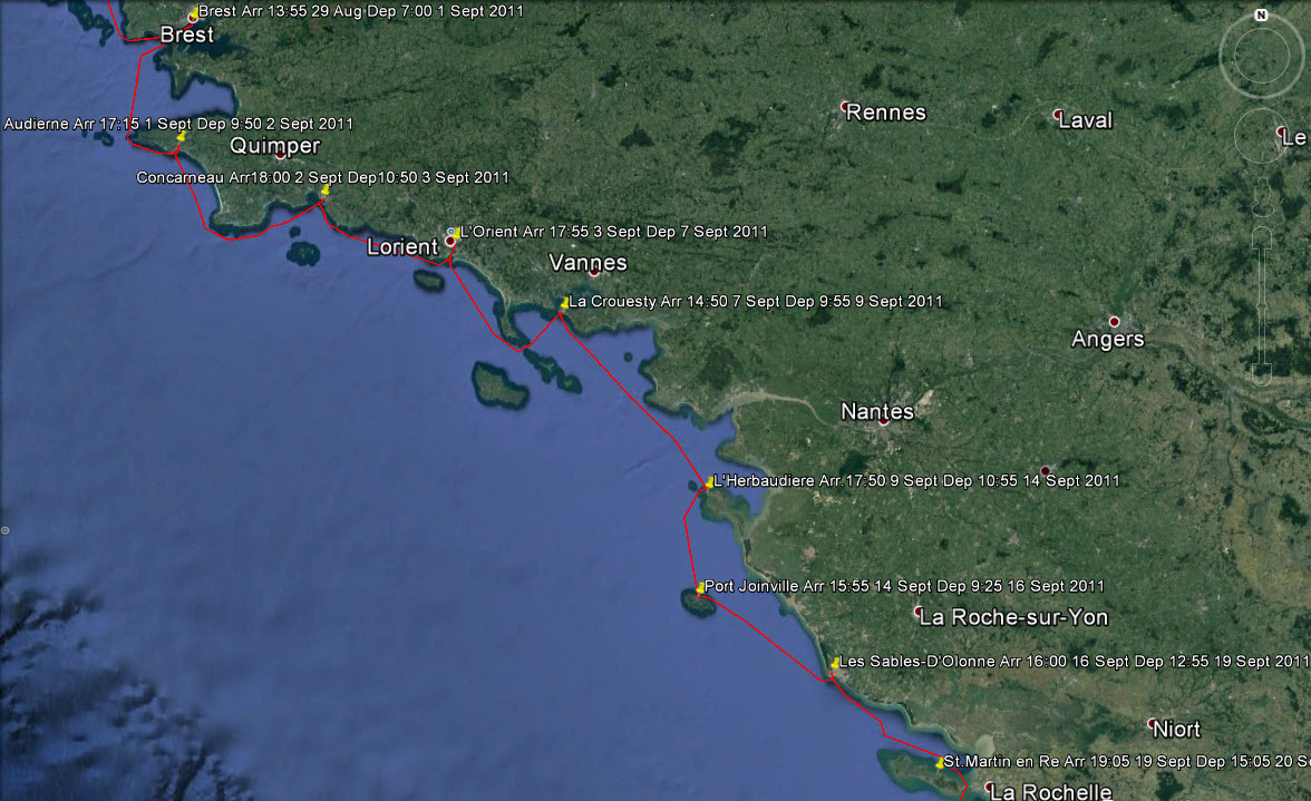 The Route from Brest to Ile de Re The climate changes quite dramatically to a milder , more Mediterranean one, on the South side of Brittany which probably explains its popularity with British yachtsmen. Once through the Raz de Sein there is a convenient port, Audierne, before a long stretch of inhospitable coast that extends past the Point of Penmarc'h. Once round that and a whole string of delightful ports are in reach. We have never passed this point without porpoises appearing around the boat; we always take this as a good omen. On this occasion we pushed on to the walled town of Concarneau.
We passed by many interesting ports and islands along this South Brittany coast calling only at L'Orient and Le Crouesty before turning South. This involves passing through the Quiberon Peninsular, an interesting exercise. It would be easy to while away a couple of months around here, and we knew what we were missing because we had been here before, but we still had a way to go and September was upon us.
In la Crouesty one of those occasional unpleasant events occurred that always leaves a bad taste. Four French customs officers descended on the boat at the dock and declared that they wanted to search the boat. It seems an invasion of privacy but that is the price you pay for being a free spirit in a boat. They even wanted to see in the water tank but when they discovered how much work it was they gave up! We were not unhappy to leave and head South to the string off islands off the West coast of France; undiscovered gems that the French seem to keep for themselves.
The next day we had a great sail to Les Sables d'Olonne without needing the engine until the harbour entrance. Then once again the pump belt slipped and the engine overheated. This was starting to become worrying but once again we got the belt tightened and it seemed to hold. The next day the wind was favourable for the run South to St. Martin on the Ile-de-Re.
Determined to get to the bottom of the problem we sought out a marine engineer the next day. He solved the problem in 10 minutes and we have never had a problem since. The wrong vee belt was installed in Falmouth! The profile of the belt must exactly fit the profile of the pulley; if it does not excessive wear occurs and no matter how much it is tightened it will slip. When I think how the mechanic in Falmouth talked with such authority and kept us waiting while he ordered the correct belt, it just shows that talk is cheap. So we set off for the final stage with much more confidence and anticipation. 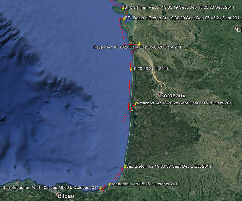 The Final Stage to Spain The island of Oleron is the last in the chain of islands going South. We decided to go through the very shallow waters at the Eastern side of the Ile de Re, under the bridge, past the commercial port of La Pallice and so to the main port of St. Denis d'Oleron.
Rounding the Northern Point de Chassiron we met a particularly large swell which made the rocks off the point a maelstrom of breaking waves and flying spray. Although we were well off we changed course a little more, particularly when we saw a wrecked fishing boat perched on the rocks. After travelling South down this coast we came to the turning point to take the channel into the Gironde Estuary and our next port of call, Royan. I do not like this entrance for it is quite narrow and has
The last steps were perhaps the most challenging for there is a long stretch of coast to the first port, Arcachon, 78 nautical miles away which means a 14 or 15 hour leg in Enterprise. But that was not the main concern; the swells on this coast are large and the entrance to Arcachon is shallow, convoluted and cannot be attempted in heavy swells or rough seas. If you cannot enter, the next port is another 70 miles and also cannot be entered in those conditions. So the challenge is to get the sea conditions right and arrive at the right time, in the daylight. We were at the end of September and the days were now getting shorter. The extra crew member would be helpful if we could not enter either port and had to go straight through to Spain. Furthermore, parts of this coast are active firing ranges and one must read the notices and keep out of those zones.
From the aerial photograph, the mass of sandbanks at the entrance show why the tide has to be just right to enter and leave but it does not show the strong tidal currents and the breaking waves from a big swell that can make the entrance impossible. Immediately on entry, the biggest sand dune in Europe, La Dune du Pilat, appears. It has been used for many movie sets to simulate desert scenes. The entry, on a flood tide, takes over an hour even doing 9.5 knots past the lighthouse at Cap Frehal. Once inside, it opens up to a a large shallow inland sea which largely dries at low tide. A marvellous playground, with endless beaches.
This area of France from the Gironde River to the Pyrenees on the Spanish border, is called Les Landes, meaning moors and heath. It is low and was largely swampy until modern agriculture drained large areas and planted maritime pines over 10,000 square kilometres. The French Army trains here and there are naval firing ranges off shore. The naval ranges are seldom used but the firing ranges from the shore out to sea are frequently used and restricted times are posted in the Marinas. 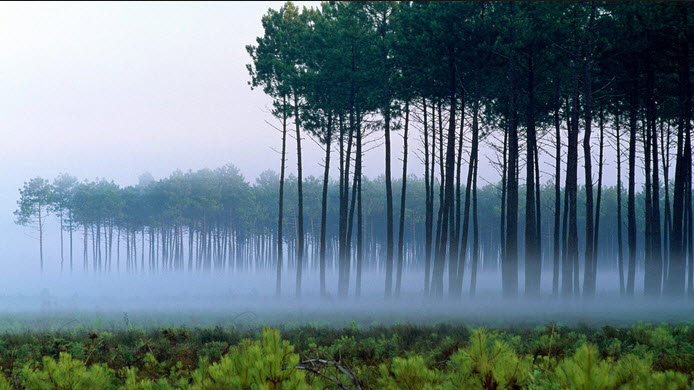 The Endless Forest of Les Landes
The great underwater cliff that is the edge of the continental shelf is cut with canyons that reach out like fingers into the shelf. As the edge gets closer to the shore these canyons can reach right up to it and feed water surges to the shore that show up as swells. So it is at Cap Breton where the canyon comes right up to the harbour entrance. 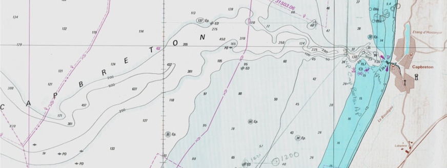 The Deep Underwater Canyon Running Into Cap Breton The Deep Underwater Canyon Running Into Cap Breton All went well, we approached swiftly on a small swell, dodged around the end of the harbour wall, and sailed sedately up beside the main street to a welcoming Marina at the end.
Then it was off to Hondarribia and the Basque country the next day; sailing South on this last leg we had time to reflect on just what The Basque Country is. Rather than a physical area it is the place where the Basque language is spoken and the Basque cultural traditions are followed, so the boundaries are rather fluid. The Northern boundary is somewhere around Bayonne in France, the Western one west of Bilbao, the Eastern is a couple of pyrenean passes from the coast around Saint-Jean-Pied-de-Port, where the French pilgrimage route to Saint- Jacques-de-Compostelle starts. Finally, the Southern border is roughly on a line South of Victoria-Gasteiz but the following map is more restrictive.
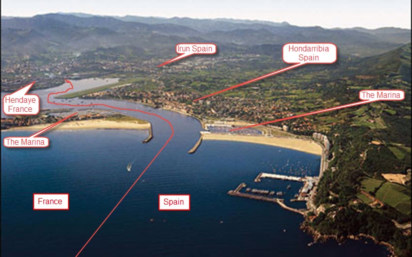 The French and Spanish Border at the Coast  Old Hondarribia Dripping in Atmosphere For other Cruising blogs see the Archive links in the sidebar at the top of this page.
Other blogs of interest are The Retirement Dream and How to Live Your Dream Enterprise over-wintered in the water at Stavanger awaiting her second new mast after our 2009 season. (see Northern Denmark & Norway) We were looking forward to a cruising season with a bit less excitement. However, the first event came from an unexpected source; the eruption of Eyjafjallajokull in Iceland. All flights to Norway were cancelled due to the ash clouds so we started our season by touring Hadrian’s Wall and the Scottish Highlands while we waited for a flight from Aberdeen. Finally arriving in Stavanger we found that we still did not have a mast and trepidation really set in.
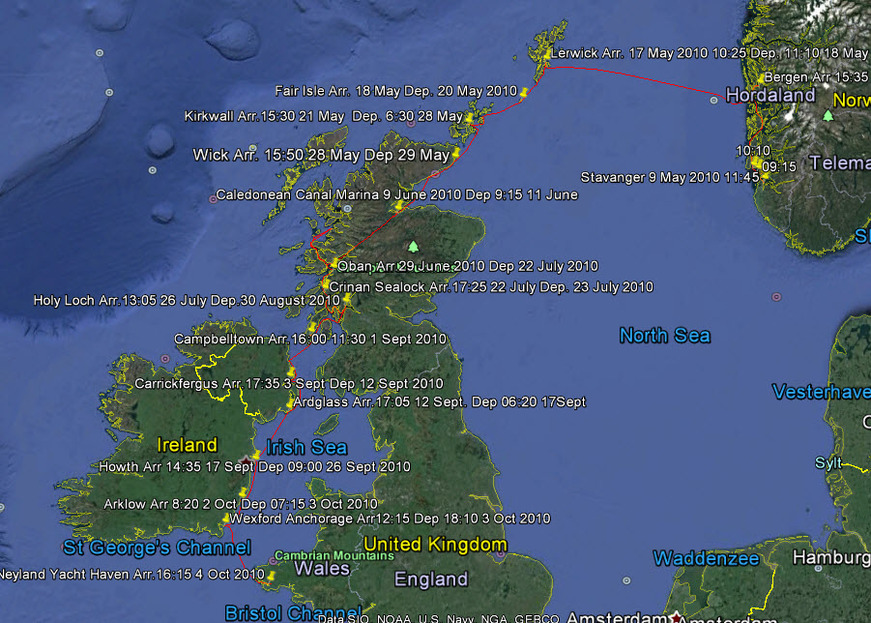 The 2010 Cruise - Go To Google Earth for the Full Version However, by May 9th we cast off to begin our cruise. The full route can be seen by following this link to Google Earth, The Norwegian Sea to the Irish Sea, make sure that you have the ‘temporary places’ box ticked when it is open. Clicking on the yellow push pins will open log entries.
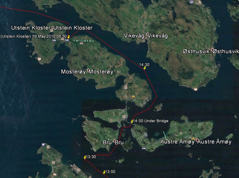 The Alternate Route Where We Hit the Bridge Only afterwards did I notice the antennae and tri-light hanging down! Later we determined by marks on the tri-light that we had cleared the mast by 2cm. The strong wind had created a tidal surge that I had not allowed for and could not calculate. We tied up that night at Utstein Kloster that we had visited the previous autumn but this time it was cold and windswept. Here we discovered that we had a dead cell in our deep cycle battery; these things always happen at inconvenient moments. Then after setting off next morning it started to snow quite hard, the first and, I hope, the last time that we sailed in a snow storm. We consoled ourselves by saying that it could only get better after that, and it did. Bergen has the reputation as the European city with the most days of rain but the Gods must have repented for it was a lovely day to sail into the harbour, with the sun highlighting the old, picturesque houses climbing up the mountainside from the wharf. 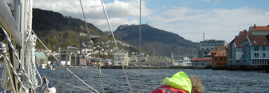 Entering Bergen Without Rain! This is the home of Eduard Grieg and there are daily lunchtime concerts throughout the summer at the composer’s home, with its modern museum and concert hall. This city is another one that was in the Hanseatic League, like the ones that we had visited in the Baltic, and which grew rich on the trade monopoly.
Arriving on Monday morning we were immediately struck by the lack of trees; this must be a very bleak place in the winter, however, there is a wild beauty to these islands that spoke to us. 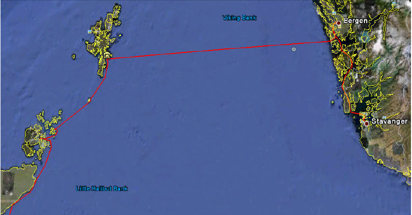 The Route From Stavanger to Scotland  Our First View of Shetland We have often noticed that people who live in harsh conditions are usually warm and welcoming; Shetlanders were no exception. The Viking roots there are very strong with the language full of Old Norse terms; it is a very distinctive culture. There may not be many trees but there are huge numbers of sea birds. Taking the local bus to the Southern tip of the main island to visit Sumburgh Head , we marveled at how close we could get to nesting Fulmars, Guillemots, Kittiwakes, Puffins and Shags. We had previously only seen these birds in small numbers but here it was overwhelming.
As a bonus there was the Jarlshof Prehistoric & Norse Settlement to see before we set sail for Fair Isle 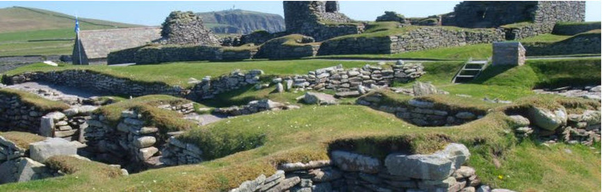 Jarlshof Prehistoric & Norse Settlement at Sumburgh Head
Dominating the island is Sheep Rock, sheer cliffs on all sides with a sloping, flat top, which from a distance looked like a lush green meadow. Discussion turned to Sheep Rock when a resident came to the dock to talk to the visitors. He said that he was the last person to graze sheep on it. In late Spring someone would scale the cliff and rig up a pulley and cable system to haul the sheep to the top, then when the sheep were all hoisted up they would be left all summer after which they were all hoisted down again; a very labour intensive process that is no longer reckoned to be worthwhile.
One hundred and twenty kilometres South are the Orkney Islands; quite different, low, fertile and sandy, with strong tidal streams coursing between the islands so it is important to get the timing right. They are much more closely related to the Scottish mainland, but still apart, and formerly speaking their own Orcadian language. Five thousand years ago people of the Neolithic culture landed here and settled. Everywhere there is evidence of ancient civilisations (including a complete Neolithic village ) overlain by Viking settlements giving a vague feeling of being in a time warp. Some of the cottages with their heavy stone slab roofs had a distinctly Neolithic air about them. We took a local bus to the Ring of Brodgar, a stone circle like Stonehenge but less well known. It is immense with 13 burial mounds near the circle. The walk towards it made us aware of many sites of Neolithic settlement and mysterious alignments.Previously we had visited Stonehenge but found this site in a sparsely settled landscape far more haunting.
Virtually nothing is known about this people, the meaning of their structures, how they could move stone slabs weighing several tons, or anything about their social system and psyche. They are still an unresolved mystery greater than the pyramids. We walked over this countryside and experienced feelings of awe and insignificance standing in the Ring of Brodgar and seeing in the distance other standing stones, each representing huge effort for no apparent reason that archaeologists have been able to fathom.
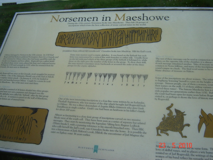 The Story of the Norsemen The Story of the Norsemen From Orkney we had to decide whether to to go down the West coast of Scotland by way of Cape Wrath or down the East side by way of John O’ Groats. We finally opted for the later as we wanted to transit the Caledonean Canal. Leaving Orkney after days of torrential rain we passed the former Eastern entrance to Scapa Flow, the huge sheltered harbour that was a major naval base in the First and Second World Wars. ‘Former’ because, after a German uboat, U-47, slipped in in 1940 and sank the battleship Royal Oak and then escaped, Winston Churchill ordered the Eastern entrances dammed up. So we could only look into Holmen Sound and the ‘Churchill Barriers’, for it was too big a diversion to find the Southern entrance. A pity, because it is an interesting place. It was here that in 1919 the interned German Naval Fleet of 52 ships was scuttled by their crews simultaneously.
The treacherous Pentland Firth was crossed without incident because we got are timing right and the weather was fair. All down the East coast of the Highlands the gorse was ablaze with yellow and we had frequent visits by porpoises. Altogether a delightful sail.
One of the surprises was how shallow the approach to Inverness was, the Moray Firth, which meant that the tide really rushed in and out; this was something that we had not allowed for in our timing so we struggled past Fort George and up to the Marina at Inverness. Our plan was to cross Scotland by the Caledonian Canal and then explore the Western Isles, fired I must confess by romantic dreams of Flora MacDonald ferrying Bonnie Prince Charlie ‘over the sea to Skye’. So before leaving Inverness we thought that we should visit that icon of Scottish history, the battlefield of Culloden (1746). The Great Glen crosses Scotland like a great rift valley from Inverness in the East, to Fort William in the West and was for a long time the battle line for the English against the Scots. Hence Fort George, Fort Augustus and Fort William. It is at the Eastern end, near Fort George that the battlefield is located. 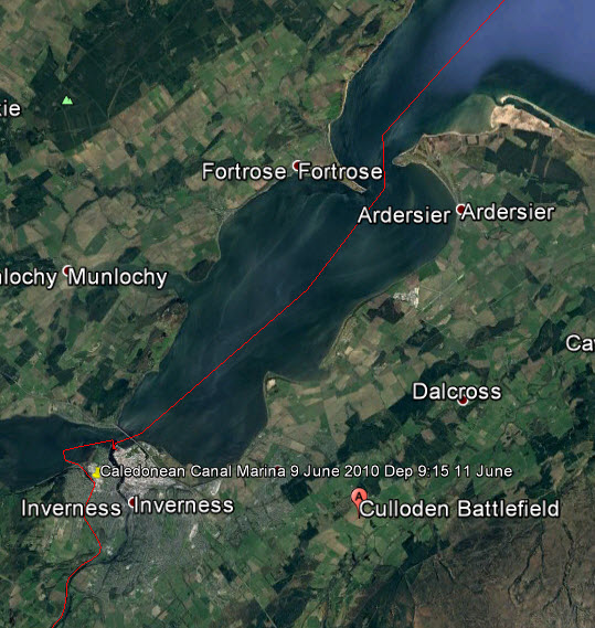 The Moray Forth, Inverness, Fort George and Culloden Thus one evening, when a light rain was falling and a mist was rising off this boggy moorland we visited Culloden. In retrospect a most suitable atmosphere for this mournful place. We were the only visitors at that time of day when the adjacent visitors' centre was closed (we returned another day to view the interactive visitor centre).
The Caledonian Canal connects a string of waterways by 29 locks, the River Ness, Loch Dochfour, Loch Ness, Loch Oich and Loch Lochy. In fact,only 33km of its 97km is in man-made canals. The first, Loch Ness was disappointing with its tacky tourist resorts exploiting The Loch Ness Monster or ‘Nessie’. However, after ascending the flight of locks at Fort Augustus it became beautifully remote and unspoiled such that we extended our passage by spending extra nights at moorings.
The passage finally skirts Ben Nevis, the highest mountain in Scotland, before descending by an impressive set of locks called ‘Neptune's Staircase’ to Loch Linnhe and the sea. 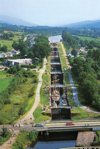 Neptune's Staircase
 Tobermory Tobermory is a pleasant tourist town and the logical jumping off point for the Western Isles. Our plan was to round Ardnamurchan and pass North of Skye through the Kyle of Lochalsh before crossing to Portree on the Isle of Lewis. However, it was not to be, as we had so often learned when sailing.
However, Scotland has a way of compensating. When we were passing Ardnamurchan again , in a temporary clearing of the weather, we were suddenly surrounded by porpoises, there must have been more than 100 for about a kilometre around the boat; some leaping in groups of 3 or 4, others singly but all in a feeding frenzy. It lasted about 10 minutes and then they were all gone. We were left breathless, realizing that we had witnessed something that very few people have seen and that we would never see again. 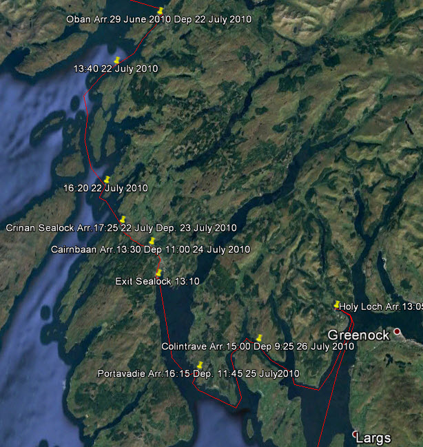 The Route from Oban to The Clyde From Oban we went South, threading through rocky islands with strong currents and eddies that made it exciting. We wanted to visit the Clyde estuary and Glasgow but in order to do this without a huge detour around the Mull of Kintyre it was necessary to transit the Crinan Canal. In the distant past we had lived in an old convoy assembly station at Kilcreggan on the Clyde and had never gone back to see it.  Enterprise Next to a Puffer Waiting in the basin to enter the canal we found ourselves next to one of the last remaining ‘puffers’ in Scotland. Now ‘puffers’ are a much loved icon in this country, they are small steam driven coasters that were the lifeline to the hundreds of coastal islands. They carried everything imaginable and could beach themselves on the sand to unload at low tide .
They became iconic when a series of stories about a puffer called ‘The Vital Spark’, and its irascible skipper ‘Para Handy’ ran for 20 years in the Glasgow Evening News from 1905. The last one in commercial service finished in 1993, killed by the roll-on roll-off vessels that did not need unloading. Later we went up Loch Fyne to Inverary where there is a puffer called The Vital Spark complete with an effigy of Para Handy. It is ironic that people pay big money for the privilege of shoveling coal, on a trip in a puffer. Old stokers must turn in their graves.
Now the Crinan Canal is a totally different kettle of fish to the Caledonian Canal since it is largely unchanged from when it was built 200 years ago, the 25 locks are all manually operated by the user so the passage is quite a feat of muscle power.
Leaving the Crinan Canal we were in an area of lochs and islands that are accessible to Glasgow and the Clyde with its history as a great manufacturing and shipbuilding centre of the industrial age. In those days this whole area was seething with activity, paddle steamers took the city people for excursions to the seaside and puffers plied their trade. Today there are relics of this age all over the area, decaying Victorian piers with their wrought iron curlicues and rusting hulks of once proud vessels. The shipyards are gone and Glasgow has many derelict factories but the area is re-inventing itself into a cultural centre with many new buildings in the downtown, and rehabilitation of the Clyde estuary. There is much nostalgia for the Golden Age of the Clyde and enthusiastic restoration efforts are under way to save features before they are lost.
Our course lay around the Isle of Arran and down the East coast of the peninsular called the Mull of Kintyre, which points like a finger to Northern Ireland, or Ulster. Over the last 50 to 60 years, great swaths of the Scottish countryside have been transformed from moors, bogs and infertile hillsides into coniferous forests. This was very evident as we sailed down the East side of the peninsular. Of course it makes good economic sense for nobody wants to live the life of a crofter scratching a living from infertile soil, but there is not much romance in looking at a coniferous plantation. Near the southern end is Campbeltown, the last harbour on this sparsely populated part of Scotland. Here the brutal Atlantic gales sweep right across the end of the peninsular. The countryside struck us as rather bleak with its steep, rocky, wind blasted crags.
The Harbour Master was right in the mould, telling us of all the stuff that we could do around Glenarm and the Antrim Coast.
But there was an even bigger surprise, abutting the village were the grounds of a large country house, Glenarm Castle. The castle itself is very grand with turrets and porticoes but not open to the public except for one or two days per year. 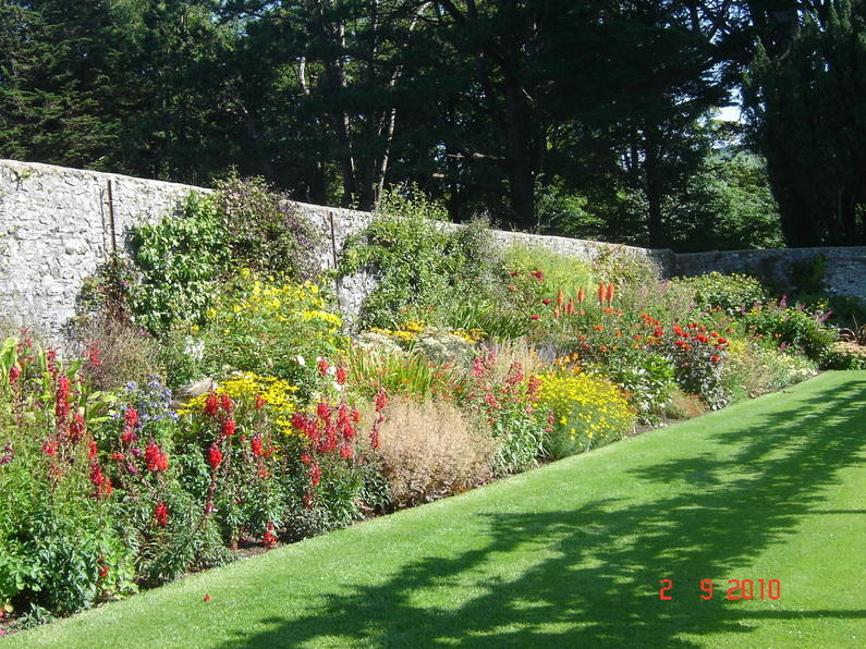 The Walled Garden ay Glenarm Castle The same goes for the meadows and grounds except for a large walled garden that has been extensively restored to its former glory, now rivaling the great European gardens. Although really too late in the season for most gardens this one still appeared in full bloom, an anomaly caused by the micro climate and sheltering walls. We were quite taken aback by this discovery, spending several hours there and returning for a second visit. Glenarm Castle is the home of Viscount and Viscountess Dunluce and their family. The castle has been in the McDonnell family (the Lords of Antrim) since it was first built in 1636. The McDonnell's have been in Glenarm for nearly 600 years and the Estate has been in the family for 400 years. Later when we had read the history of Ireland and learned of the Plantations we started to understand how these great houses, scattered throughout Ireland, fitted into the troubled history of the country.
From Carrickfergus we sailed South to the fishing port of Ardglass, near the border with Eire, passing the mountains of Mourne where they ‘sweep down to the sea’. It was a relief to refresh our souls with the beauty of the scenery but later we were to explore the countryside and found that echoes of the Troubles were nearby in towns like Newry, Armagh and Portadown. Then it was on to Howth in Dublin Bay as our cruise drew towards its end. 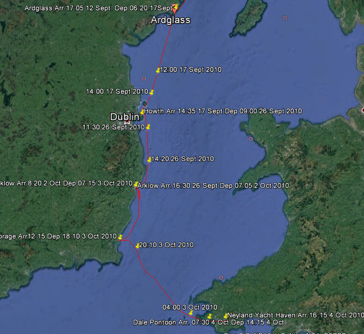 The Route from Ardglass to Neyland Suddenly the atmosphere felt quite different; gone was the underlying tension, people positively sought you out to chat, and they always seemed to have time to do it. Dublin was a hotbed of culture and we made the most of it with visits to three theatres, The Gate, The Abbey and Smock Alley, this latter one dating back to 1662; the Dublin Writers Museum and to the Book of Kells at Trinity College. The history of the ‘Easter Rising’ interested us and we saw key sites such as the General Post Office and others while covering other places like the Oscar Wilde Memorial. Everywhere there were side walk cafes, especially along the banks of the Liffey, and we were like kids in a candy shop. 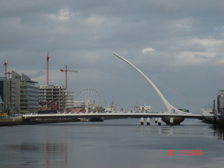 A Celtic Harp Over The River Liffey We could not resist the urge to dig deeper since we had read Edward Rutherford’s ‘Ireland Awakening’ and that history was all around us. Consequently we set off by car to cross Ireland and get a feeling for the country.
The West Coast is mountainous, bleak and treeless with poor soils. Traveling North we appreciated the wild beauty but it must have been a hard life; a few potatoes and digging peat . The extent of peat digging can be seen from aerial photographs; the whole countryside is scarred.
One item really got to us. This landowner was growing pineapples for his table in a heated glass-house while he evicted his starving tenants! During this great famine food was being exported to England. 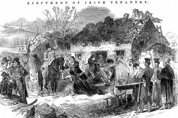 Contemporary Print of Evictions  While the Land Owner Lived in Luxury The history of Ireland is a long tragic history of man’s inhumanity to man, it is a wonder that modern Irishmen can smile at all.
So as soon as the weather eased up we left for Wexford. Well not right into Wexford Harbour for it is a shallow, shifting channel and we did not want to get caught in there by bad weather.
That is how we ended up for the winter next to the ruins of the dock that was going to be the transatlantic terminal for Brunel’s great ship ’ The Great Eastern’, but that is another story. For other Cruising blogs see the Archive links in the sidebar at the top of this page.
Other blogs of interest are The Retirement Dream and How to Live Your Dream The mainland of Denmark, the Jylland peninsula, has a split personality. The west coast is windswept sand dunes and shallow coastal sand banks that take the full fury of North Sea storms in the winter but are incredibly beautiful on a summer’s day with vast numbers of sea birds; whereas the central and eastern area is a green pastoral land.
Across the north of Jylland is an inland passage to the North Sea called Limfjord. We thought that for our 2009 cruise we would take this, apparently tranquil, passage to the North Sea and then across to Scotland. The season was to work out quite differently.
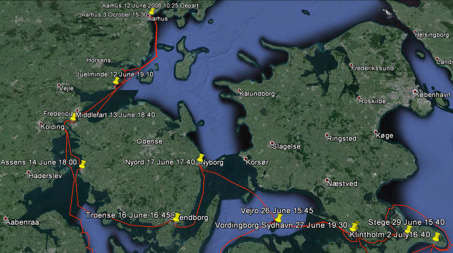
The full details of what actually happened can be seen by following this link to Google Earth, Northern Denmark & Norway make sure that you have the ‘Temporary Places’ check box ticked when it is open. Clicking on the yellow push pins will open the log book entries. The first leg was from Århus up the east coast to Hals and then through Limfjord to the east coast port of Thyborøn. 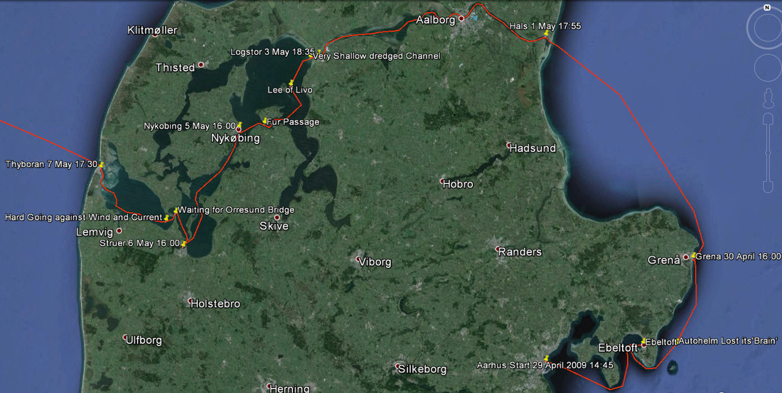 First Part Aarhus to Thyboron After completing the winter maintenance we set sail around the east coast by way of Ebeltoft & Grenå, entering the Limfjord at Hals.
At first the passage was as we expected but as we progressed westwards the passage became shallower and a strong west wind was always blowing. Now shallow waters and strong winds always mean big waves, so as the channel widened out the waves grew bigger turning our tranquil passage into quite a challenge, shipping lots of water over the deck for there was a storm in the North Sea. It was pretty countryside but we hardly had time to observe it!
At Thyborøn we agonised most of the next day about launching into our 3 day passage to Scotland as the storm, though subsiding was a long way from having completely passed. We had a strong crew of 6 persons, 3 of whom had planes booked back to Canada in a few days and the weather was forecast to gradually improve. So I made the classic mistake of making a decision based on deadlines rather than weather and then rationalised it. So at 17:30 we set off in high spirits for Scotland. 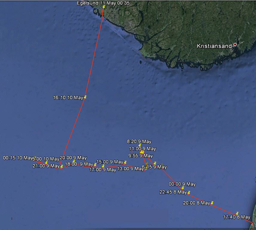 The Second Part - What Actually Happened
The seas were big, not more than expected, but 4 hours later 3 crew members were down with seasickness. The seas were too big to use the auto-helm so we settled into hand steering which was much more demanding of the remaining crew. As the night came on the wind built from the west so we had to change course to Northwest to keep sailing and found that the waves knocked us further off course. By morning we were well north of our desired track, so tacked to get back southwards, but on that tack we were being driven east. It was a long night during which the cabin table broke loose and had to be tied down. The first mate was thrown into the chart table and got a black eye. By early morning one of the crew had recovered sufficiently to take a watch and by noon the wind had backed sufficiently to tack again. Finally we were making good progress in the direction that we wanted to go but the seas were still big and lumpy. From this point we knew that the weather would only improve and we started to calculate our arrival time in Scotland. Then during the midnight watch of the second night a mainstay brass turn-buckle broke. After the initial crash there was an eerie silence. We were dragging the mast, sails and rigging over the side with stanchions and lifelines torn away. The mast was pounding the hull like a battering ram but it was far too dangerous in the dark to go on deck to cut it free. We could afford to wait for daylight because we had a steel hull. All the debris over the side acted like a sea anchor but it also tended to put us broadside to the waves, so we started the engine to keep us bow on. That lasted about 20 minutes before the rigging fouled the prop so that was the end of that.
In response to our relayed distress call an oceanographic research vessel, the G.O. Sars, found us at 02:30. To see her approaching with searchlights sweeping the sea was a memorable moment. She stood weather guard on us until the coastguard cutter arrived at 10:30 and took us in tow. It was a rough 14 hr tow in those seas at 6 knots.
In the morning we had time to reflect, celebrate and look around the charming town of Egersund. We had made the newspapers and people came to look at us. A deep sea trawler fleet is based here, the so called ‘factory ships’ that are at sea for months and go to the farthest corners of the North Atlantic so there is a long tradition of sea faring history here.
The next 3 months were what we called the Norwegian interlude. We were determined to turn it into a positive experience and, looking back on it, it was great. After fixing up the insurance and putting the repairs into the good hands of Eigerøy Båt og Motor AS, we moved into a holiday cabin on nearby Eigerøy and walked and cycled in the area.
We also explored the modern, bustling city of Stavanger where we experienced our first ‘flash mob’. Through social media the word goes out to meet in a certain location in a couple of hours and we happened to be in the spot when hundreds of people suddenly arrived, a ghetto blaster got going with action songs, like ‘YMCA’, and everyone joined in. After an hour it is all over as if nothing had happened. It was apparently quite the rage that year.
On another occasion we travelled up Lysefjorden then up switchbacks and a spiral tunnel to the ice fields.
This area is home to Europe’s southernmost population of wild reindeer. Several ancient trails dating back to the Stone Age pass through this area. Then we went down to the coastal road with its extensive tunnels, cliff hanging roads and picturesque fishing ports.
In this harsh environment it is not difficult to picture the isolation in former times when transportation and sustenance depended on the sea. When the sea was rough you stayed put and went hungry if you could not trap wild animals.
The 17th May is Norway’s National Day. The whole community gets involved in the parades and national costumes abound which, we were told, are past down in families for generations; it was an exciting experience for us in Egersund. National pride in their modern, progressive state, which a hundred years ago was a country of fishermen and subsistence farming, was evident everywhere.
Finally after 3 months of this interlude the boat was better than new, as we had taken the opportunity to make major overhauls, but we still had to travel as a motor boat to Stavanger, a 60 nm open sea journey, to have the new mast and sails installed. So began the next stage of our sailing season. 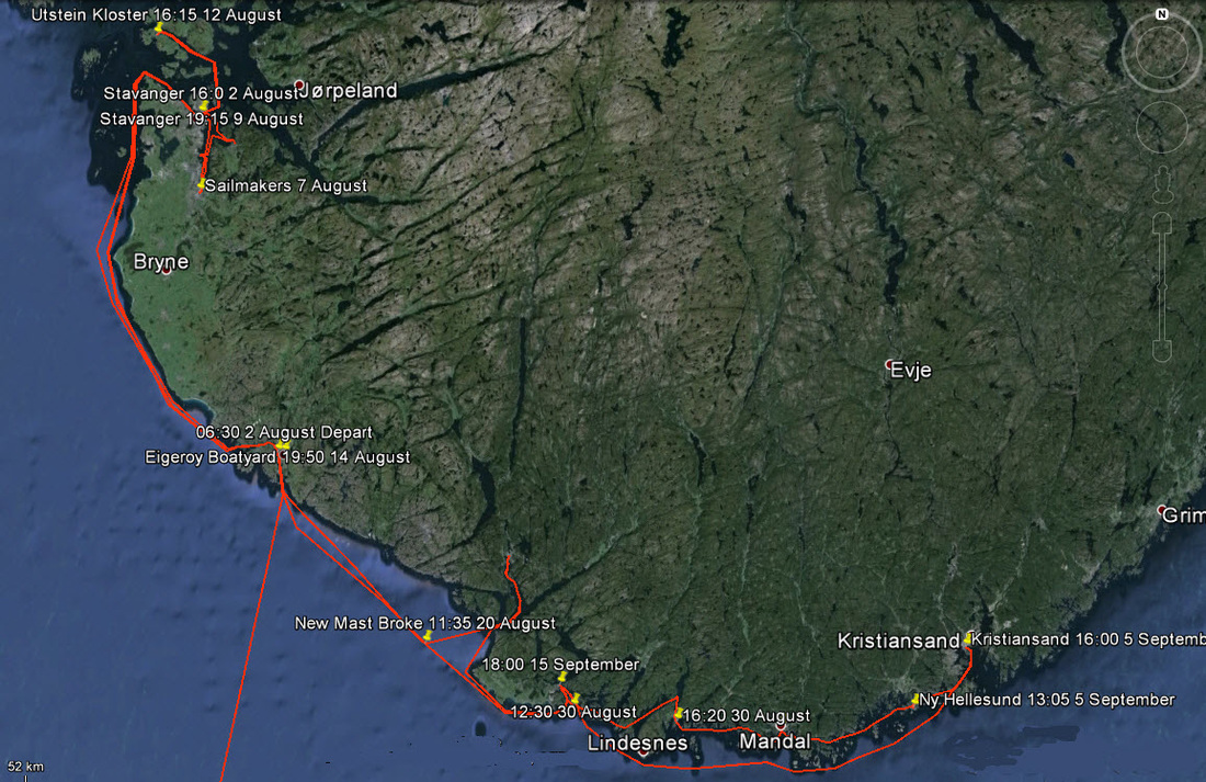 The Third Part - Coastal Exploring A keeled yacht without its mast and sails is unbalanced and tends to act like a pendulum, rolling a lot in cross seas. So we were a little apprehensive about the passage to Stavanger. As it turned out the rolling was not too bad and it was the torrential rain that bothered us more. After the new mast and sails were installed they had to be modified so we took the boat on the short trip to a sail maker in Sandnes. This turned out to be a very interesting trip as we were invited to a house party with some of his friends at Oltedal where we experienced great Norwegian hospitality and an insight into the way of life. Since the hostess managed a large salmon farm in a nearby fjord we were given a personal tour of the farm. The high technology involved in the operation was a real surprise.
We sailed around the area testing the new mast and sails before we were ready to move on. One of our excursions was to ancient monastery, Utstein Kloster, where we heard that there was a choral concert being given. The island of Utstein seemed very remote to hold a concert but we later found out that there was a bridge so it was not as inaccessible as we thought. We tied up at the dock, had cocktails at the hotel, and then walked a couple of kilometres to the monastery to listen to an elegant concert. It was all a bit surreal.
We decided that it was now so late in the season that we should go back to Denmark for the winter, stopping at Egersund for some adjustments to be done in the boat yard. So on the 2nd August we started back the way that we had come, but this time we would go back down the Norwegian coast before crossing to Hirtshals in Denmark. Once again it was not to be. On the 20 August, offshore and approaching the southernmost point of Norway, the new mast suddenly broke in two places, one a metre above the deck and the other at the cross trees. This time however it was at 11:35 on a good sea, with little or no collateral damage. We felt like old hands at this situation and immediately secured the rigging from fouling the prop. Then we motored into the nearest port, Flekkefjord, dragging the debris. Being a Saturday afternoon, we were quite a sensation when we arrived in the centre of town.
In typical Norwegian style, the local yacht club immediately put together a working party to sort out the mess and salvage the sails and what is more invited us to their homes for meals and showers. We were really touched by this spontaneous kindness.
This time the liability mess was much more complicated, we only knew that it certainly was not ours, and we determined to not hang around while it was sorted out. So we decided to explore the Norwegian coast eastwards, as a motor boat. This meant that we would take as many inner passages as possible and by so doing we discovered some glorious hidden places but the navigation was tricky in these ‘skerries’. If you can imagine a pepper pot sprinkling rocks in the water, some of which show above the surface but most are just below; then those are ‘skerries’ and there or lots of them along this coast. Our first step was Forsund, a picturesque town behind skerries. However, we quickly learned our first lesson about navigating in the skerries. Never try to take a short cut!
We realised that we had missed branching off the main channel but since the secondary channel was parallel to the main one and in plain view for a while, rather than going back we thought that we would cut across to get back on track. Big mistake! 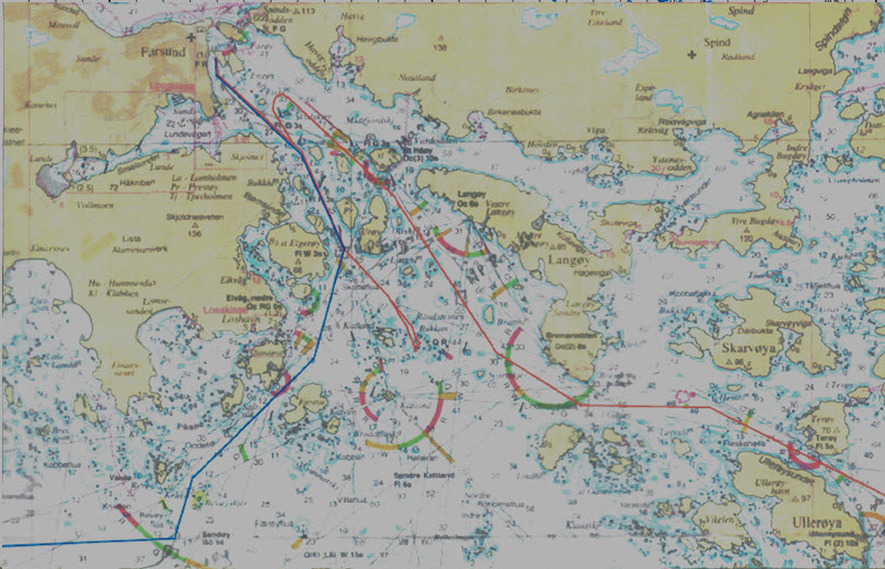 Blue Track - Arriving in Forsund and Red Track Leaving! We found ourselves in a maze of semi-submerged and submerged rocks and had to retrace our path, greatly humbled. Because we did not have a mast we were able to take an inside passage to Mandal that used a recently opened canal which had been built to save motor boats from having to navigate the notorious Cape Lindesnes.
The leg to Kristiansand passes through the Hellesund passage which contains a very special place. It is an enclosed basin that is entered through a cleft in the rock which is only slightly wider than the width of the boat, you would not know it was there without a chart and even then you can sail right by. It is quite eerie to sail the boat into this narrow cleft and see markings on the walls made by sailors years ago.
We had hoped to stop here for lunch but the mooring rings were all taken and it was too deep to anchor, so we pushed on along this fascinating route to Kristiansand.
We had hoped that by the time we reached this town the fight over who was liable to replace our mast would have been resolved and if it was the mast supplier then we would have sailed on to Oslo. But nothing had been resolved so we decided to sail back to Stavanger while the weather was good and leave the boat there for the winter. Naively assuming that the matter would be resolved in the near future and the work could be done in time for the next season. So a fabulous year of adventure, exploring and fascinating cruising ended on a bit of a sour note. For other Cruising blogs see the Archive links in the sidebar at the top of this page.
Other blogs of interest are The Retirement Dream and How to Live Your Dream After our #sail cruise up the West Coast of Sweden and to the North-East of the Baltic Baltic Sweden and Finland we decided that we would cruise the South-western Baltic, i.e. Southern Denmark, Germany and the South coast of Sweden. Although this is the most populated part of the Baltic, there are still many quiet and beautiful places for a #dreamchaser. Of course every area has a rich and diverse history. For the complete route, go to Google Earth (and remember to tick the boxes in 'Temporary Places') When you scroll over a yellow push pin the log book entry will come up. The South-Western Baltic 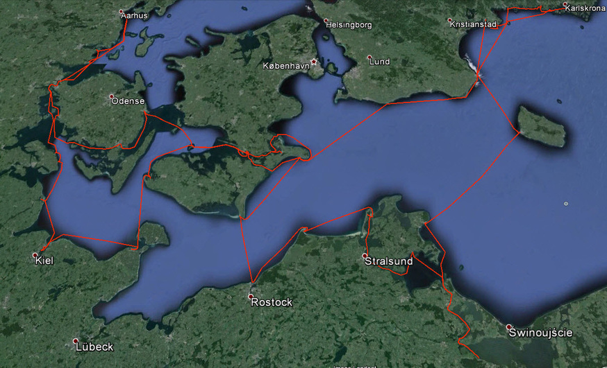 We started down the Lillebaelt, the name given to the passage between the mainland of Jylland and Funen the westernmost of the two main islands of Denmark. Each side of this waterway is punctuated with inlets sheltering small towns nestling in a green and pleasant land. Looking at the map you may think that this a sheltered waterway but the reality is that it funnels the wind and can be quite breezy. Good #sailing, if it is blowing in the direction that you wish to go!
 Turning east we followed the coasts of the two big islands, Funen and Zejland, picking our way around many tiny islands and finding small villages and some bigger towns. Midsummer’s Day found us in Nyord where the festival was celebrated with a bonfire on a floating raft in the harbour (quite close to us!). To enjoy a midsummer’s night gently rocking in the cockpit, listening to the music by the glowing embers of the bonfire is a #liveaboard experience we will remember for the rest of our lives.
At the end of this passage we circumnavigated the island of Møn with its shallow, shifting channels to the West and the impressive white cliffs to the East. From here we went along the North German coast from Rostock (Warnemȕnde) to the Polish border. This has been the German Riviera for many years. The Prussian kings made the island of Rȕgen their summer resort and the main town of Bergen still shows the grand elegant building of a German Golden Age. 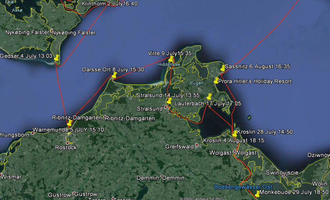 At Rügen one can turn inland to an area called the Hiddensee a little known area of interconnected lakes and rivers running to the Polish border. Here you come across the ancient Hanseatic town of Stralsund, sadly badly damaged in World War 2 but raised again and very interesting. A little further on is the more sinister Peenemünde where V1 and V2 rockets were developed and manufactured; now a museum. All the places along this coast have been greatly restored since reunification of Germany and the German Riviera is back.
Leaving Germany we went north to the island of Bornholm, passing on our way Hitler’s huge 10,000 apartment holiday resort , at Prora, for the Party faithful. Bornholm is an outlier of Denmark and is a flagship of a greener ‘smart-grid’ world. This scheme is part of ‘Eco Grid EU’ that involves switching all cars on the island to electric and using their batteries each night as grid storage. Innovation is not limited to industry for there are numerous artists and galleries throughout. 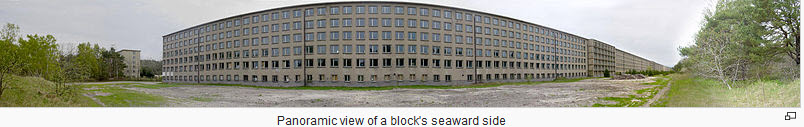 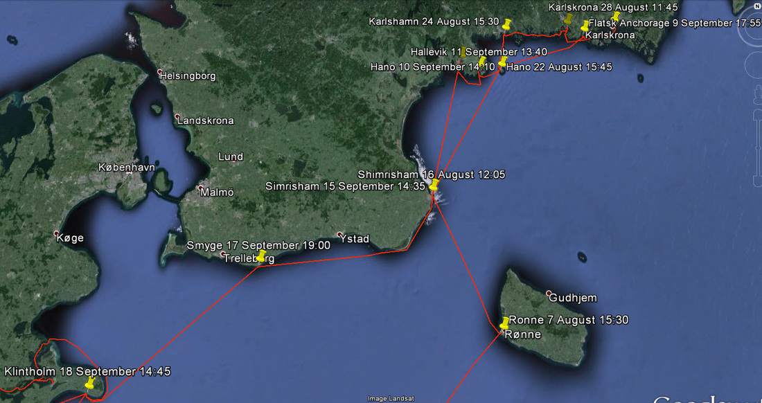 The southern coast of Sweden between Simrishamn and Karlskrona is a quiet coast with lots to explore. The sparsely populated island of Hanö had sculptures strategically placed around it creating multiple surprises as we hiked around it. Karlskrona has been the headquarters of the Swedish Navy for centuries and as such is packed with interesting maritime history. Approaching it one passes the area of numerous foreign submarine intrusions made famous by Kurt Wallander in his novel ‘The Troubled Man’. Kungsholm Fortress with its walled harbour is a ‘must see’.
_We came back to circle the Danish islands of Falster and Lolland on our way back to the German coast. Lolland is famous for its ‘Hydrogen Community’. This is a wind generated power system that stores electricity by manufacturing hydrogen by electrolysis and then converting it back to electricity when the wind is not blowing by the use of fuel cells. We Travelled East this time into the Kieler Bucht, the headquarters of the German Navy, with famous place names everywhere. Entering the bay we passed the impressive U-Boat Memorial to 35,000 sailors lost at sea with an example of their iron coffins at the base.
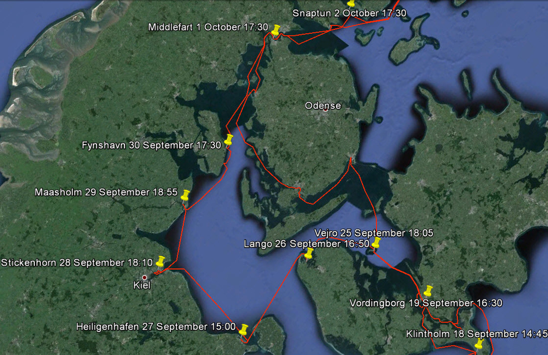 From here we went north up the coast of Schleswig Holstein, territory that has gone back and forth between Denmark and the German Principalities for centuries. We closed the loop at Middlefart and so back to Århus that we had left 4 months earlier. Cruising the Baltic always leaves you with the feeling that so many interesting places were passed by and your head is so full of new facts and experiences. You need a #retirement winter to reflect and relive it all. For other Cruising blogs see the Archive links in the sidebar at the top of this page.
Other blogs of interest are The Retirement Dream and How to Live Your Dream 2007 was our most ambitious cruise, we set out to explore the lesser known watery byways of Scandinavia and search for adventure. We discovered it in spades and started a love affair with these northern waters and peoples. Our enthusiasm was infectious for family and friends all wanted part of the action so that we ended up with multiple rendezvous’ to pick up visitors for a couple of weeks each. Our route is shown on the following link to Google Earth. You will have to zoom in and out quite a bit as there is a great deal of detail and make sure that the boxes in 'Temporary Places" are ticked. The 2007 Cruising Route We first did a circuit around, Sjælland Denmark to our first rendezvous in København.  2007 Season Part 1
Then up the west coast of Sweden to Oslo, Norway where we looked up old friends that we had not seen for 52 years!  2007 Season Part 2
Then back down the coast and across the centre of Sweden via Lake Vänern and the Göta Canal to the east coast to make our next rendezvous on the canal. Into the Baltic and up the east coast through the archipelago to Stockholm where the Tall Ships Regatta was just arriving. 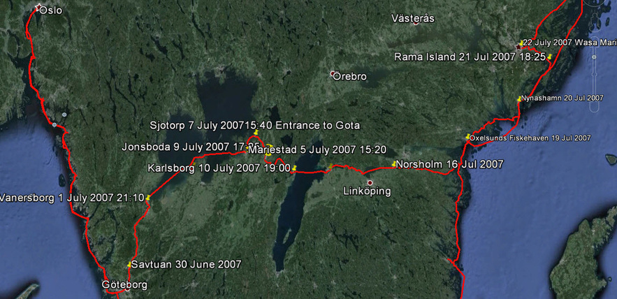 2007 Season Part 3
Then on northwards and across the Gulf of Bothnia to the little known Åland Islands where a Viking gathering complete battle was occurring. Then through the Finnish islands and across the Gulf of Finland to Tallin in Estonia, mooring next to the Olympic Flame from the 1980 Games. Our next rendezvous was in Helsinki, Finland. We had contemplated sailing to St. Petersburg, Russia but the paperwork was so horrendous compared with catching the train that we left the boat behind and took the train for an unforgettable few days. Back then to exploring the islands around Helsinki before our next rendezvous in Tallin. 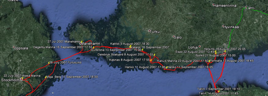 2007 Season Part 4
We had planned to return by way of Riga, Latvia to Sweden but strong westerly gales were forecast for the next two weeks which would have meant that we were navigating shallow, shelving lee shores. So we decided that it was wiser to return the way that we had come. However ,the Göta Canal was now closed for the winter and we had therefore to circumnavigate southern Sweden. This turned out to be a wise decision as even the coastal route had its challenges with the weather that late in the season. 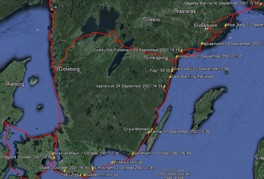 2007 Season Part 5
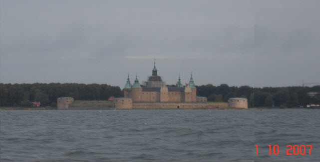 Kalmar Castle
We closed the loop at København, which was our next rendezvous. Then we sailed around the north coast of Sjaelland in very stormy weather to complete the cruise back in Århus almost exactly 6 months from when we started. 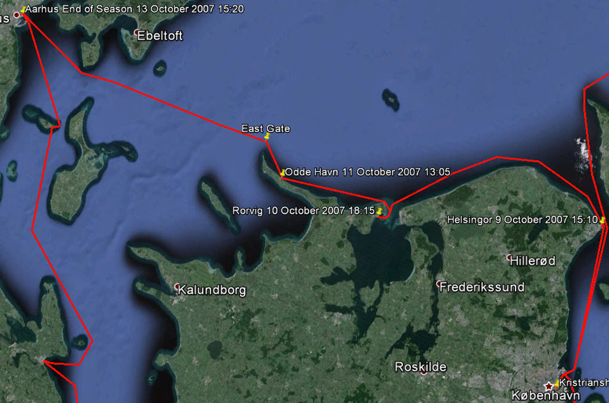 2007 Season Part 6
Every day was an experience and many were very exciting. The route took us to places that felt isolated and unspoiled, for we were often the only boat there. The sailing season in these northern latitudes tends to centre on mid-summer (21 June) and by the end of August many facilities are shut for the winter; not that that prevents use of the docks. Apart from the weather deteriorating in September, we experienced the sudden fogs that are typical of the early October period. It was a fabulous year and every leg deserves a chapter on its own. For other Cruising blogs see the Archive links in the sidebar at the top of this page.
Other blogs of interest are The Retirement Dream and How to Live Your Dream
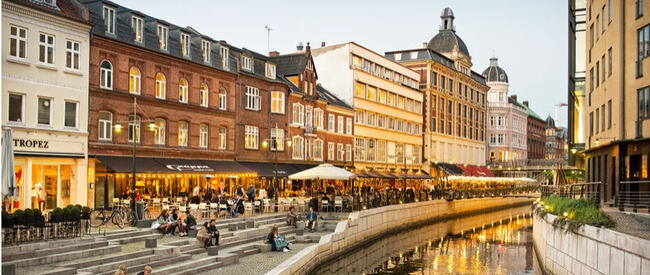 Our Destination - Århus Denmark As soon as my winter work for the ‘oil patch’ was over we travelled back to England on March 18 to pick up our car from where it had been left for the winter. Then drove to Locmiquélic, on the estuary of the Blavat River leading to Lorient, where Enterprise awaited us at her mooring. All was well, except for a letter pinned to the mast asking us to call Customs in Vannes. The French Customs also act as a sort of taxation police, they dress like police and travel around looking for any tax infringements as well as customs duties. So, our hearts sank when we saw the letter but decided to worry about that later.
The next day we continued west around the headland of Penmarc’h to our next stop at Audierne. Penmarc’h is a formidable headland with scattered rocks way out to sea. We have passed it several times and it is always rough as currents clash here but we have usually been accompanied by porpoises playing around our bow and this time was no exception. 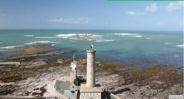 The Headland of Penmarc’h
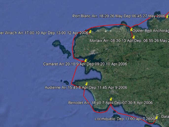 Locmiquélic to Morlaix
We had passed through on the last of the north going current so soon had to fight the current across the Baie de Douarnez, which was anticipated, but with the wind piping up to Force 3 against the tide it became a long, uncomfortable slog in a confused sea. The town of Douarnez has an interesting history as the birthplace of the sardine canning industry. When Napoléon was at his apogee, he needed a method of preserving food to feed his huge army, so a competition was launched to find such a method. It was won by Nicolas Appert in 1810 with a preserving method using sealed glass jars. For the sardine fishing fleet in Douarnez, fishing in these waters, this was a godsend for getting their product to new markets and sardine canning factories were established. Ten years later, with developments in tin plating and the invention of the can opener, the glass jars were dispensed with and canned sardines, as we know them today, were born. Today the industry is no more in Douarnez, having moved to more lucrative fishing grounds. At Camaret we were the only yacht in the marina, it felt very odd.
We had two urgent things to do once we had arrived in Morlaix; one was to meet our son and granddaughter in Paris but for that we needed our car which was back in Locmiquélic. So, the other thing was to get back to Locmiquelic. Now all through our cruising life on Enterprise we operated on the basis of having a car available to explore the countryside and cities away from the coast. First, we would usually use it to get to the last place we had left the boat and then sail away and leave it, sometimes for months, until we reached a place where it would be useful, then we travelled back to pick it up. However, it is often easier said than done because to get from one fishing village to another by public land transport is often very convoluted. This is particularly so in France for the main transportation links all radiate from Paris like a giant octopus and trying to cross from one leg to another is always difficult and sometimes impossible. On several occasions it was quicker to go into Paris and out again even though it was hundreds of kilometres longer. So, it took us a whole day with two train rides, two bus rides, a ferry ride and a fair amount of walking to get back to the car in this case. It was always worth it to have a car occasionally, for when driving through the countryside we would always find interesting places way off the beaten track. This car journey to Paris took us through Villedieu-les-Poêles, a town built on the manufacture of copper cooking pots, to the Bayeux Tapestry, then to Monet’s garden at Giverney.  The Bayeaux Tapestry
Finally to the elegant town of Chantilly where the upper crust of Parisians went to the races. Arriving at Charles de Gaulle Airport there was a precursor of things to come when part of it was suddenly shut down due to a terrorist scare.
We had spent 3 months in the winter of 1983 in Paris, so we knew our favourite places and made the most of the 3 days that we had.
The second priority was to take one of the hundreds of guided walking tours available. We took the one in the Palais de Justice where the French legal system was explained and several court rooms, with trials in progress, were visited. The court room where Marie Antoinette was tried has hardly changed since that time. We could imagine the offices of the famous Maigret right here on the Quai des Orfèvres side of the Palais.  Palais de Justice
Back at the boat there was a long list of items to be attended to, including extra handholds around the hood (lessons from experience in heavy weather) and extra rails at the back of the cockpit for the BBQ and the outboard motor.
As soon as June returned from England with the car it was also time to tackle that annoying letter from the French Customs that had greeted us when we arrived back to Locmiquélic. Their office was in Vannes, a 3-hour drive away. After much interrogation they said that the boat had been in France for a year and therefore required a 'passport' for tax purposes regardless of whether we were on it or not. Actually, the taxes on the boat for 2005 were zero but they were still going to fine me 300 Euros for not having a 'passport'. They were determined to get money out of us one way or another. Then, because the boat was now outside their District, we would have to go to the office in Brest to get the 'passport'. Finally, I got back to the boat at 21:00 feeling very much down. A few days later we drove to Brest to visit the Customs Office who were appalled that we had been fined by the Vannes District; they said that a ‘Passport’ was not necessary and they were not going to issue one; we should forget the whole thing and enjoy our cruise. Our first big lesson in French bureaucracy. We benefited from that lesson when we changed our car registration to France from the UK. “There are so many regulations that one has to turn a blind eye to some or nothing would ever get done.” That was the lesson that we had learned. 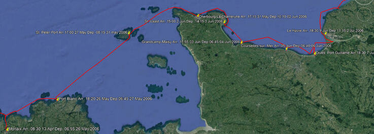 The Route from Morlaix to Le Havre We finally cast off from Morlaix on 26 May heading for Le Havre by way of Port Blanc, St. Peter Port, Cherbourg, St. Vaast, Grandcamp-Maisy, Courseulles and Dives-sur-Mer. This was our next rendezvous for we had agreed to crew for a friend on a cruise from Le Havre to the Scilly Isles and back to Falmouth. We were in the lock for 7:00 and sailed down the river on the rising tide to anchor in the Oyster beds until the tidal streams were right. At 13:00 we weighed anchor to carry on. By 1700 the wind really got up and we gave up the target of the Île-de-Bréhat and ran into Port Blanc (see our first experience in Port Blanc in 2004) but there was a very strong current to beat to get in. It was rough in there which gave us trouble picking up the mooring buoy and we had to launch the dinghy to do so. Finally we got it secured to the stern but before we could work it around to the bow, we swung into a neighbouring boat and smashed our port bow light. We eventually got the mooring line to the bow and things settled down. A very uncomfortable evening tossing about but June managed to cook supper. We both crashed with exhaustion to wait out the storm for a day at the mooring.
There is a brass plaque on the harbour wall commemorating the events. If you have watched the movie The Guernsey Literary and Potato Peel Pie Society you would recognize the harbour. We had visited the harbour several times on different boats but this time we decided to stay over for 3 days to explore the island and buy and install a new bow light. We were a bit disappointed with the island as it has been a bit overdeveloped and seemed to us like one big suburban sprawl.
The next leg to Cherbourg requires precise timing for the currents are extremely strong such that a sail boat cannot possibly fight them. So, at 08:15 we sailed out into the Little Russell channel, then into the Great Russell before threading the eye of the needle of the Alderney Race, around Cap de La Hague and on to Cherbourg. Our 2004 cruise blog describes this section in detail; this time it all went according to plan.
 Then it was time for the lock to open and we set off for Grandcamp-Maisy. A most perfect sail. Wind abeam and doing 6 knots. Straight through the lock on our arrival at 1800. Grandcamp-Maisy is located between Utah Beach and Omaha beaches of the D-Day landing on 6 June 1944 and held a real secret, for just outside of town was a huge buried Nazi command complex. Although the surface gun emplacements were known, the vast underground complex was unknown to the Allies and even to the locals. Built in particular secrecy, and under strict security, using forced labor brought in from the Soviet Union, Czechoslovakia and Poland. After the war the entrance was buried and the place forgotten for 70 years until it was rediscovered in the very year of 2006.
Omaha Beach was the bloodiest of all the landings because although planes dropped 13,000 bombs before the landing: they completely missed their targets; intense naval bombardment still failed to destroy German emplacements at the Maisy Battery and Pointe du Hoc. I had explored these beaches a few years before and when you see these fortifications with their 2 m thick concrete, like the U-boat pens, it is not surprising. The result was that Omaha Beach became a horrific killing zone, with the wounded left to drown in the rising tide. 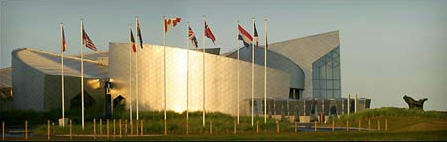 Juno Centre at Courseulles-sur-Mer Juno Centre at Courseulles-sur-Mer A great sail to Courseulles with the genoa poled out. We got the spinnaker out and rigged but by the time that we were ready to fly it the wind had changed. An excellent day. We had not planned to arrive on the 62 Anniversary of the Canadians landing on these beaches, code named Juno. There were lots of veterans in uniforms around and at the Canadian Museum there were ceremonies and speeches. Then we walked along a beautiful sandy beach; it was hard to put oneself in that moment in 1944.
Another lovely summer day and we set out for Dives – Port Normande. A wonderful sail. An interesting approach. It looks as if you are going to sail right up onto the beach and then you suddenly turn to starboard and follow a dredged channel through a gap that opens up and there is a lock to enter into a huge new harbour.
We tied up next to a Dutch couple of our vintage and spent time talking to them. They had exactly the same antique compass that we had! The harbour was surrounded with new apartment blocks. Many units were still empty. There is so much to see that we decided to stay a second night. It is just like a movie set of a 20/30's movie. The buildings survived the war and are, in their way, fascinating. It was from the harbour of Dives-sur-Mer that William the Conqueror set out on the Norman Conquest of England in 1066. A monumental plaque in the church lists the companions of the Conqueror.
Locked out of Dives at 1100 and turned for Honfleur. The wind really came up and there was a strong current behind us. Scooted along at 8+ knots. Veered off up the Seine for Honfleur. However, we had not done our homework on the Seine currents and they turned against us before we reached Honfleur such that we were just crawling along and in danger of missing the lock to get in. So, we turned around and sailed back down and crossed over to the other side for Le Havre. We stupidly missed a Cardinal and sailed over a sandbank area. We did touch bottom but did not go aground; that would have been serious on a falling tide. A ridiculous, unnecessary error. There was a cruise ship coming out of Le Havre as we were going in, which is always interesting, like sailing very close to a moving skyscraper. 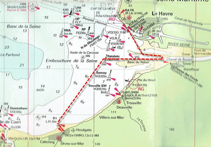 Our Seine Estuary Error The next day was fine so we decided to go to Morlaix and bring up the car. We found that it was impossible to go directly and we had to catch a train to Paris, St. Lazarre. Cross the city to Gare Montparnasse and catch a train to Rennes, then a train from Rennes to Morlaix!
We researched where we could leave the car for the next 6 weeks, a skill that we were starting to hone, for standard parkades are far too expensive; marinas are usually OK since they are used to people being away for a 2- or 3-week cruise but sometimes they have events scheduled for their parking lots. We found that places that store holiday trailers in the winter are usually empty and cheap in the summer. However, they are usually out of town and require a long taxi journey to reach them. So, when that is factored in, we opted for an in-city parkade this time. A few days later our friend’s boat arrived and we set off in it to sail to the Scilly Isles; but that is another story. If you are interested in our cruise to the Scilly Isles click on this Google Earth link. (Depending on your browser, you may find that these two links just download a file that you then have to open). Make sure that you have the ‘temporary places’ box ticked when it is open. Clicking on the yellow push pins will open log entries. 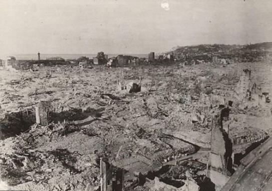 Le Havre After the Bombing of September 1944 Le Havre After the Bombing of September 1944 We have all heard of the bombing of Dresden but few have heard of the bombing of Le Havre in September 1944 when 5,000 men , women and children were killed by Allied bombs for a very dubious military advantage. Many feel that it was a war crime. In 1949 I went to Le Havre on a student exchange as part of a programme to rebuild ties between the UK and Europe after the war years of hate propaganda and devastation wrought by the Allies. The old city near the docks was just a wasteland of rubble with a couple of new buildings under construction.
Arriving back early in the morning of 2 July by the night ferry from our cruise to the Scilly Isles and Cornwall we cast off and were on our way to Denmark by 11:15. This would be a different sort of challenge to our trip South down the western side of the English Channel in 2004. It is similarly strewn with sandbanks, somewhat more extensive, but there are less conveniently placed ports in the first part of the trip. ‘Convenient’ to a sailor means that the window for tidal access (if there are locks, sills or bars) is such that you can enter and exit to catch the tidal streams in the right direction. If there is not sufficient time between earliest exit and latest arrival then you are stuck with fighting the tidal current until the next port.
For us, with or draft of 1.43m, we could enter at all states of the tide (provided that the dredging was up to date). These high white cliffs are a geological extension of the white cliffs of the Jurassic coast and the Isle of Wight on the Southern English coast and that remained after the Atlantic Ocean had broken through. Approaching from the sea the first thing that comes into view is the ancient Benedictine Monastery perched on the cliff top and famous the world over for its liqueur. Le Tréport was the next port, about 38nm away. We could have gone for Dieppe but that was not quite far enough. Like Fécamp, Tréport is a former fishing port located in a river valley that cuts through the cliffs. However, this port was more problematic as there was a bit of a bar at the entrance and the depth contours on the chart did not match those in the Almanac; it all sounded as if the dredging was not up to date. Okay at high tide but a possible problem at anything less than half tide.
Then the infamous Somme River with its slaughter of epic proportions in the First World War and its 1 million casualties and then the equally infamous Étaples army base where one of the hushed-up mutinies of the same war occurred.
Boulogne is a tidal port and to reach the marina you must lock in. However, there are tidal pontoons that avoid having to lock in and that is where we went as we wanted to get away early to catch the tidal current going North. We found this location to be a rather depressing place next to an abandoned ferry dock that is rotting away. When the Channel Tunnel was completed there were far too many ferries for the remaining traffic and a brutal shakedown of the industry ensued. Boulogne missed out while Calais remains busy; similar situations exist everywhere we go, where an industry declines and the towns are left stranded. Local tragedies that most of us never see.  The Tidal Pontoons in Boulogne The Tidal Pontoons in Boulogne The pontoons for visitors were at the base of an intimidating dock structure, I always dislike these situations when you are up against the dark underside of a dock with the noise and slosh of the water at low tide. We did not explore the town, which was perhaps a pity because it has a long and interesting history, but it was raining hard and we were to cast off at 04:45 the next morning, July 4, to catch the tidal current. These early starts are always a little intimidating and this was particularly so; we felt like we were the only persons awake as we cast off from that ominous dark underside of the dock and motored passed the rows of silent boats. Sailing North from Boulogne the Channel narrows considerably and it is necessary to take an in-shore route to avoid the busy traffic lanes although this means that there are plenty of well marked sandbanks. Just after Cap Gris Nez we sailed past the village of Wissant. This was the Nazi headquarters for lobbing shells across the Channel; a practice that they kept up for nearly 4 years! Dodging lots of fishing boats again today, not surprising as Boulogne has an active fishing fleet. Motor sailing again. With the current at first but then it turned and the last bit was a battle. Arriving in Calais there are harbour traffic lights that prevent entry if a ferry is leaving, once through those there is a lifting bridge to wait for before reaching the marina. A busy port with ferries coming and going all the time. This is where Julius Cesar assembled his legions for the invasion of Britania; Calais has been the centre of battles over the centuries. It was conquered by the English in 1346 and remained English until it was retaken by the French in 1558. History repeated itself in 1805 when Napolean assembled his army here for the invasion of England which he later aborted. Then in 1940 the retreating British Forces held out here against the Nazi army and in the the process Calais was totally destroyed. Then after liberation it was bombed by the Allies by mistake! Currently it is in the news as the centre for refugees trying to get to England. The city was rebuilt in the utilitarian, concrete style of the 1950's but without the flair of Le Havre.
As we approached the Belgium border the French customs boat came out and hovered on our tail, probably checking up on us through our MMSI number but they did not board us. Then they went off to another yacht that they did board. We had been told that having an MMSI number and transmitting that number via AIS would reduce the hassle from customs police and it seemed to work here and latter in the River Elbe. This was to be a day of sandbars in the Scheldt Estuary.  Traffic Control Lanes in this Area This is an area that seems to get very little exposure and yet has been the scene of great events. The Estuary is the main route to Antwerp and Rotterdam and branches off here from the traffic lanes continuing North to Hamburg and the Baltic. Just at this junction, less than 4 years earlier at Hinder Junction, a container ship ( the Tricolor) had rammed into the back of a car carrier which sank in 90 minutes taking 2,800 high-end cars down with it.
The incident triggered a lot of publicity about the lax standards in commercial shipping and the large number of near misses. There is a tendency to think that because a vessel is large it must be meticulously navigated but after reading the reports on this accident, we always assumed that there was no lookout on these large ships. In fact, the situation gets worse with auto navigation because it breeds an over confidence and yachts are often virtually invisible from the bridges of these large vessels.
We walked to a nearby village and found a poor, cheap grocery store. When we got to the cash desk, they would not take our French credit card (Carte Bleu) so we had to put most of the stuff back. Left with 6 euros in our pocket and a bad taste in our mouth. So, the day's impression of Belgium was rather negative but this is our only stop in the country so it did not matter.
Sat in the café next door and had coffee. Spoke to a fellow who was born in Southampton like us. After our jobs were done, we walked into the old town of Vlissingen. It was Sunday afternoon and the centre all go with jazz blaring out from a temporary hall on the town green. It was a fete day but many places were closed. We wandered around and found it fascinating. Found an internet place but it was closed on Sundays! Stopped at the Marina bar and had drinks with bitterballen. We rather like them but they only seem to be available in the Netherlands. In the evening I went back to the bar to see the Final of the World Cup. France versus Italy, a very exciting game ending in a penalty shoot out after extra time. Italy won 1 – 0 but there was not the excitement of Calais because we were no longer in France.  Our Route Through Zeeland Vlissengen to Wemeldinge We left Vlissingen at noon after buying groceries and charts to cover the next region. We did not have any info about the Dutch canal system until we reach Willemstad. We did very well under a baking sun all day. It exhausted me for on the inland waterways, you can't rely on the autohelm and must stand at the wheel all the time. Our route took us through 5 bridges between Vlissingen and the village of Middleburg and that was only 3 nm! No stopping but carried straight on to the Veere Meer and over into another canal and through a couple of sluis until we came out into the tidal Oosterschelde. Perfect timing. Then on to Wemeldinge. Current against us in this tidal water. Lovely surprise for the marina was great, although quite large. We radioed in for a berth and were allocated F7, a pontoon with smooth easy access with electricity right next to the boat. Very efficient and convenient.
Nowhere else, wherever we go, has this degree of exactness, precision, cleanliness and so on. In the afternoon we went to our bar and used their internet. We spent a good 3 hours sending email and organising our trip to England for my brother-in-law's 75th birthday party. They only charged us 5 euros for all that time; which was cheap compared to other places. Then we walked all around the headland on the dyke. It was very refreshing to have a breeze with the intense sun. Then back through town to buy phone cards and back to the boat and supper. HOT: HOT Glaring sun all day from 8:00 the next day. After breakfast it was 9:00 and we left the lonely spot called Welmeldinge. I would return as it was a very hospitable place. Then it was on to Krammersluisen where there was only a short wait before we were out again and on to Volkeraksluizen.
We left to make the 10:13 bridge opening. It was a bit tricky to get out with all the rafting up. Then up the Hollands Diep before turning to port and into the river system. This took us into the Province of South Holland, a densely populated and more industrial province. The whole system around here is busy with big barges. The River Patrol stopped us and asked us to use the starboard side of the river (where we should have been anyway). Further on, we took a wrong channel, down the Oud Maas and did not realise it for a while before we had to backtrack to the main channel. Then there was a long wait (20 min) for a spoorbrug; Veerkeersbrug. These are always slow as they only open to the train timetable and not traffic demand. This area is very confusing with waterways everywhere.  Finally, we took a humble entrance into Alblassadam with a little marina on the other side of a broken green bridge. Found a corner spot and neighbours helped us in. Another fellow explained how to get to an Albert Hein grocery store - they are everywhere. Travelled from Alblassadam to Gouda. Neighbours helped us out again as there was a nasty cross wind. Pottered around to get the 10:13 spoorbrug opening. Tied up for a short while to wait for it. Once through another 9 bridges to go until we arrive in Gouda. This canal trip has taken us through all the different views of the Netherlands, industrial areas, recreational zones with their hundreds of dinghies whipping around, quiet rural suburbs and cities. We could have by-passed the recreational zone for there are several alternate routes but I am glad that we have done it, but would not do it again.
Travelled from Gouda to Lisse via Leiden - a heavy day in the heat with 19 bridges to get through. It seems that all our day was about bridges. A number of them were time specific but most of them opened when it suited them. It is the railway ones (spoorbruggen) that seem to cause the trouble.
 Sixhaven Marina, Amsterdam, Just Across from Central Station The log of that cruise can be found on the Google Earth File on this link. However, this episode is different story. After they had left we took the train to Paris and the next morning a train to Le Havre where we picked up the car and took the ferry to England to attend my brother-in-law's 75th birthday party. Then a visit to see the Constable paintings at the Tate Gallery and a Proms Concert at the Albert Hall before travelling back to Haarlem via Harwich and the Hook of Holland. Finally, after having a Wabasto hot water heating system fitted, getting the engine checked out, the VHF programmed for our MMSI number, the ship registration updated and then, loaded with vegetables from nieghbours gardens, we left for the Baltic at 15:30 on the 1st September. We went down the canal tucked in behind the barge Watergeus and at the second bridge tied up to her as there was a 1½ hour wait. All bridges through Haarlem were closed between 16:00 and 17:40. At last, tied up at Haarlem Yacht Club at 18:50 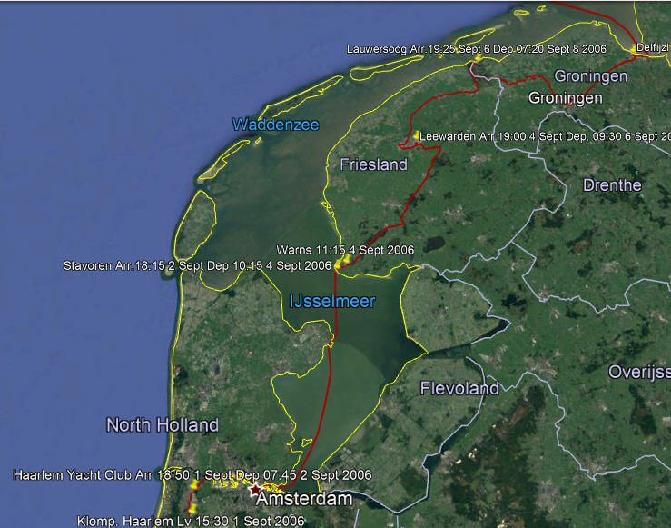 Our Route Through the N Part of the Canal System
From Stavoren there are various possibilities; lock out of the IJsselmeer into the Wadenzee, but for that route you need to be able to sit on the bottom at low tide and you need good weather; go through the canals to Lawersoog, lock out into the Wadenzee and take a shallow winding passage through sandbanks to get outside the islands but the weather must be good for that; finally go all the way up to Delfijzl in the canals and lock out into the River Eems. We decided to go to Lawersoog and then make a decision about Delfzijl.
To Delfzijl on the Eems River. 07:30 -18:30 a mixed day. We had to call up on the VHF about getting the bridge open at Reitdiepbrug. They said "press the button"! It turned out to be on a pile close to the bridge; obviously designed for motor boats for it was very tricky for us to reach the button so close to the bridge. Several bridges like that today. Through Groningen - 14 bridges which were all synchronized and opened as we approached. It was a long day as there is little chance to use the autohelm which means that you are stood at the wheel all the time. As far as Groningen it was extremely picturesque but after that it became rather boring. Once again, perhaps we should have stopped at Groningen for it looked fascinating with its ultramodern buildings. Several bridges had artwork on the underside that could only be seen when the bridge was open. At Delfzijl we locked out of the controlled waterways and into the marina at the Eems river level. The German border runs down the centre of the river. 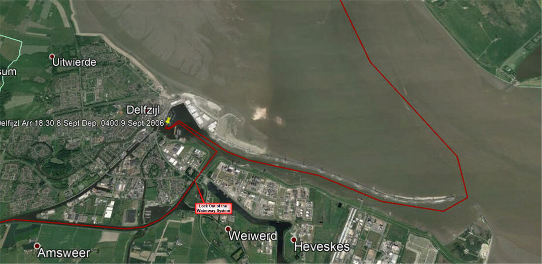 Our Route at Defzijl Where We Exited the Controlled Water System There were some tricky navigational calculations for today to catch the right tidal streams in the River Eems and then to get through the Gat at Langeroog. Left Delfzijl at 04:00 9th September and it was rather intimidating with a mass of navigation lights as one left the harbour entrance and inserted oneself into the traffic stream at the right place. The channel does a big sweep to the West to get outside the island of Borkum. There is a passage on the inside but you need a flat bottom to dry out at low tide and then float again on the rising tide. Tricky entrance to get in between the islands with strong currents with a small window. Arrived at Langeoog harbour 14:55.  Langeoog Harbour - Sandbanks Everywhere
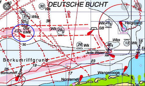 Traffic separation Schemes Approaching Helgoland Traffic separation Schemes Approaching Helgoland We got away as early as possible and so ploughed a furrow in the mud to get out. It was a bumpy ride into the wind. We both feel very tired because of the long hours that we had been sailing and the nature of the sail. Crossed the Jade River entrance and traffic lane then the Elbe lanes and North to Helgoland. It was quite a stressful time. We were finally rafted up and were rather penned in by others rafting up to us. We did not go into town although it has been developed as a casino and duty free destination since its days of being a practice target for bombers. Helgoland to Brunsbüttel and into the Kiel Canal today. Up at 05:00 to let our neighbour out and then left at 07:00 - arrived Brunsbüttel 16:05 An early start as it is vital to get the current in the Elbe right. It is so strong that you cannot fight it at the flood/ebb so you have to get to Brunsbüttel well before the full ebb current. We had the 'departure shuffle' when you are not rafted on the outside but have to leave first.
The trip was OK to get to the Kiel Kanal, arduous but altogether reasonable and we did not encounter any of the difficulties we had read about. The South bank of the estuary is the North end of the Waddenzee a huge area of sandbanks that are submerged at high tide. This is 'Riddle of The Sands' territory. Erskine Childers, the author, was a fascinating character who ended up being executed by a firing squad. Approaching Cuxhaven the coast 'hardens' wih dykes holding back the sea. One's eye is always on the clock and the tidal stream for if it looks like you cannot make Brunsbüttel before the full ebb current then Cuxhaven is the last place to stop. We were in good time, went straight on and were very lucky that the lock gates were open and we could go straight into the lock. There are four locks side by side, the two small original ones (out of service when we arrived) and two huge ones completed in 1914 and built to handle the Kaiser's battle ships. We entered one of these. 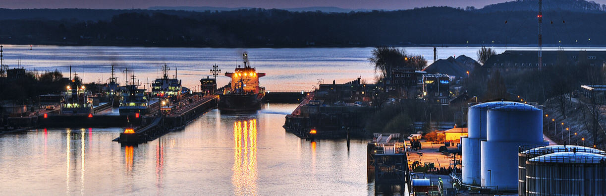 The Lock That We Used, With The Gate Open The procedure for small pleasure vessels is different from the usual i.e. tying up to chains on the walls or bollards at the top; here there are floating, slimy log pontoons that you must tie up to, probably they act as fenders for large ships. A crew member must manage the lines from the pontoon as it floats up. This is not so easy if you have a boat with a high freeboard. Another problem is that the boats fender float because the logs are at water level, so you can get some nasty black marks on a pristine boat. It is the same situation at the other end in the Haultenau locks but there you have to secure the boat and go to the Kanal office to pay the passage fees.
We had not found a succinct set of regulations for sailing the Kanal and were muddling through. Then we sailed past a traffic light set up; three rows of lights on top of each other. We did not understand the traffic light system. Did they only apply to large vessels? The traffic lights were Red Red White and we were debating whether to stop since 3 Reds means that yachts must stop and we had been seeing a single Green. We decided to proceed and at that moment the VHF switched itself to channel 16 with an emergency alarm followed by an emergency announcement in German. (We had 'dual watch' on the VHF set to Channel 2 for canal traffic and Channel 16). We did a U turn and went back to where we could see the traffic lights and reflected about the meaning. We proceeded. However, looking back we saw a rescue helicopter doing something. So there was an emergency but it was elsewhere. Although we had set off late to do the 66km to Rendsburg and worried about making it in time, we did it by sunset and were tied up in a box about then. Quite a day. We did not leave for the last leg to Haltenau until 15:20 and it took 20 minutes to get to the Kanal, this turned out to be too late. Unknown to us, at the 86km point the Kanal narrows (the 'Eastern Section') and larger vessels take turns in this stretch. At 84 km there is a widening with mooring piles down both sides and as we went by we passed a yacht hovering outside the piles but we did not realise the significance and continued. 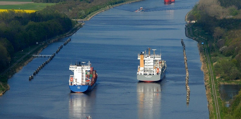 Mooring Piles at Kilometre 84 before the Eastern Section A couple of kilometres further on, at the narrowest part, we met a large frieghter coming the other way and squeezed close to the bank. What we did not realise is that the ship pushes a bow wave which lifted us up and slid us down and outwards towards the ship. We were so close to the bank that we touched bottom in the trough. The same thing happened as the stern went by but that was not so alarming as the ship had then passed. When we arrived at the Holtenau Locks it was getting dark, just in time to comply with the regulation of not travelling after dusk. The mass of lights were confusing and we hovered by the old locks that are usually used for small craft. The large locks were full with ocean going vessels. Eventually they left and two more entered. Then the light went white for us. The small locks were not being used and we were being tucked in with these huge vessels! Then we had to wait for two more large vessels to enter. We were the only pleasure craft in the lock.
I was a bit shaken by the experience as I don't have the head for heights that I used to have and it all felt claustrophobic. Next time we will make sure that it is daylight!! We exited to a mass of lights in the pitch darkness and crept over to the tiny marina at Holtenau. Now we are in the Baltic. The harbourmaster banged on the hull at 07:00 and gave us a sudden start to the day! Lovely sunny morning. We walked around Holtenau, picturesque on the waterfront; cottages and roses etc., then we walked up to the top and back.
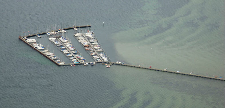 Wackerballig Marina, Very Tight Alleys in a High Wind We made a mess of trying to get into the box. The trouble is that you can get the stern lines on the piles but then have to drive forward strongly at the risk of hitting the dock hard but even then you can't get over the bow to secure it before the bow blows off and you end up diagonally in the box, or worse if the adjacent box is empty. After a couple of tries we gave up and backed out with great difficulty and left the marina. The alleyways were tight so we could not turn round in such a strong wind. We continued and put in at Gelting. Hard to get in between the piles (as usual) but made it. 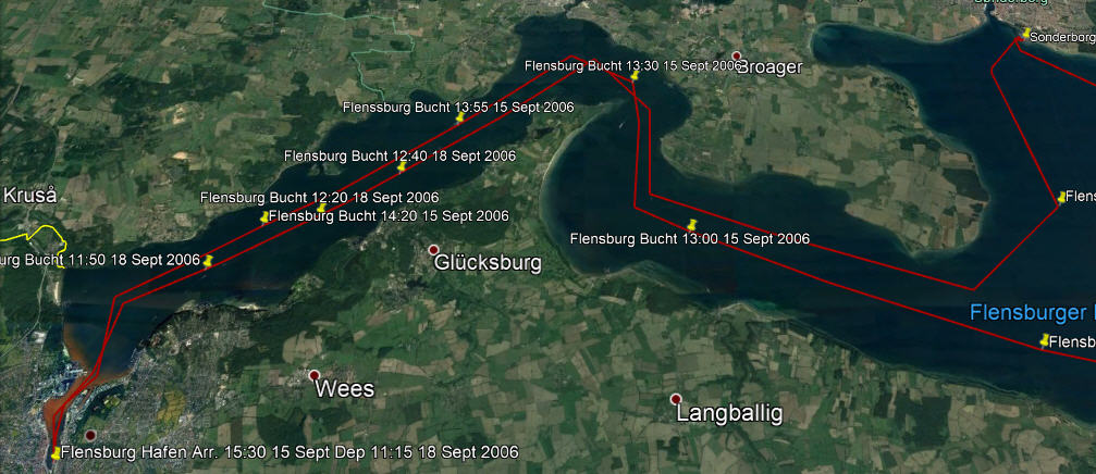 After great showers at Gelting we set sail for Flensburg on 15 September. Again a fine, sunny sail, brisk and enjoyable, there were lots of sail boats out, some racing. The border between Denmark and Germany runs down the centre of Flensburg Bucht so we were crossing from one country to the other all day. Put in at Flensburg at 15:30.
Flensburg struck us as a very pleasant town and has the dubious honour of having been the capitol of Germany for three weeks from 1 May (the death of Hitler) to 23 May 1945 when the Regime was dissolved. Until 1864 Flensburg was part of the Kingdom of Denmark until lost in a war with the Prussians, there is still a strong Danish presence here. Tomorrow our friend Ron is joining us for the sail up to Århus and driving our car up from Haarlem to get here. 18 September. Showers and then a walk up to the butcher. Back to the boat and off to Sønderborg . Pleasant enough sail until fog set in and it got a bit tossy. Tied up at the quay wall close to the red brick castle. This was our first experience of Denmark. We walked into town. It all struck us as clean and beautifully maintained. Now we have to change from Euros to Kroner. Denmark like the UK kept their own currency. 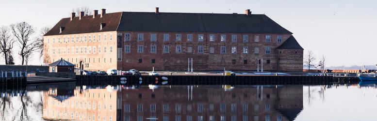 Sønderborg Castle Housing the Museum 19 September - In the morning we went to see the castle museum close to the boat. Fascinating and so well displayed. At noon we left for Marstel, about 30nm. Arrived at 18:15 through a very narrow channel entrance. A good sail today but very rolly in a choppy sea. Went to the pub in town in the evening and chatted to three retired merchant seamen. It seems that Marstal is very popular with the martime community that finally want to drop the anchor. A very pleasant evening. Engine on and cast off at 13:30 in a SW wind Force 5 from a very wide box with a strong cross wind. Used the new spinnaker line to hold the bow as we backed out. It worked well but the danger is that the long line can easily get caught around the prop when it is released. 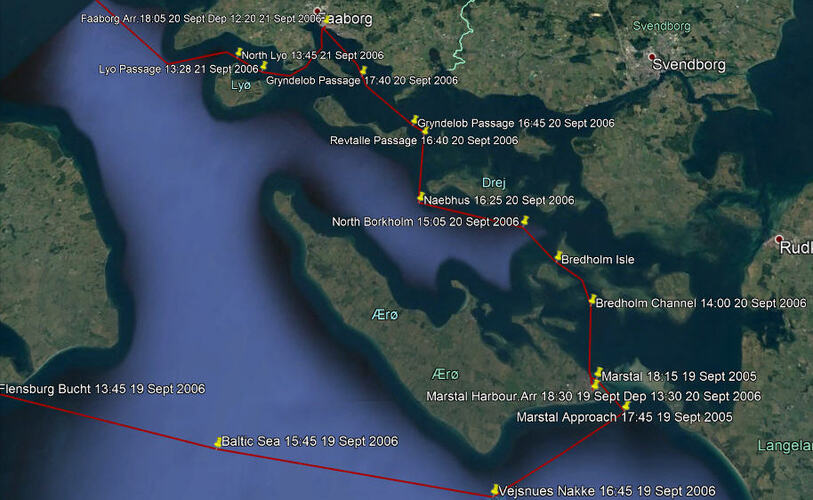 Sonderborg to Marstel to Faborg An interesting day picking the narrow channels and then a flog against the wind until we cut through the Reutille Passage. A challenge but that is why we came this way. Then a short cut to Fåborg through the Grydelob Passage. The wind moderated to Force 3 and came around to the West. It was a truly beautiful day, Enterprise sailed nearly the entire 30 nm, sea was just right, the sun shone and the land looked warm and comforting. Very sucessful sail. Our first box at Fåborg did not fit and we got wedged in. Changed to a wider box; you would think that we could judge the width by now but it is easier to go for a snug fit than one that is too wide. 21 Sept - Wind SW Force 3 A bit of discussion about the channel markers, where we will cut across Lyo Kug to Assens. Engine on and cast off using the long bow line technique again. Out through the exit channel using the Leading Line, then West past the N Cardinal to Knoldon Point and on to Assens. A superb sail. We rigged up to use the spinnaker but the wind got too strong for it. Again, lots of discussion about the passage. Not many sail boats out but lots of ferries hopping from island to island and a few tall-masted ships. In the first box that we tried we misjudged the width of the piles again and got stuck at the widest part like a cork in a bottle! Backed out and found another one.
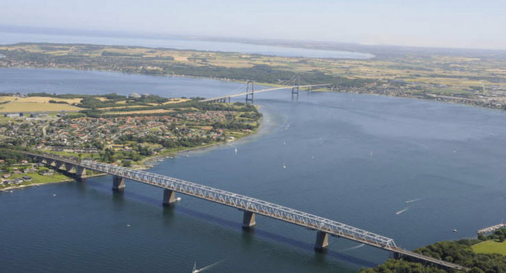 The Little Belt Looking NE Juelsminde is a small, pretty and welcoming town with a good marina. In the summer a destination for rural, family holidays, the sort of place that invites you to stay longer but we were so close to our destination and the season was getting late that we felt an urgency to move on.
26 September, our last day of sailing this season and it was with mixed feelings that we sailed from Tunø to Århus. Sandbanks are all around Tunø so it important to not take the direct route but thread the sandbanks. We took the route to the East. Trying the spinnaker again today across Århus Bugt in light winds and mist. We put it up and down twice. As we approached Århus in the late afternoon high speed ferries crossed our path and commercial traffic increased. We tied up at the Aarhus Yacht Club in the Fiskerihavn. At that time there was a busy container port next door which would give us hours of interest in the days to come. It was great to have the car close by in the parking lot which enabled us to go downtown and sample the excellent cuisine to celebrate our arrival. The following day we drove to the airport to say goodbye to our crew member who had sailed with us from Flensburg. We were to spend the next 3 years in the Baltic and get to know the city quite well. It was the start of a love affair with Århus. For other Cruising blogs see the Archive links in the sidebar at the top of this page.
Other blogs of interest are The Retirement Dream and How to Live Your Dream If the Cruise of 2004 was our sailing baptism of fire, then 2005 was to be our maintenance baptism of fire and a test of our resolve to stick it out. If we had not ‘burned our bridges’ we may not have. We knew that the maintenance would be a major job because that was the only ship we could afford, but we thought that we had tackled the worst of it in early 2004 when we first arrived to take possession. This was alluded to but passed over in my blog of that time. November 8th 2004 found us tied up in the marina behind a lock gate at the head of the Morlaix River in Brittany, France at the end of our first season in Enterprise.
The original design of Enterprise used the hull as partial walls for the grey water tank and the fresh water tank. The top of these tanks consisted of steel plates fixed to flanges. The catch was that each plate was held down by bolts, 74 for the grey water tank and 68 for the fresh water tank; all rusted in place! The previous owner said that he had never opened them and judging from state of the bolts I could imagine that they had never been opened. We were not worried because we had power wire brushed the exterior of the whole hull and not found any signs of corrosion. However, it was on my mind that we should get those covers off and see what was going on inside; particularly because we were drinking water from one of them.  Schematic of The Tanks on Enterprise After a few days we decided that we should take advantage of the farmhouse, before the weather became too cold, to clean out the ship and tackle those tank lids. Those rusty bolts alone were going to be a two- or three-day job, and so it proved. Finally, the steel plates were lifted and we were appalled. The grey water tank was nearly full of a back sludge that had mushrooms growing in it! The freshwater tank was not bad but certainly not somewhere from which you would want to drink water. Our hearts sank at the prospect of cleaning them out so that the hull would be clean enough to take an epoxy coating.
That experience changed everything. We could not feel secure until we had inspected every square centimetre of the inside surface of the hull. The ship was now perched on dry land so we could not live on her and so faced a complete winter in the farmhouse while we gutted the ship; disassembling all the cabinet work to access the inside hull. So started 3 months of relentless work as all the woodwork was ferried to the farmhouse and sanded and varnished before returning while the inside of the hull was meticulously inspected, wire brushed and given two coats of an epoxy paint. The problem turned out to be confined to a narrow band inside the grey water tank where the surface of detergent-laden water had sat for years. Apparently, detergent is a mild acid so the duration of sitting, and the oxygen/water interface was enough to eat through. The damage was confined to 2 cm either side of the surface and the rest was fine. We located, with difficulty, a welder in an adjoining village who simply cut the areas out and replaced them with new material. An unexpected advantage of a steel hull
Like renovating an old house, with every step the project grows. We decided that we should have the grey water tank removed and replaced with a rigid plastic one shaped to fit the hull. Furthermore, it should be re-plumbed with a diverter valve so that it could act as a black water tank capable of being emptied from a pumping station, i.e., no discharges whatsoever. This is a requirement for sailing in the Baltic and increasingly elsewhere.
There was no way we were going to drink water from that black hole of a freshwater tank so we would have to have twin stainless tanks made to fit the hull shape. Twin tanks so that we could track our use without running out and make sure that they were used in rotation. It was all growing in scope by the day for we also decided to take advantage of the stripped hull to apply sheets of insulation to stop the cabin getting too hot and too cold. A side effect of all this work was that we built up a network of suppliers, tradesmen and interested onlookers that stood us in good stead to become engaged with the local culture. They told us about all sorts of local events, curiosities, and places to visit that we would never have found otherwise. Also, which villages served ‘ouvrier’ lunches and where the best boulangeries were; intimate recitals or lectures in obscure half ruined monasteries. A word of explanation about ouvrier, or ‘worker’, lunches is in order. The French countryside abounds with independent tradesmen running around in their little white vans and, for them, the 2-hour lunch is sacred. Certain cafes cater to this trade by offering a sort of gastronomic, communal meal at an incredibly cheap price. Everyone sits at benches at a shared table and each table is served a five-course meal, in communal bowls, with wine included. So, at noon the main village street fills up with white vans that seem to appear from nowhere and disappear again at 14:00. Perhaps that explains why deadlines never seem to mean a thing. Unfortunately, we were so overwhelmed by the boat work that we could not fully take advantage of most of it. We found that French, small-town tradesmen do good work but strictly in their own time frame. They will tell you what you want to hear with not the slightest intention of meeting those dates. Negotiations generally took place in the village bar over a pastis and that is perhaps why. Once you figured out the ‘rules of the game’ and relaxed, it was all rather fun.
 Switching the Lower Stays Switching the Lower Stays The ship was lifted back into the water on 1 March 2005 and the mast erected, but we were not impressed with how it was done. All panic and hurry which resulted in the lower stays being installed the wrong way round! We gave up on waiting for them to come back and fix it, so I did it myself. However, the work was far from over for there was still a huge ‘to-do’ list and the new tanks were not yet in. It would be another five months before we actually sailed away to start our 2005 cruise on 7th August. We moved back onto Enterprise on the 13th May, even though we were still working with fresh water from a bucket but at least, now we were living on the ‘job site’. Our experiences of the previous season brought home to us some serious safety risks. Standing on a slippery deck in a rough sea to furl the mainsail was one, going up forwards in heavy weather to release a jammed line was another and also being tossed around in the cockpit while trying to steer. In spite of all the man-overboard drills that you are taught in sailing school it was obvious that, in the real world, you were most likely to go overboard in a heavy sea and then you were lost, especially at night. It was not ‘rocket science’ to figure out that the best course of action was to never go overboard in the first place. Our strategy therefore was prevention. We had ‘lazy bag’ reefing installed so that we did not have to go on deck to drop the mainsail. 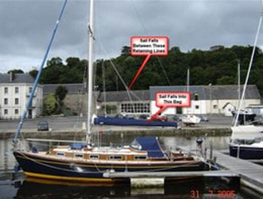 The Lazy Bag and Rigging Arrangement The next thing was non-slip paint on deck and coach roof. Then handholds strategically placed such that there was always one hand holding on to the ship. We rigged jack stays along the deck on both sides so that when going forwards you could clip on the safety harness and stay attached. Finally, we installed lights to flood the deck if somebody had to go forward at night, for there are always unforeseen emergencies. However, all this took time to organise and install.
On May 12th our new water tanks turned up, just a month late so we figured that we were doing well. After trial fitting them I coated them with Vaseline, sprayed foam into the hull space and pressed them into the foam before it set. They seem to be really rigid but removable. Then I hooked up the plumbing, flushed out the system and filled them up. Goodbye to the buckets!
We had previously committed to crew for our brother-in-law on his yacht for the last two weeks in June, so the 15th June saw us casting off from Roscoff just a few kilometres from Morlaix, in his yacht, to sail round to South Brittany to explore that coast and the off-shore islands before returning to Brest; but that is another story.  There Were Lots of Reasons to Celebrate that July It is a well-known fact that the longer you stay in a port the harder it seems to leave. That’s how it seemed to us that year. There was always another job to do before we left. Finally, everything was ready and on 7th August at 9:20 we cast off for the lock opening to catch the falling tide in the Morlaix River. It was magical. Gliding down the winding pastoral river in a beautiful pristine ship at last.
At low tide tractors can drive out to do this work. At high tide it is too deep to work on them so there is no activity and, in fact, no sign that there is anything there at all. A sailor who is not paying attention to his charts, could sail right over them, or worse, get caught by them and settle down on them as the tide went out. However, if you know where to anchor, it makes an ideal place to wait for the tide to come in and fill the Morlaix River. That is what we did at the end of last season when we arrived and had to wait until the next morning for the lock at Morlaix to open. I wrote about the experience in last season’s blog. This time we sailed straight through and out the narrow entrance to the outer approaches, a veritable maze of rocks both visible and hidden just below the surface. Guarding this narrow entrance on a single rock is the Chateau du Taureau a fortress originally built in 1542 to protect Morlaix after a disastrous raid on the city by an English fleet. Although the channels are well marked today, they are braided and easy to confuse in mist and darkness. 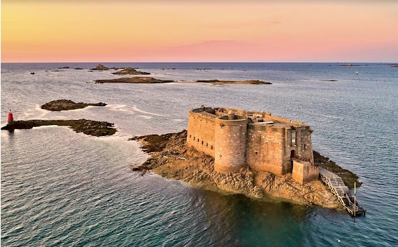 The Chateau du Taureau Guarding the Entrance since 1542 In a future year we would do this passage in the dark and in the rain and that was scary. Now we were trying to catch the west flowing current down the coast, but because we could not exit Morlaix until nearly high tide, it was too late to catch it by the time we reached the outer reaches of the entrance. The strategy was therefore to turn west and anchor for the night in a deeper part of the passage between the mainland and the Île de Batz. This passage almost dries out at low tide, but not quite, so there is just enough water to get through and a few deeper areas to anchor. 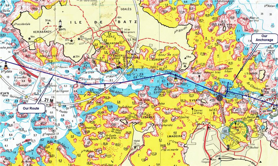 The Île de Batz Passage, Our Anchorage and Route (Yellow areas dry at Low Tide) When you switch from living on land to living on water everything changes. All that was of importance on land is no longer of any consequence and now life centers around the tides, the phase of the moon (that determines the size of the tides), the calendar (equinoctial gales) and the weather. Your world is always moving, hopefully a gentle rocking, and you are aware of every sound. The creaking of a rope, the lapping of water and many other tiny sounds. They become so familiar that you know exactly what is going on; when the wind rises and by how much; or when it changes in direction; a loose rope or something not quite right. It is very comforting, but it takes a while to acquire that knowledge, until then one worries at every new sound. What was not so comforting was to hear birds strutting over the deck and knowing that you would have to clean up the bird shit in the morning. We found our anchorage pool and sat that night close to the island across from the Town of Roscoff and could see the lights of the sidewalk cafés, the calliope and people strolling. In short, a typical summer resort in full swing. The countryside behind Roscoff is ideally suited to growing onions and garlic so that in the post-war years it became the centre of the ‘Johnnie Onion’ trade.  Johnnie Onions' on the Streets of UK circa 1950 As a young boy I can remember that each year there would appear on the residential streets of our town men on bicycles loaded down with strings of onions. They dressed the part with beret and stripped jersey and called out their wares as they cycled through the streets. We called them ‘Johnnie Onion Men’ and I now know that they came from Roscoff. Once the onions were all harvested and plaited into braids a shipload would sail to Southampton and these salesmen would fan out to all the surrounding towns until the boatload was sold. A colourful piece of history. The next morning, we picked up the Westward current to travel down the coast to the Aberwrac’h River where we tied up at a mooring just off the village. This is a rocky coast of rugged, dangerous beauty. We passed over the site of a Canadian disaster that is little known. On the night of April 29, 1944, the Canadian destroyer HMCS Athabascan was laying mines off the town of Plouescat when it was torpedoed with the loss of 128 lives. It is an interesting footnote that 6 months earlier she had been one of the first ships damaged by the earliest form of guided missile developed by the Nazis. We stumbled across the Commonwealth War Graves Cemetery in Plouescat when we were exploring the coast in the winter and would later come across the sites elsewhere, of little-known tragedies that had been kept secret at the time they occurred. 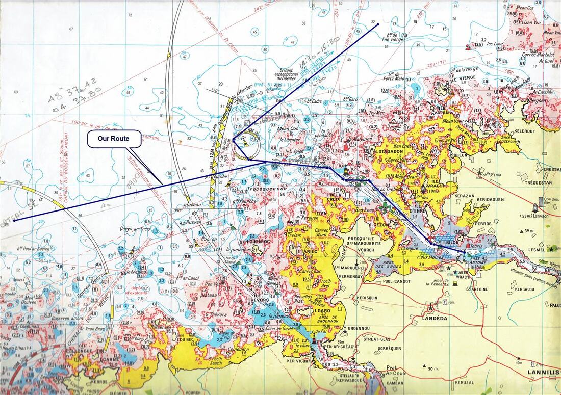 Like Everywhere on this Coast a Challenging Entrance into the Aberwrac'h River
I am writing this blog years after the passage and realize how much our feelings about the sea and sailing changed over the years. Trying to put myself back in that headspace I see that we concentrated such a lot on the techniques of sailing and developing safe procedures until they became second nature. As for the sea, we saw ourselves as pitted against an adversary that we had to outwit. Four years on and it was totally different. We had gained an understanding of the sea that grew with every passing year. Gradually we grew to see it as a living, powerful entity that was totally indifferent to whether we were there or not; it was a matter of reading it and living with it. We no longer read it superficially but saw it as a three-dimensional thing with its hidden turbulence at depth with tidal currents flowing over cliffs and through canyons, welling up to cause over-falls, whirlpools and sudden fogs. A place that is calm at one state of wind and tide but can be dangerous at another. It was simply a matter of reading all the components and not being there when it was dangerous. We did not always get it right. By the time we had to leave the sea after 14 years on Enterprise, we had developed an almost spiritual communion with the sea. 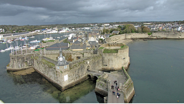 The Walled City of Concarneau This Southern coast of Brittany is less rugged than the Northern coast and the climate is different; dramatically so, almost Mediterranean in the summer. We were headed for The Morbihan, a sheltered area only connected to the sea through a narrow entrance and containing many islands as well as the city of Vannes.
If you have never had to navigate such a passage you may wonder where the challenge is since it is all laid out on a chart and there are a few marker buoys. Remember GPS was relatively new and electronic charts tied to auto-helms were still in the future for small vessels. Now place yourself at sea level looking at the horizon; it looks like an unbroken line of rocks! You must know where you are on the chart, pick a course and go for it towards the rocks, hoping that as you get closer the passage and marker buoys will appear before you get too close. Often the wind and tidal currents will be pushing 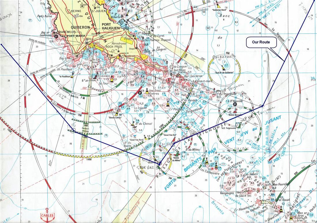 Our Route Through the Teignouse Passage - Harder than it Looks. you on a course different from the one you chose so constant rechecking and adjustment is needed. Often something does not seem to fit but you convince yourself that it does, until you can’t fool yourself any longer and must do a hasty U-turn with your tail between the legs and try again. It is all a rather exhilarating challenge that we enjoy. The arrival at the narrow entrance to The Morbihan must be timed for an hour or so each side of slack water for the tide rushes in and out fiercely and there is no sense fighting it. Inside this sheltered sailing area our priority was to find an anchorage for the night, normally not a difficult thing. However, we were at the peak of the season and there were yachts everywhere that we wanted to anchor. Now, when you anchor the ship swings about the anchor point as the tide changes so that in a 12-hour tidal cycle you will swing through 180 degrees. If you are next to another anchored yacht, you don’t have to be that whole distance apart since you will both swing in the same direction. However, it is not an exact science because different hull shapes react differently, so every sailor judges it a bit differently. Now in this case we were forced to anchor near another yacht whose owner thought that we were too close, although I did not. Finally, to pacify him we raised anchor and moved further away but I was not happy for we were right on the edge of the holding ground i.e., the area where the seabed is deemed suitable for an anchor to dig in. In those circumstances we always sleep badly and get up several times to check our position as the tide changes. All seemed well until we were getting up at first light with the current at its maximum when the anchor broke out and we were being carried away with the anchor dragging across the bottom! Quickly firing up the engine to hold the ship the problem becomes how to get the anchor chain up for it is pulling against the ship which is battling the current and the winch cannot pull against that force, at that angle. It was a matter of aligning the ship to the chain and then getting just enough acceleration to take the pressure off the chain so that it could be winched in. We would never have managed it if it had been dark, and I cursed myself for being so accommodating to the yacht next door. Another step in the learning process. 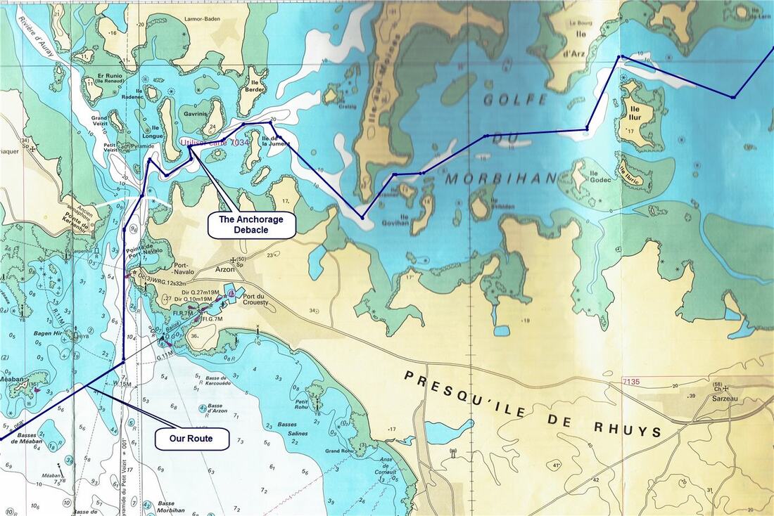 Our Route into The Morbihan and The Anchor Debacle When we were safely moored in Vannes, we returned by public transport to pick up our car in Morlaix and then drove to Paris to pick up our son Timothy who was arriving from Canada. On the drive to Paris, we stopped by Giverney again but were disappointed. The age of mass tourism has arrived with buses lined up disgorging hordes of people. No longer can you wander in the gardens but must follow the designated circuit and shuffle along with the crowds. That did not however dampen our enthusiasm to show Enterprise off and put it through its paces in the next 10 days. First, we explored some islands in the Morbihan even though it was extremely busy, finally mooring off Aurey which is on one of the peripheral estuaries.
After a couple of days, we went up the Vilaine river to Roche Bernard, a town listed for its outstanding beauty. To reach it you must go through a lock, but unbeknown to us, due to the drought, it was only operating once a day. 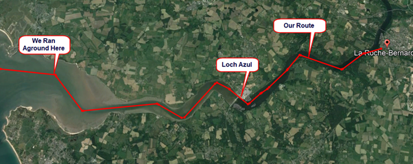
Then the weather changed to rain and stronger winds, of which the latter suited us just fine. The last port was Le Palais on Belle Île, one of the larger islands off this coast. It looked as if there was no room in the harbour with several yachts on every mooring buoy, but the harbour master came out with his dinghy and told us to point bow between two other yachts. He then rammed us in with his dinghy; they were not going to lose paying visitors! We spent a day there and rented bicycles for a trip around the island.
These islands in the Bay of Biscay, due to their isolation, all developed their own distinct cultures and have remained relatively unknown, and little visited until recent times. The bicycles were an ideal way to explore. Finally, back through the Teignouse Passage off the Quiberon Peninsular and back to Vannes; the visit was over. However, before we left Vannes, two weeks later, my brother-in-law, arrived to sail with us as far as Bordeaux. We soon learned that if you sail in interesting waters there is no shortage of crew! We started our ‘island hopping’ journey to Bordeaux by sailing South, initially for the island of Noirmoutier. This felt like a new adventure however, because most pleasure sailors don’t venture very far South from here. Why is that you may ask? Well, this bay off the North Atlantic has a reputation, part mythology built up over the centuries and part based in fact.
Swells are large waves that do not break and if you are not in shallow water are usually of no concern. However, as they approach shallower water, headlands, and sandbanks, they can become very nasty indeed, even on a beautiful day with no wind. We were to discover this, but as we set forth on this 17th September 2005 our knowledge of the sea and how to read it had a long way to go. In the days of sailing ships, few navigational aids and no weather forecasts, ships returning from Africa, or the Americas feared being driven into this bay. So, it built up in their minds as an inferno of sea monsters and was so depicted on the early charts. This feeling still exists in the folk lore of sailing today.
Then it was on to the Île d'Yeu, a rocky outcrop with sandy beaches, far from the mainland so there is no danger from the bridge-builders here. Consequently, it has retained much of its charm and unique character of an isolated fishing community. |We dried out here, propped against the harbour wall, and were able to check out the bottom of the ship between tides. I was obviously still traumatised by the events of last winter.
Port Joinville is the harbour name, and a delightful place it is. Its only claim to fame is that Marshal Pétain, the hero of the First World War Battle of Verdun, who was tried and found guilty of treason after the Second World War was exiled and died here. Then a right-wing group of body-snatchers stole his body with the object of burying it at Verdun. However, they were caught before they could complete their plan and the body is back on the island. Our next island was the Île de Ré, another low sandy one with a similar history in salt making. Once again it had been joined to the mainland by a long bridge and that has turned it into a mass tourist destination but luckily it too was not yet on the international tourism radar. However, this island was different because it controlled the approaches to France’s naval port of La Rochelle and the shipyards at Rochefort, so it was fortified. Louis XIV’s builder of fortifications, Vauban, built one of his signature star shaped battlements at Saint-Martin-de-Ré, complete with inner moat. It was in that moat that the marina was located, and you had to lock in from the sea. A more picturesque scene could not be imagined as we sat in the cockpit under the floodlight walls of the castle. The old medieval town was just humming with restaurants, bistros, and cafés
Leaving that idyllic anchorage, we sailed East and under the connecting bridge, turning South past LaRochelle. We were starting to worry about being late for our rendezvous in Bordeaux with another son who was flying from Canada to sail with us part of the way back. It seemed that everyone wanted to visit us that year. So, we made the decision to sail past the next island and go directly for Royan in the mouth of the Gironde River. Now we made mistakes that nearly led to disaster.
This rather depressing atmosphere is not helped by the looming presence of the massive U-Boat pens that the Nazis built. 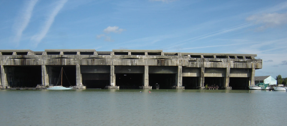 Overwhelmingly Brutalist U-Boat Pens Ten bays that could each hold two U-boats with huge steel doors, built to resist the heaviest bombardment, which makes them very costly to remove. The City has tried to partially re-purpose them into art galleries but we found it only partially successful since the massive brutality of the structure is overwhelming. Two have been left the way they were with the original signage and added historical explanation. Fascinating and eerie at the same time. 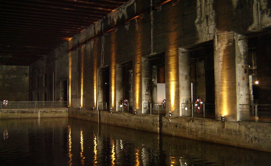 From the Early Triumphalist Days, All the U-boats were Gradually Lost – Sad and Depressing Here my brother-in-law left us, and another son arrived from Canada. Bordeaux is an ancient town and former capital of the Duchy of Aquitaine made famous by Eleanor of Aquitaine. A remarkable woman who shaped much of the history of Europe in the 82 years that she was upon the earth. We walked the town and saw the house where, it is claimed, that she lived for a while. The city had lots to see and, like so many places that we would visit in the following years, we promised ourselves that we would come back to it, but we never did. It was getting late in the season, and we were anxious to make our way back to Southern Brittany before getting caught by equinoctial gales in Southern Biscay, so we did not stay as long in Bordeaux as it merited. On our way back North, we were not going to make the same mistake again of going through the Pertuis de Maumusson so took the outside passage up the West coast of the Île d’Oléron. We kept well offshore for we could see the swells rising up as they approached the shore and become, large breaking waves on the rocky shore; our recent memories were still too fresh for comfort. Finally, rounding the northernmost outlying rocks we turned East for the shelter of the port of Saint-Denis-d'Oléron, and made our next mistake. At low tide the foreshore here is completely dried out but the port retains a minimum of 2 metres deep by means of a sill (a sort of wall) across the entrance. This is a common technique as an alternative to opening and closing a lock, but the disadvantage is that the access window is significantly reduced. To access the harbour, you must have enough depth of water to sail over the sill, say a depth of water outside the harbour of 4.2 metres whereas with a lock it could be opened when the water was close to 2 metres. Thus, in a tidal cycle of 12 Hours there may only be a window of 3 Hours for access. I knew that we were very late for the access window but in my engineering way I did the calculations and decided that we could just make it. I had not appreciated that tide tables and times are only approximate and can be affected by pressure, wind, and storm surges. So, approaching the harbour we sailed right past the offshore waiting buoys and went for the entrance. About 100 metres off we touched bottom and were stuck, it was 21:30. There was nothing we could do as the tide went out and the ship slowly laid down on her side. My biggest concern was that we may lay on a sharp rock and the second was that battery acid may spill out; that is the reason that batteries are always placed in wooden boxes that act as sacrificial material to absorb the acid. We would have been the laughingstock of the village except that by the time we were high and dry it was midnight and nobody was around, thank goodness. By 03:15 we started lifting and by 07:30 we could start the engine and motor away to the offshore waiting buoy, tie up and catch up with our sleep. A lesson never forgotten. 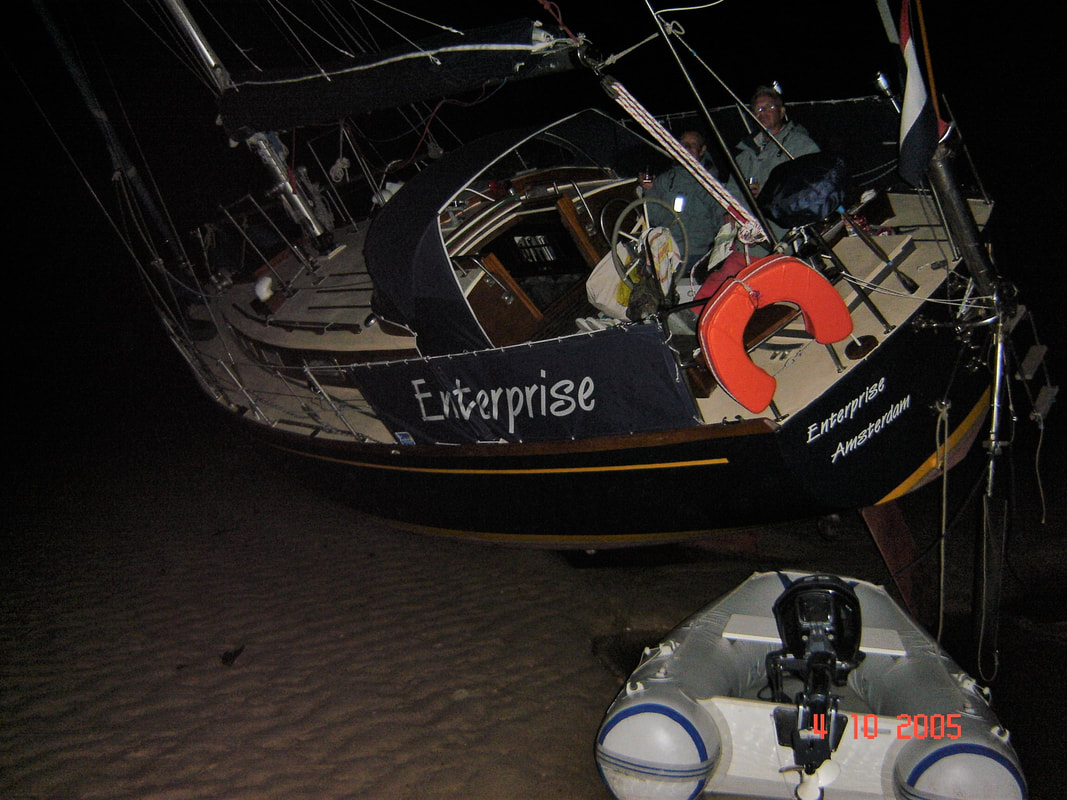 High & Dry at Midnight at St. Denis d’Oléron - We Strolled on the Sea Bed We did not realize it at the time, but we were incredibly lucky. The ship has a broad enough keel that it will stand on its own and, if the seabed is soft mud that is deep enough, it will be reasonably stable but if it is hard sand it will be unstable and could suddenly fall either way. We knew enough to heel the ship as the tide went out so that it would lie down but we did not know the nature of the sea bed and just hoped that there would not be a sharp rock on which it would come to rest; there wasn't. Later we were to learn that the incoming tide can be dangerous depending on the configuration of the land and the weather conditions. The tide can come in like a series of standing waves that can swamp the cockpit and get into the hull through the dorade ventilators and vent pipes. Then, as the water gets deeper, waves develop that will lift the ship on the crests and drop it in the troughs, giving it a terrible pounding until the water gets deep enough for the ship to float in the troughs. This scenario is something that we had never seen discussed in sailing literature but were to experience, in other peoples' ships; thank goodness. On this occasion we got out unscathed and never put ourselves in that position again. Local keeled ships that want the option of drying out at low tide are fitted with telescopic legs hinged on both sides that can be lowered before the tide goes out. We had considered having some fitted but they are awkward for just occasional use and you need to know the sea bed onto which you are going to settle. We were always moving on so would never know that. From there we sailed up the Charente River to the town of Rochefort. In the days of wooden sailing ships this was the main shipbuilding centre for the French Navy but has now become a museum piece with the buildings and docks preserved; a little-known gem located up a beautiful tidal river. Just before reaching the town, you pass under the famous transporter bridge, one of only six of this scale still operating in the world and a Historical Monument in France. In the coming years we would be fortunate enough to sail under three of them. 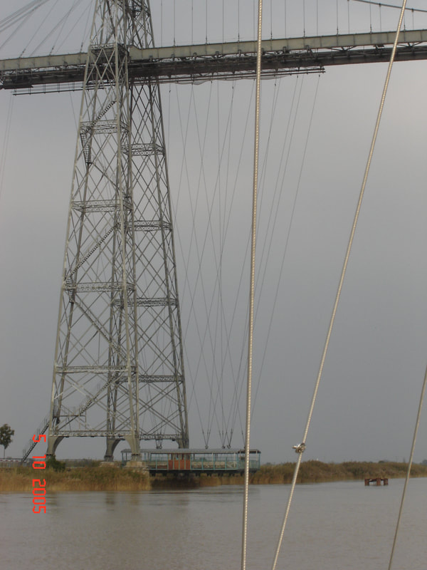 The Enormous Transporter Bridge Showing the 'Gondola' Shortly past the bridge the Corderie Building comes into view. This remarkable building is 375 metres long and was where all the ropes for the ships were manufactured. Today it is a maritime museum dedicated to rope making in all its manifestations. We would visit on the following day. 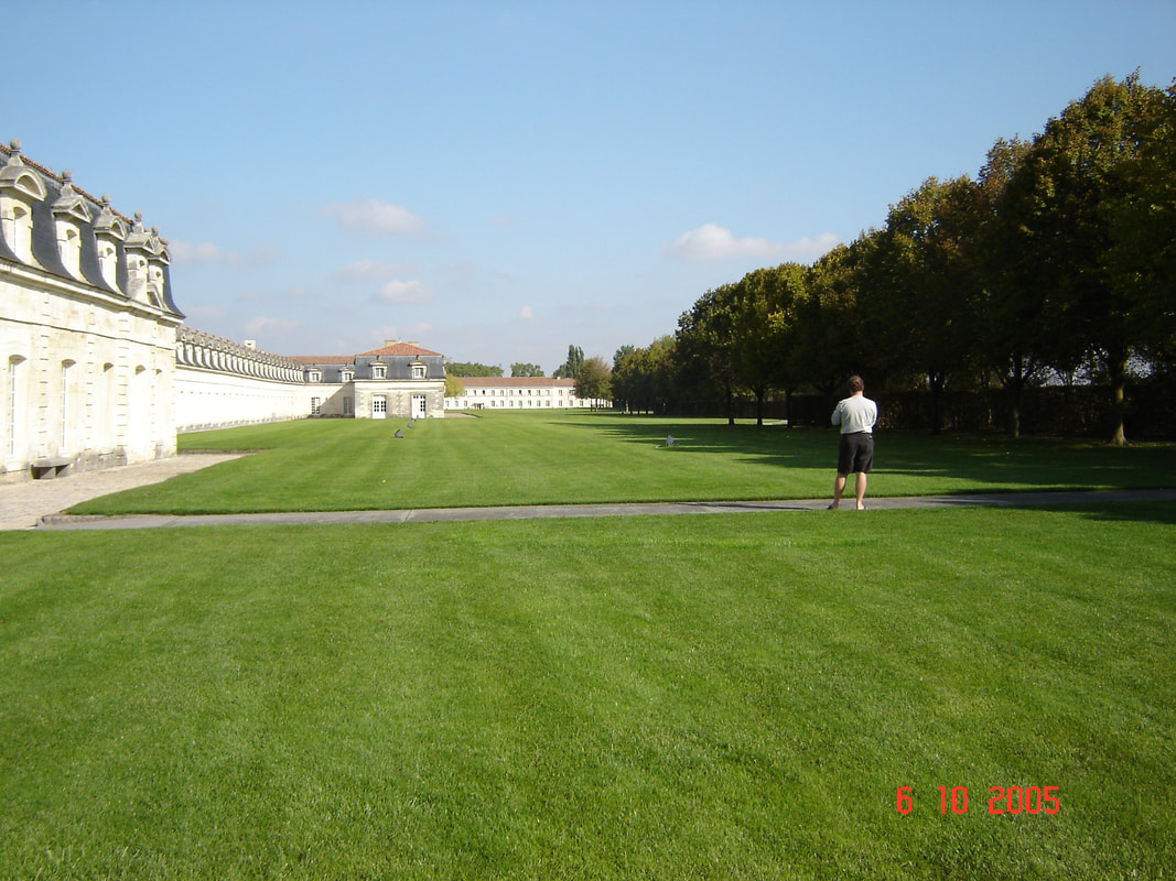 La Corderie - The Longest Building I Have Ever Seen. A little further and we locked into a nest of inner harbours where the marina was located. This was such a fascinating place that we stayed an extra day. Perhaps the most fascinating thing here was the grand project to build a replica of the Hermoine, a ship that was built at Rochefort and sailed to the United States in 1780 to participate in the American Civil War. The replica was to be built as close as possible to the original using the same materials and sailed to the United States. When we visited it was just over 7 years into the construction and they had completed the lower portion of the hull with its massive timbers. It would be another 9 years before it was completed. 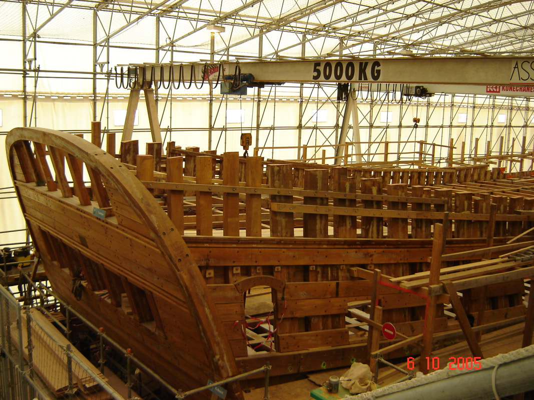 The Stern of the Hermoine – Fascinating to See the Framing at this Stage.  The Progress Chart of the Hermoine We then traced out outward route back to Vannes but now the ports were almost deserted for we were in October. It was like a totally different, quieter world that we really enjoyed. Our son left us in Vannes, and we pottered along the South Brittany coast in worsening weather to dock the ship for the winter on the 31st of October in the little village of Locmiquélic in the estuary leading up to L’Orient. We then had time to reflect on the previous 12 months; the moments of despair that almost broke us and the moments of exhilaration that made us feel that it was worth it. But perhaps the most important thing was that we had changed, we had learned a great deal about ourselves and our resilience, about the sea and our relationship with it, and how we could no longer imagine living in any other way!
|
Author June and I (David Phillips) have sailed the European and UK coasts for 30 years, the last 14 in Enterprise. It has been a continual exploration , inspiration and growth of experience. We would not have missed a minute of it.
It is a symbiotic relationship, you look after her and she looks after you and takes you into a fascinating world that is otherwise inaccessible. Ill health finally forced us to sell her. On 2 September 2017 she was sold. We hope that she will bring the same life changing experiences to the new owners as she brought to us. Archives
August 2019
Categories
|
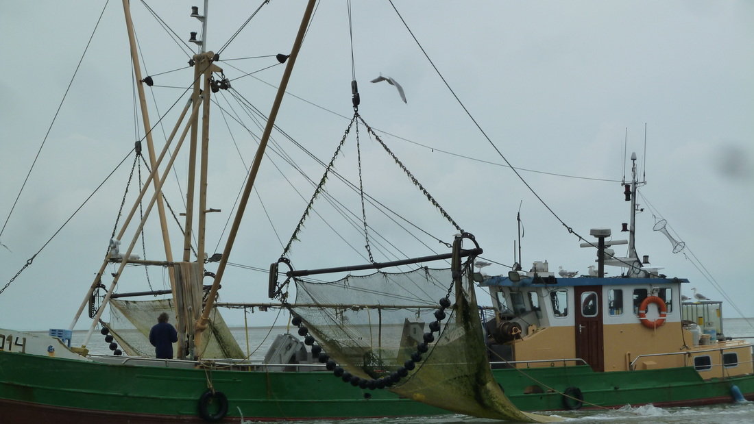
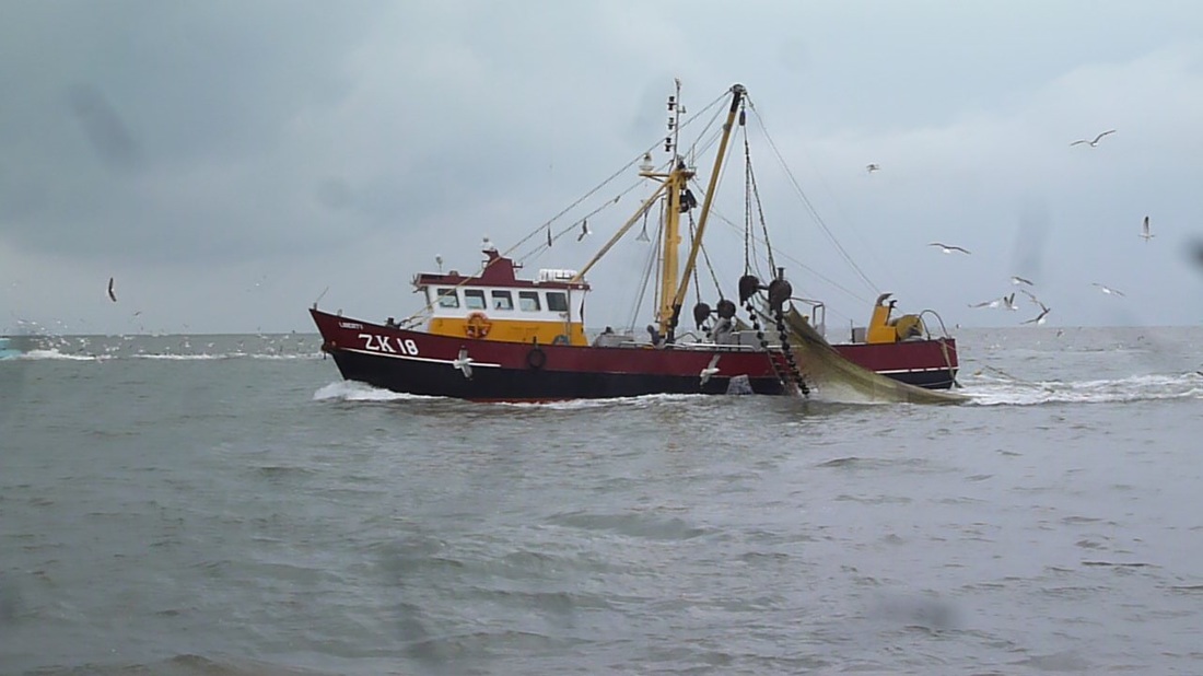
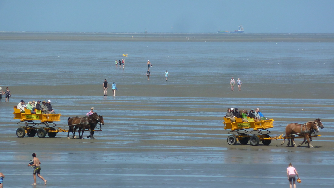
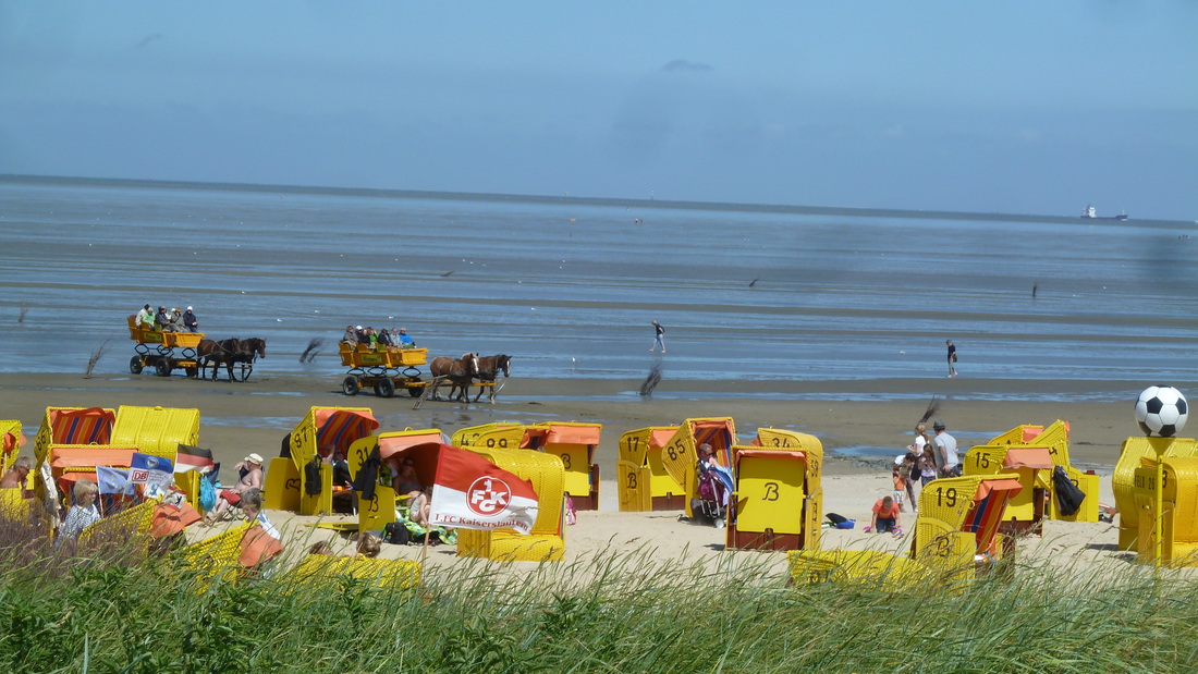
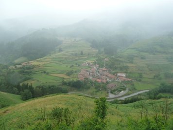
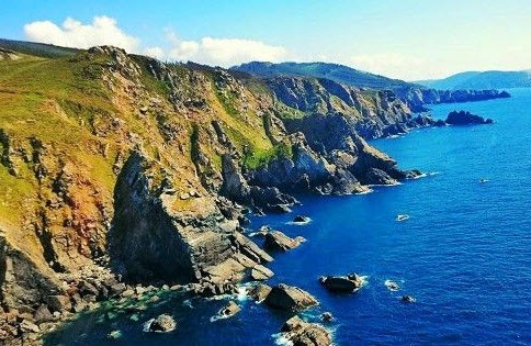
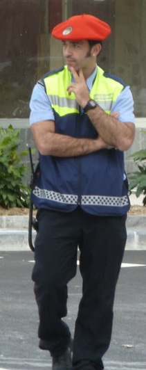
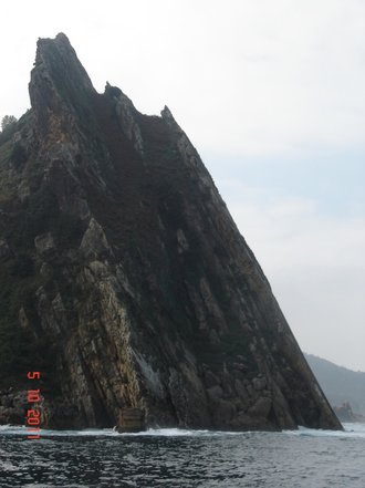
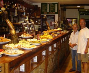
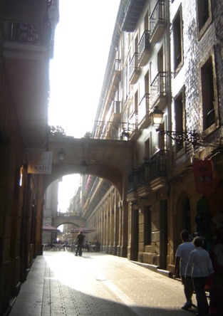
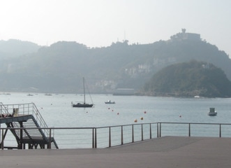
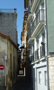
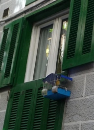
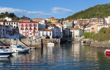
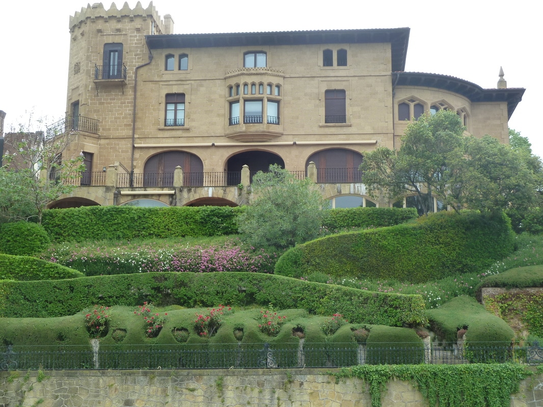
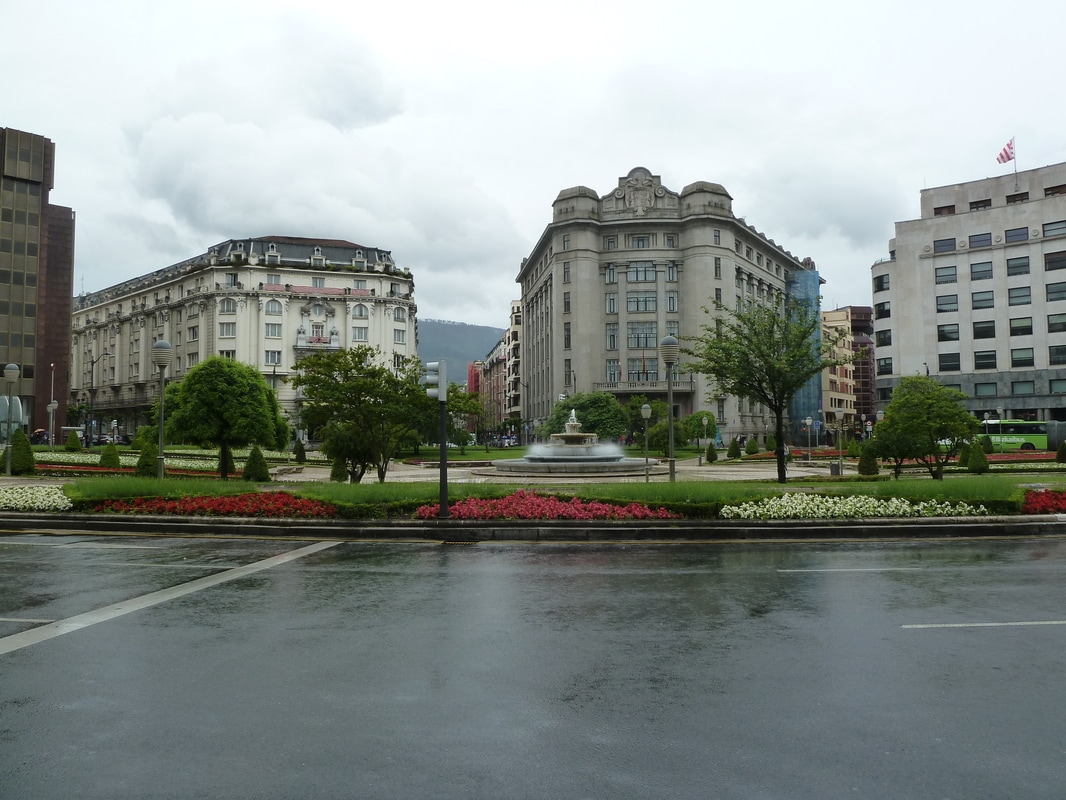
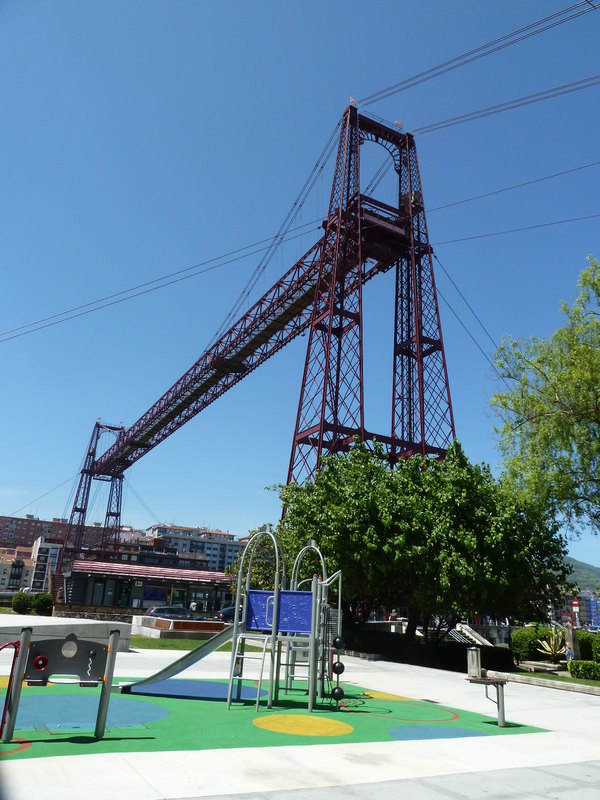
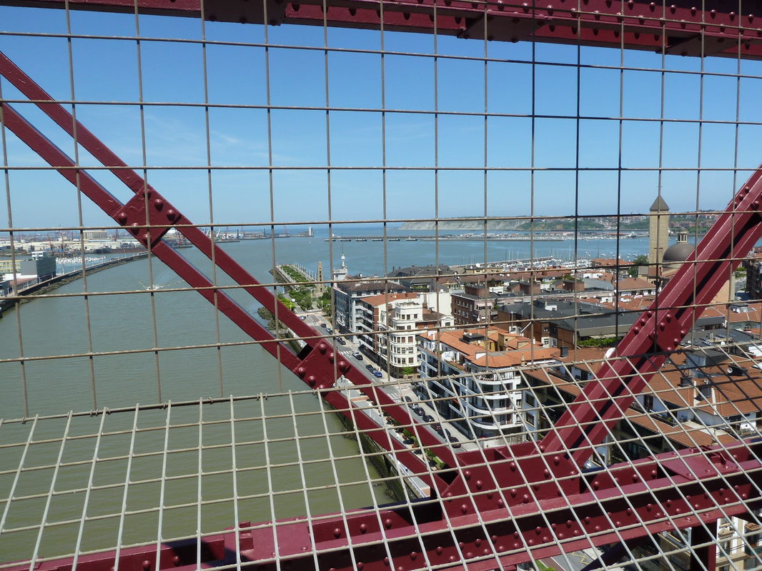
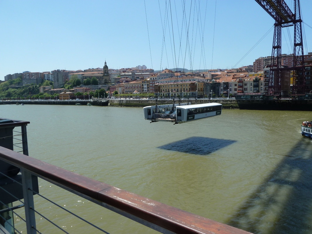
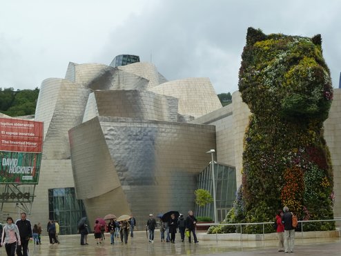

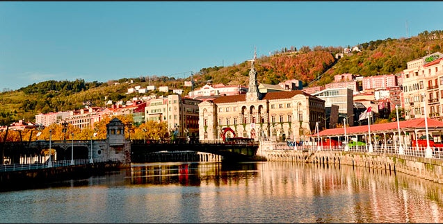
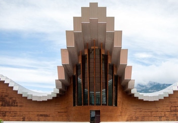
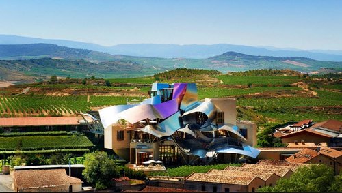
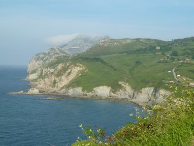
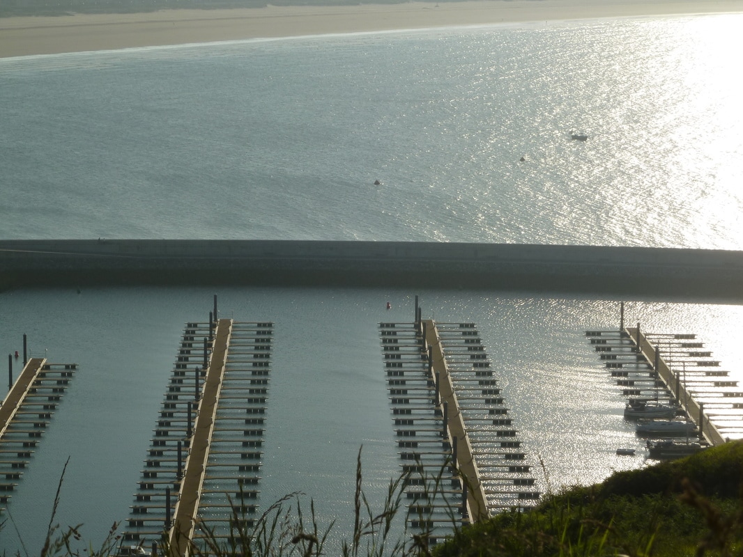
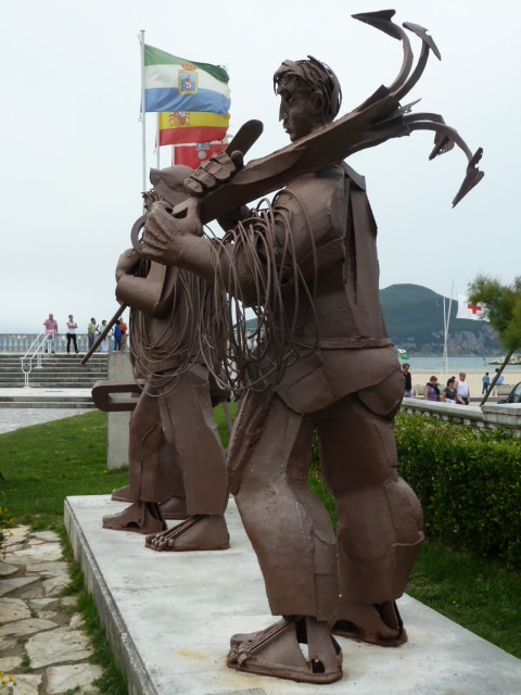
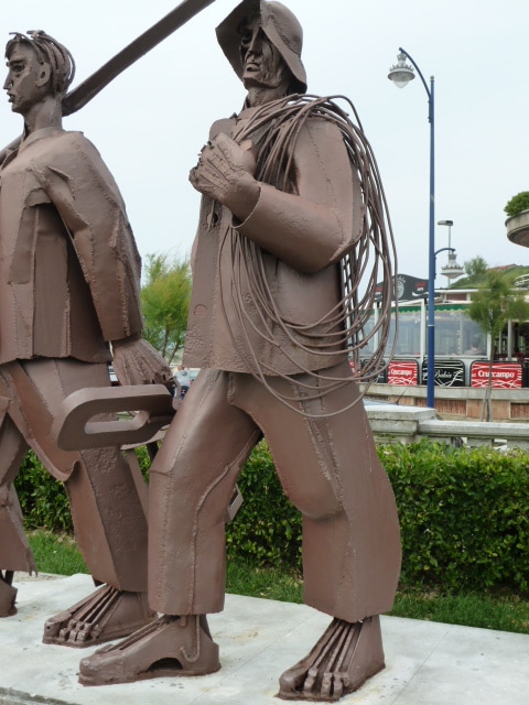
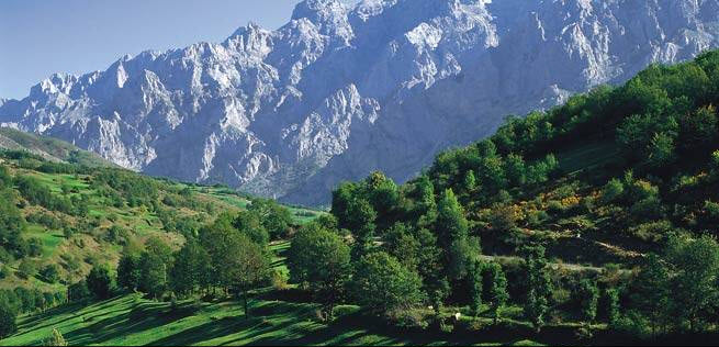
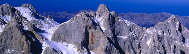
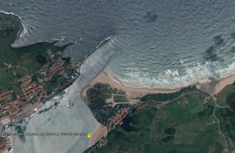
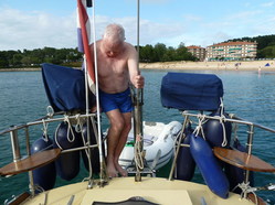
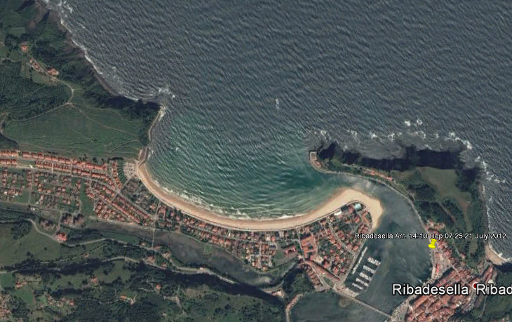
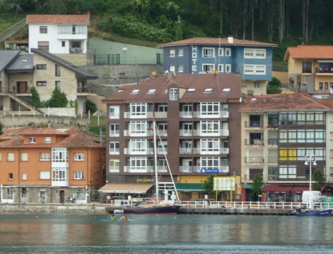
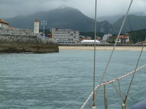
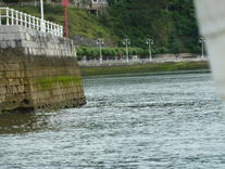
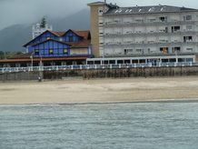
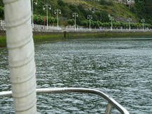
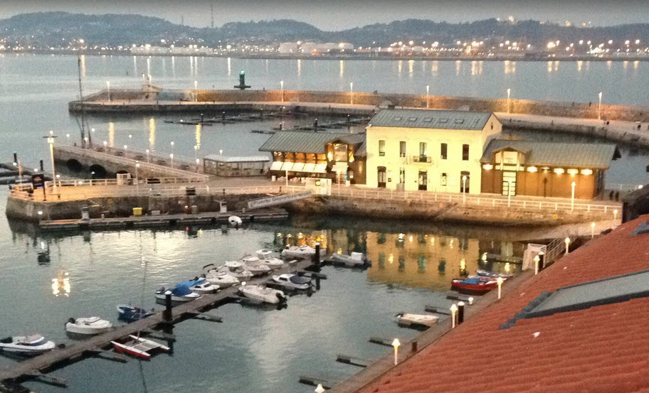
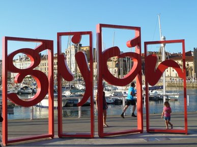
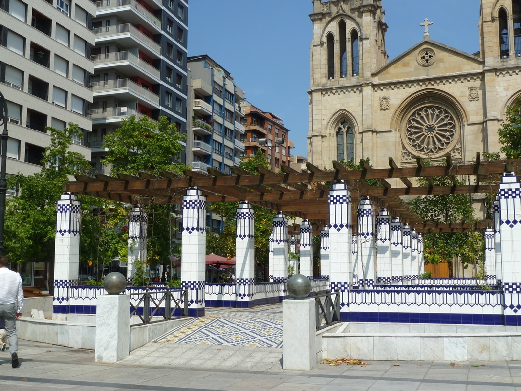
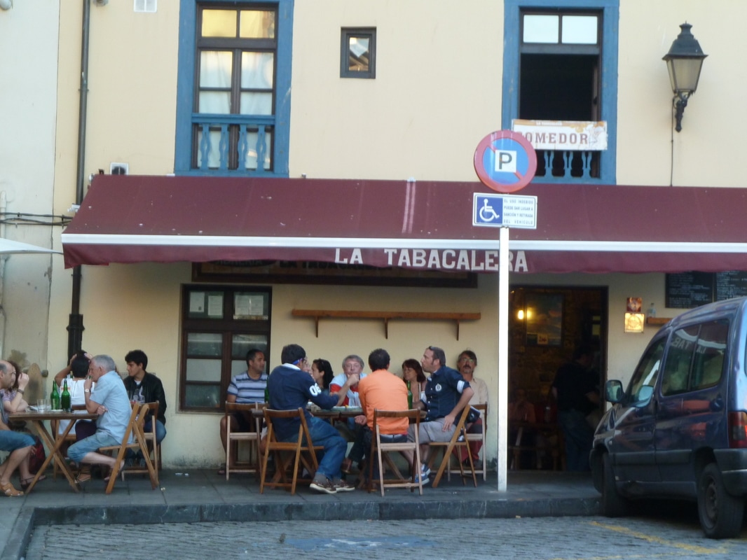
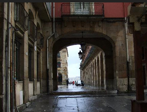
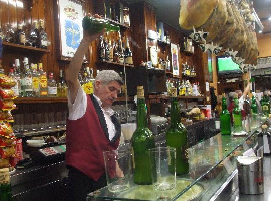
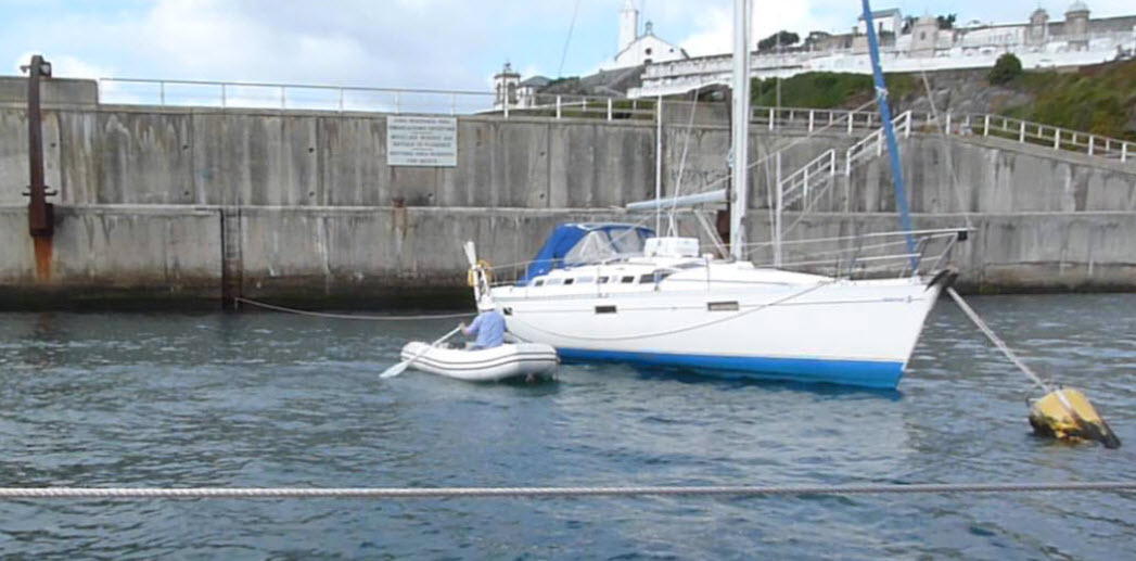
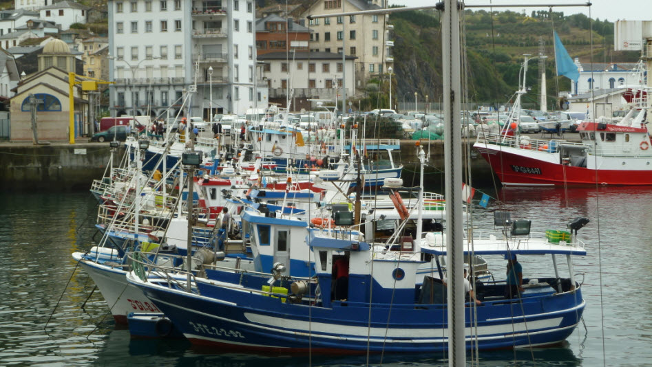
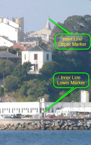
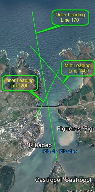
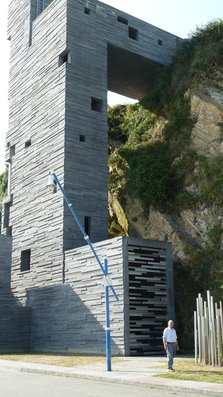
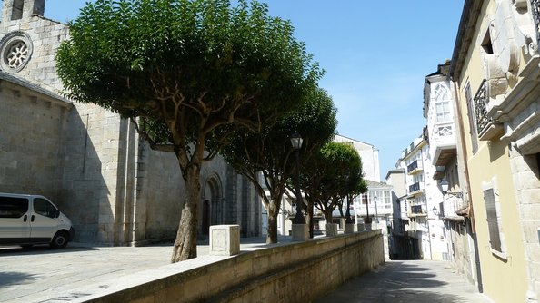
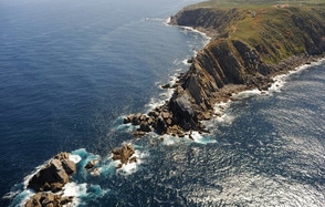
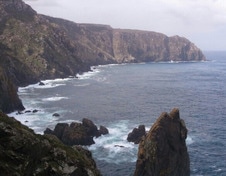
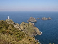
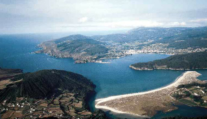
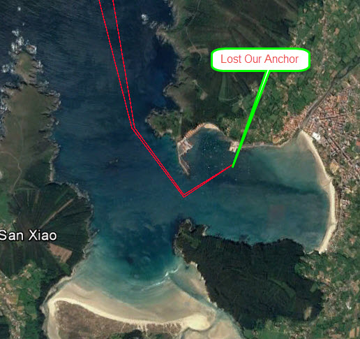
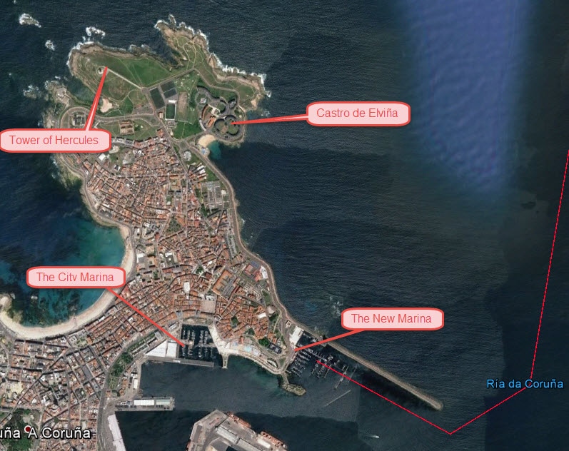
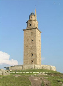
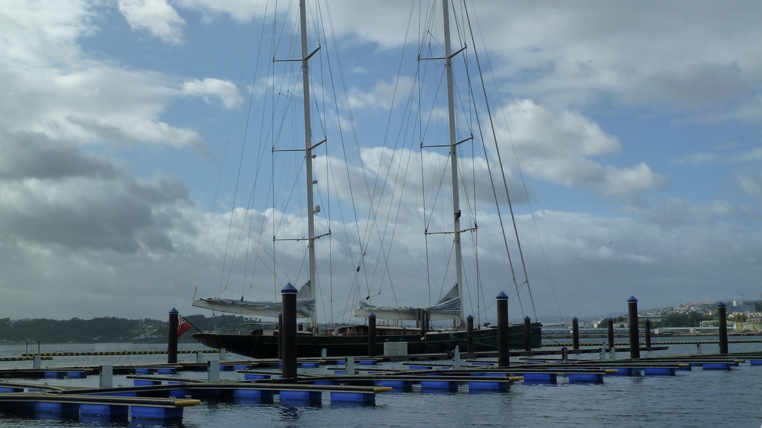
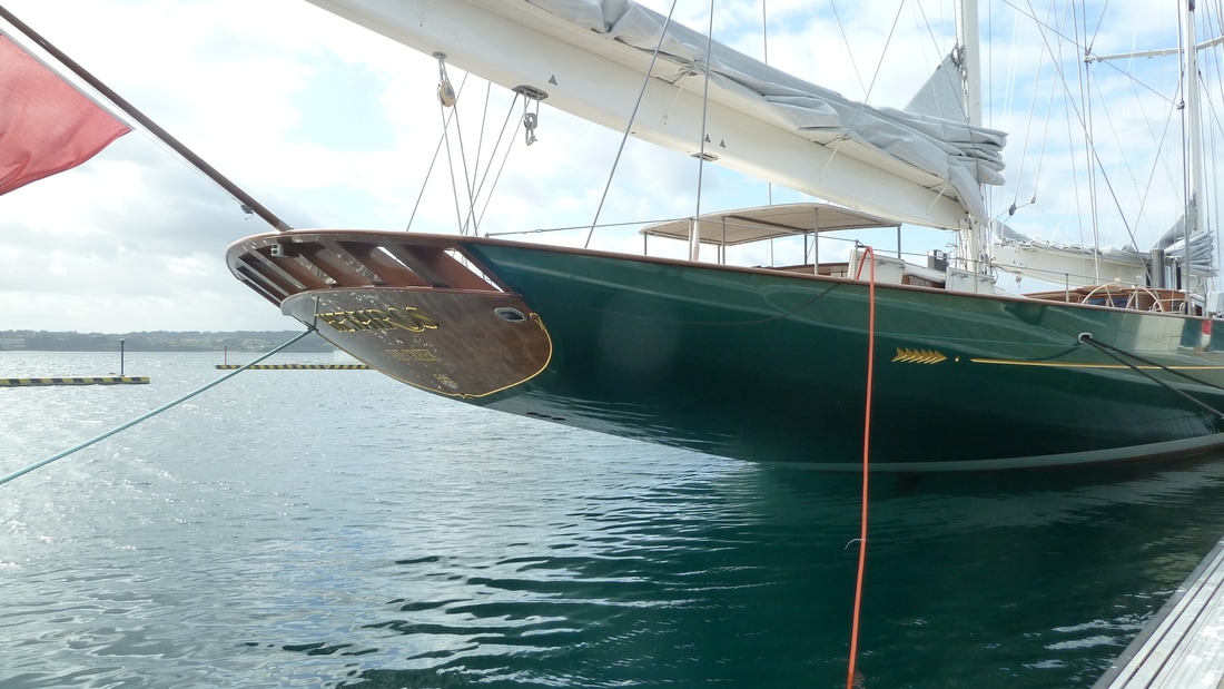
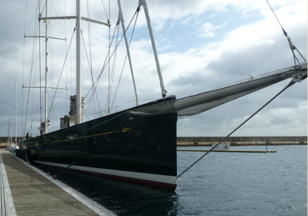
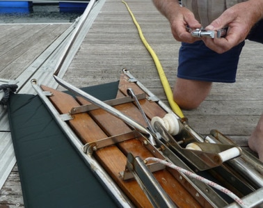
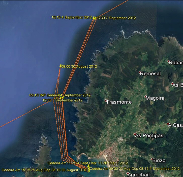
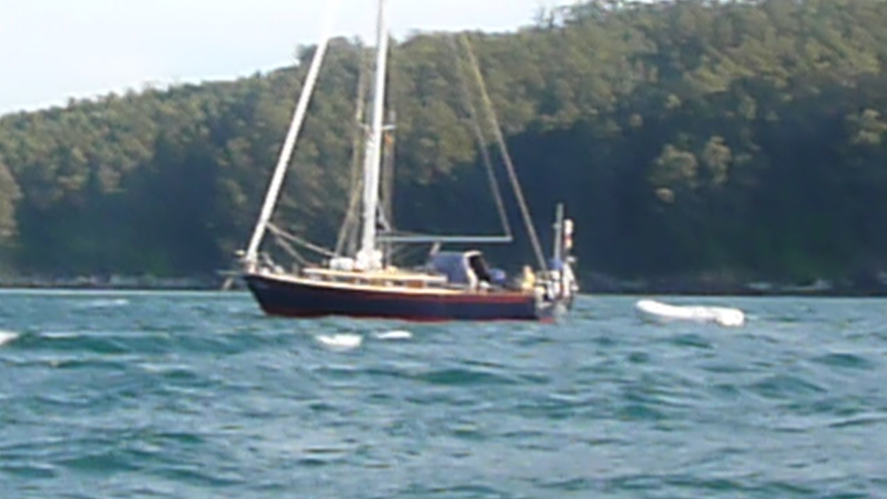
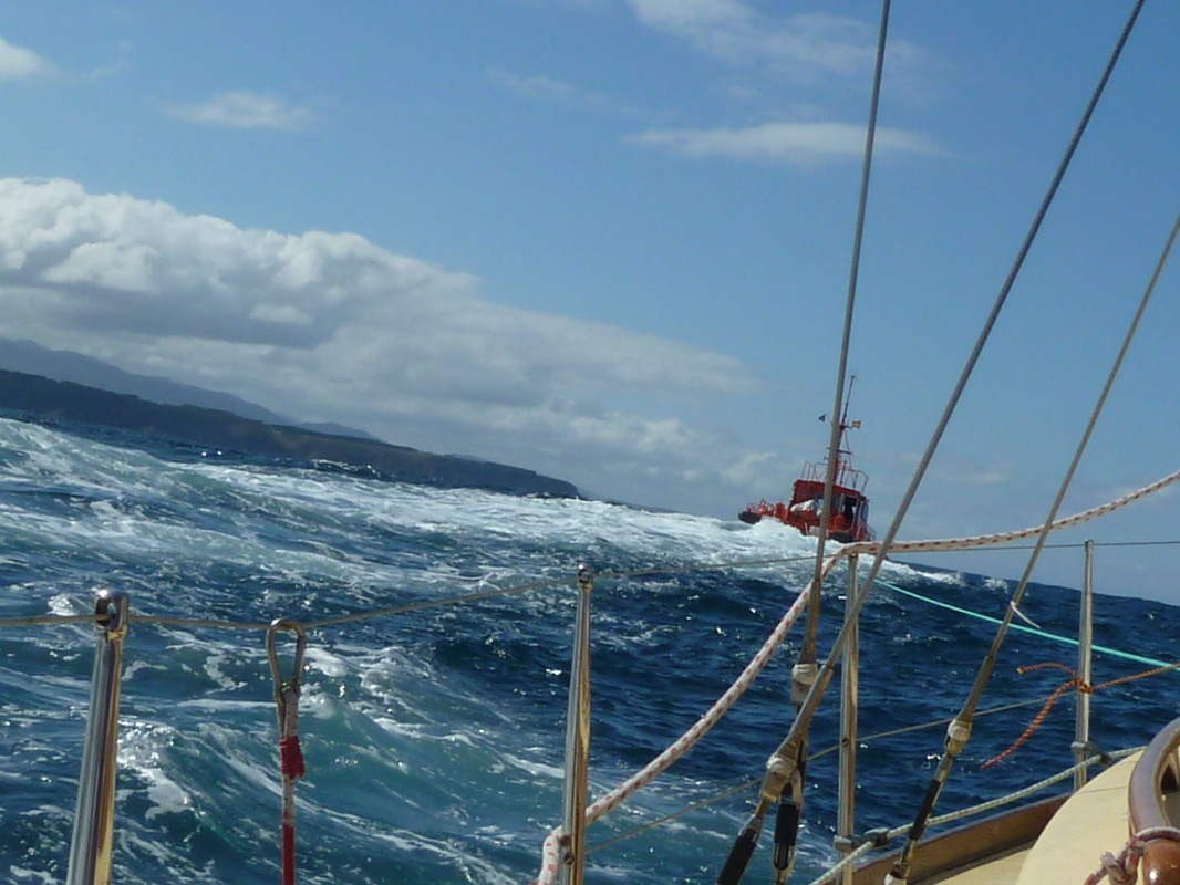
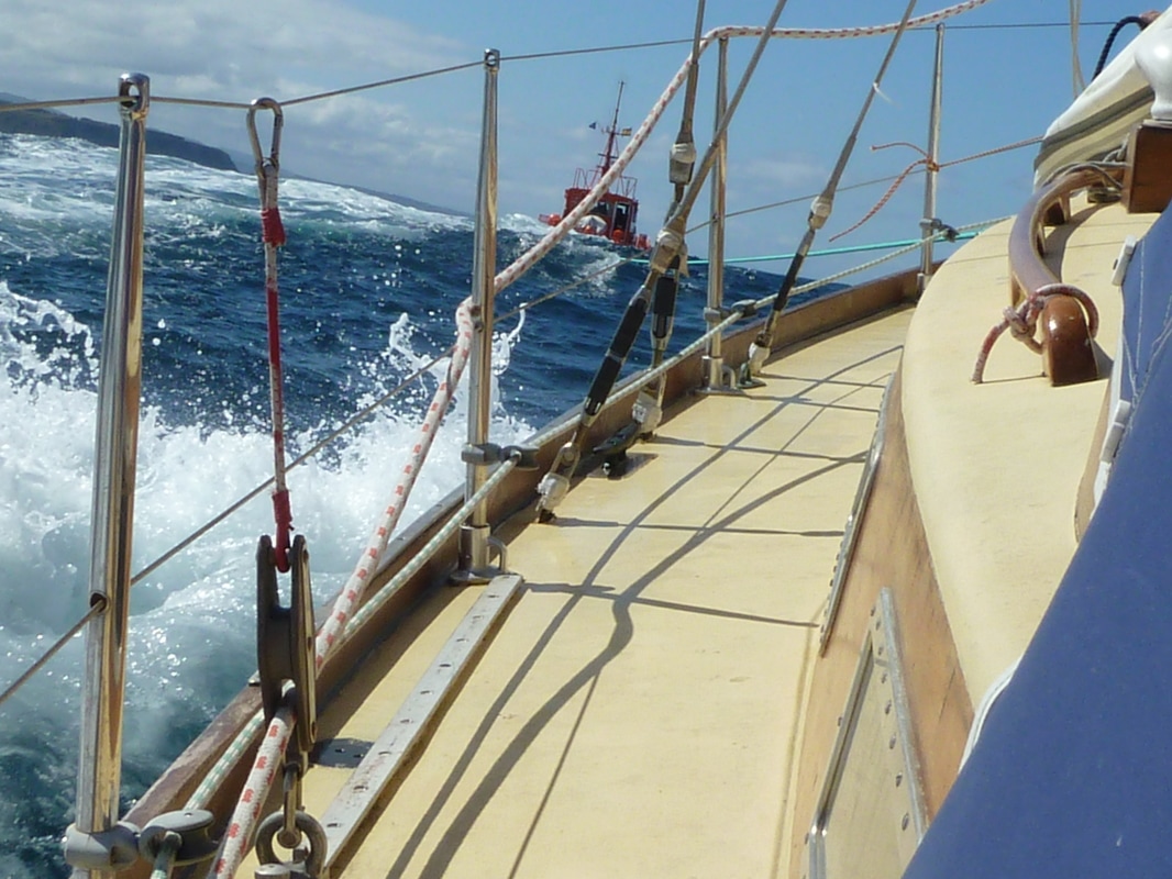
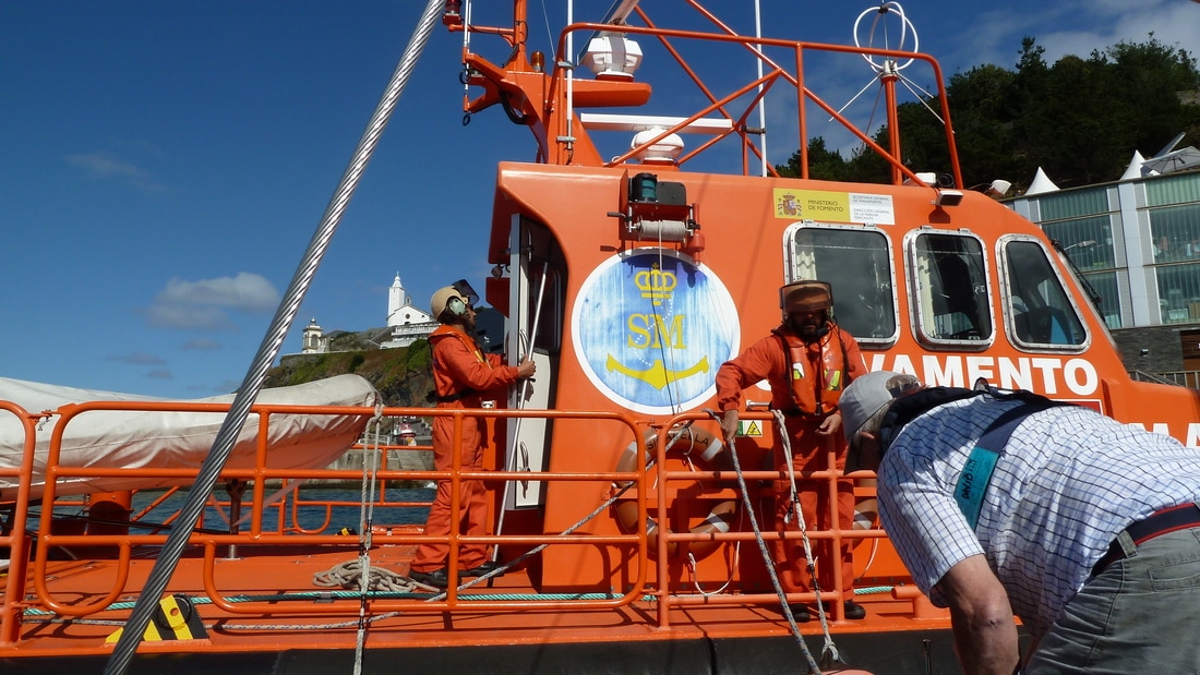
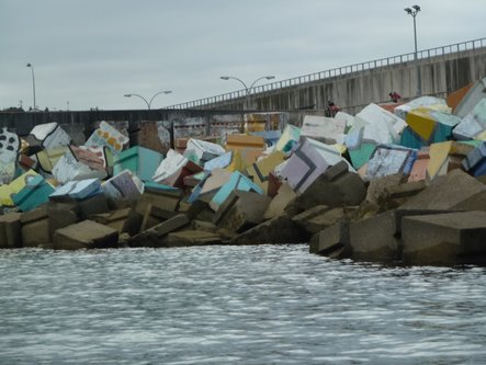
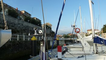
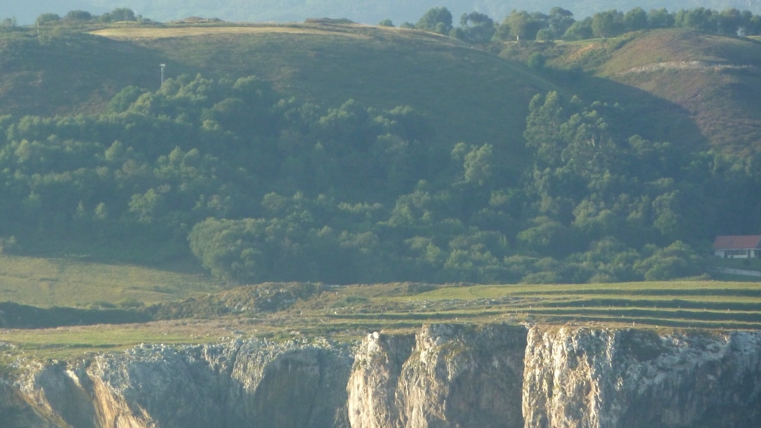
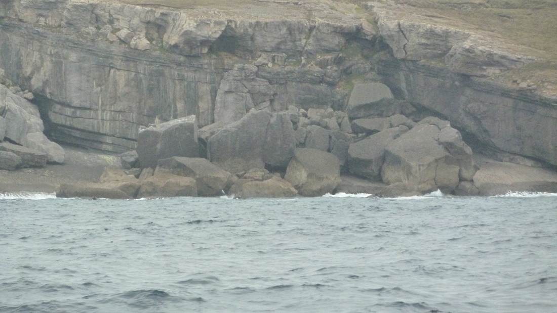
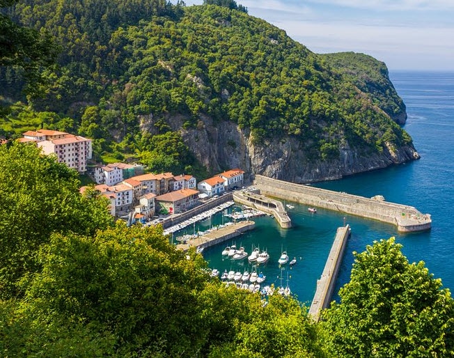
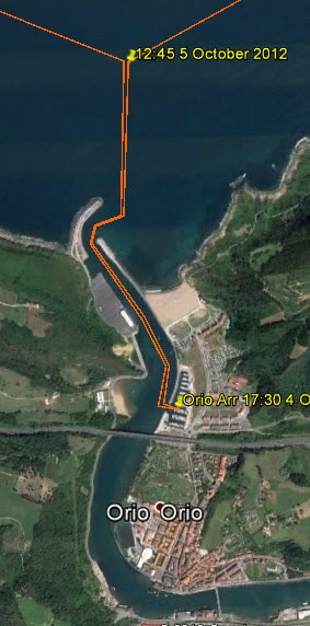

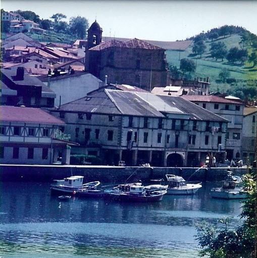
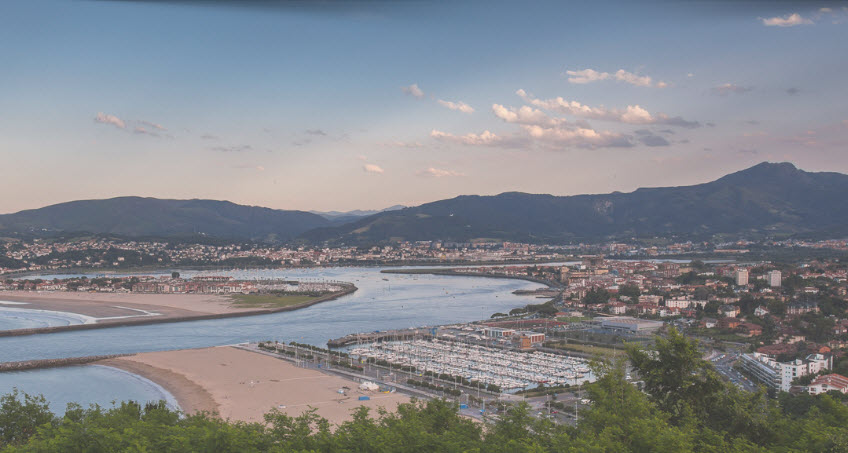
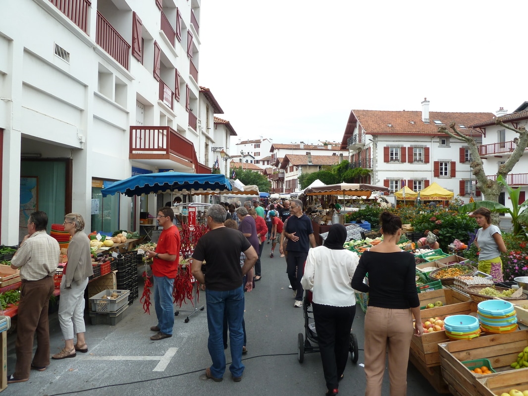
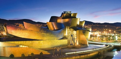
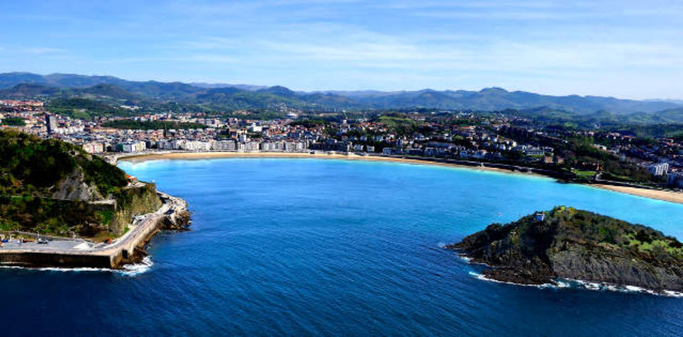
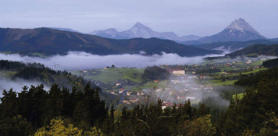
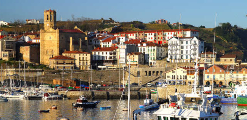
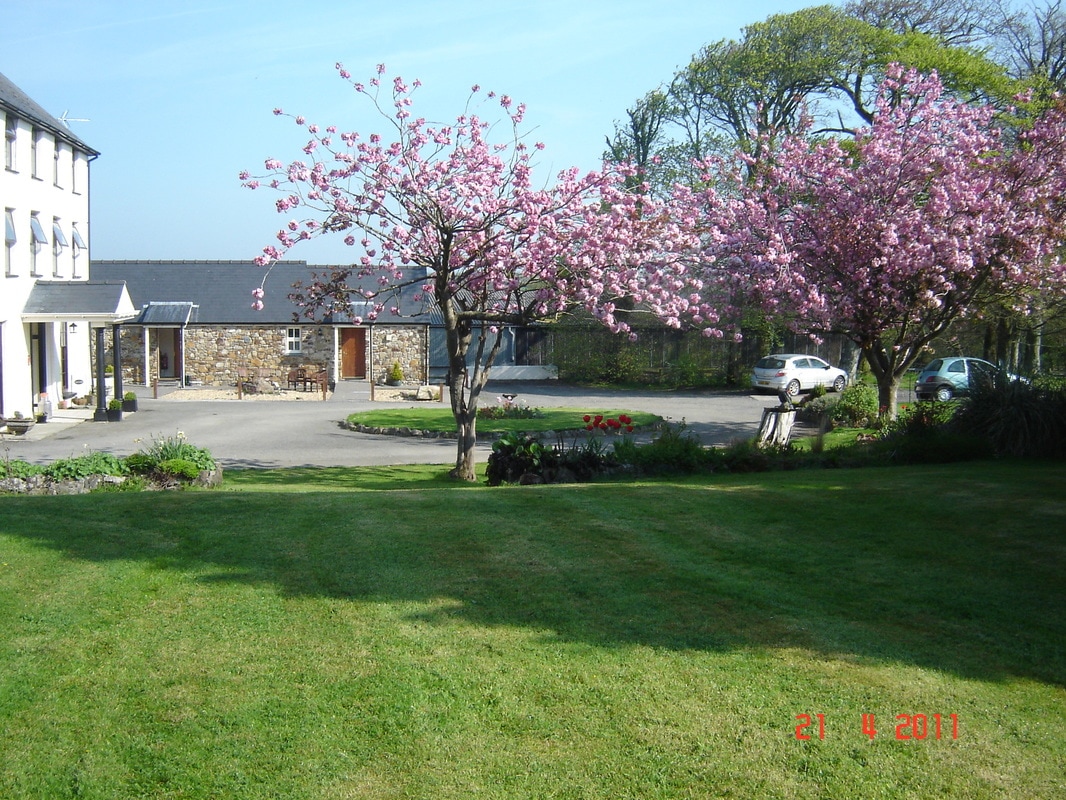
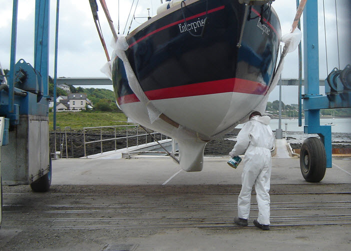
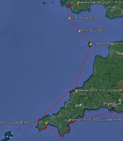
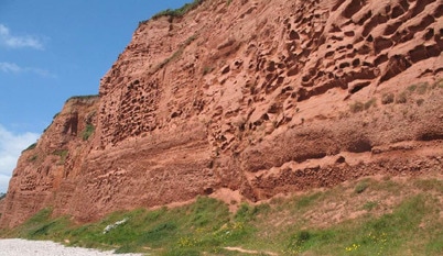
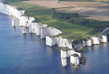
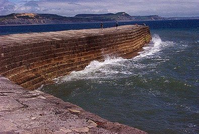

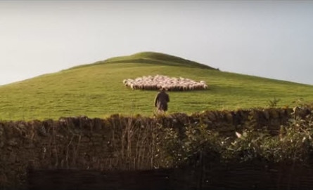
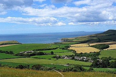
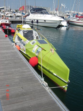
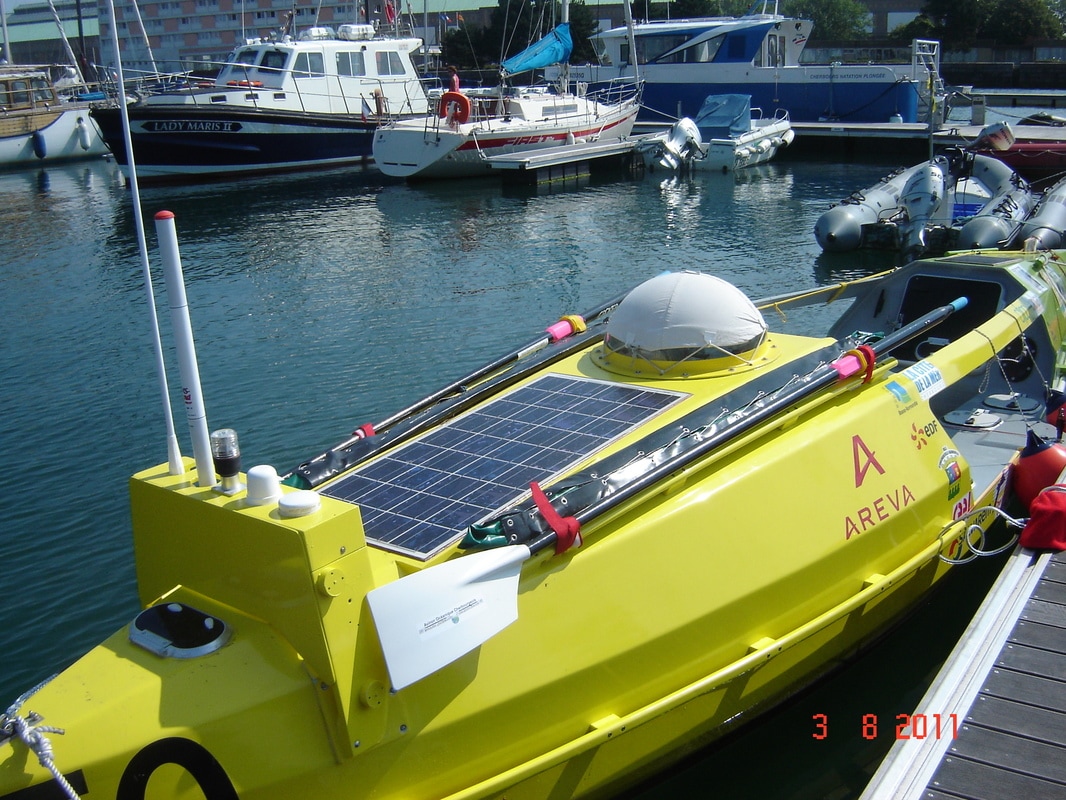
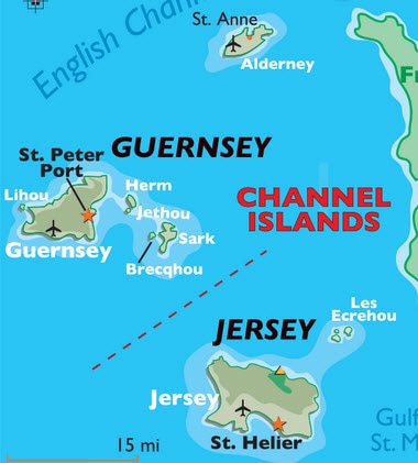
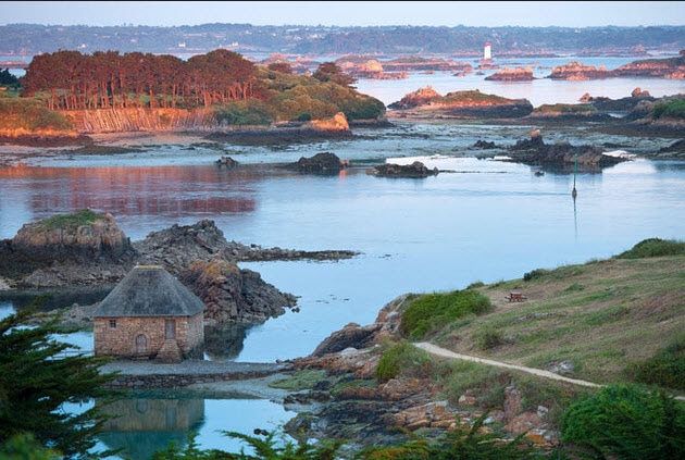
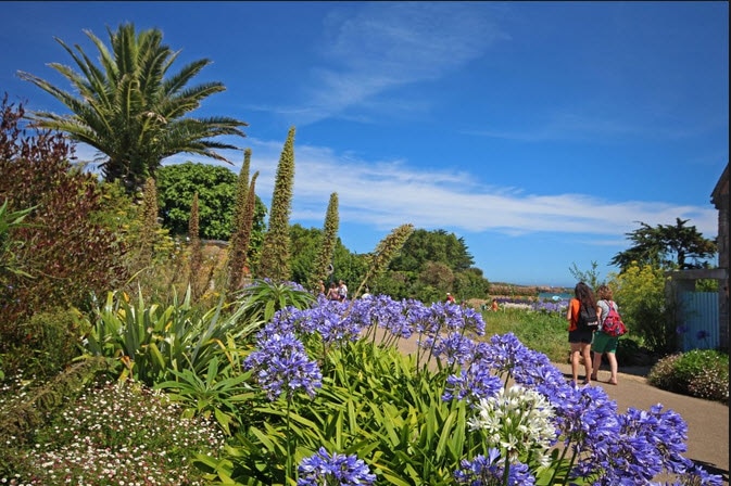

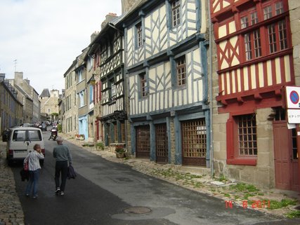
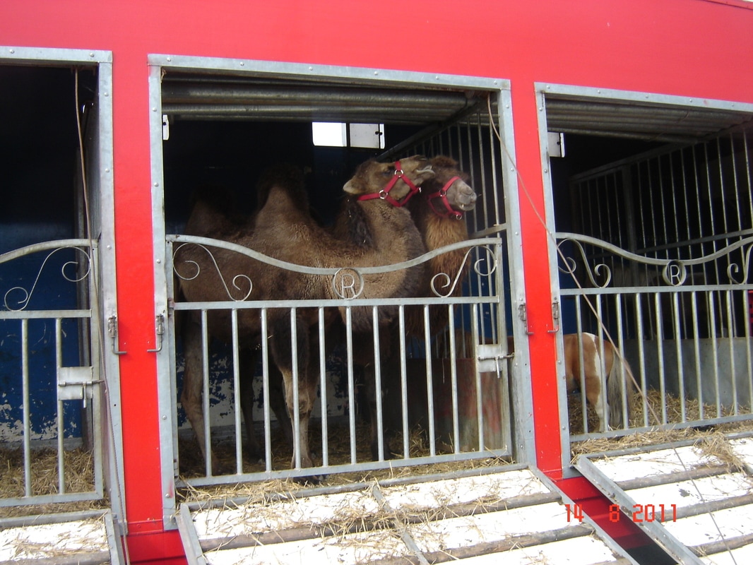
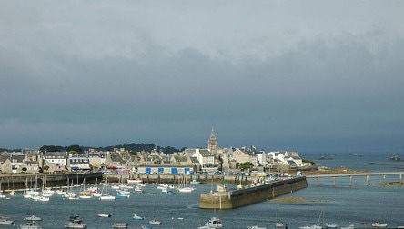
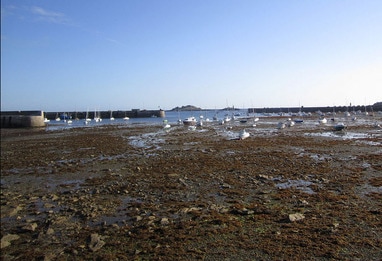
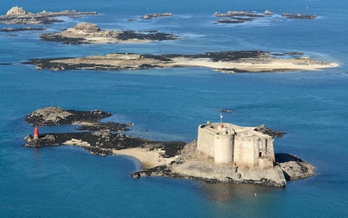
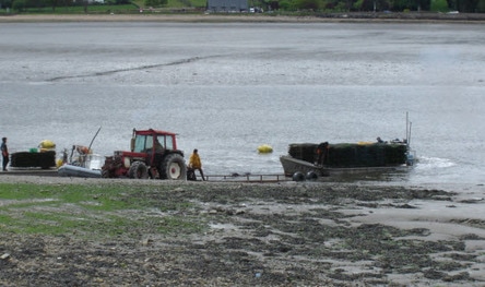

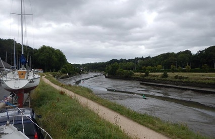
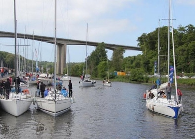
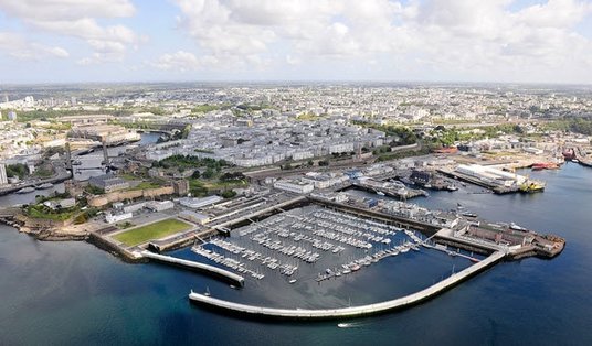
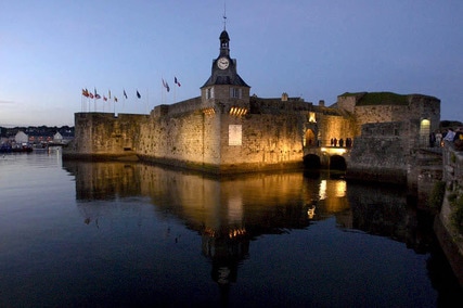

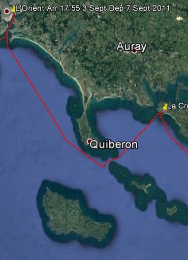
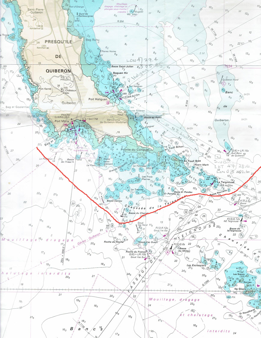
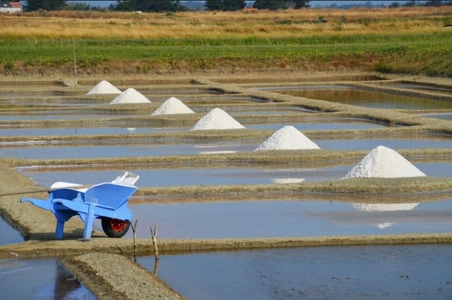
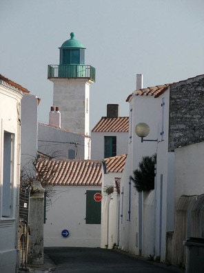
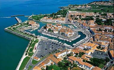
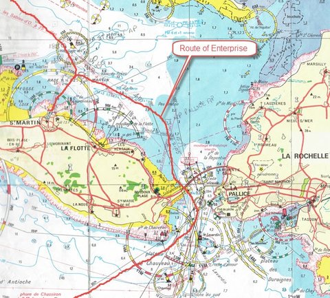
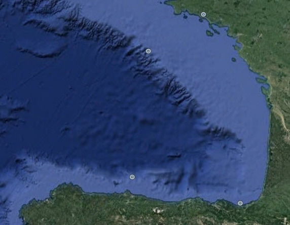
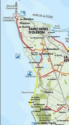
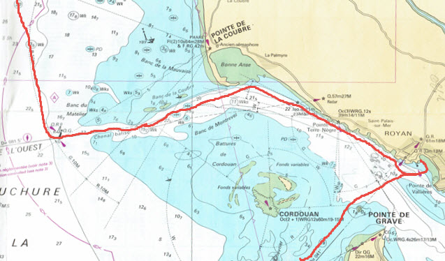
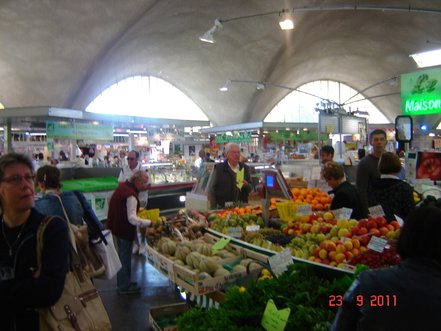
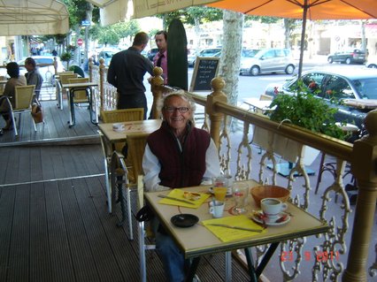
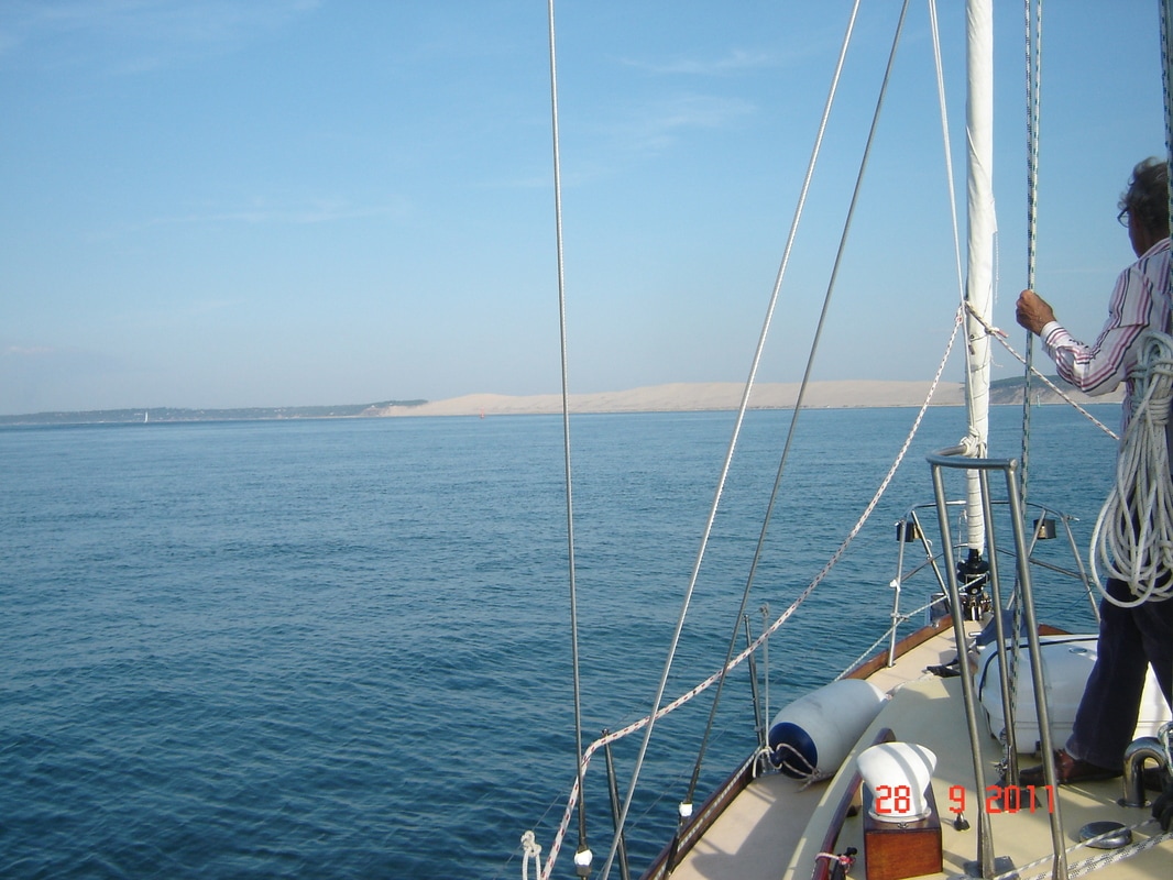
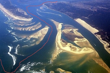
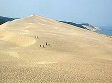
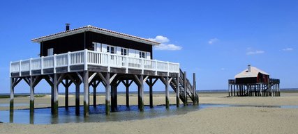
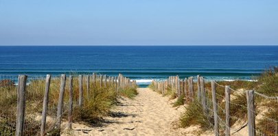
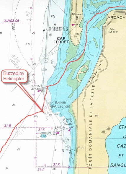
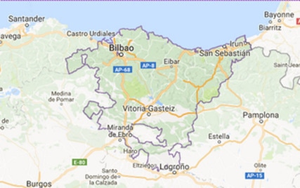

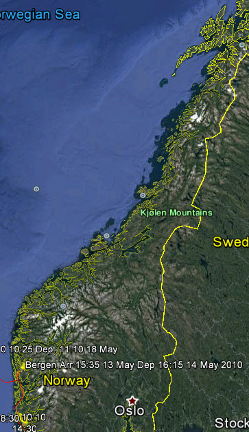
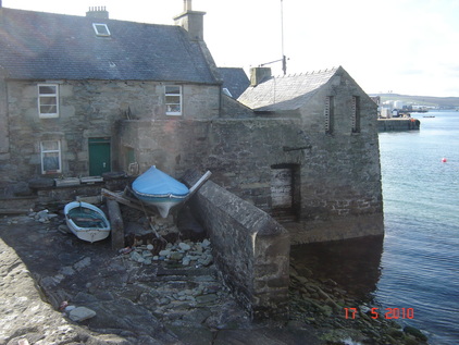
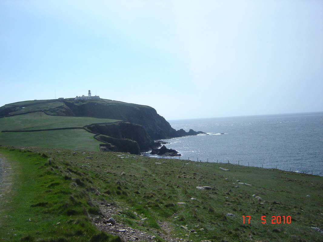
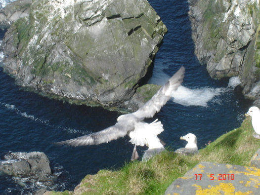
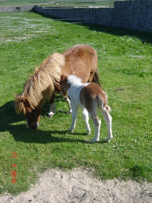
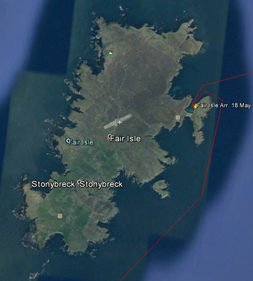
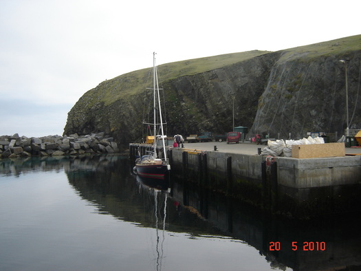
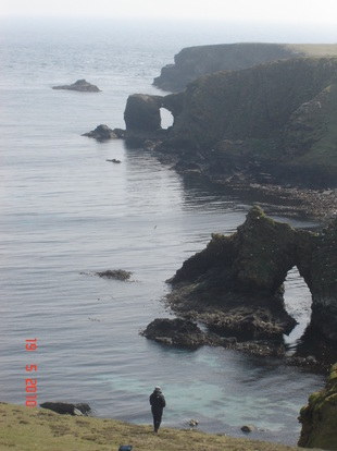
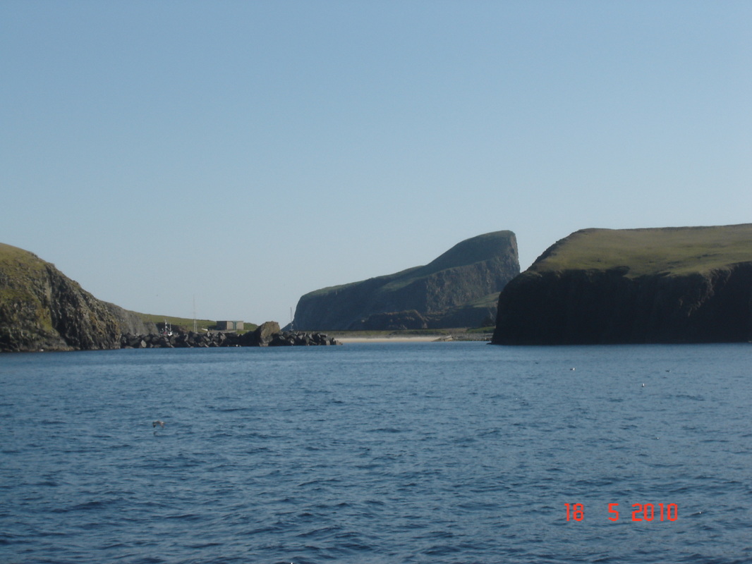
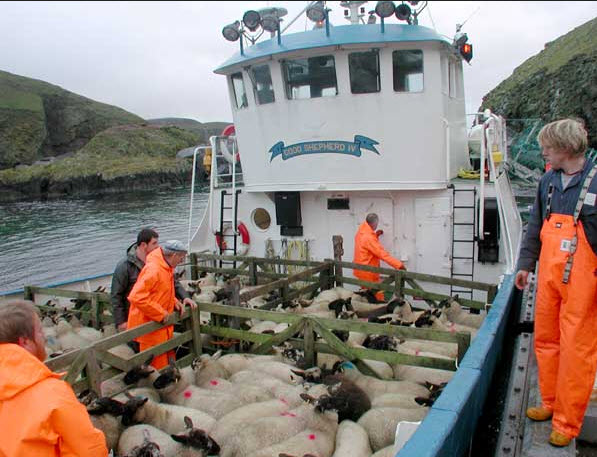
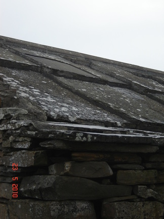
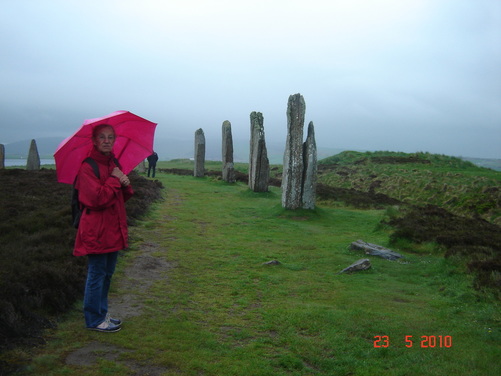
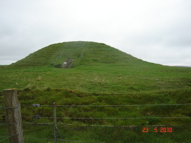
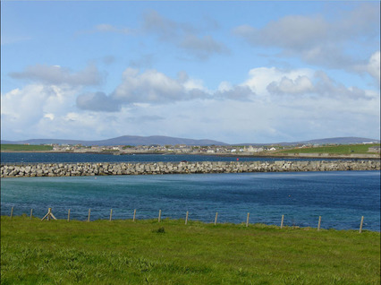
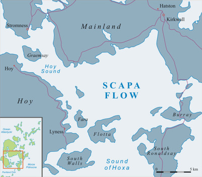
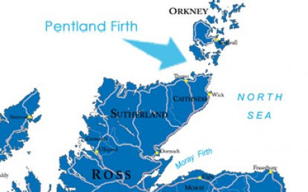
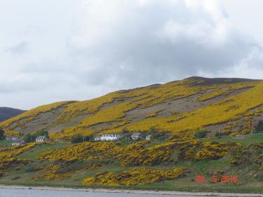
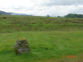
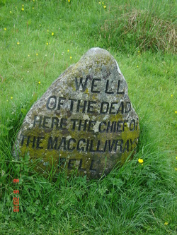
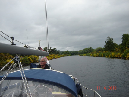
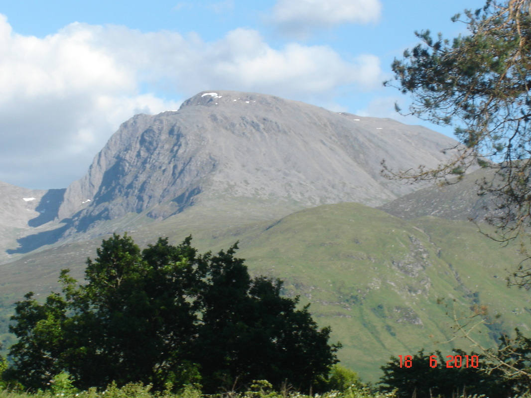
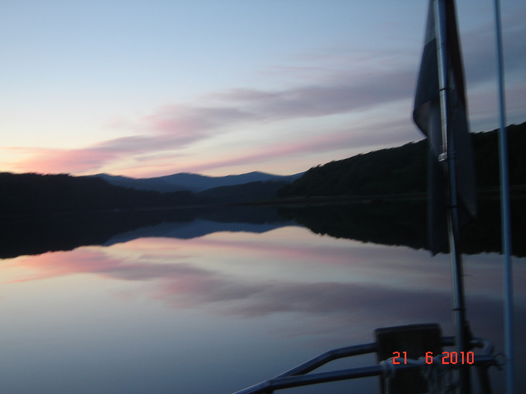
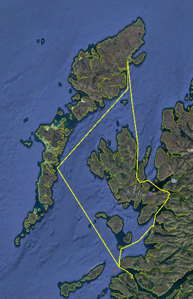
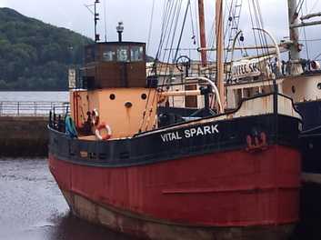
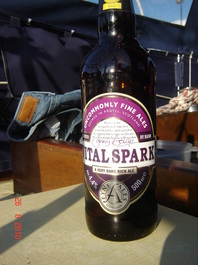
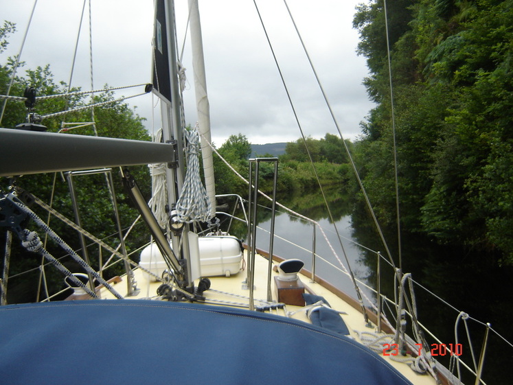
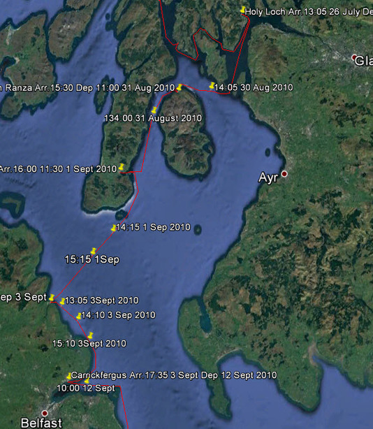
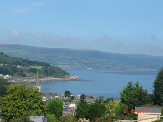
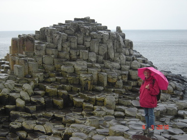
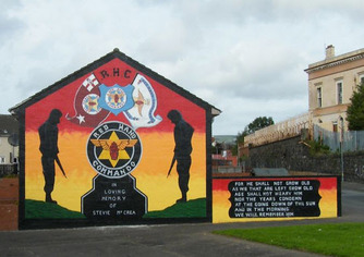
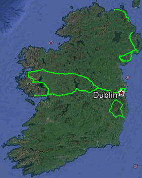
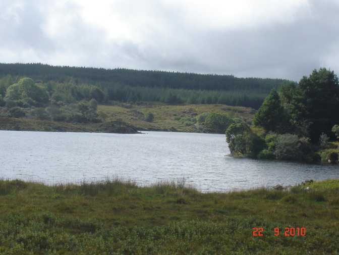
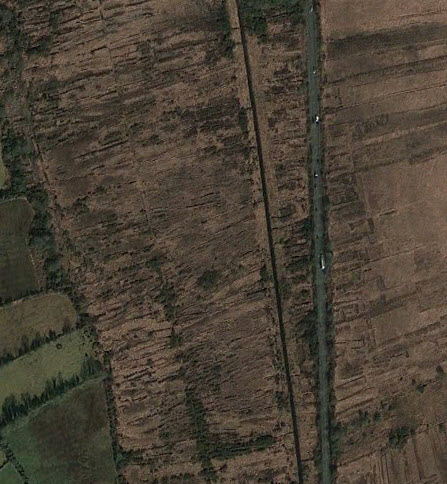
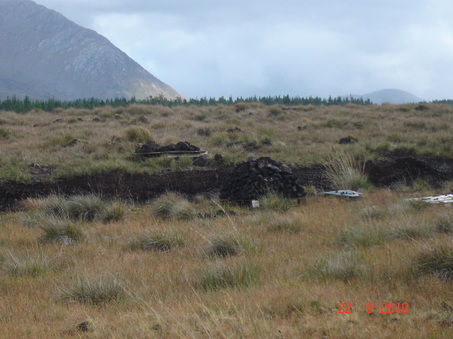
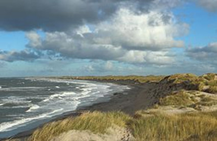
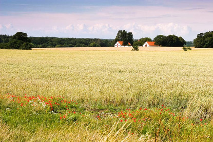
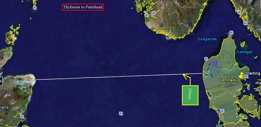
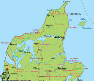
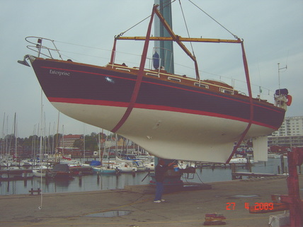
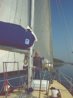
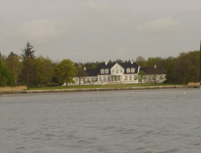
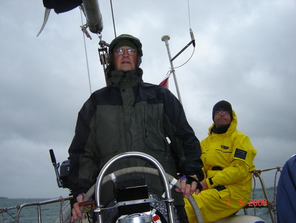
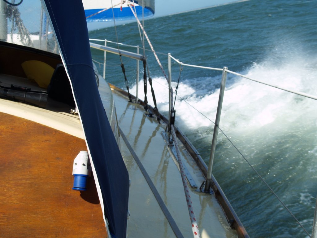
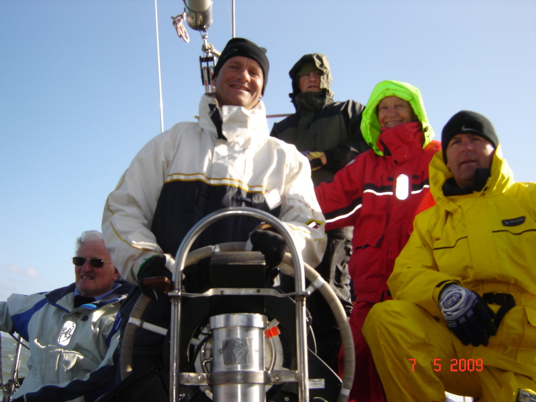
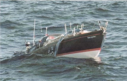
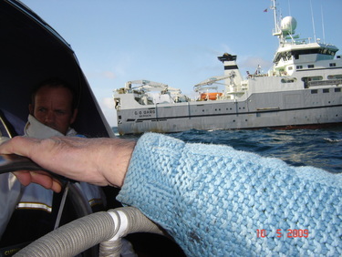
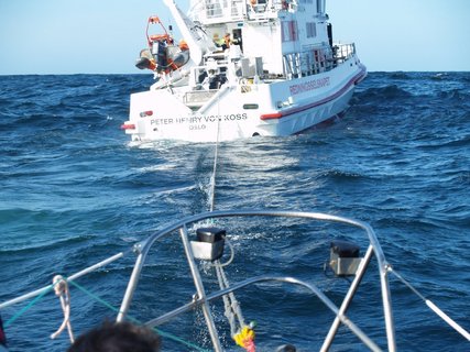
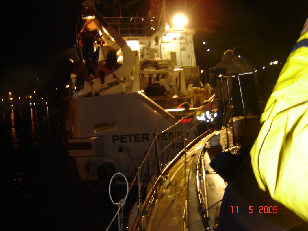
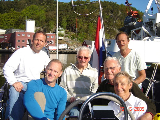
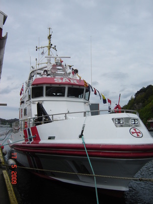
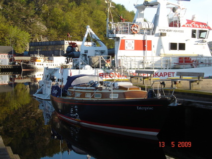
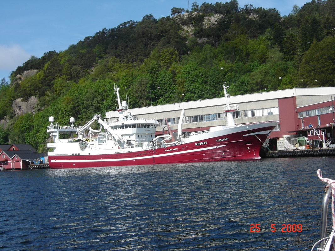
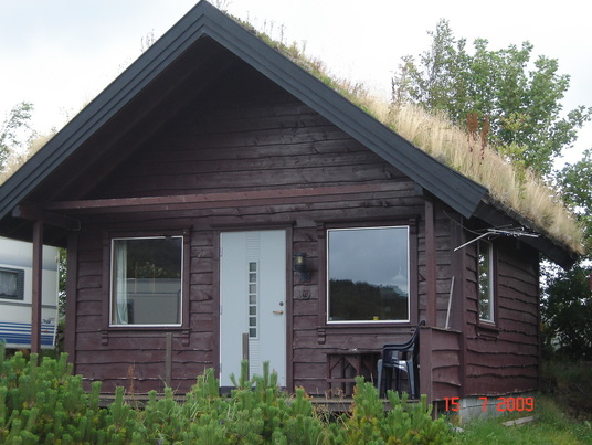
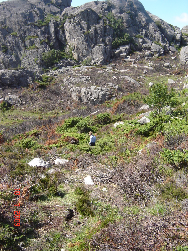
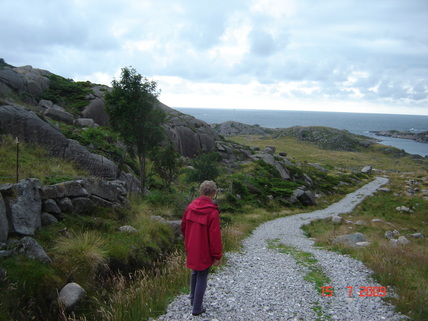
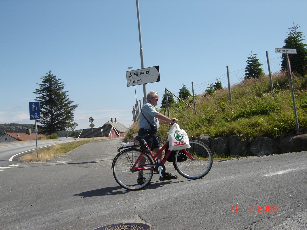
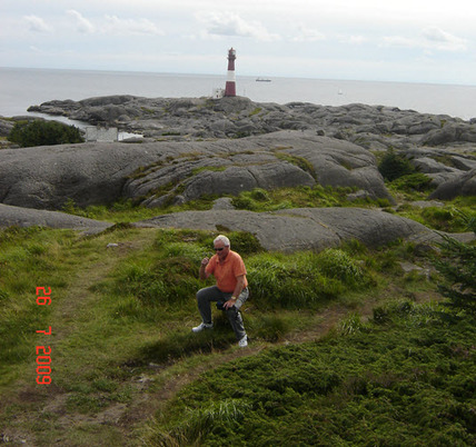
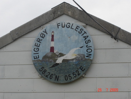
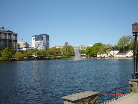
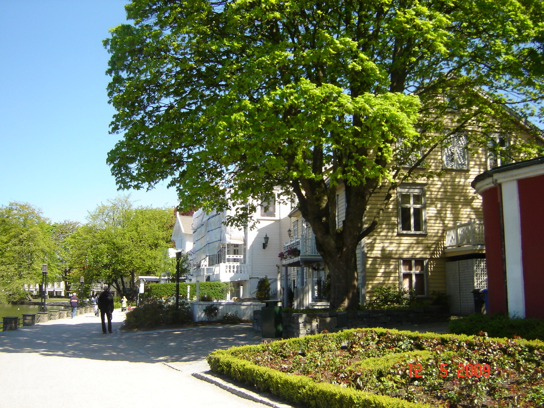
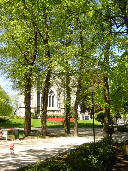
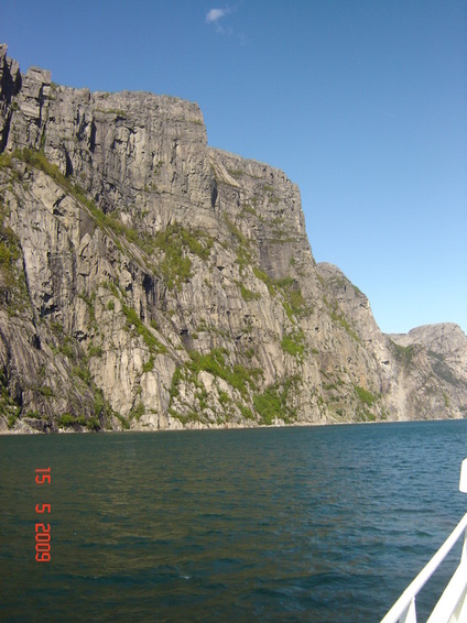
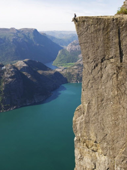
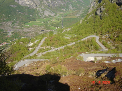
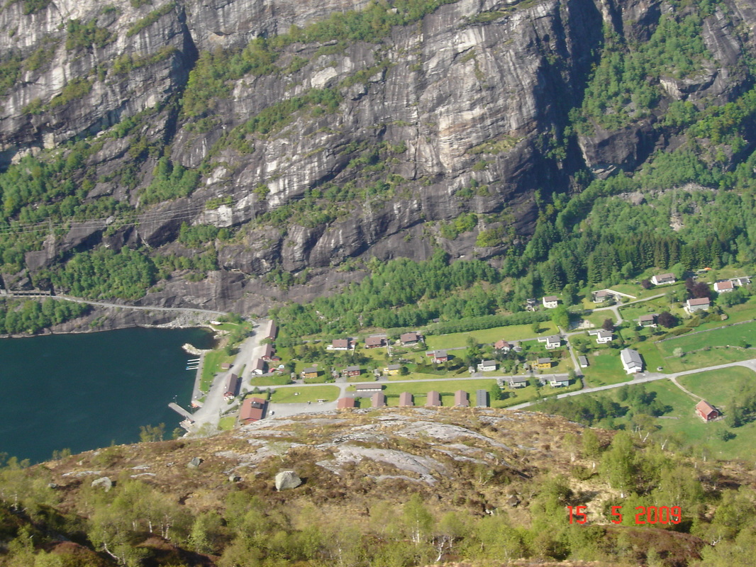
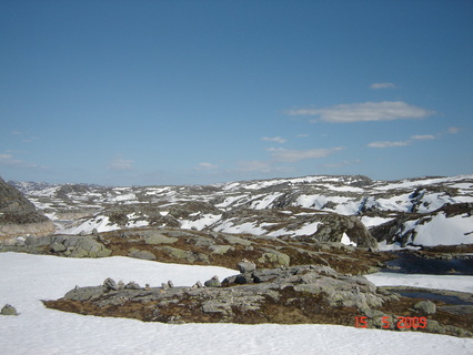
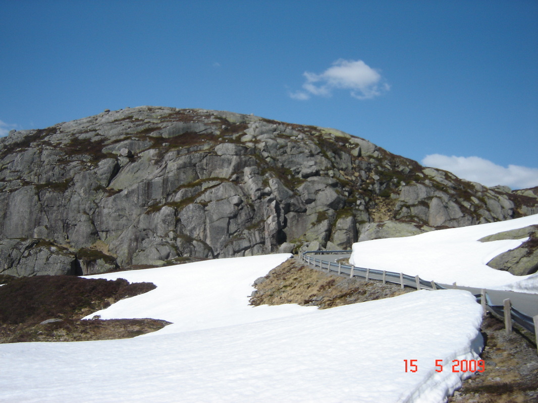
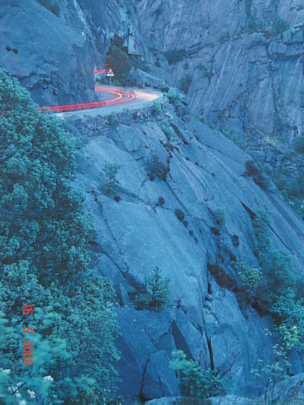
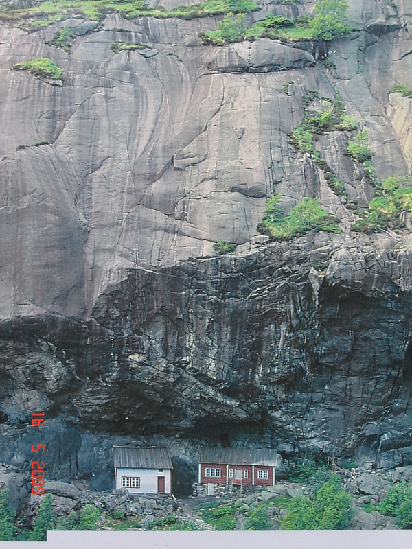
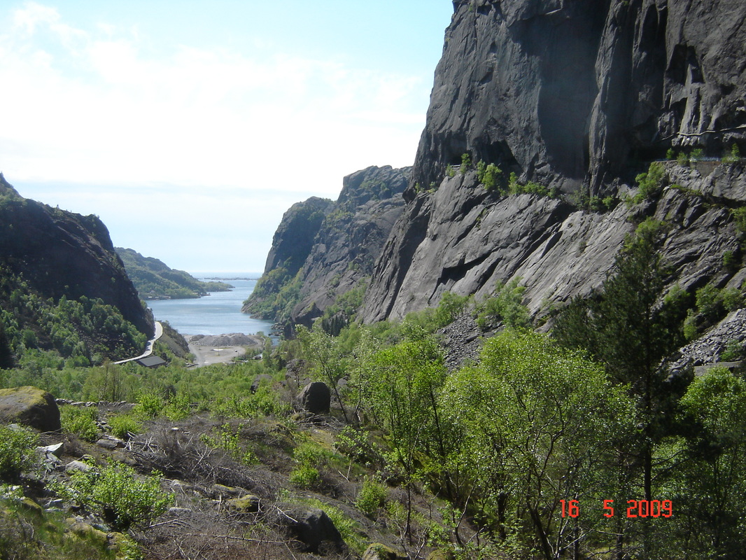
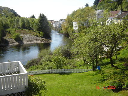
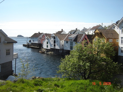
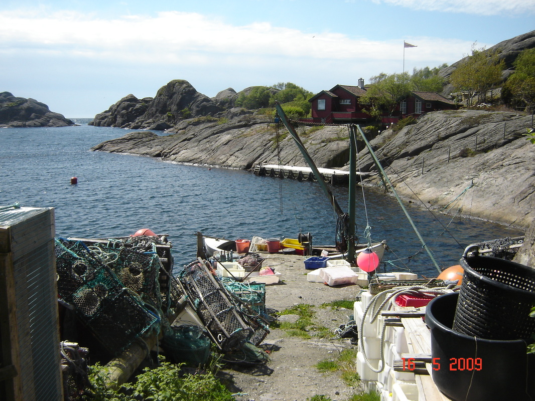
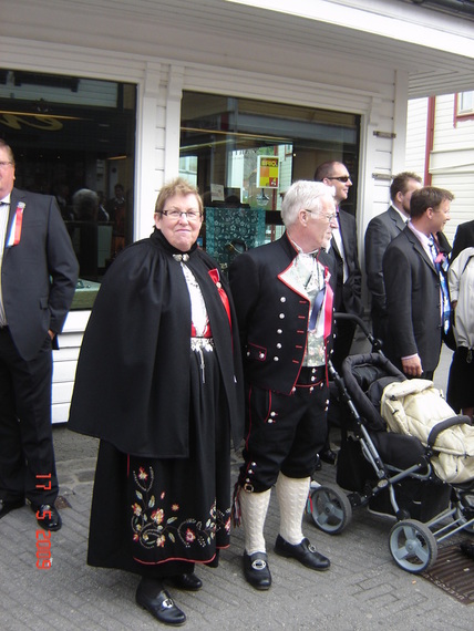
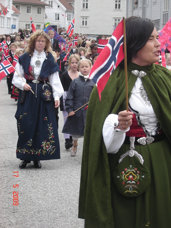
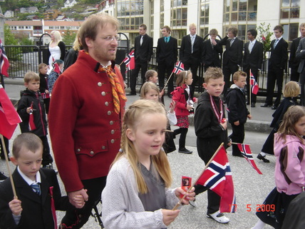
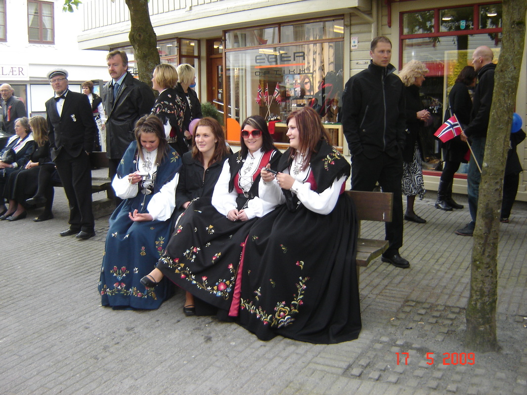
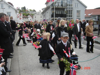
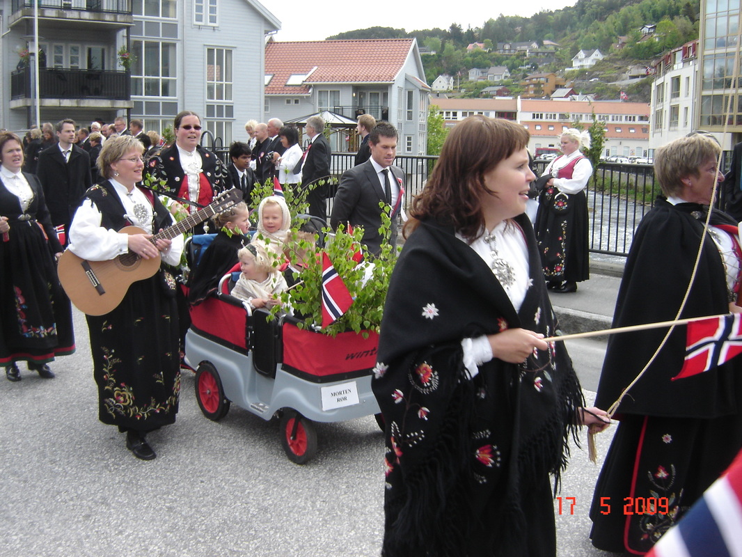
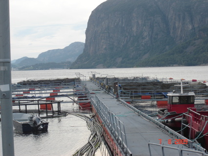
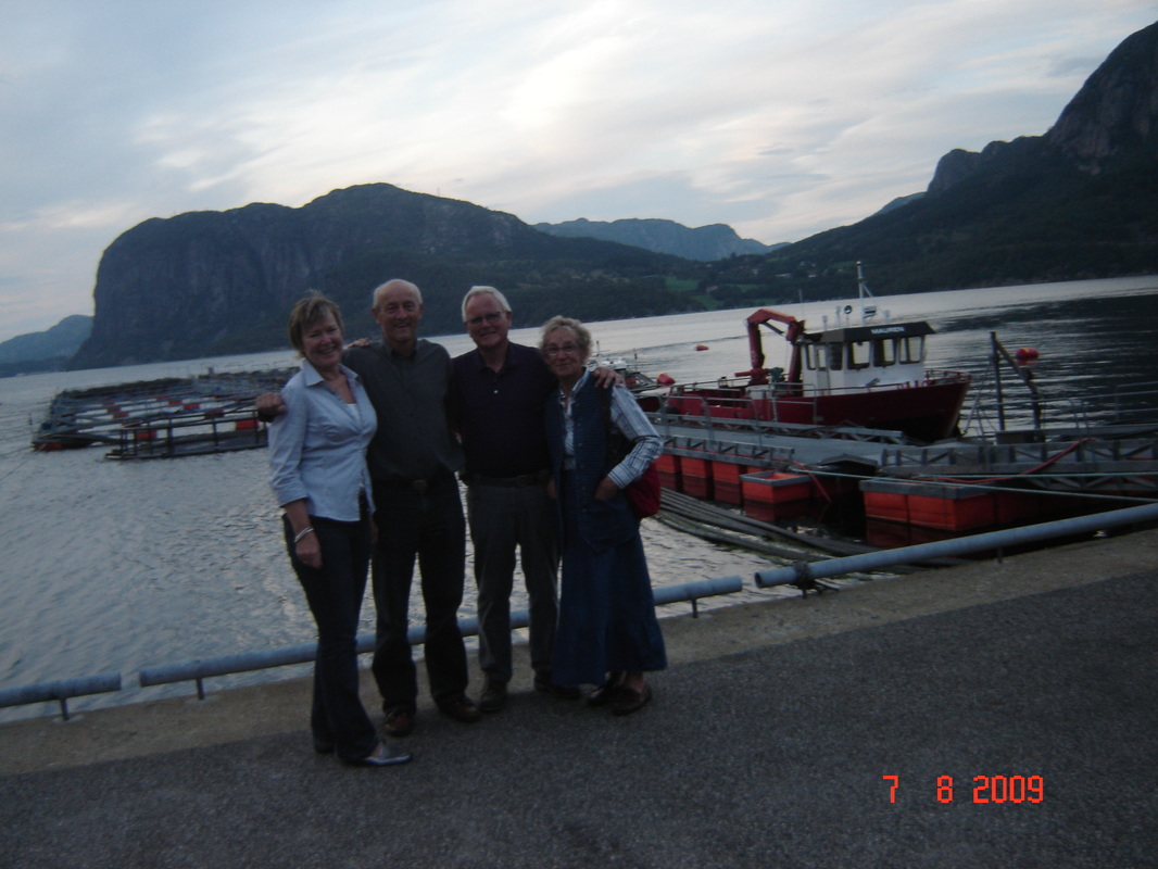
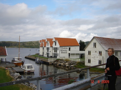
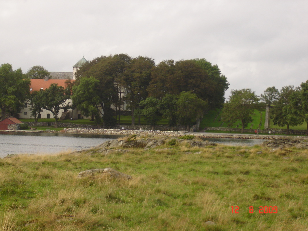
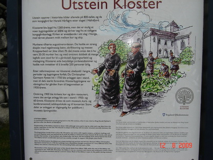
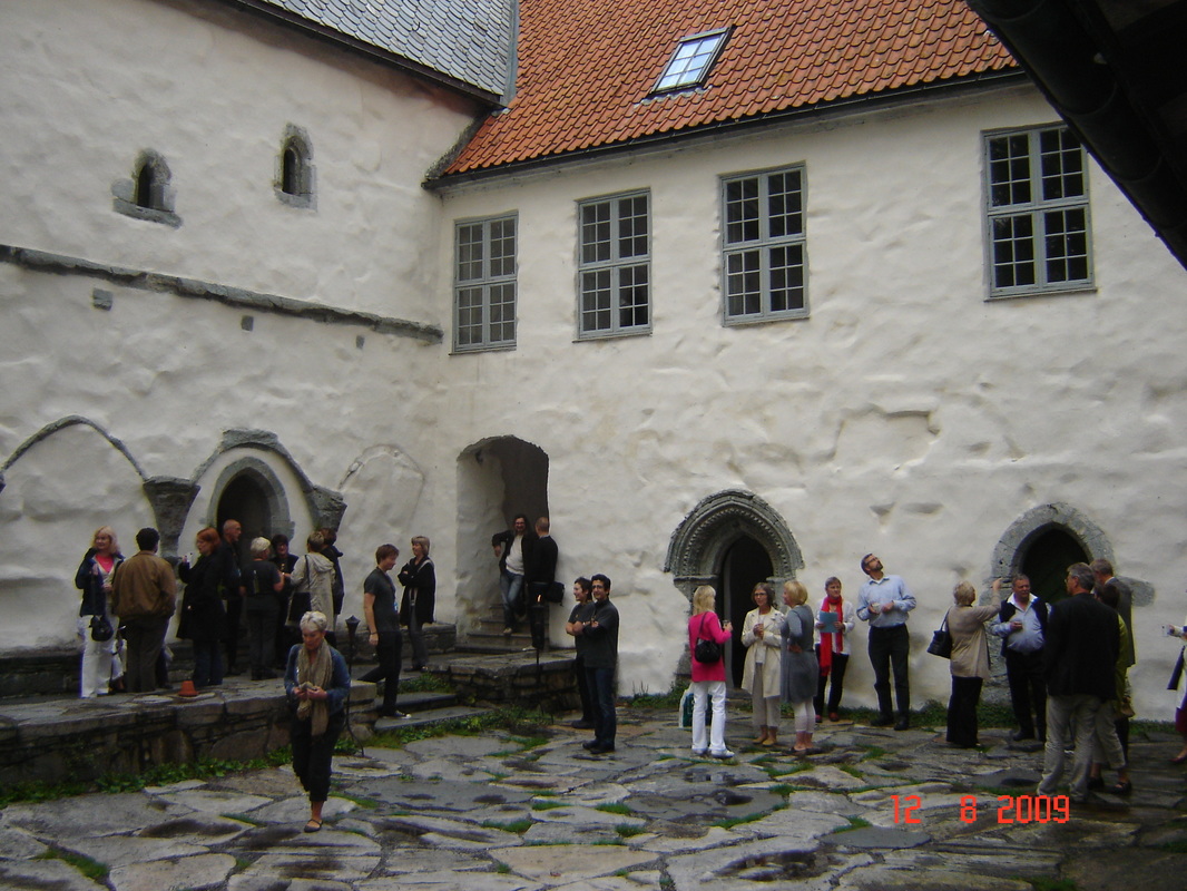
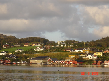
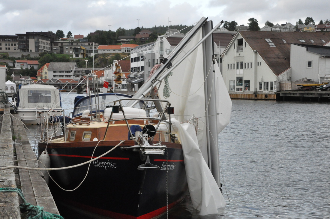
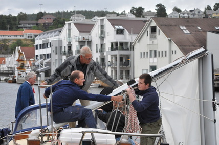
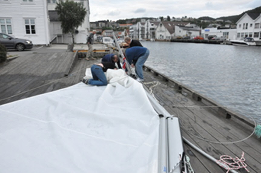
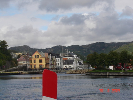
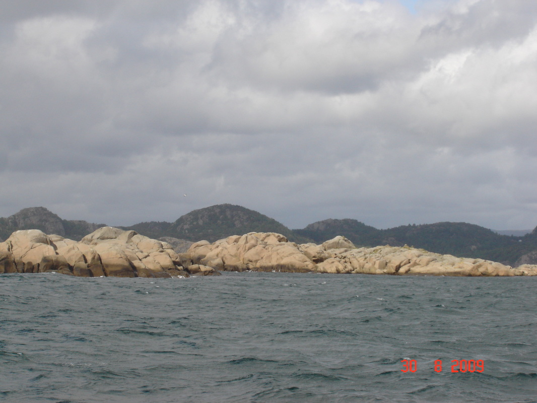
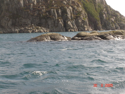
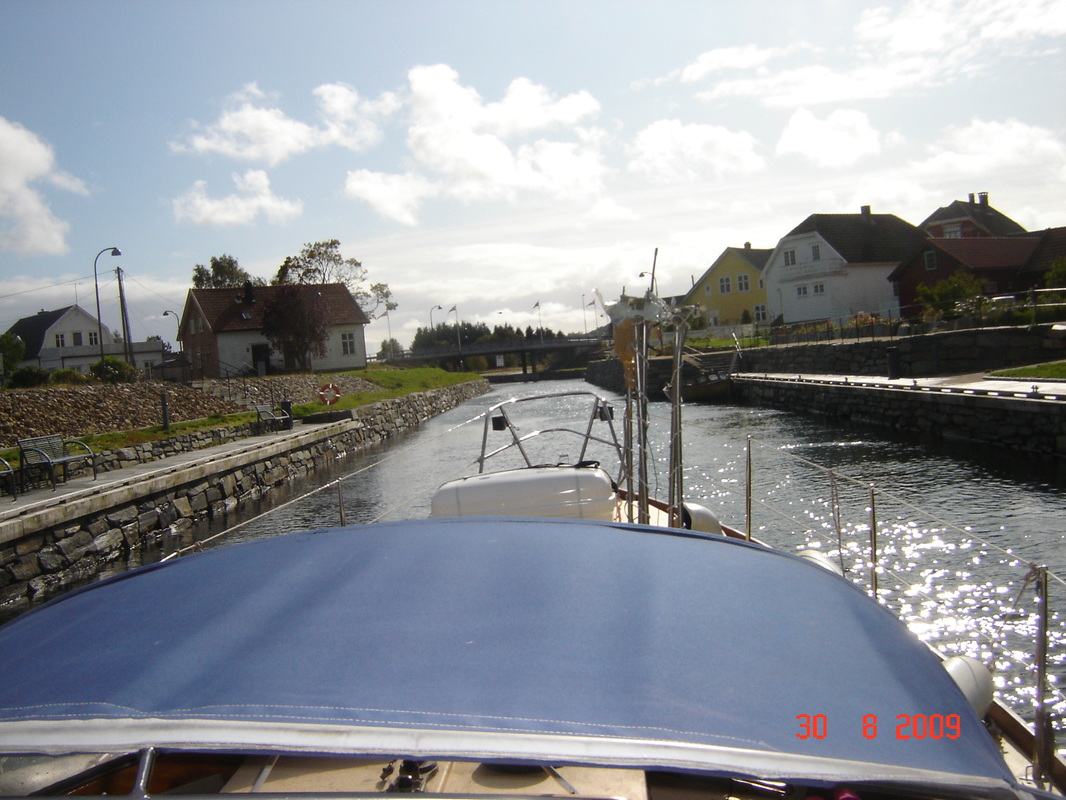
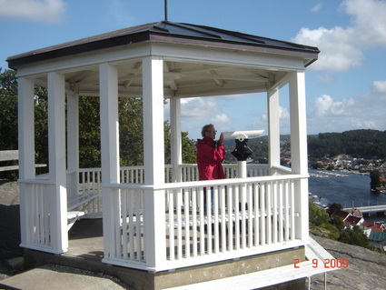
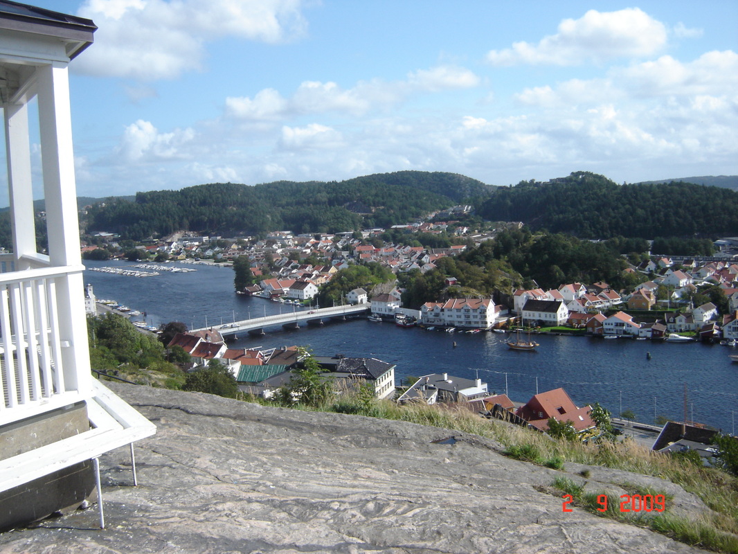
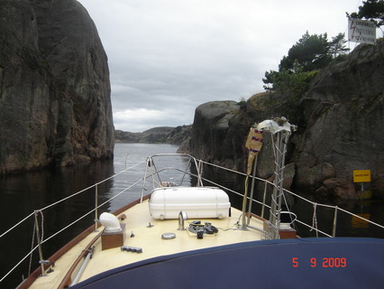
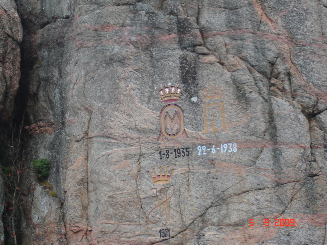
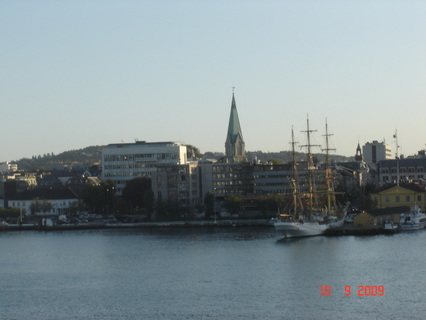
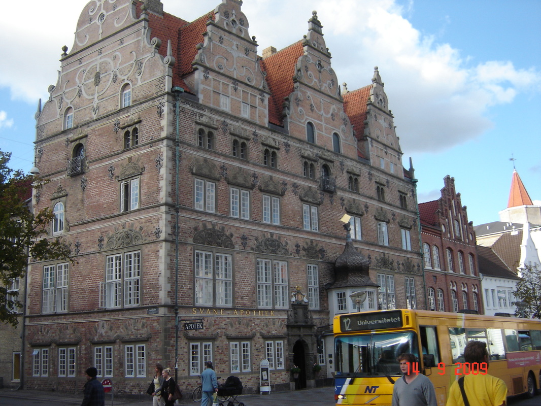
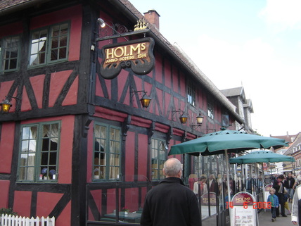
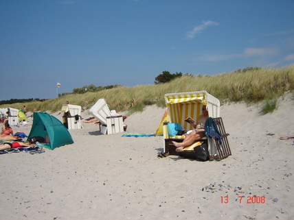
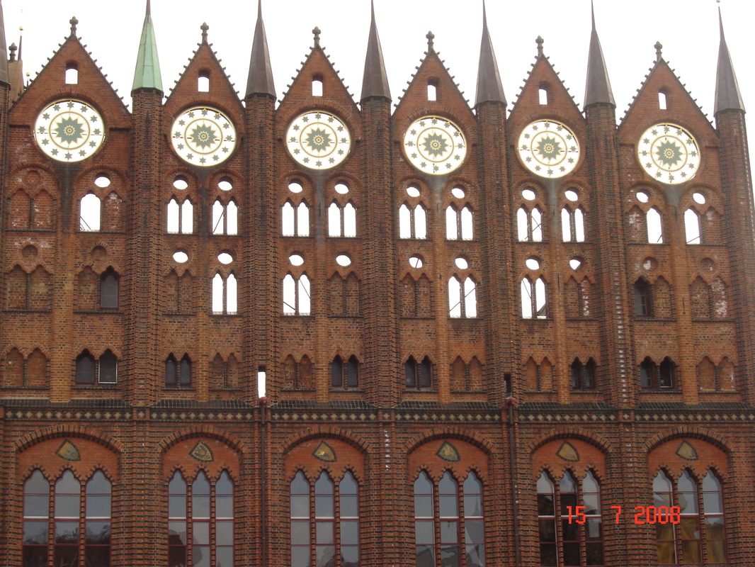
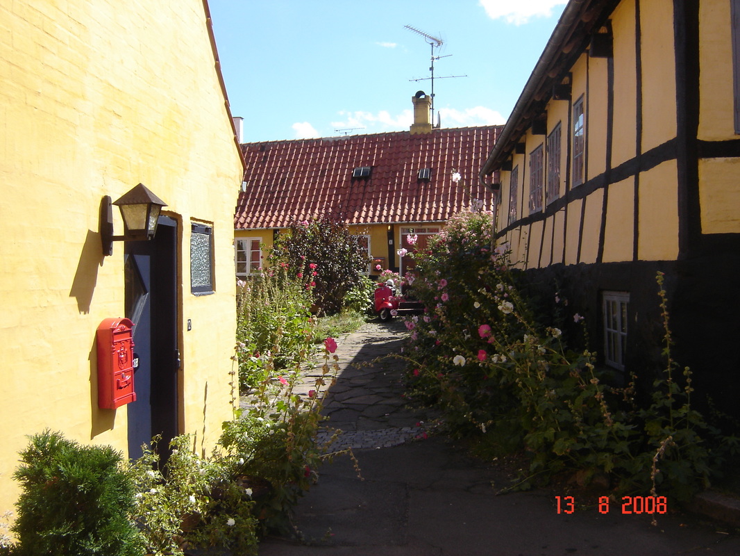
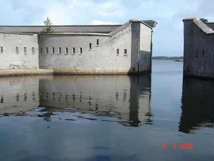
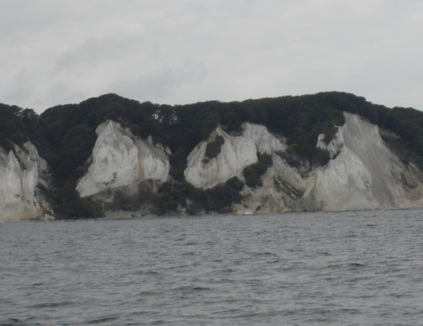
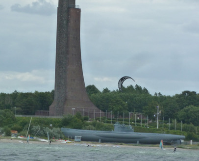
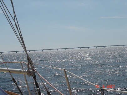
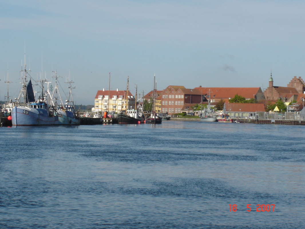
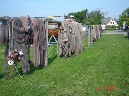
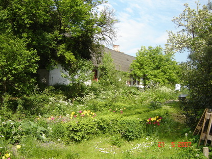
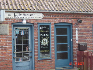
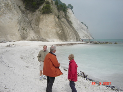
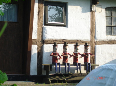
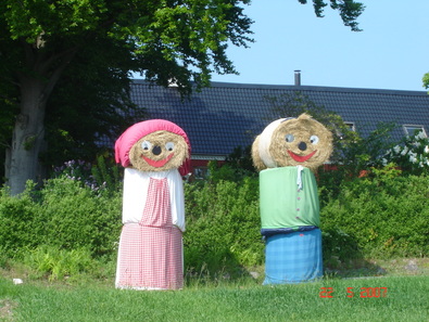
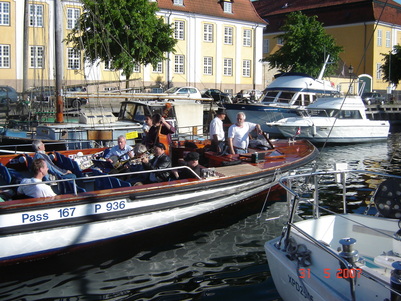
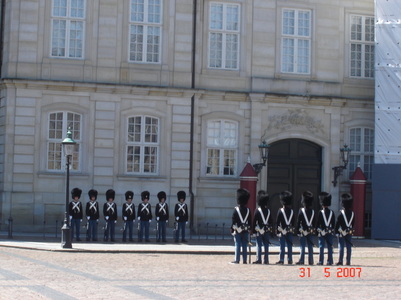
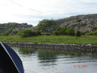
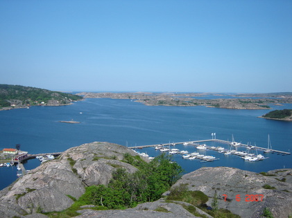
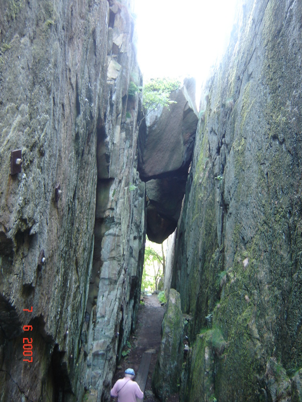
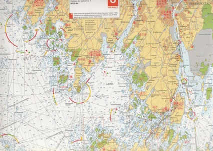
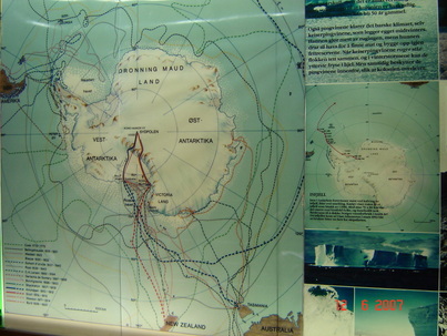
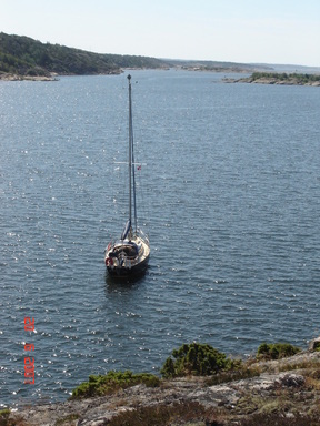
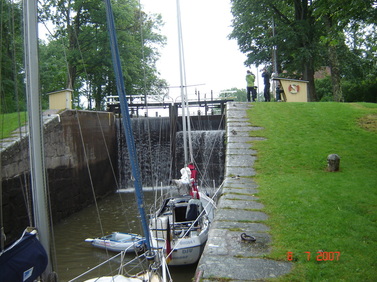
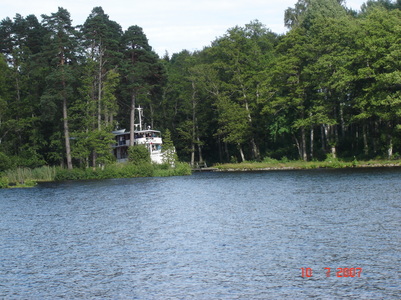
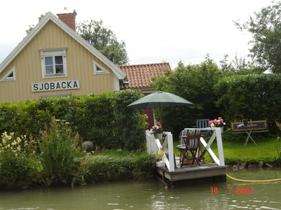
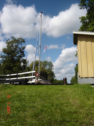
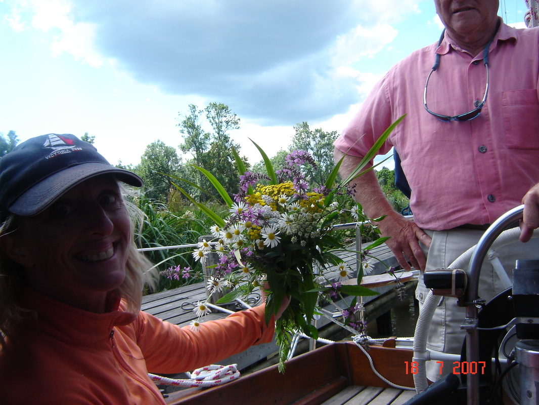
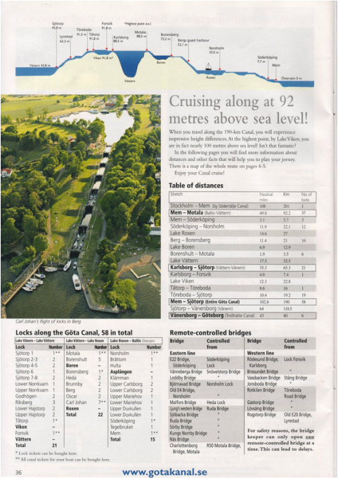
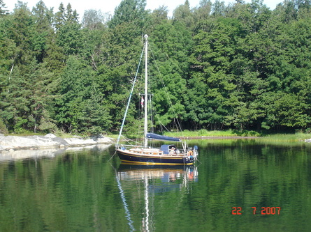
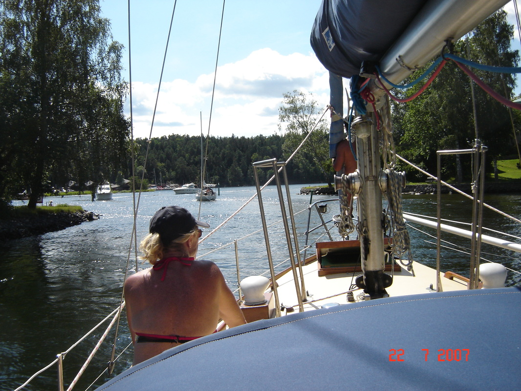
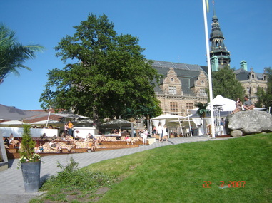
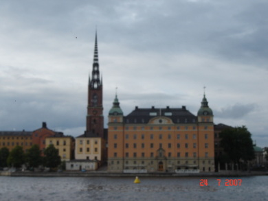
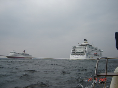
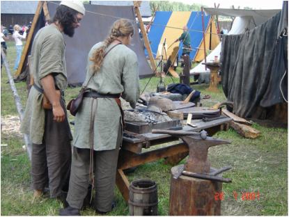
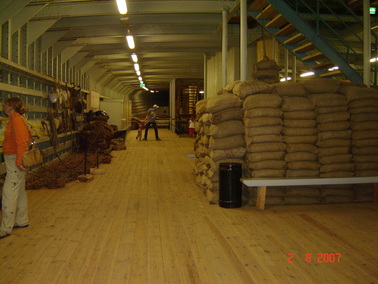
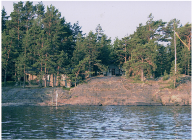
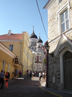
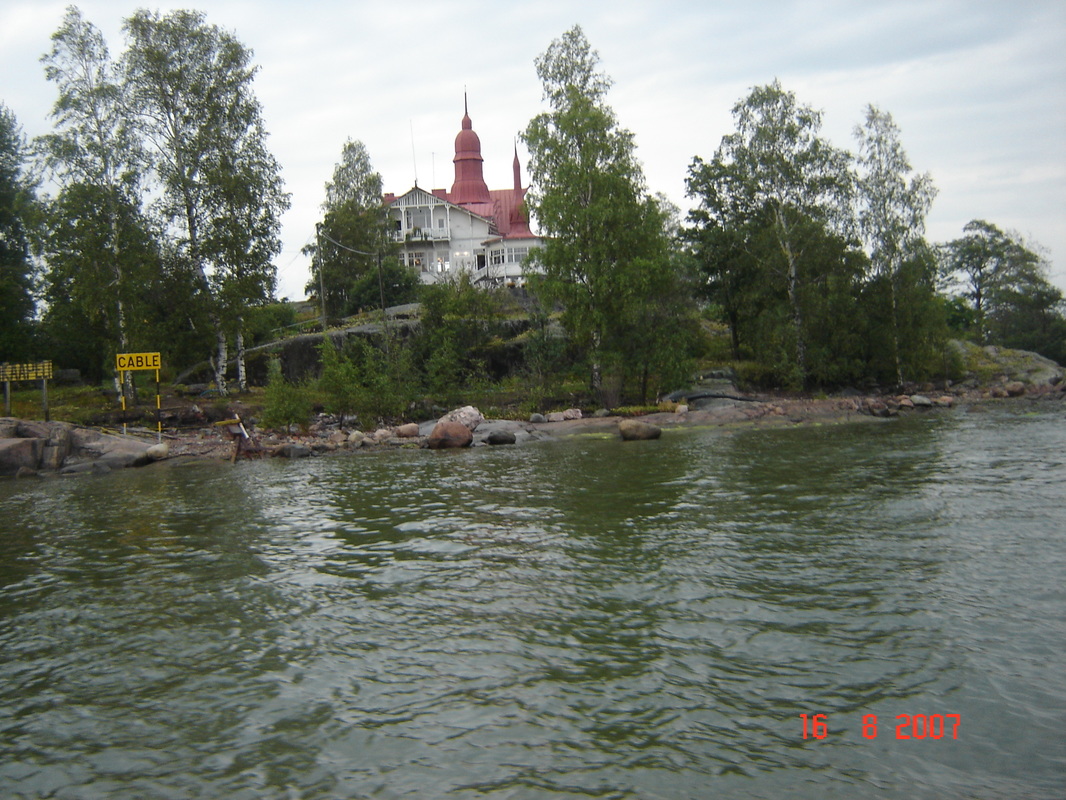
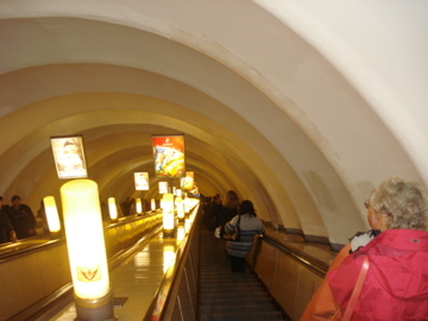
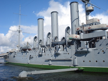
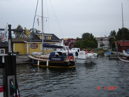
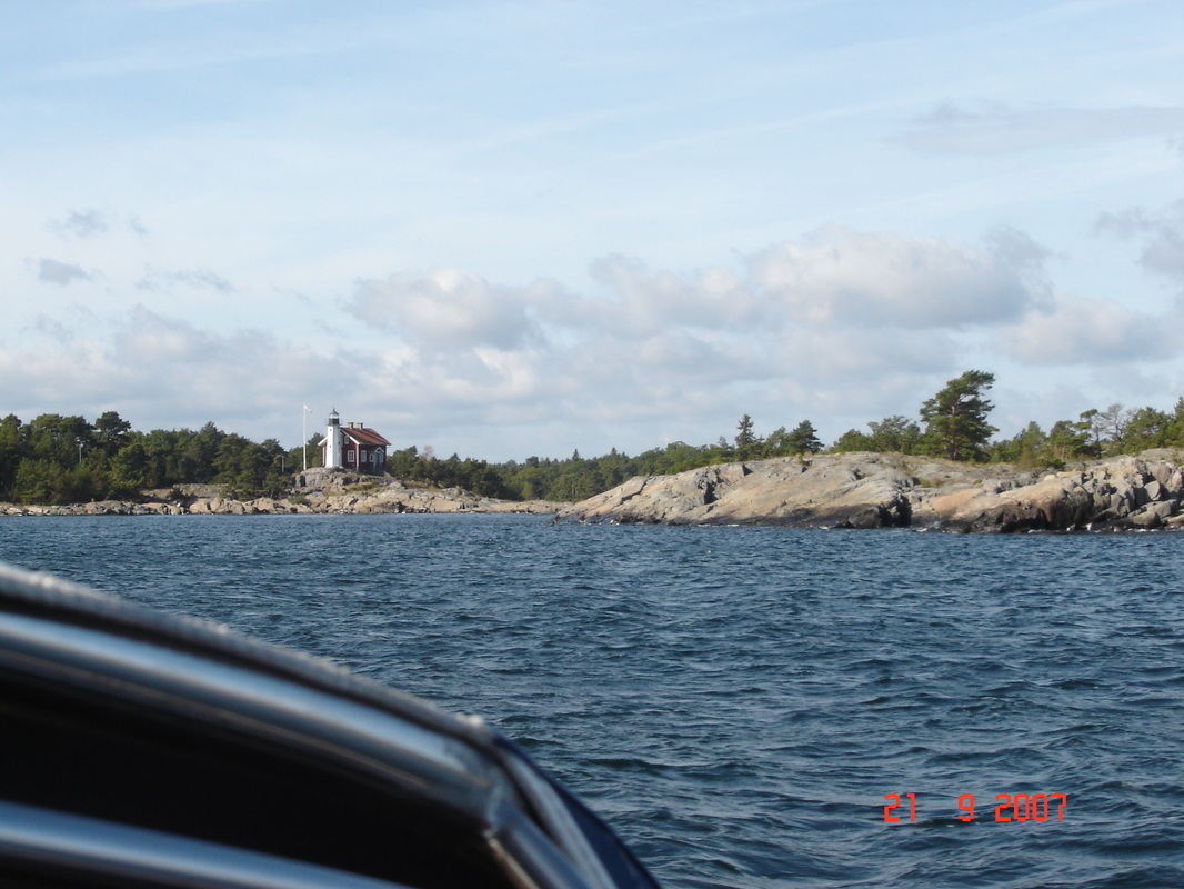
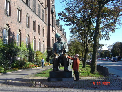
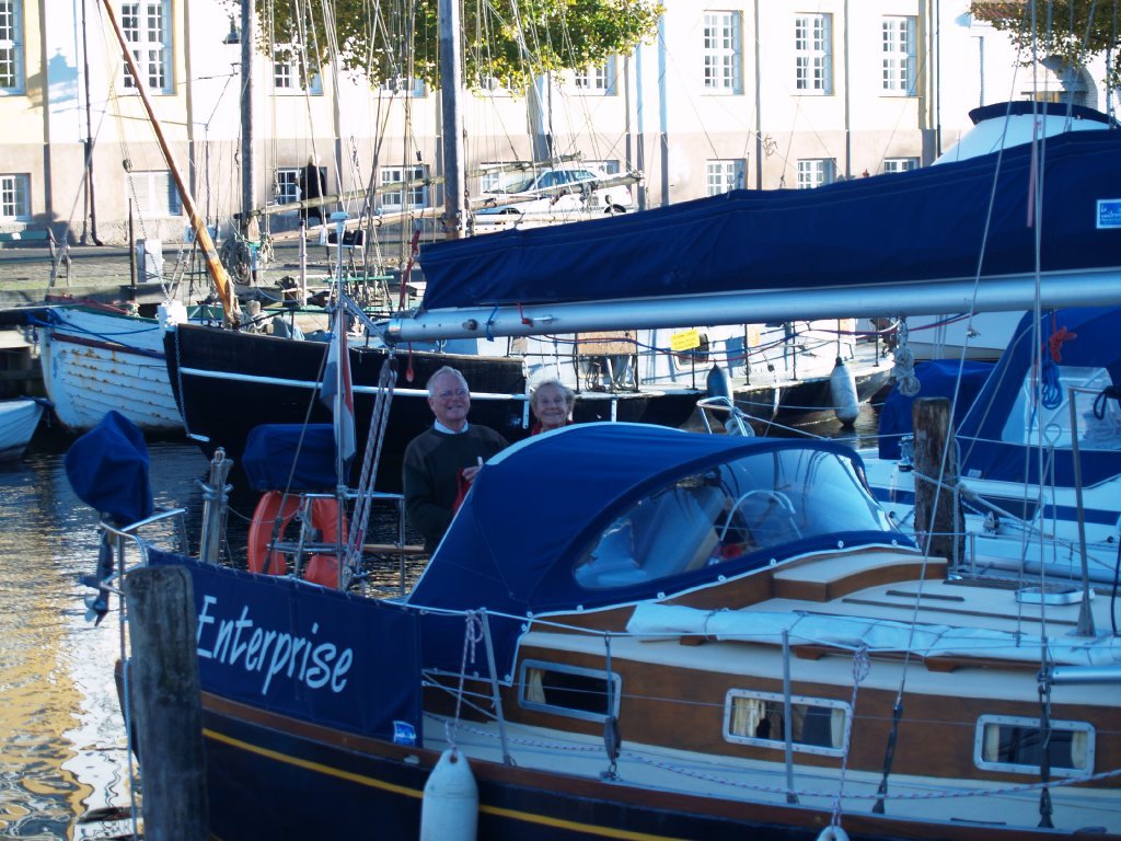
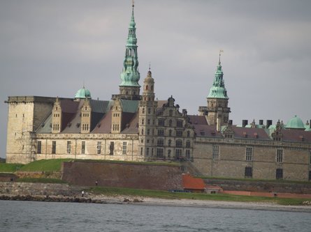
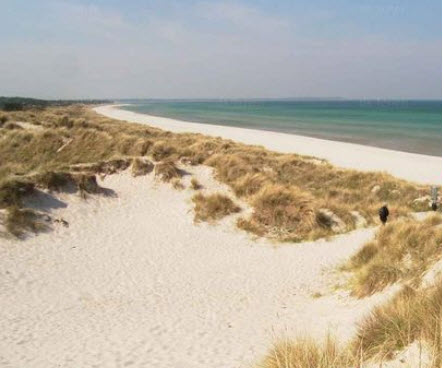
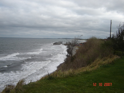
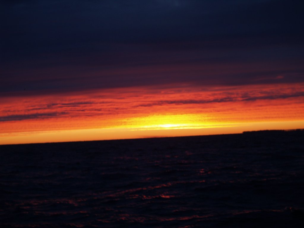
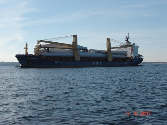
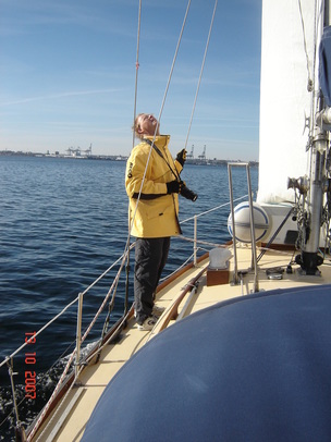
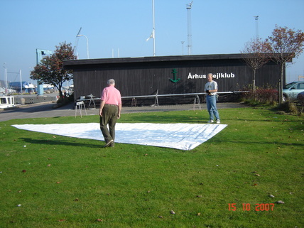
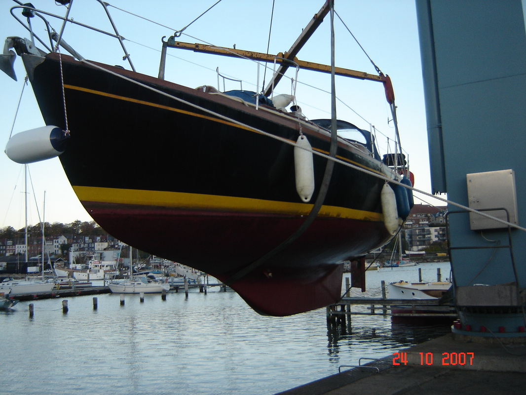
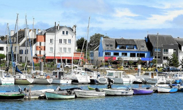
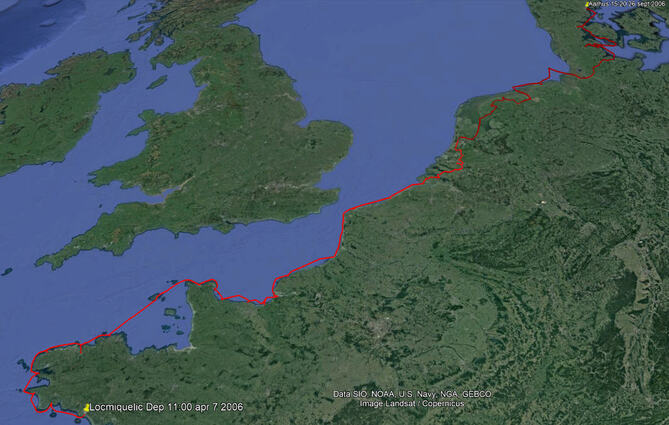
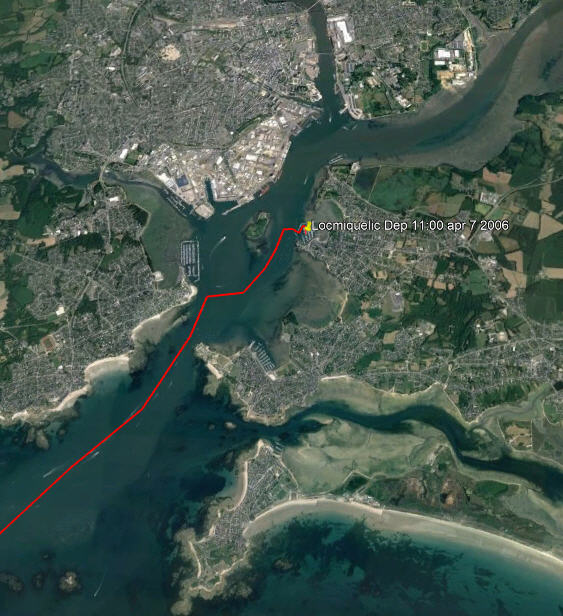
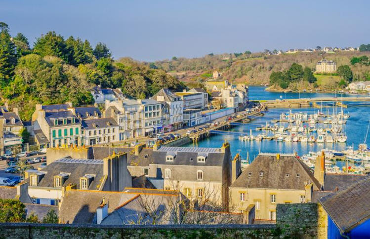
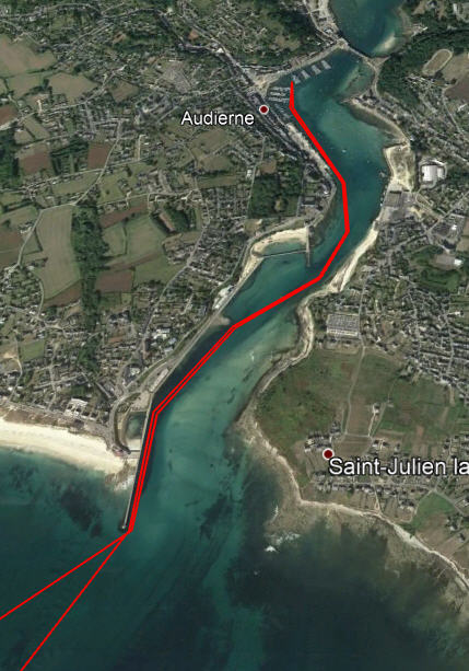

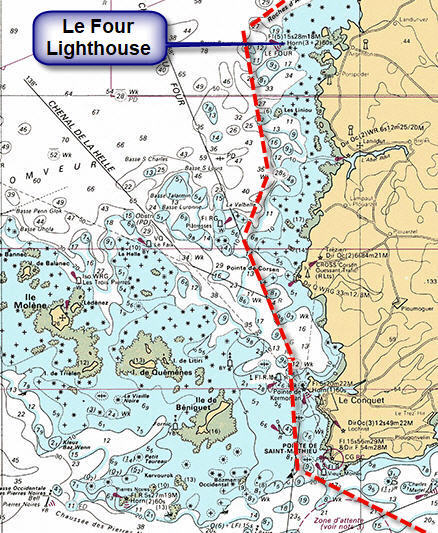
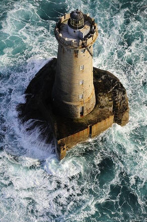
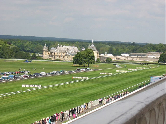


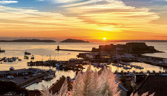
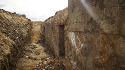
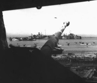

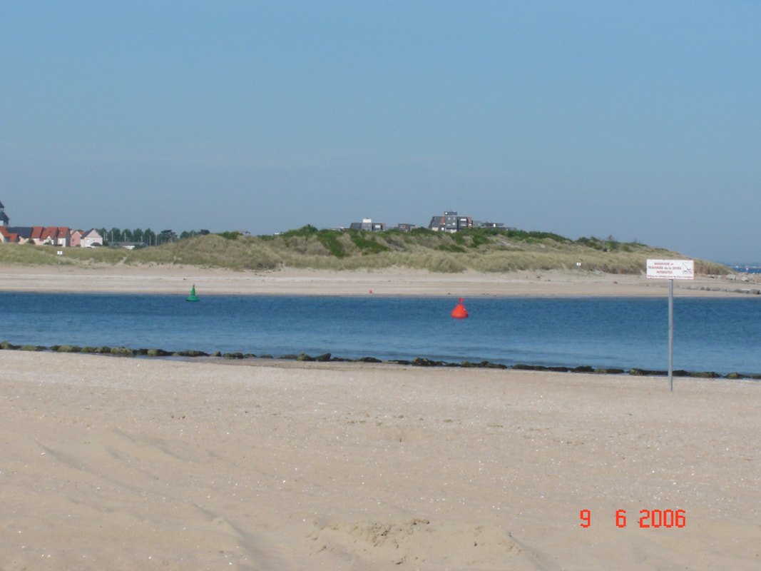
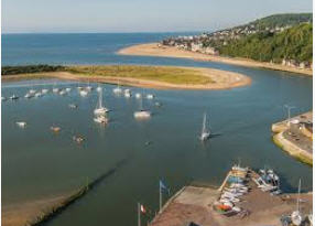
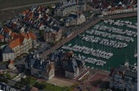
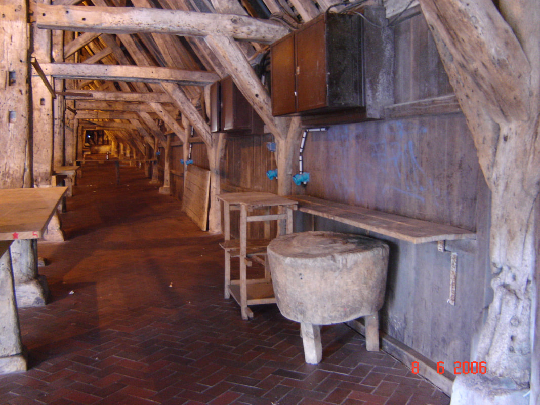
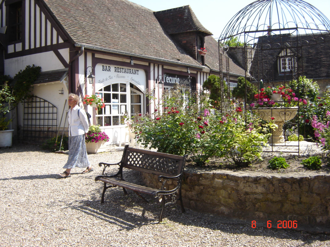
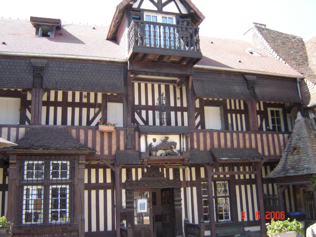
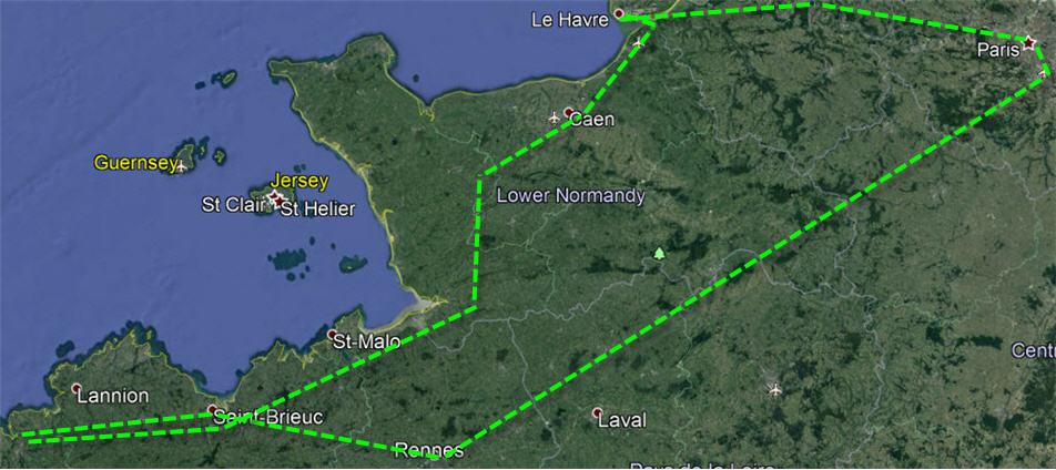
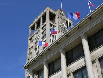
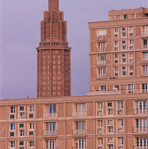
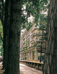
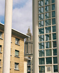
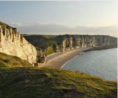
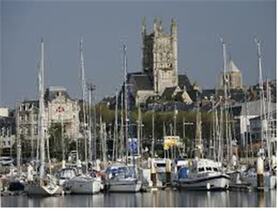
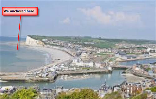
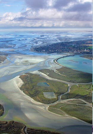
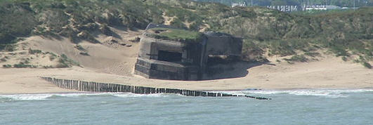
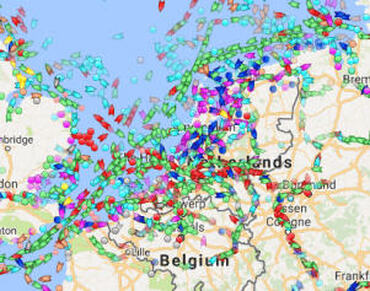
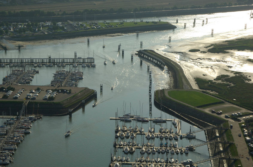
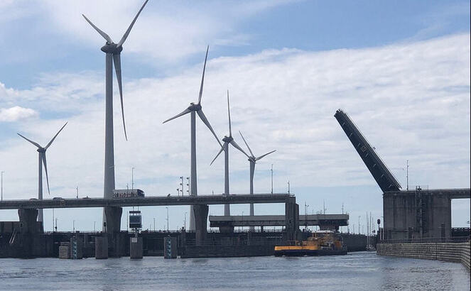
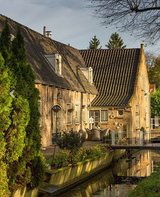
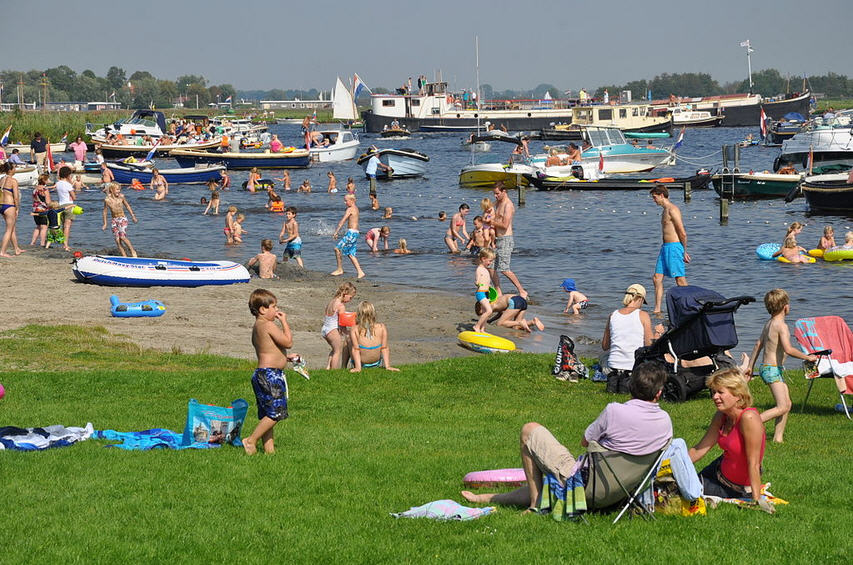
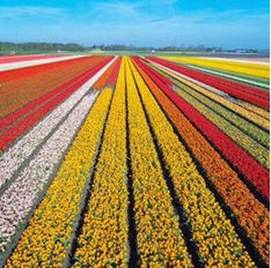
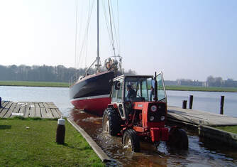

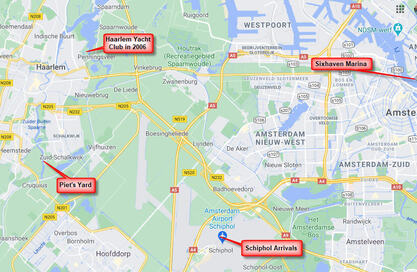
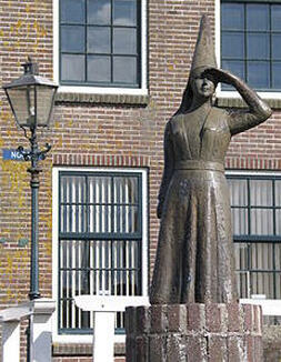
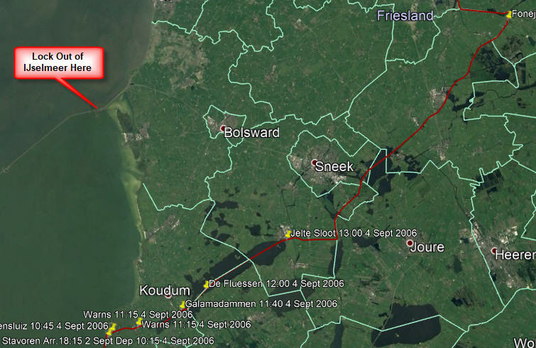
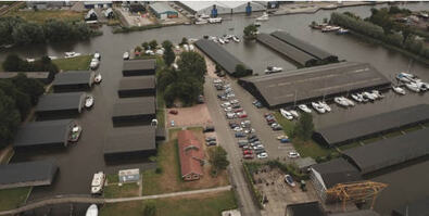
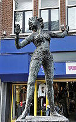
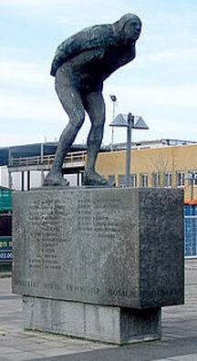
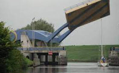
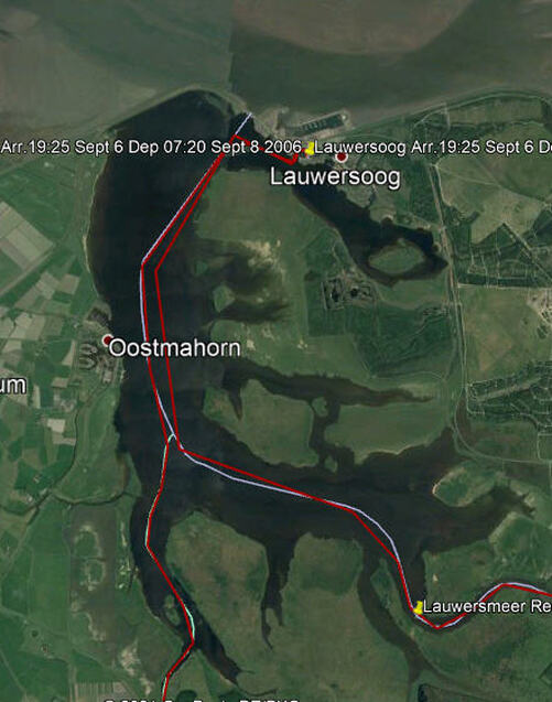
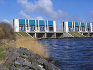
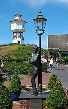
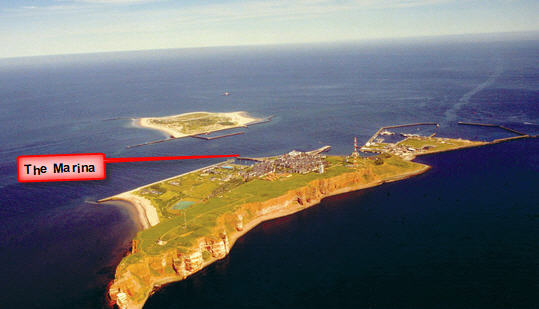
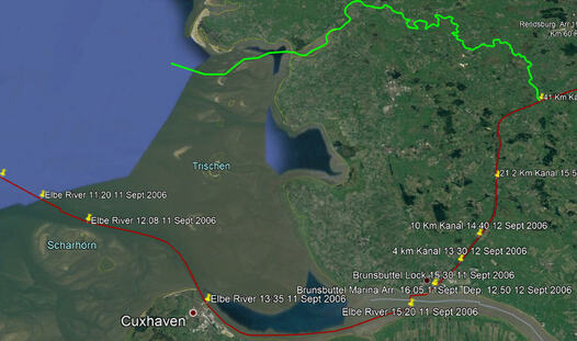
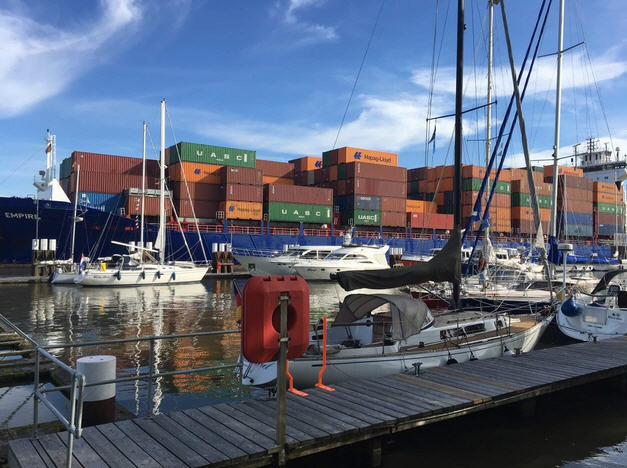
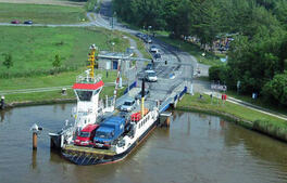
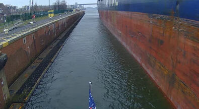
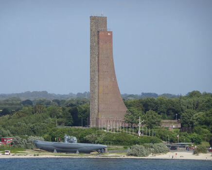
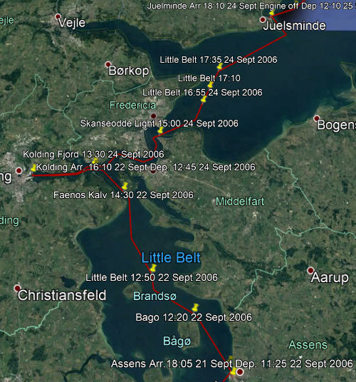
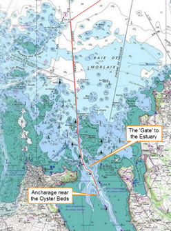
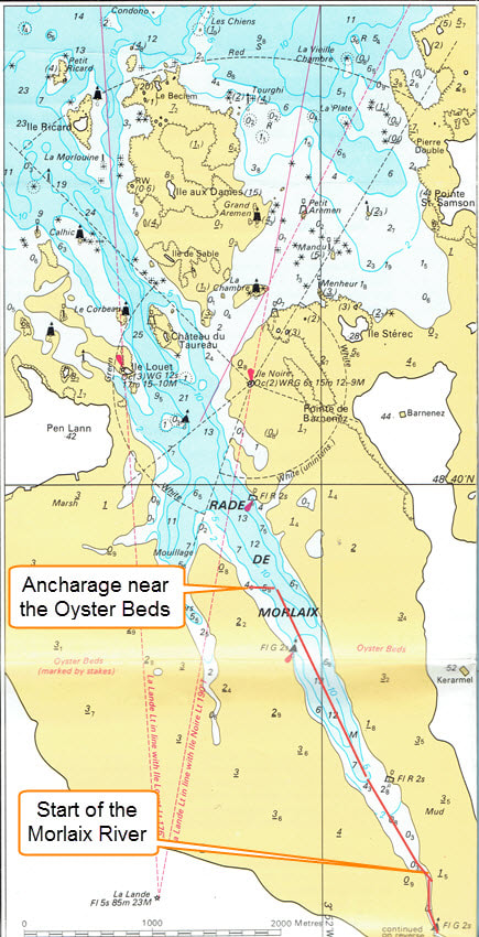
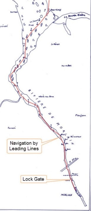
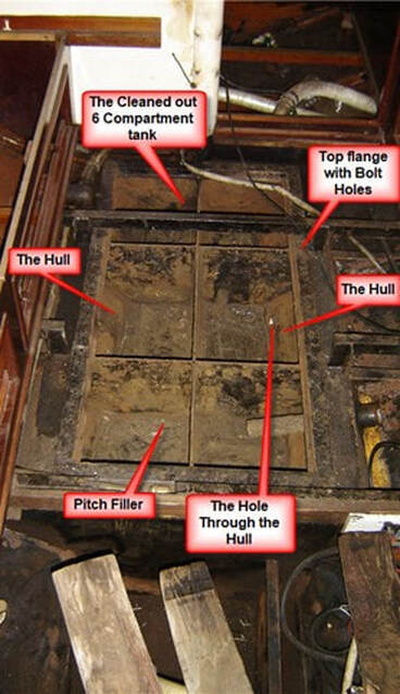
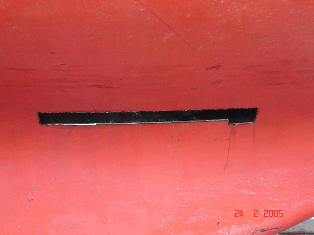
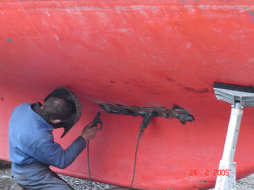
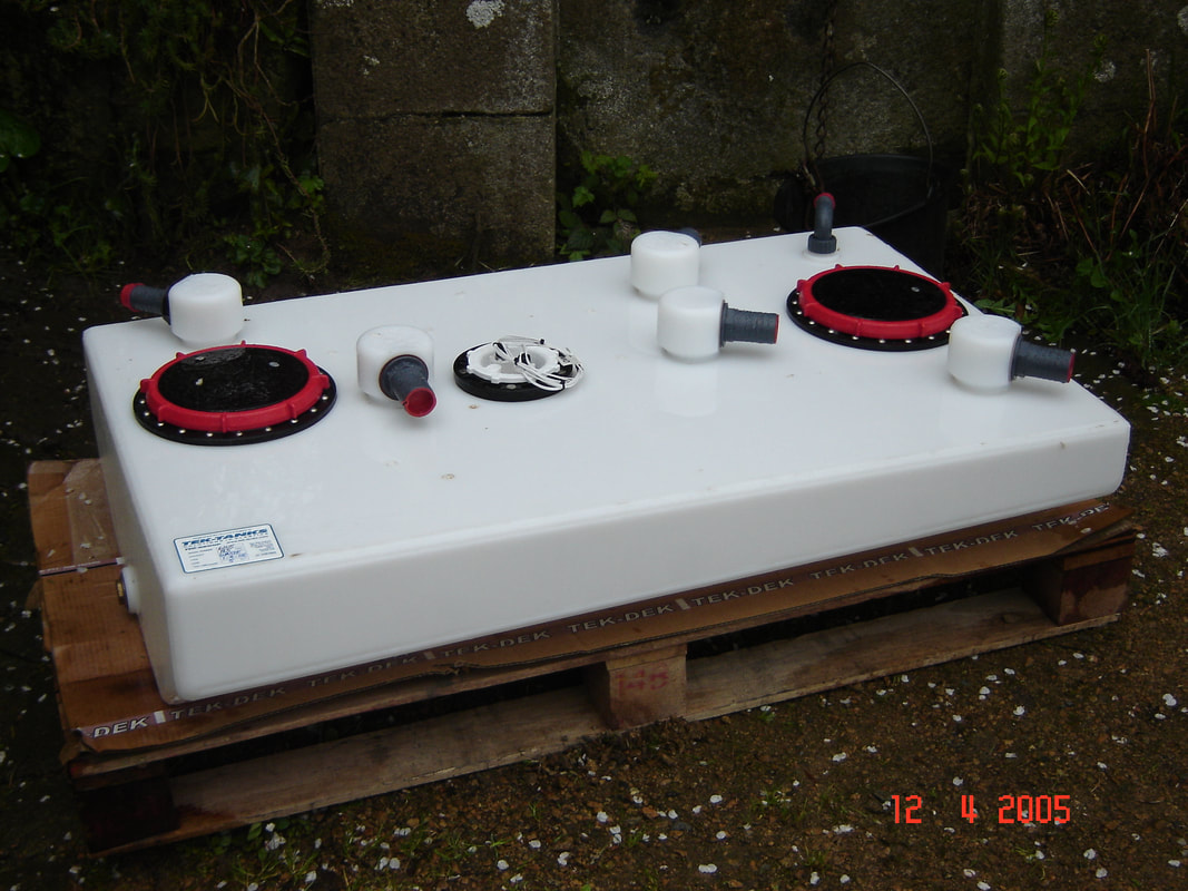
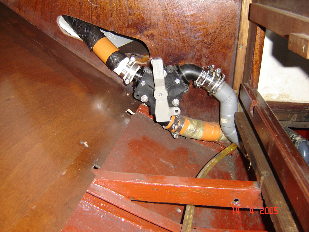
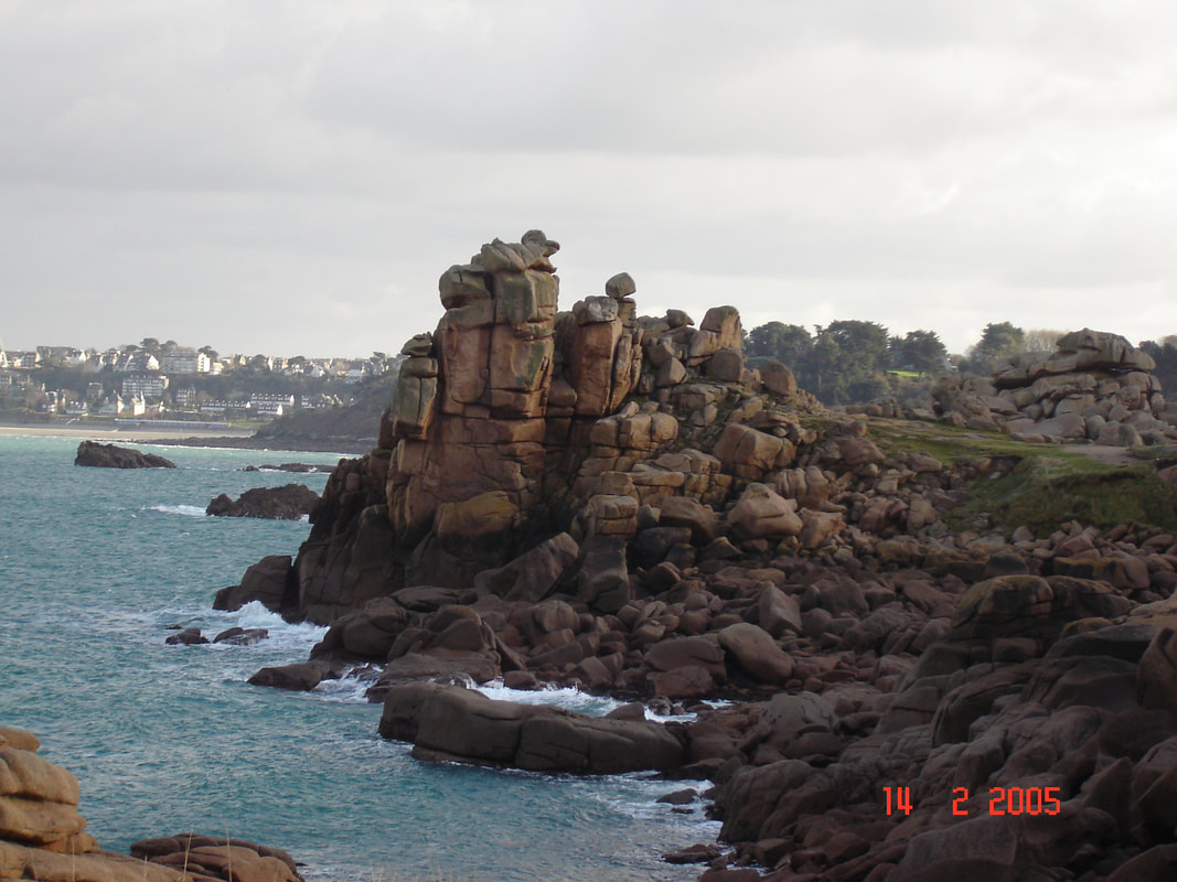
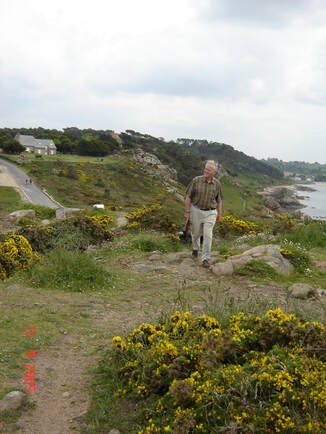
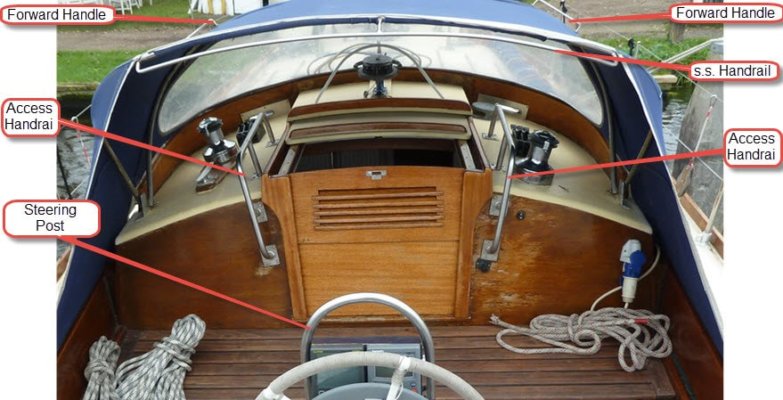
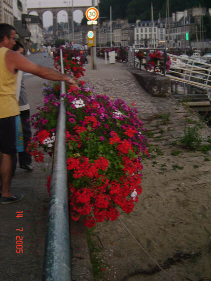
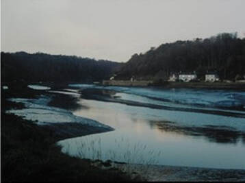
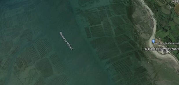
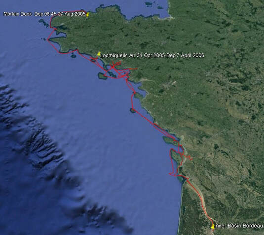
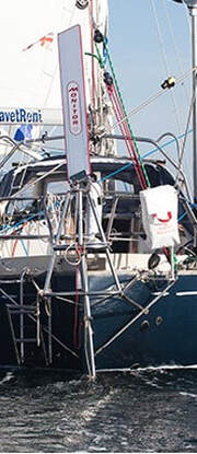
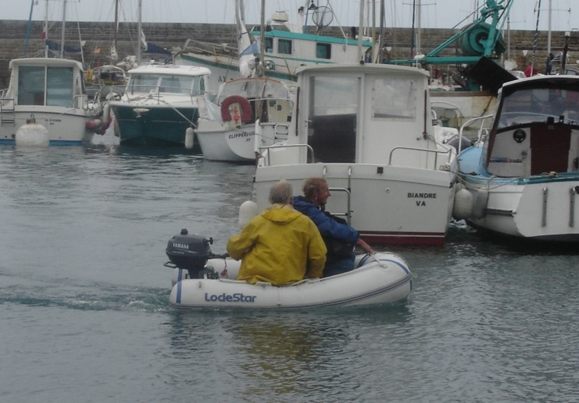
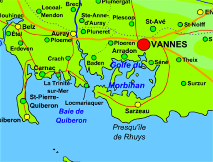
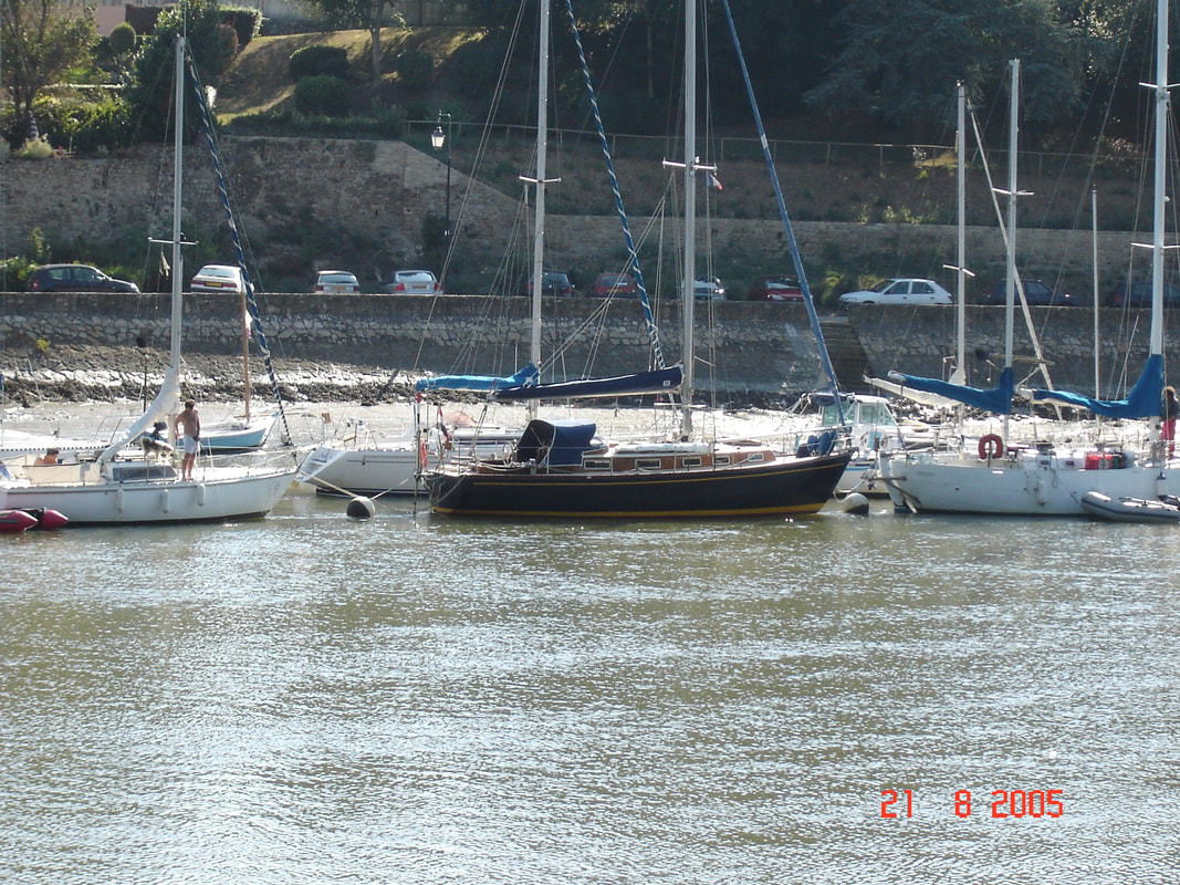
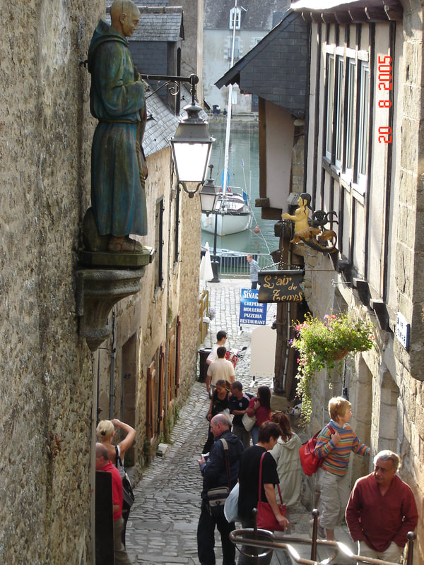
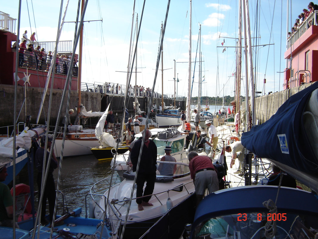
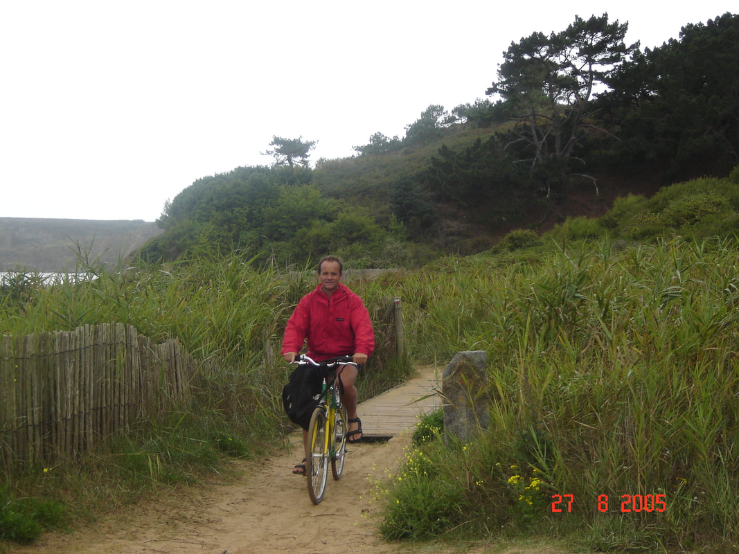
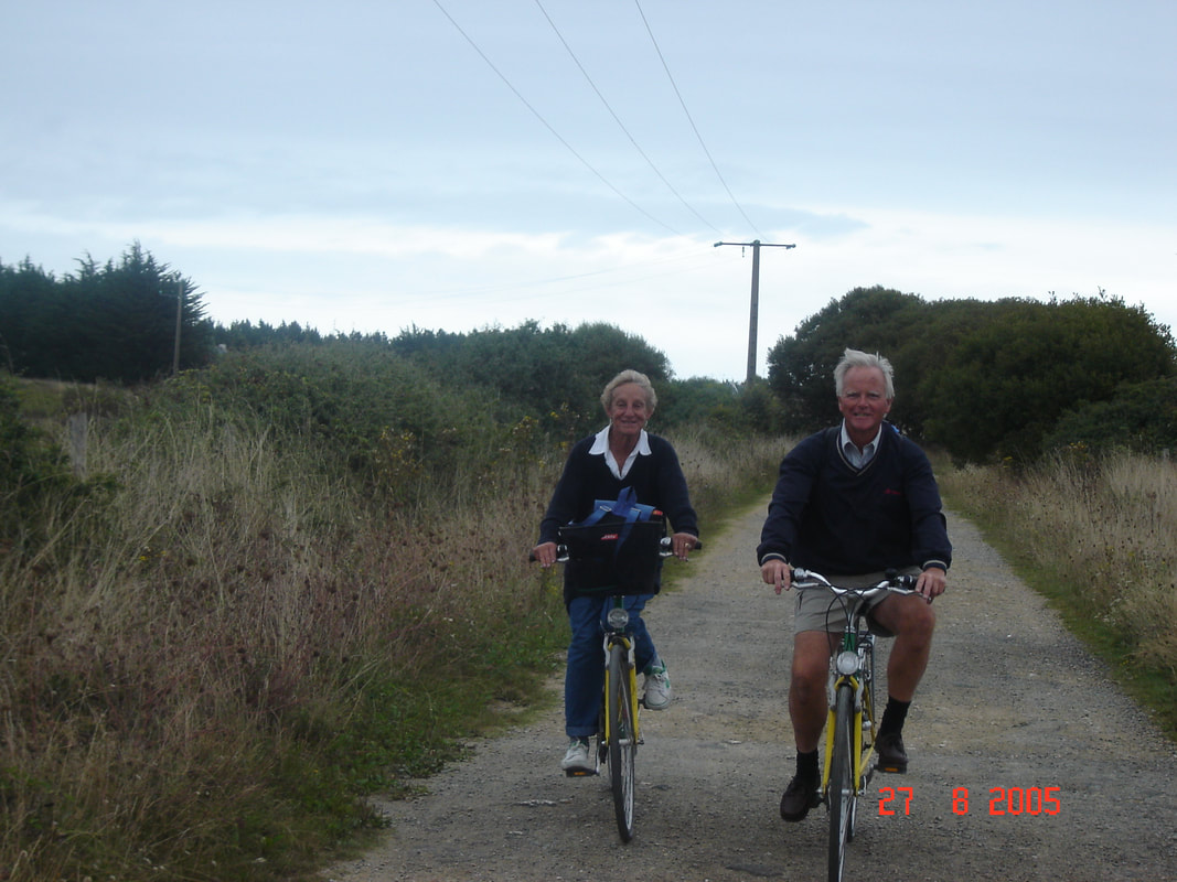
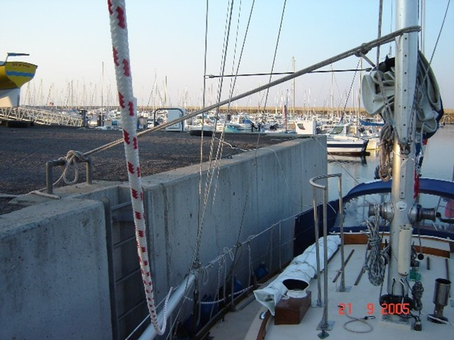
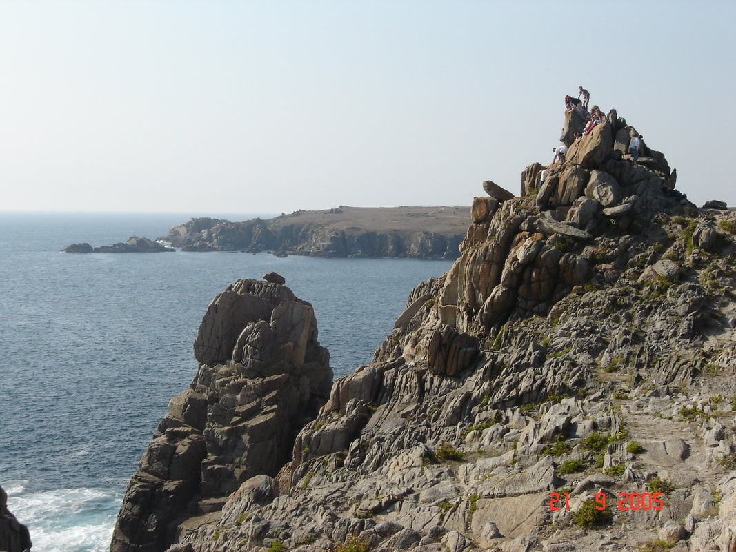
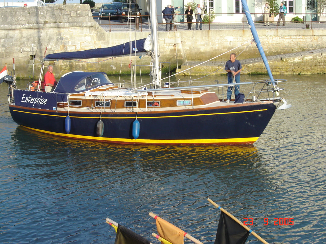
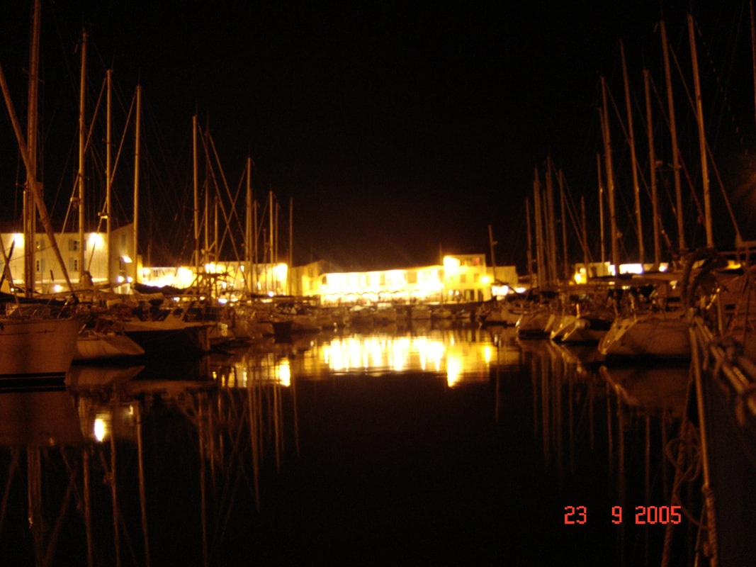

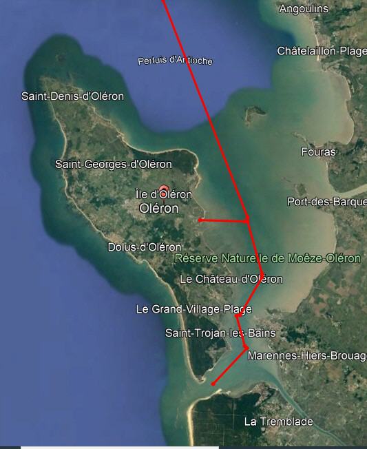
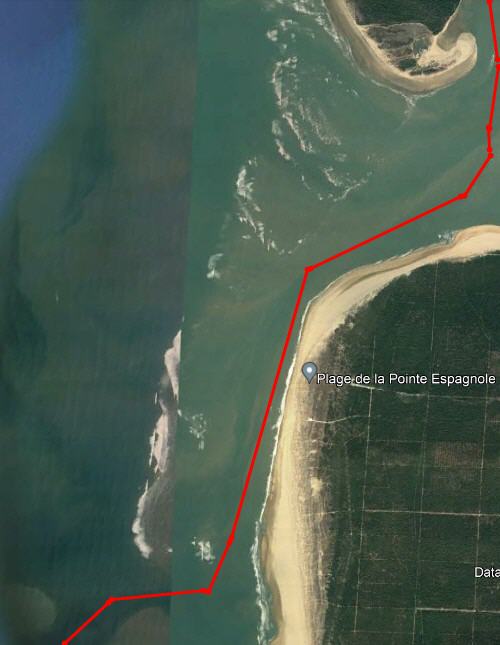
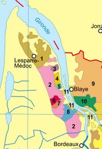